
$1,545
/ Month
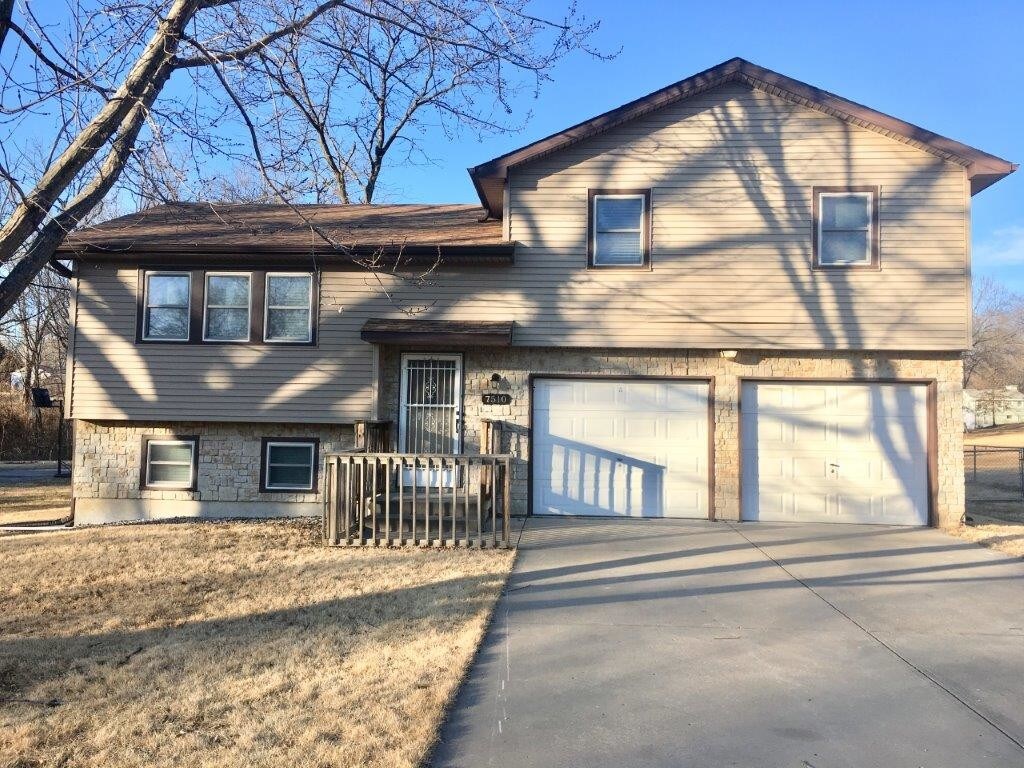
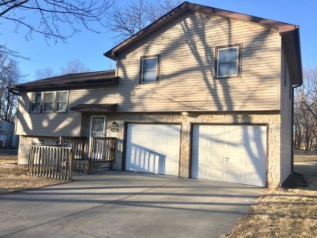
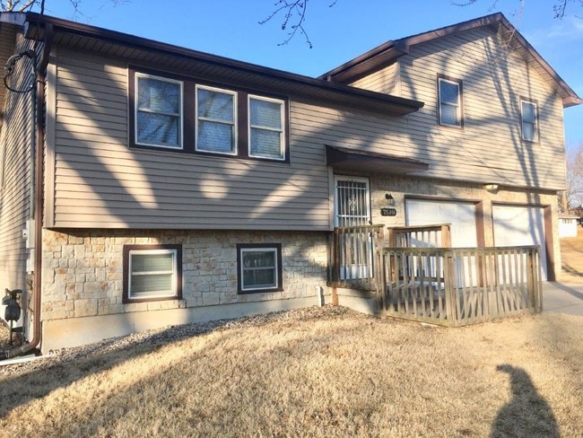
7510 Walnut St
Liberty, MO 64068
2 Weeks Ago
|
Edit
Favorites
7510 Walnut St

Favorites
Check Back Soon for Upcoming Availability
| Beds | Baths | Average SF |
|---|---|---|
| 3 Bedrooms 3 Bedrooms 3 Br | 2 Baths 2 Baths 2 Ba | 1,594 SF |
About This Property
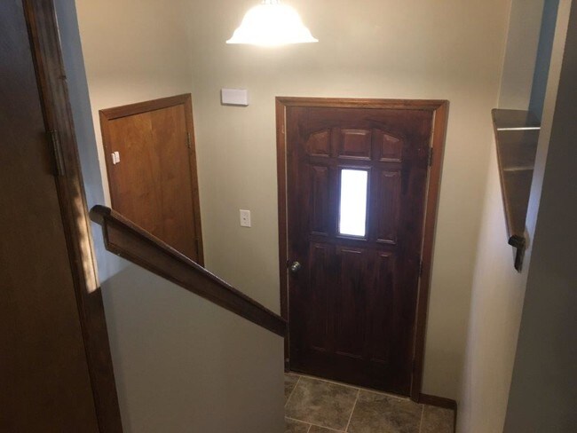
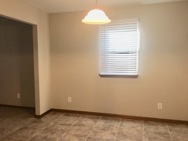
We are sharing the love! Apply now and app fees are credited back when you sign a lease in February! Home sits on a quite dead end road. We've installed new tile throughout the home in the kitchen and bathrooms, along with granite counter tops in the kitchen and new stainless steel appliances which include a built in microwave over the stove. Basement is finished with a large laundry room and full bath and walks out to the back yard. Yard is fenced in with a covered deck in the back, 2 car garage!
7510 Walnut St is a house located in Clay County and the 64068 ZIP Code. This area is served by the North Kansas City 74 attendance zone.
Location
Get Directions
The small city of Liberty is a cozy suburban city positioned just outside the northeastern corner of Kansas City, about fifteen miles from the Power and Light District. While largely serving as a residential suburb for its larger neighbor, Liberty hosts a thriving shopping, dining, and entertainment scene of its own: a large cluster of shopping centers on the west side offers a huge selection of major chain stores, while the Downtown district surrounding the historic Clay County Courthouse features a diverse selection of charming coffeehouses, taverns, specialty shops, and other locally-owned businesses in the vintage storefronts.
The diverse rental market features a terrific selection of apartments, condos, and houses to fit any budget, and the great schools and low crime rate have helped make Liberty one of the Kansas City area’s most desirable communities among folks raising families.
Learn more about living in Liberty
Education
| Colleges & Universities | Distance | ||
|---|---|---|---|
| Colleges & Universities | Distance | ||
| Drive: | 13 min | 6.4 mi | |
| Drive: | 22 min | 13.4 mi | |
| Drive: | 24 min | 15.6 mi | |
| Drive: | 27 min | 16.3 mi |
7510 Walnut St is within 13 minutes or 6.4 miles from Metropolitan Community College. It is also near Graceland University and Park University.
Schools


Public Elementary School
Grades PK-5
630 Students
Attendance Zone
Public Middle School
Grades 7-8
638 Students
Attendance Zone
Public High School
Grades 9-12
1,284 Students
Attendance Zone
Private Elementary, Middle & High School
Grades PK-12
60 Students
Nearby
School data provided by
 The GreatSchools Rating helps parents compare schools within a state based on a variety of school quality indicators and provides a helpful picture of how effectively each school serves all of its students. Ratings are on a scale of 1 (below average) to 10 (above average) and can include test scores, college readiness, academic progress, advanced courses, equity, discipline and attendance data. We also advise parents to visit schools, consider other information on school performance and programs, and consider family needs as part of the school selection process.
View GreatSchools Rating Methodology
Data provided by GreatSchools.org © 2025. All rights reserved.
View GreatSchools Rating Methodology
Data provided by GreatSchools.org © 2025. All rights reserved.
Transportation options available in Liberty include River Market North On 3Rd St At Grand Wb, located 11.6 miles from 7510 Walnut St. 7510 Walnut St is near Kansas City International, located 18.9 miles or 27 minutes away.
| Transit / Subway | Distance | ||
|---|---|---|---|
| Transit / Subway | Distance | ||
| Drive: | 17 min | 11.6 mi | |
| Drive: | 18 min | 11.8 mi | |
| Drive: | 18 min | 11.9 mi | |
| Drive: | 18 min | 12.2 mi | |
| Drive: | 19 min | 12.4 mi |
| Commuter Rail | Distance | ||
|---|---|---|---|
| Commuter Rail | Distance | ||
|
|
Drive: | 22 min | 13.9 mi |
|
|
Drive: | 23 min | 15.0 mi |
|
|
Drive: | 38 min | 26.5 mi |
| Airports | Distance | ||
|---|---|---|---|
| Airports | Distance | ||
|
Kansas City International
|
Drive: | 27 min | 18.9 mi |
Time and distance from 7510 Walnut St.
| Shopping Centers | Distance | ||
|---|---|---|---|
| Shopping Centers | Distance | ||
| Drive: | 7 min | 2.9 mi | |
| Drive: | 8 min | 3.1 mi | |
| Drive: | 9 min | 3.9 mi |
7510 Walnut St has 3 shopping centers within 3.9 miles, which is about a 9-minute drive. The miles and minutes will be for the farthest away property.
| Parks and Recreation | Distance | ||
|---|---|---|---|
| Parks and Recreation | Distance | ||
|
Shoal Creek Living History Museum
|
Drive: | 10 min | 5.9 mi |
|
Martha Lafite Nature Sanctuary
|
Drive: | 16 min | 7.1 mi |
|
Richard Berkley Riverfront Park
|
Drive: | 17 min | 9.0 mi |
|
Frank Vaydik Park
|
Drive: | 17 min | 10.4 mi |
|
Harry S Truman National Historic Site
|
Drive: | 24 min | 14.3 mi |
7510 Walnut St has 5 parks within 14.3 miles, including Shoal Creek Living History Museum, Martha Lafite Nature Sanctuary, and Frank Vaydik Park.
| Hospitals | Distance | ||
|---|---|---|---|
| Hospitals | Distance | ||
| Drive: | 11 min | 6.6 mi | |
| Drive: | 14 min | 8.4 mi | |
| Drive: | 14 min | 8.5 mi |
7510 Walnut St has 3 hospitals within 8.5 miles, the nearest is New Liberty Hospital District which is 6.6 miles away and a 11 minute drive.
| Military Bases | Distance | ||
|---|---|---|---|
| Military Bases | Distance | ||
| Drive: | 50 min | 32.6 mi |
7510 Walnut St is 32.6 miles and a 50 minute drive from Fort Leavenworth.
You May Also Like
Similar Rentals Nearby


What Are Walk Score®, Transit Score®, and Bike Score® Ratings?
Walk Score® measures the walkability of any address. Transit Score® measures access to public transit. Bike Score® measures the bikeability of any address.
What is a Sound Score Rating?
A Sound Score Rating aggregates noise caused by vehicle traffic, airplane traffic and local sources

7510 Walnut St
Liberty, MO 64068