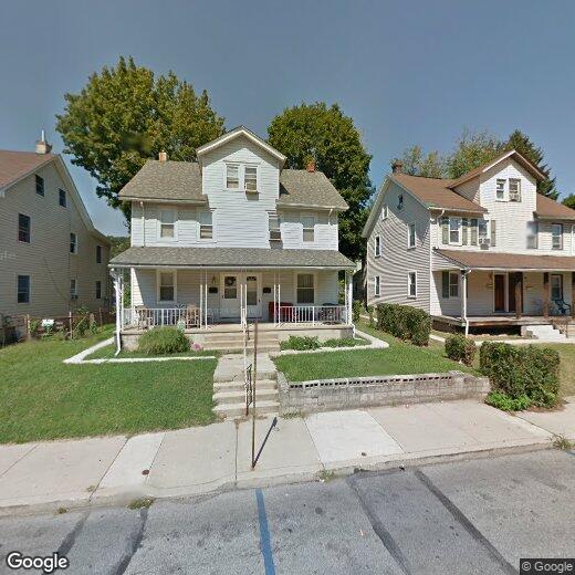
747 E Chestnut St

747 E Chestnut St

,

Coatesville, PA 19320

Share Listing
Favorites
747 E Chestnut St
Share Listing
Favorites

Check Back Soon for Upcoming Availability

Beds Baths Average SF
3 Bedrooms 3 Bedrooms 3 Br 1 Bath 1 Bath 1 Ba
Location
747 E Chestnut St, Coatesville,
PA 19320
Get Directions
| Edit

Under 30 minutes

Commute Time is calculated at rush hour.
City - Coatesville

Coatesville is the only city in Chester County, Pennsylvania, sitting about 39 miles west of Philadelphia along the historic Lincoln Highway corridor. Its identity is deeply rooted in steel-making history. The Lukens Steel Company helped shape the city in the early 20th century, and that industrial legacy still gives Coatesville a gritty, authentic character that sets it apart from the polished suburbs surrounding it.

Today, the city is in the midst of a steady revitalization, drawing interest from renters who want Chester County access without the premium price tag that comes with neighboring communities. The Brandywine River traces the area’s edge, and the National Iron and Steel Heritage Museum anchors a growing cultural presence downtown.

Housing here covers a solid range of options, from converted rowhouses and older brick apartment buildings to newer apartment communities that reflect ongoing investment in the city’s future.

Learn more about living in Coatesville 
Education
Colleges & Universities Distance
Drive: 25 min 14.0 mi
Drive: 26 min 15.5 mi
Drive: 30 min 17.8 mi
Drive: 40 min 22.1 mi
747 E Chestnut St is within 25 minutes or 14.0 miles from West Chester Univ.. It is also near Immaculata University and Lincoln University.
Transportation

747 E Chestnut St is near Philadelphia International, located 37.3 miles or 62 minutes away.

Commuter Rail Distance
Walk: 12 min 0.7 mi
Drive: 4 min 2.7 mi
Drive: 9 min 5.5 mi
Drive: 14 min 6.9 mi
Drive: 19 min 10.3 mi
Airports Distance
Airports Distance
Philadelphia International
Drive: 62 min 37.3 mi

Walkability Near 747 E Chestnut St Coatesville, PA 19320

Getting Around
Moderately Walkable
Walkability
60 / 100
Limited Public Transit
Transit
30 / 100
Fairly Drivable
Drivability
50 / 100
Somewhat Bikeable
Bikeability
20 / 100

Scores provided by

What do Walkability, Transit, Drivability, and Bikeability mean? Walkability measures the walking distance to day-to-day needs. Transit measures access to public transportation. Drivability measures congestion, parking availability, and access to major roads. Bikeability measures the suitability for cycling. How It Works
-
Soundscore
- / 100

Traffic

-

Airport

-

Businesses

-

Scores provided by

HowLoud What is a Sound Score Rating? A Sound Score Rating aggregates noise caused by vehicle traffic, airplane traffic and local sources. How It Works
Points of Interest

Time and distance from 747 E Chestnut St.

Shopping Centers Distance
Drive: 3 min 1.3 mi
Drive: 4 min 2.2 mi
Drive: 5 min 2.9 mi
747 E Chestnut St has 3 shopping centers within 2.9 miles, which is about a 5-minute drive. The miles and minutes will be for the farthest away property.
Parks and Recreation Distance
Sadsbury Woods Preserve
Drive: 13 min 6.5 mi
Hibernia County Park
Drive: 15 min 6.7 mi
ChesLen Preserve
Drive: 18 min 7.9 mi
Springton Manor Farm
Drive: 21 min 8.8 mi
Springton Manor Farm Carriage House
Drive: 21 min 8.8 mi
747 E Chestnut St has 5 parks within 8.8 miles, including Hibernia County Park, Sadsbury Woods Preserve, and ChesLen Preserve.
Hospitals Distance
Hospitals Distance
Drive: 6 min 2.8 mi
747 E Chestnut St is 2.8 miles and a 6 minute drive from Brandywine Hospital.
Military Bases Distance
Drive: 58 min 34.1 mi
Drive: 70 min 43.0 mi
Drive: 63 min 46.5 mi
747 E Chestnut St has 3 military bases within 46.5 miles, the nearest is Ommelanden Range which is 34.1 miles away and a 58 minute drive.

You May Also Like

Similar Rentals Nearby