
$2,650 / Month
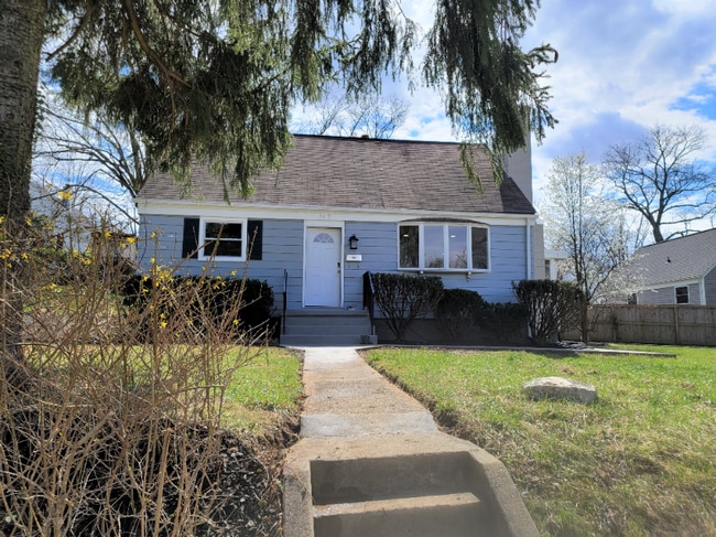
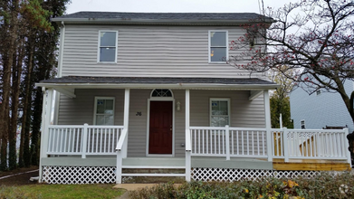
747 Chips Rd
Pikesville, MD 21208
2 Weeks Ago
Favorites
747 Chips Rd

Favorites
Check Back Soon for Upcoming Availability
| Beds | Baths | Average SF |
|---|---|---|
| 3 Bedrooms 3 Bedrooms 3 Br | 2 Baths 2 Baths 2 Ba | 1,368 SF |
Fees and Policies
The fees below are based on community-supplied data and may exclude additional fees and utilities.
About This Property
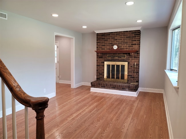
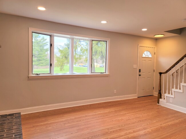
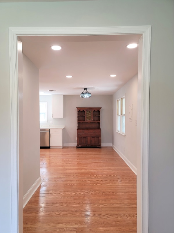
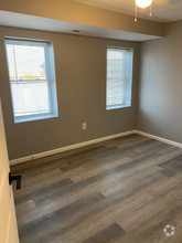
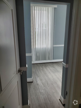
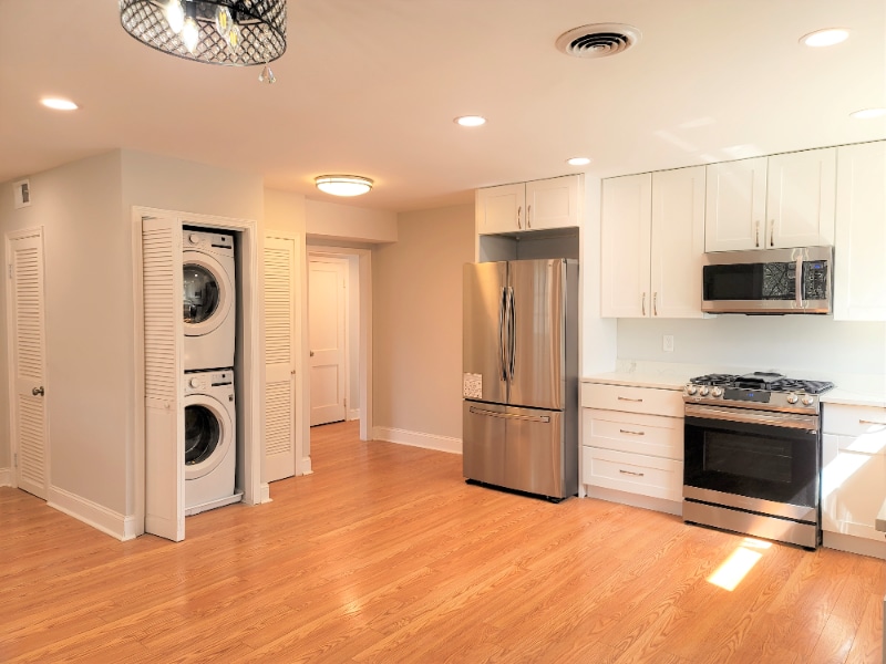
Property Id: 902598 Recent renovation on large landscaped corner lot with view of Silver Creek Pk. Roof, appliances and all systems are new. L/R with recessed lights, working wood freplace, 9' ceilings on 1st floor, oak laminate flooring throughout, coat closet on 1st fl, open kitchen-dining layout with 42” cabinets, Samsung stainless steel appliances, quartz countertop, full size, front-loading LG stacked washer and dryer, MBR suite on 1st floor with WIC and full bath, celing fans in B/Rs, screened-in porch with ceiling fan off the side overlooking flowering trees, updated replacement windows throughout. Upstairs 2 B/Rs with plenty of closets, finished attic for storage. Front, side and read yards for BBQs, outdoor entertaining, or kids playing. Large lot with a view of the park, plenty of yard and loads of natural light! Other amenities: A short 8 minute walk to Sudbrook Park, 12-minute walk to Milford Mill Gwynn Falls Trail, convenient commuter routes such as Md-26, I-70, I-695, and I-795.
747 Chips Rd is a house located in Baltimore County and the 21208 ZIP Code. This area is served by the Baltimore County Public Schools attendance zone.
House Features
Washer/Dryer
Dishwasher
Microwave
Refrigerator
- Washer/Dryer
- Cable Ready
- Fireplace
- Dishwasher
- Disposal
- Microwave
- Oven
- Refrigerator
- Tile Floors
- Lawn
Location
Get Directions
Located exactly 11 miles northwest of Baltimore, Lochearn gives residents a tight-knit neighborhood feel and quick access to fantastic outdoor recreation. Bordered by the Baltimore Beltway (Interstate 695) and the downtown city limits, Lochearn provides its locals with unparalleled access to the best of Baltimore and surrounding suburbs. Lochearn is home to plenty of neighborhood amenities, parks, dining, and entertainment options. Find locals on Liberty Road at the seafood restaurants and pubs, at Windsor Mill Road for Ethiopian cuisine and local shops, or walking the trails at Villa Nova Park. There are affordable apartments to be had near the center of town, making a commute into Boston easy.
Learn more about living in LochearnBelow are rent ranges for similar nearby apartments
Amenities
- Washer/Dryer
- Cable Ready
- Fireplace
- Dishwasher
- Disposal
- Microwave
- Oven
- Refrigerator
- Tile Floors
- Lawn
Education
| Colleges & Universities | Distance | ||
|---|---|---|---|
| Colleges & Universities | Distance | ||
| Drive: | 17 min | 6.7 mi | |
| Drive: | 19 min | 7.1 mi | |
| Drive: | 22 min | 8.2 mi | |
| Drive: | 17 min | 9.1 mi |
747 Chips Rd is within 17 minutes or 6.7 miles from Stevenson Univ., Greenspring. It is also near Stevenson Univ., Owings Mills and Coppin State University.
Schools


Public Elementary School
Grades PK-5
451 Students
Nearby
Public Elementary School
Grades K-5
469 Students
Nearby
Public Elementary School
Grades 1-5
296 Students
Attendance Zone
Public Middle School
Grades 6-8
967 Students
Attendance Zone
Public High School
Grades 9-12
1,324 Students
Attendance Zone
Private Elementary, Middle & High School
Grades PK-12
1,019 Students
Nearby
School data provided by
 The GreatSchools Rating helps parents compare schools within a state based on a variety of school quality indicators and provides a helpful picture of how effectively each school serves all of its students. Ratings are on a scale of 1 (below average) to 10 (above average) and can include test scores, college readiness, academic progress, advanced courses, equity, discipline and attendance data. We also advise parents to visit schools, consider other information on school performance and programs, and consider family needs as part of the school selection process.
View GreatSchools Rating Methodology
View GreatSchools Rating Methodology
Transportation options available in Pikesville include Old Court, located 1.4 miles from 747 Chips Rd. 747 Chips Rd is near Baltimore/Washington International Thurgood Marshall, located 15.3 miles or 27 minutes away.
| Transit / Subway | Distance | ||
|---|---|---|---|
| Transit / Subway | Distance | ||
|
Old Court
|
Drive: | 4 min | 1.4 mi |
| Drive: | 5 min | 1.8 mi | |
| Drive: | 10 min | 3.3 mi | |
| Drive: | 12 min | 4.2 mi | |
| Drive: | 12 min | 7.0 mi |
| Commuter Rail | Distance | ||
|---|---|---|---|
| Commuter Rail | Distance | ||
|
|
Drive: | 22 min | 8.1 mi |
|
|
Drive: | 24 min | 9.8 mi |
|
|
Drive: | 18 min | 10.8 mi |
|
|
Drive: | 22 min | 12.6 mi |
|
|
Drive: | 26 min | 15.0 mi |
| Airports | Distance | ||
|---|---|---|---|
| Airports | Distance | ||
|
Baltimore/Washington International Thurgood Marshall
|
Drive: | 27 min | 15.3 mi |
Time and distance from 747 Chips Rd.
| Shopping Centers | Distance | ||
|---|---|---|---|
| Shopping Centers | Distance | ||
| Drive: | 4 min | 1.6 mi | |
| Drive: | 6 min | 1.9 mi | |
| Drive: | 6 min | 1.9 mi |
747 Chips Rd has 3 shopping centers within 1.9 miles, which is about a 6-minute drive. The miles and minutes will be for the farthest away property.
| Parks and Recreation | Distance | ||
|---|---|---|---|
| Parks and Recreation | Distance | ||
|
Carrie Murray Nature Center
|
Drive: | 15 min | 5.6 mi |
|
Gwynns Falls - Leakin Park
|
Drive: | 15 min | 5.6 mi |
|
Cylburn Arboretum
|
Drive: | 18 min | 6.0 mi |
|
Rodgers Farms
|
Drive: | 14 min | 6.0 mi |
|
Gwynns Falls Trail
|
Drive: | 17 min | 8.4 mi |
747 Chips Rd has 5 parks within 8.4 miles, including Rodgers Farms, Carrie Murray Nature Center, and Gwynns Falls - Leakin Park.
| Hospitals | Distance | ||
|---|---|---|---|
| Hospitals | Distance | ||
| Drive: | 7 min | 2.9 mi | |
| Drive: | 12 min | 4.6 mi | |
| Drive: | 14 min | 5.2 mi |
747 Chips Rd has 3 hospitals within 5.2 miles, the nearest is Northwest Hospital Center which is 2.9 miles away and a 7 minute drive.
| Military Bases | Distance | ||
|---|---|---|---|
| Military Bases | Distance | ||
| Drive: | 40 min | 23.3 mi |
747 Chips Rd is 23.3 miles and a 40 minute drive from Fort George Meade.
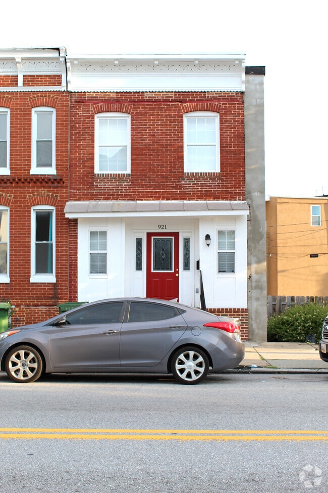
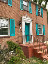
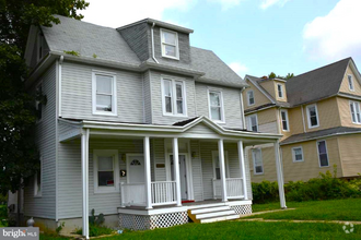
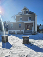
You May Also Like
Similar Rentals Nearby

What Are Walk Score®, Transit Score®, and Bike Score® Ratings?
Walk Score® measures the walkability of any address. Transit Score® measures access to public transit. Bike Score® measures the bikeability of any address.
What is a Sound Score Rating?
A Sound Score Rating aggregates noise caused by vehicle traffic, airplane traffic and local sources
747 Chips Rd
Pikesville, MD 21208