

$4,500
/ Month
7340 Carter Ave
Newark, CA 94560
Today
|
Edit
Favorites
415-786-5077
-
Bedrooms
3
-
Bathrooms
2.5
-
Square Feet
2,100 sq ft
-
Available
Available Now
Highlights
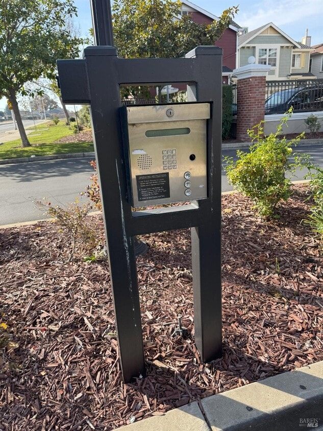
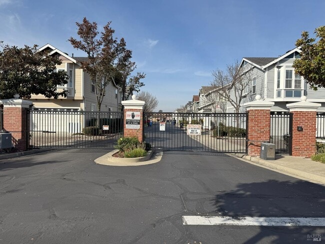
- Gated Community
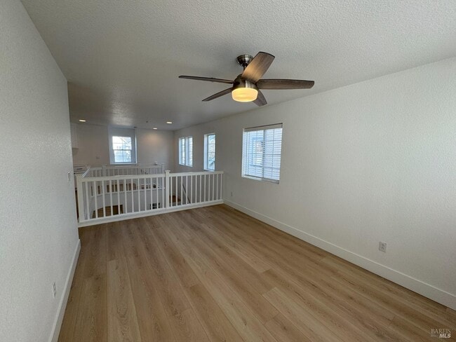
- Engineered Wood Flooring
- Loft
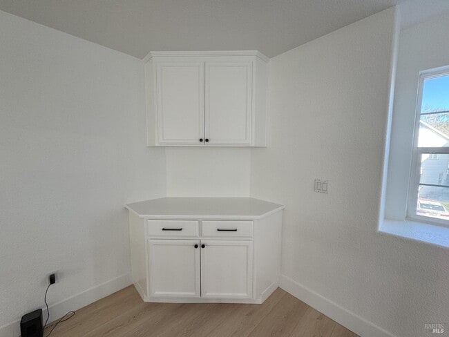
- Granite Countertops
- Breakfast Area or Nook
- Family Room Off Kitchen
7340 Carter Ave

Favorites
About This Home
Available Now
GATED COMMUNITY: Carter Station is a stunning neighborhood. Home features 3 bedrooms plus a loft. New kitchen appliances and counter tops, new flooring throughout, washer/dryer, and much more. MLS#326000230
7340 Carter Ave is a house located in Alameda County and the 94560 ZIP Code. This area is served by the Newark Unified attendance zone.
* Price shown is base rent. Excludes user-selected optional fees and variable or usage-based fees and required charges due at or prior to move-in or at move-out. Price, availability, fees, and any applicable rent special are subject to change without notice.
* Square footage definitions vary. Displayed square footage is approximate.
Home Details
Home Type
Single Family Detached Home
Year Built
Built in 1999 | Remodeled
Bedrooms and Bathrooms
Bathroom on Main Level
Primary Bedroom Upstairs
2.5 Bathrooms
3 Bedrooms
Home Design
Wood Siding
Composition Roof
Slab Foundation
Home Security
Carbon Monoxide Detectors
Fire and Smoke Detector
Fire Suppression System
Interior Spaces
Engineered Wood Flooring
Loft
Family Room Off Kitchen
Living Room
Dining Room
Ceiling Fan
2,100 Sq Ft Home
2-Story Property
Kitchen
Granite Countertops
Breakfast Area or Nook
Free-Standing Gas Oven
Kitchen Island
Gas Cooktop
Ice Maker
Microwave
Dishwasher
Self-Cleaning Oven
Disposal
Laundry
Dryer
Washer
Listing and Financial Details
Security Deposit $4,500
Assessor Parcel Number 92-42-23
Lot Details
Wood Fence
Outdoor Features
Patio
Parking
2 Car Attached Garage
Auto Driveway Gate
Garage Door Opener
Utilities
Central Heating and Cooling System
Gas Water Heater
Cable TV Available
Internet Available
Natural Gas Connected
Community Details
Security
Gated Community
Fees and Policies
The fees below are based on community-supplied data and may exclude additional fees and utilities.
-
Garage - Attached
Property Fee Disclaimer: Based on community-supplied data and independent market research. Subject to change without notice. May exclude fees for mandatory or optional services and usage-based utilities.
Contact
- Listed by David Henry | Marin Commercial Realty
- Phone Number
- Contact
-
Source
 BAREIS MLS ®
Copyright 2026, Bay Area Real Estate Information Services, Inc. All Rights Reserved.
Location
Get Directions
Amenities
- High Speed Internet Access
- Island Kitchen
- Breakfast Nook
- Hardwood Floors
Newark, California is a quiet community fringed by thousands of acres of pristine wetlands on the eastern edge of the San Francisco Bay. Located 25 miles south of Oakland, Newark forms part of the Tri-City area, along with Union City and Fremont. The neighborhood is family-oriented with rows of small homes and many parks interspersed throughout. Many people who work in nearby San Jose or across the bay in Palo Alto choose to live in Newark for the more affordable cost of living and more laid-back pace of life.
Five parks are housed within Newark’s boundaries, adding the aquatic scenery and outdoor attractions of the area. Amenity-laden apartment communities sit just minutes from the conveniences along the Nimitz Freeway and Fremont.
Learn more about living in Newark
Education
| Colleges & Universities | Distance | ||
|---|---|---|---|
| Colleges & Universities | Distance | ||
| Drive: | 6 min | 2.4 mi | |
| Drive: | 16 min | 9.5 mi | |
| Drive: | 17 min | 11.5 mi | |
| Drive: | 25 min | 15.3 mi |
7340 Carter Ave is within 6 minutes or 2.4 miles from Ohlone College, Newark. It is also near Ohlone College, Fremont Campus and Chabot College.
Schools


Public Elementary School
Grades K-5
321 Students
Attendance Zone
Public Elementary School
Grades K-5
343 Students
Nearby
Public Middle School
Grades 6-8
1,047 Students
Attendance Zone
Public High School
Grades 9-12
1,510 Students
Attendance Zone
Private Elementary & Middle School
Grades K-8
219 Students
Nearby
Private Elementary & Middle School
Grades PK-8
Nearby
Private Elementary, Middle & High School
Grades 1-12
Nearby
School data provided by
 The GreatSchools Rating helps parents compare schools within a state based on a variety of school quality indicators and provides a helpful picture of how effectively each school serves all of its students. Ratings are on a scale of 1 (below average) to 10 (above average) and can include test scores, college readiness, academic progress, advanced courses, equity, discipline and attendance data. We also advise parents to visit schools, consider other information on school performance and programs, and consider family needs as part of the school selection process.
View GreatSchools Rating Methodology
Data provided by GreatSchools.org © 2026. All rights reserved.
View GreatSchools Rating Methodology
Data provided by GreatSchools.org © 2026. All rights reserved.
Transportation options available in Newark include Fremont Station, located 5.2 miles from 7340 Carter Ave. 7340 Carter Ave is near Norman Y Mineta San Jose International, located 19.0 miles or 25 minutes away, and Metro Oakland International, located 20.2 miles or 27 minutes away.
| Transit / Subway | Distance | ||
|---|---|---|---|
| Transit / Subway | Distance | ||
|
|
Drive: | 10 min | 5.2 mi |
|
|
Drive: | 11 min | 5.3 mi |
|
|
Drive: | 11 min | 5.7 mi |
|
|
Drive: | 13 min | 7.8 mi |
|
|
Drive: | 15 min | 10.1 mi |
| Commuter Rail | Distance | ||
|---|---|---|---|
| Commuter Rail | Distance | ||
| Drive: | 5 min | 2.9 mi | |
| Drive: | 6 min | 3.1 mi | |
| Drive: | 22 min | 12.0 mi | |
| Drive: | 23 min | 14.2 mi | |
| Drive: | 24 min | 14.6 mi |
| Airports | Distance | ||
|---|---|---|---|
| Airports | Distance | ||
|
Norman Y Mineta San Jose International
|
Drive: | 25 min | 19.0 mi |
|
Metro Oakland International
|
Drive: | 27 min | 20.2 mi |
Time and distance from 7340 Carter Ave.
| Shopping Centers | Distance | ||
|---|---|---|---|
| Shopping Centers | Distance | ||
| Walk: | 2 min | 0.0 mi | |
| Walk: | 17 min | 0.9 mi | |
| Drive: | 2 min | 1.2 mi |
7340 Carter Ave has 3 shopping centers within 1.2 miles, which is about a 2-minute drive. The miles and minutes will be for the farthest away property.
| Parks and Recreation | Distance | ||
|---|---|---|---|
| Parks and Recreation | Distance | ||
|
San Francisco Bay National Wildlife Refuge
|
Drive: | 6 min | 2.3 mi |
|
Quarry Lakes Regional Recreation Area
|
Drive: | 7 min | 3.8 mi |
|
Alameda Creek Regional Trail
|
Drive: | 7 min | 4.1 mi |
|
Ardenwood Historic Farm
|
Drive: | 9 min | 4.8 mi |
|
Coyote Hills Regional Park
|
Drive: | 10 min | 5.2 mi |
7340 Carter Ave has 5 parks within 5.2 miles, including San Francisco Bay National Wildlife Refuge, Ardenwood Historic Farm, and Quarry Lakes Regional Recreation Area.
| Hospitals | Distance | ||
|---|---|---|---|
| Hospitals | Distance | ||
| Drive: | 10 min | 5.1 mi | |
| Drive: | 10 min | 5.2 mi | |
| Drive: | 14 min | 9.2 mi |
7340 Carter Ave has 3 hospitals within 9.2 miles, the nearest is Kaiser Foundation Hospital - Fremont which is 5.1 miles away and a 10 minute drive.
| Military Bases | Distance | ||
|---|---|---|---|
| Military Bases | Distance | ||
| Drive: | 29 min | 18.0 mi |
7340 Carter Ave is 18.0 miles and a 29 minute drive from Ames Research Center.
You May Also Like
Similar Rentals Nearby


What Are Walk Score®, Transit Score®, and Bike Score® Ratings?
Walk Score® measures the walkability of any address. Transit Score® measures access to public transit. Bike Score® measures the bikeability of any address.
What is a Sound Score Rating?
A Sound Score Rating aggregates noise caused by vehicle traffic, airplane traffic and local sources

7340 Carter Ave
Newark, CA 94560