
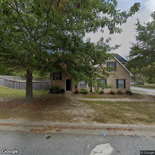
7211 Mill Arbor
7211 Mill Arbor
Lithonia, GA 30058
2 Weeks Ago
|
Edit
Favorites
7211 Mill Arbor

Favorites
Check Back Soon for Upcoming Availability
| Beds | Baths | Average SF |
|---|---|---|
| 3 Bedrooms 3 Bedrooms 3 Br | 2 Baths 2 Baths 2 Ba | — |
Location
Get Directions
Hills of granite create a fascinating landscape. Carved into this rugged terrain is the "City of Stone." For a city perched on a bed of rock, Lithonia is surprisingly green. Pine and oak trees line the streets, while a historic downtown offers terrific shops and boutiques. But granite put Lithonia on the map -- this city is located just south of one of Georgia's most-recognizable landmarks, Stone Mountain.
Home to roughly 2,000 residents, Lithonia is a small city located about 18 miles east of Atlanta. I-20 leads residents into the city. Panola Mountain State Park and the Davidson-Arabia Mountain Nature Preserve are to the south of Lithonia, providing terrific outdoor adventures.
Learn more about living in Lithonia
Education
| Colleges & Universities | Distance | ||
|---|---|---|---|
| Colleges & Universities | Distance | ||
| Drive: | 23 min | 11.3 mi | |
| Drive: | 27 min | 14.3 mi | |
| Drive: | 25 min | 15.0 mi | |
| Drive: | 30 min | 15.5 mi |
7211 Mill Arbor is within 23 minutes or 11.3 miles from Georgia Perim., Clarkston. It is also near Agnes Scott College and Georgia Perim. Coll., Decatur.
Transportation options available in Lithonia include Indian Creek, located 10.0 miles from 7211 Mill Arbor. 7211 Mill Arbor is near Hartsfield - Jackson Atlanta International, located 25.0 miles or 39 minutes away.
| Transit / Subway | Distance | ||
|---|---|---|---|
| Transit / Subway | Distance | ||
|
|
Drive: | 21 min | 10.0 mi |
|
|
Drive: | 23 min | 11.7 mi |
| Commuter Rail | Distance | ||
|---|---|---|---|
| Commuter Rail | Distance | ||
|
|
Drive: | 37 min | 25.3 mi |
| Airports | Distance | ||
|---|---|---|---|
| Airports | Distance | ||
|
Hartsfield - Jackson Atlanta International
|
Drive: | 39 min | 25.0 mi |
Time and distance from 7211 Mill Arbor.
| Shopping Centers | Distance | ||
|---|---|---|---|
| Shopping Centers | Distance | ||
| Drive: | 8 min | 3.0 mi | |
| Drive: | 8 min | 3.1 mi | |
| Drive: | 8 min | 3.1 mi |
7211 Mill Arbor has 3 shopping centers within 3.1 miles, which is about a 8-minute drive. The miles and minutes will be for the farthest away property.
| Parks and Recreation | Distance | ||
|---|---|---|---|
| Parks and Recreation | Distance | ||
|
DeShong Park
|
Drive: | 11 min | 4.4 mi |
|
Yellow River Park
|
Drive: | 15 min | 5.6 mi |
|
Arabia Mountain Heritage Area and Nature Center
|
Drive: | 15 min | 6.4 mi |
|
Yellow River Game Ranch
|
Drive: | 18 min | 8.2 mi |
|
Stone Mountain State Memorial Park
|
Drive: | 23 min | 10.3 mi |
7211 Mill Arbor has 5 parks within 10.3 miles, including DeShong Park, Yellow River Park, and Arabia Mountain Heritage Area and Nature Center.
| Hospitals | Distance | ||
|---|---|---|---|
| Hospitals | Distance | ||
| Drive: | 12 min | 5.6 mi | |
| Drive: | 19 min | 10.7 mi | |
| Drive: | 26 min | 13.3 mi |
7211 Mill Arbor has 3 hospitals within 13.3 miles, the nearest is Emory Hillandale Hospital which is 5.6 miles away and a 12 minute drive.
| Military Bases | Distance | ||
|---|---|---|---|
| Military Bases | Distance | ||
| Drive: | 36 min | 22.7 mi | |
| Drive: | 38 min | 25.7 mi |
7211 Mill Arbor is 22.7 miles from Fort Gillem, and is convenient to other military bases, including Fort McPherson.
You May Also Like
Similar Rentals Nearby
-
-
-
-
1 / 58

-
-
-

-
-
-


What Are Walk Score®, Transit Score®, and Bike Score® Ratings?
Walk Score® measures the walkability of any address. Transit Score® measures access to public transit. Bike Score® measures the bikeability of any address.
What is a Sound Score Rating?
A Sound Score Rating aggregates noise caused by vehicle traffic, airplane traffic and local sources
7211 Mill Arbor
Lithonia, GA 30058