
$2,600
Total Monthly Price
12 Month Lease
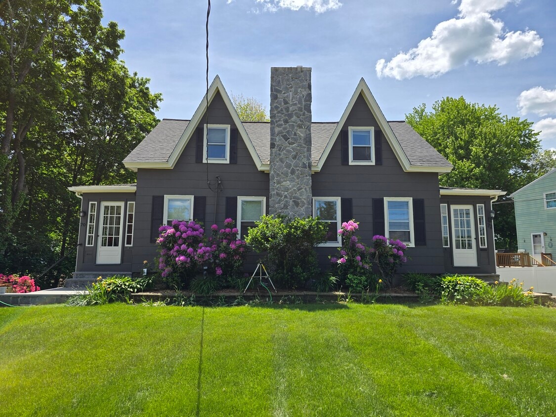
72 High St
Mansfield, MA 02048
Favorites
-
Bedrooms
3
-
Bathrooms
1
-
Square Feet
1,147 sq ft
-
Available
Available Jun 15
Highlight
- Hardwood Floors
72 High St

Favorites
About This Home
12 Month Lease,
$2,000 deposit,
Available Jun 15
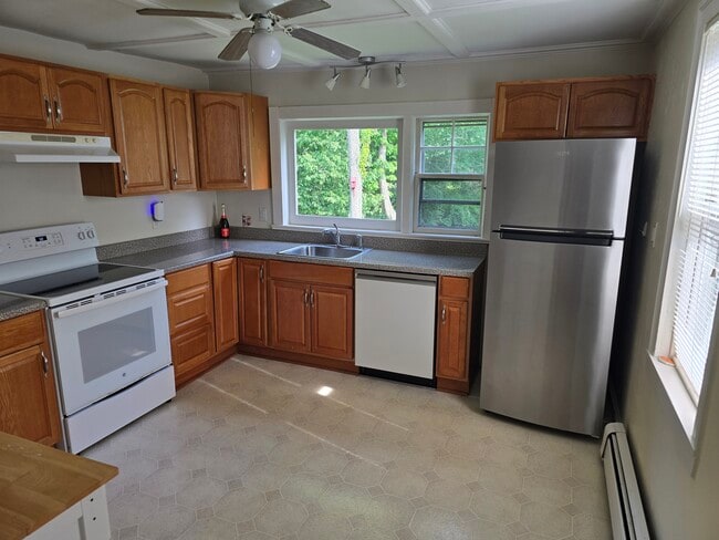
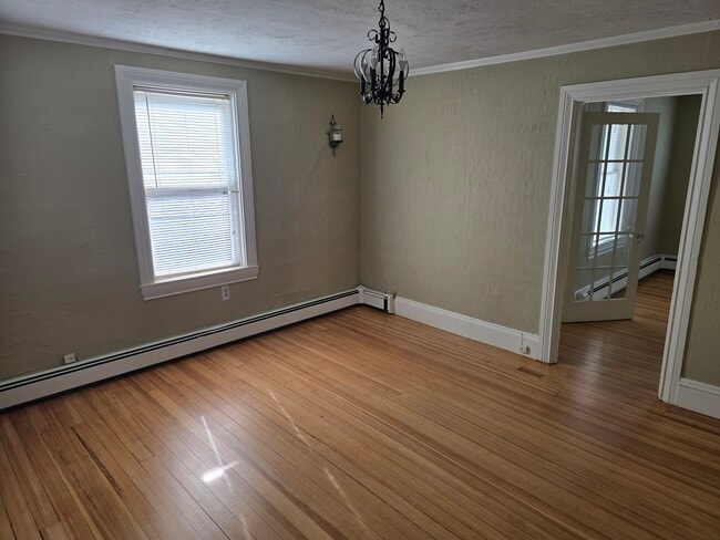
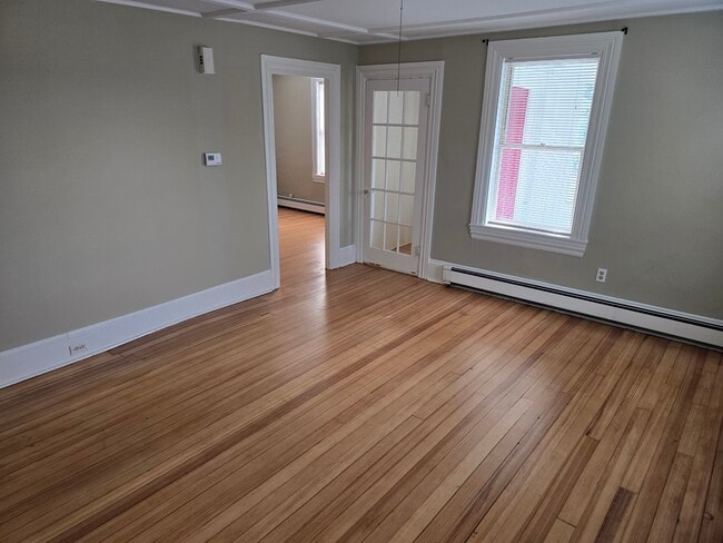
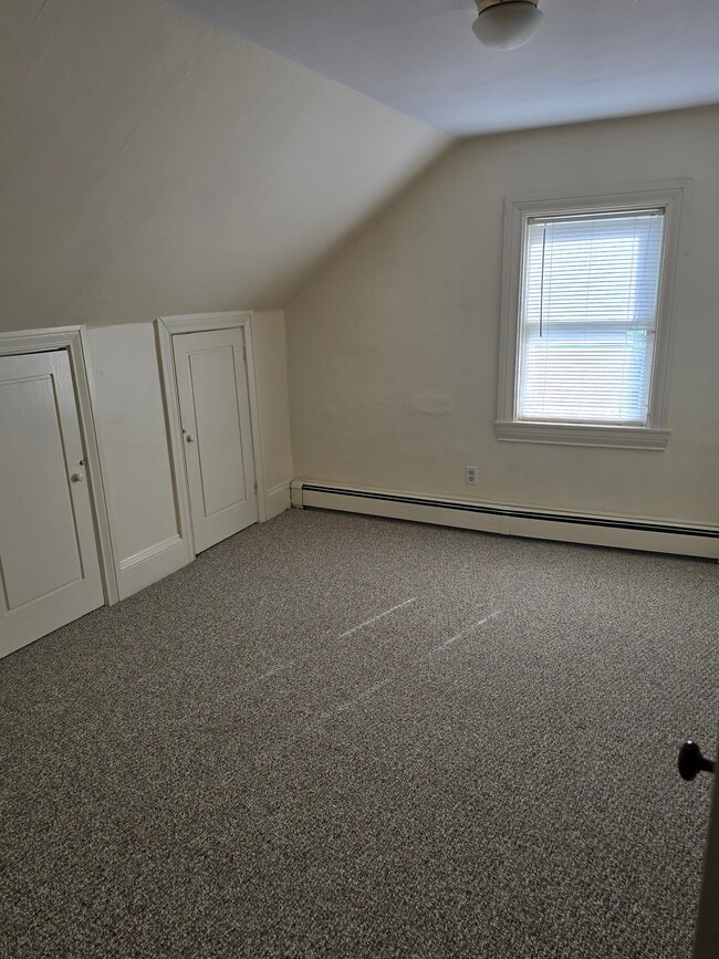
Commuter's dream in Mansfield and HEAT is included!! $2600/Month 7 minute walk to the MBTA station and Blue Apple Bus. 6 minute drive to 95 and 4 minute drive to 495. 3 Bedrooms, 1 Bath, located on the Rumford River with gorgeous views of Fulton Pond. Updated appliances (fridge less than 4 years old, dishwasher less than 2 years old.) Hardwood floors on the first floor, wall to wall carpet on second floor. Older home with lots of original charm. Owners live on property. NOTE: No laundry on property. Rent includes water, sewer, landscaping, trash pickup and heat. (Yes, heat is included). Tenant takes care of their electric, internet and snow removal for their driveway and steps.
72 High St is a townhome located in Bristol County and the 02048 ZIP Code.
* Price shown is total price based on community-supplied monthly required fees. Excludes user-selected optional fees and variable or usage-based fees and required charges due at or prior to move-in or at move-out. Price, availability, fees, and any applicable rent special are subject to change without notice.
* Square footage definitions vary. Displayed square footage is approximate.
Townhome Features
Dishwasher
Hardwood Floors
Refrigerator
Carpet
- Dishwasher
- Refrigerator
- Hardwood Floors
- Carpet
- Trash Pickup - Curbside
- Pond
Contact
- Contact
Location
Get Directions
Mansfield is a peaceful suburb about 30 miles south of Boston and 20 miles north of Providence, Rhode Island. This family-friendly city is home to great schools and scenic outdoor areas like the sprawling Great Woods Conservation Area and Marie Streese Conservation Area. The Interstate 95 and 495 junction and the Mansfield train station, served by MBTA’s commuter line between Providence and Boston, make the city great for commuters as well. The Mansfield Municipal Airport is situated towards the south of town, making further travel accessible. Other amenities in Mansfield include Mansfield Crossing, a large shopping center off Interstate 495, and great local restaurants off Main Street in Mansfield Center. Several sprawling golf courses reside outside of the city, and residents enjoy the quick travel time to Boston and Providence for big-city amenities and attractions.
Learn more about living in Mansfield
Education
| Colleges & Universities | Distance | ||
|---|---|---|---|
| Colleges & Universities | Distance | ||
| Drive: | 11 min | 5.4 mi | |
| Drive: | 20 min | 9.7 mi | |
| Drive: | 30 min | 14.4 mi | |
| Drive: | 29 min | 17.2 mi |
72 High St is within 11 minutes or 5.4 miles from Wheaton College, Norton. It is also near Stonehill College and Massasoit C.C., Brockton.
Getting Around
 What do Walkability, Transit, Drivability, and Bikeability mean?
Walkability measures the walking distance to day-to-day needs.
Transit measures access to public transportation.
Drivability measures congestion, parking availability, and access to major roads.
Bikeability measures the suitability for cycling.
How It Works
What do Walkability, Transit, Drivability, and Bikeability mean?
Walkability measures the walking distance to day-to-day needs.
Transit measures access to public transportation.
Drivability measures congestion, parking availability, and access to major roads.
Bikeability measures the suitability for cycling.
How It Works
Fairly Walkable
Walkability
50
/ 100
Some Public Transit
Transit
50
/ 100
Exceptionally Drivable
Drivability
90
/ 100
Fairly Bikeable
Bikeability
40
/ 100
Scores provided by
-
Soundscore™
-
/ 100
Traffic
-Airport
-Businesses
-Scores provided by
HowLoud What is a Sound Score Rating? A Sound Score Rating aggregates noise caused by vehicle traffic, airplane traffic and local sources. How It Works
Amenities
- Dishwasher
- Refrigerator
- Hardwood Floors
- Carpet
- Trash Pickup - Curbside
- Pond
72 High St Photos
What Are Walk Score®, Transit Score®, and Bike Score® Ratings?
Walk Score® measures the walkability of any address. Transit Score® measures access to public transit. Bike Score® measures the bikeability of any address.
What is a Sound Score Rating?
A Sound Score Rating aggregates noise caused by vehicle traffic, airplane traffic and local sources.
72 High St
Mansfield, MA 02048