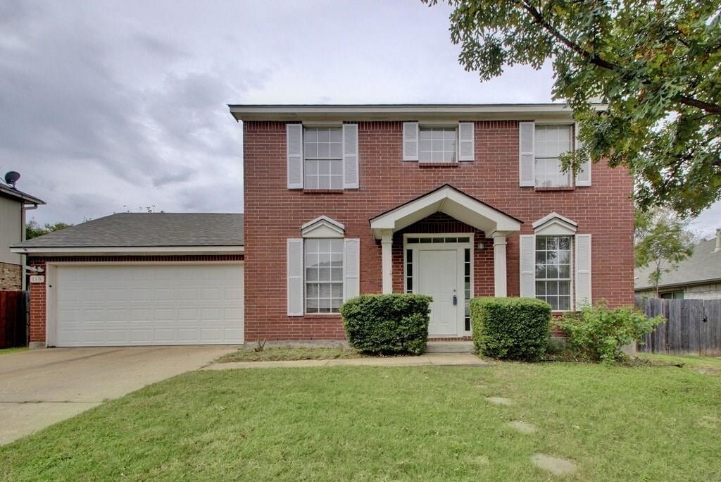
$1,475 / Month

710 Camp Fire Trail

,

Pflugerville, TX 78660

2 Weeks Ago
| Edit

Under 30 minutes

Commute Time is calculated at rush hour.
Share Listing
Favorites
710 Camp Fire Trail
Share Listing
Favorites

Check Back Soon for Upcoming Availability

Beds Baths Average SF
3 Bedrooms 3 Bedrooms 3 Br 2.5 Baths 2.5 Baths 2.5 Ba 1,498 SF

Fees and Policies

The fees listed below are community-provided and may exclude utilities or add-ons. All payments are made directly to the property and are non-refundable unless otherwise specified.

  • Dogs Allowed
  • Fees not specified
  • Cats Allowed
  • Fees not specified

About This Property

Open House Saturday October 27th 2:30-3:30pm. Great updated 3 bed 2.5 bath home in the Setters Ridge Subdivision. Large fenced-in back yard . Close to schools, bike trail, parks, and library. Pets Welcome. No application fee. Vacant and ready for immediate move in.

710 Camp Fire Trail is a house located in Travis County and the 78660 ZIP Code. This area is served by the Pflugerville Independent School District attendance zone.

House Features

  • Refrigerator
Location
710 Camp Fire Trail, Pflugerville,
TX 78660
Get Directions
City - Pflugerville

Pflugerville sits 14 miles northeast of Austin, carrying a distinct identity shaped by the German settlers who farmed this land starting in 1849. Named after Henry Pfluger Sr., who arrived from Germany following the revolutions of 1848, the city has grown from a rural farming community into one of Travis County's most established suburban destinations. Today, major employers like Amazon's distribution facility anchor the local economy, and the Pflugerville Independent School District serves the broader community through multiple campuses. State Highway 130 and State Highway 45 keep downtown Austin within easy reach without putting residents in the middle of the city's bustle.

The housing landscape here spans a wide range, from spacious townhomes and single-story rentals to modern apartment communities with resort-style amenities. Renters looking for more room to breathe will find generous floor plans compared to what closer-in Austin neighborhoods typically offer.

Learn more about living in Pflugerville 
Amenities
  • Refrigerator
Education
Colleges & Universities Distance
Drive: 10 min 4.6 mi
Drive: 14 min 6.5 mi
Drive: 21 min 12.6 mi
Drive: 21 min 14.9 mi
710 Camp Fire Trail is within 10 minutes or 4.6 miles from The Art Institute of Austin. It is also near Austin C.C., Northridge Campus and Austin C.C., Round Rock Campus.
Schools
Public Elementary School
Grades PK-5
500 Students
Attendance Zone
Public Middle School
Grades 6-8
815 Students
Attendance Zone
Public High School
Grades 9-12
1,814 Students
Attendance Zone
Private Elementary, Middle & High School
Grades PK-12
187 Students
Nearby
Private High School
Grades 9-12
101 Students
Nearby
Transportation

Transportation options available in Pflugerville include Howard Station, located 5.5 miles from 710 Camp Fire Trail. 710 Camp Fire Trail is near Austin-Bergstrom International, located 26.9 miles or 38 minutes away.

Transit / Subway Distance
Drive: 11 min 5.5 mi
Drive: 16 min 7.8 mi
Drive: 17 min 8.1 mi
Drive: 19 min 10.4 mi
Drive: 18 min 11.9 mi
Commuter Rail Distance
Drive: 26 min 17.6 mi
Drive: 29 min 19.6 mi
Airports Distance
Airports Distance
Austin-Bergstrom International
Drive: 38 min 26.9 mi

Walkability Near 710 Camp Fire Trail Pflugerville, TX 78660

Getting Around
Fairly Walkable
Walkability
40 / 100
Minimal Public Transit
Transit
0 / 100
Exceptionally Drivable
Drivability
90 / 100
Fairly Bikeable
Bikeability
50 / 100

Scores provided by

What do Walkability, Transit, Drivability, and Bikeability mean? Walkability measures the walking distance to day-to-day needs. Transit measures access to public transportation. Drivability measures congestion, parking availability, and access to major roads. Bikeability measures the suitability for cycling. How It Works
-
Soundscore
- / 100

Traffic

-

Airport

-

Businesses

-

Scores provided by

HowLoud What is a Sound Score Rating? A Sound Score Rating aggregates noise caused by vehicle traffic, airplane traffic and local sources. How It Works
Points of Interest

Time and distance from 710 Camp Fire Trail.

Shopping Centers Distance
Walk: 14 min 0.7 mi
Drive: 4 min 1.5 mi
Drive: 4 min 1.6 mi
710 Camp Fire Trail has 3 shopping centers within 1.6 miles, which is about a 4-minute drive. The miles and minutes will be for the farthest away property.
Parks and Recreation Distance
Copperfield Nature Trail and Park
Drive: 9 min 4.6 mi
Walnut Creek Park
Drive: 10 min 5.4 mi
Jourdan-Bachman Pioneer Farms
Drive: 12 min 5.9 mi
Balcones District Park
Drive: 16 min 7.9 mi
The Stephen F. Austin Planetarium
Drive: 16 min 9.1 mi
710 Camp Fire Trail has 5 parks within 9.1 miles, including Copperfield Nature Trail and Park, Walnut Creek Park, and Jourdan-Bachman Pioneer Farms.
Hospitals Distance
Hospitals Distance
Drive: 8 min 4.4 mi
Drive: 14 min 7.1 mi
Drive: 15 min 8.3 mi
710 Camp Fire Trail has 3 hospitals within 8.3 miles, the nearest is Baylor Scott & White Medical Center Pflugerville which is 4.4 miles away and a 8 minute drive.
Military Bases Distance
Drive: 80 min 63.8 mi
Drive: 100 min 81.7 mi
710 Camp Fire Trail is 63.8 miles from Fort Hood, and is convenient to other military bases, including Randolph Air Force Base.

You May Also Like

Similar Rentals Nearby