


$2,200 / Month
71 Maywood St
Roxbury, MA 02119
2 Weeks Ago
Favorites
71 Maywood St

Favorites
Check Back Soon for Upcoming Availability
| Beds | Baths | Average SF |
|---|---|---|
| 2 Bedrooms 2 Bedrooms 2 Br | 1 Bath 1 Bath 1 Ba | 1,291 SF |
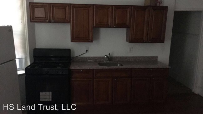
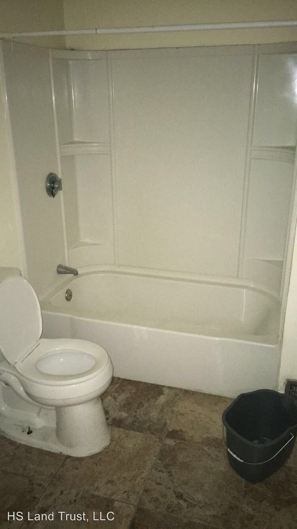
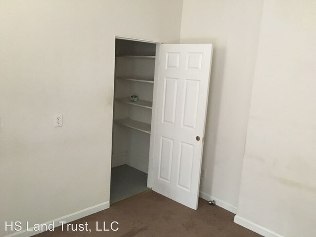
About This Property
(617) 522-8842 - - (RLNE3426434)
71 Maywood St is a condo located in Suffolk County and the 02119 ZIP Code.
Location
Get Directions
Roxbury is a historic and diverse community in southwest Boston, adjacent to some of the city’s most iconic landmarks. The north side borders the campus of Northeastern University and is just a few blocks from Fenway Park, the Medical Center, Back Bay, and the Emerald Necklace. The south side encompasses Franklin Park, allowing you to easily access the trails, playground, zoo, and golf course, ensuring fun for the whole family, wherever you look.
What is it like to live in Roxbury? Well, numerous public parks are spread throughout the community, providing lots of options when you feel like spending time outdoors. The neighborhood is mostly residential, with some of the more affordable apartments, condos, and rental houses in the city. With several MBTA stops around the neighborhood, all of Boston is right at your fingertips.
Learn more about living in RoxburyBelow are rent ranges for similar nearby apartments
| Beds | Average Size | Lowest | Typical | Premium |
|---|---|---|---|---|
| Studio Studio Studio | 3129 Sq Ft | $1,800 | $1,918 | $2,000 |
| 1 Bed 1 Bed 1 Bed | 4258-4260 Sq Ft | $1,900 | $2,268 | $3,200 |
| 2 Beds 2 Beds 2 Beds | 2700-2702 Sq Ft | $2,200 | $3,016 | $4,250 |
| 3 Beds 3 Beds 3 Beds | 4721 Sq Ft | $1,225 | $3,442 | $4,900 |
| 4 Beds 4 Beds 4 Beds | 6579 Sq Ft | $1,075 | $4,287 | $7,495 |
Education
| Colleges & Universities | Distance | ||
|---|---|---|---|
| Colleges & Universities | Distance | ||
| Drive: | 5 min | 2.3 mi | |
| Drive: | 5 min | 2.5 mi | |
| Drive: | 6 min | 2.5 mi | |
| Drive: | 5 min | 2.6 mi |
71 Maywood St is within 6 minutes or 2.5 miles from Northeastern University. It is also near Wentworth Inst. of Technology and MCPHS University, Boston.
Transportation options available in Roxbury include Jackson Square, located 1.5 miles from 71 Maywood St. 71 Maywood St is near General Edward Lawrence Logan International, located 6.3 miles or 13 minutes away.
| Transit / Subway | Distance | ||
|---|---|---|---|
| Transit / Subway | Distance | ||
| Drive: | 3 min | 1.5 mi | |
| Drive: | 4 min | 1.8 mi | |
| Drive: | 4 min | 1.8 mi | |
| Drive: | 5 min | 1.9 mi | |
| Drive: | 5 min | 2.1 mi |
| Commuter Rail | Distance | ||
|---|---|---|---|
| Commuter Rail | Distance | ||
| Walk: | 18 min | 1.0 mi | |
| Walk: | 21 min | 1.1 mi | |
| Drive: | 3 min | 1.3 mi | |
|
|
Drive: | 6 min | 2.2 mi |
|
|
Drive: | 6 min | 2.6 mi |
| Airports | Distance | ||
|---|---|---|---|
| Airports | Distance | ||
|
General Edward Lawrence Logan International
|
Drive: | 13 min | 6.3 mi |
Time and distance from 71 Maywood St.
| Shopping Centers | Distance | ||
|---|---|---|---|
| Shopping Centers | Distance | ||
| Walk: | 5 min | 0.3 mi | |
| Walk: | 11 min | 0.6 mi | |
| Drive: | 4 min | 1.7 mi |
71 Maywood St has 3 shopping centers within 1.7 miles, which is about a 4-minute walk. The miles and minutes will be for the farthest away property.
| Parks and Recreation | Distance | ||
|---|---|---|---|
| Parks and Recreation | Distance | ||
|
Lower Neponset River Trail
|
Walk: | 15 min | 0.8 mi |
|
Franklin Park Zoo
|
Walk: | 20 min | 1.0 mi |
|
Roxbury Heritage State Park
|
Drive: | 3 min | 1.4 mi |
|
Dorchester Shores Reservation
|
Drive: | 6 min | 2.6 mi |
|
Squantum Point Park
|
Drive: | 14 min | 5.0 mi |
71 Maywood St has 5 parks within 5.0 miles, including Lower Neponset River Trail, Franklin Park Zoo, and Roxbury Heritage State Park.
| Hospitals | Distance | ||
|---|---|---|---|
| Hospitals | Distance | ||
| Drive: | 3 min | 1.5 mi | |
| Drive: | 4 min | 1.6 mi | |
| Drive: | 6 min | 2.5 mi |
71 Maywood St has 3 hospitals within 2.5 miles, the nearest is Boston Medical Center which is 1.5 miles away and a 3 minute drive.
You May Also Like
Similar Rentals Nearby
-
-

-

-

-

-
1 / 7

-

-
-
-


What Are Walk Score®, Transit Score®, and Bike Score® Ratings?
Walk Score® measures the walkability of any address. Transit Score® measures access to public transit. Bike Score® measures the bikeability of any address.
What is a Sound Score Rating?
A Sound Score Rating aggregates noise caused by vehicle traffic, airplane traffic and local sources
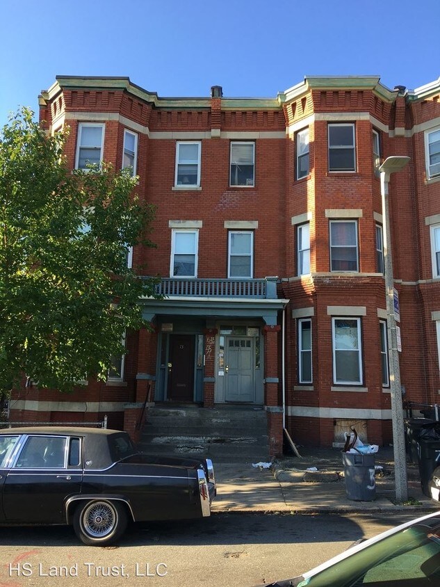
71 Maywood St
Roxbury, MA 02119