

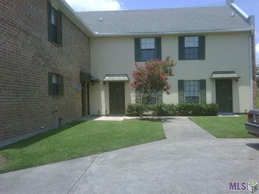
7081 Perkins Place Ct
Baton Rouge, LA 70808
Favorites
7081 Perkins Place Ct

Favorites
Check Back Soon for Upcoming Availability
| Beds | Baths | Average SF |
|---|---|---|
| 2 Bedrooms 2 Bedrooms 2 Br | 1 Bath 1 Bath 1 Ba | 1,200 SF |
About This Property
Charming two story, 2 bedroom/ 1.5 bath townhouse with all appliances in the One Perkins Place subdivision. Call Latter & Blum at (225) 297-7888 for more information!
7081 Perkins Place Ct is a house located in E Baton Rouge County and the 70808 ZIP Code.
Location
Get Directions
Named by French explorers as the “Red Stick City,” Baton Rouge is Louisiana’s capital city bursting with history and culture. A beautiful fusion of Cajun and Creole culture molds an extraordinary experience throughout this riverfront city.
The Louisiana State Capitol building dominates the landscape of downtown Baton Rouge, a gargantuan tower built in classic 1930s art deco style. Next door, the historic Spanish Town is a popular community for artists and bohemian types, with beautifully preserved homes and tree-shaded streets giving the impression of a charming small town.
While Baton Rouge is home to several colleges, Louisiana State University is the hub of the city. Tiger football is the undisputed center of attention throughout the fall. The famous Tiger Walk, tailgating, and raucous home games at Tiger Stadium, also known as Death Valley, is an experience thousands enjoy every season.
Learn more about living in Baton Rouge
Education
| Colleges & Universities | Distance | ||
|---|---|---|---|
| Colleges & Universities | Distance | ||
| Drive: | 10 min | 5.0 mi | |
| Drive: | 13 min | 6.1 mi | |
| Drive: | 21 min | 13.0 mi |
7081 Perkins Place Ct is within 10 minutes or 5.0 miles from Baton Rouge Community College. It is also near Louisiana State University and Southern Univ., Baton Rouge.
You May Also Like
Similar Rentals Nearby


What Are Walk Score®, Transit Score®, and Bike Score® Ratings?
Walk Score® measures the walkability of any address. Transit Score® measures access to public transit. Bike Score® measures the bikeability of any address.
What is a Sound Score Rating?
A Sound Score Rating aggregates noise caused by vehicle traffic, airplane traffic and local sources
7081 Perkins Place Ct
Baton Rouge, LA 70808