
$2,400
/ Month
7028 Heathfield Rd
Baltimore, MD 21212
Today
|
Edit
Favorites
443-944-6631
-
Bedrooms
3
-
Bathrooms
2
-
Square Feet
--
-
Available
Available Feb 23
Highlights
- Fireplace
- Basement
7028 Heathfield Rd

Favorites
About This Home
Available Feb 23
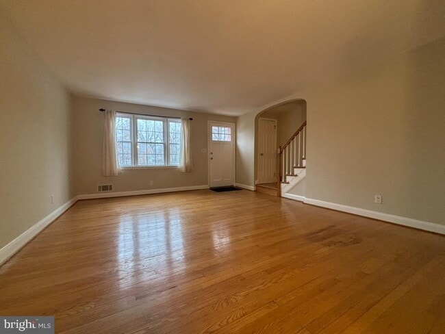
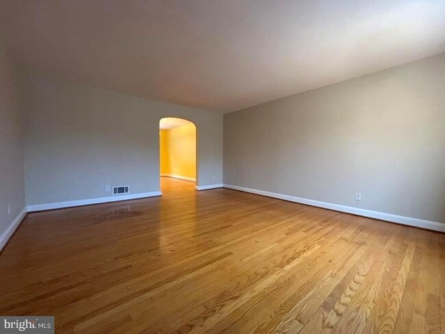
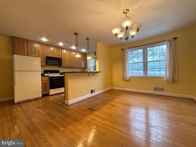
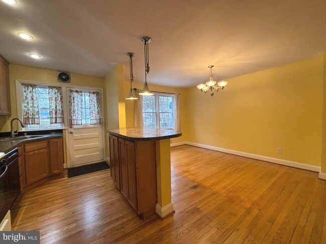
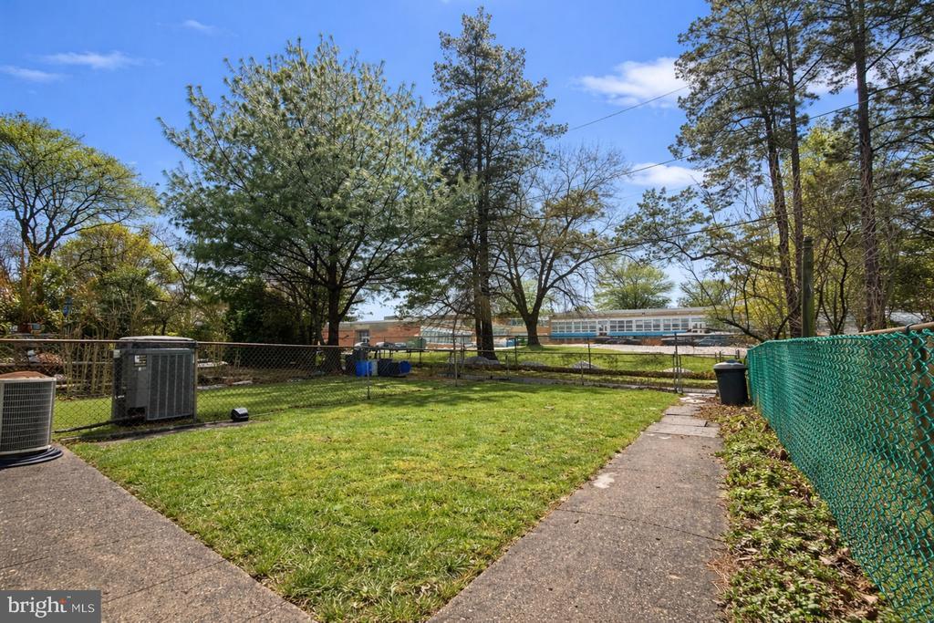
Fantastic Rodgers Forge Location! Exceptional Properties. Exceptional Clients. Absolutely charming 3-bedroom, 2 full bath townhome in rarely available Rodgers Forge! Main floor features living room, open dining room & kitchen w/ breakfast bar. The upper level provides 3 bedrooms, all with fresh paint, and a full bath. The fully finished lower level contributes a large family room, full bath, bonus room, and laundry room. Fantastic exterior space, fenced in back yard & sun-filled front porch. Short distance to schools (right across from the back yard), RF tot lot, and easy commuter routes.
7028 Heathfield Rd is a townhome located in Baltimore County and the 21212 ZIP Code. This area is served by the Baltimore County Public Schools attendance zone.
* Price shown is base rent. Excludes user-selected optional fees and variable or usage-based fees and required charges due at or prior to move-in or at move-out. Price, availability, fees, and any applicable rent special are subject to change without notice.
* Square footage definitions vary. Displayed square footage is approximate.
Townhome Features
- Fireplace
- Basement
Contact
- Listed by John Dustin Majewski | AB & Co Realtors, Inc.
- Phone Number
- Contact
-
Source
 Bright MLS, Inc.
Copyright © 2026 Bright MLS, Inc.
Location
Get Directions
Towson Circle encompasses parts of Interstate 695, 83, and the slew of neighborhoods that surround the center of Towson. In recent years this part of the city has become the home of modern retail centers like Circle East, which provides upscale shopping and dining as well as impressive modern architecture for this charming Maryland suburb. There’s an amazing mix of single-family homes, affordable apartments, and modern mid-rise communities available to renters, all with fantastic proximity to the center of the city and the plentiful parks that surround it.
Learn more about living in Towson Circle
Amenities
- Fireplace
- Basement
Education
| Colleges & Universities | Distance | ||
|---|---|---|---|
| Colleges & Universities | Distance | ||
| Walk: | 16 min | 0.8 mi | |
| Drive: | 6 min | 2.3 mi | |
| Drive: | 9 min | 3.0 mi | |
| Drive: | 8 min | 3.1 mi |
7028 Heathfield Rd is within 16 minutes or 0.8 mile from Towson University. It is also near Loyola University Maryland and Notre Dame of Md. Univ..
Schools


Public Elementary School
Grades K-5
396 Students
Attendance Zone
Charter Elementary & Middle School
Grades PK-5 & 7
376 Students
Nearby
Public Middle School
Grades 6-8
1,073 Students
Attendance Zone
Public High School
Grades 9-12
1,676 Students
Attendance Zone
Private Elementary & Middle School
Grades PK-8
148 Students
Nearby
Private High School
Grades 6 & 10
6 Students
Nearby
School data provided by
 The GreatSchools Rating helps parents compare schools within a state based on a variety of school quality indicators and provides a helpful picture of how effectively each school serves all of its students. Ratings are on a scale of 1 (below average) to 10 (above average) and can include test scores, college readiness, academic progress, advanced courses, equity, discipline and attendance data. We also advise parents to visit schools, consider other information on school performance and programs, and consider family needs as part of the school selection process.
View GreatSchools Rating Methodology
Data provided by GreatSchools.org © 2026. All rights reserved.
View GreatSchools Rating Methodology
Data provided by GreatSchools.org © 2026. All rights reserved.
Transportation options available in Baltimore include Falls Road, located 3.6 miles from 7028 Heathfield Rd. 7028 Heathfield Rd is near Baltimore/Washington International Thurgood Marshall, located 17.0 miles or 37 minutes away.
| Transit / Subway | Distance | ||
|---|---|---|---|
| Transit / Subway | Distance | ||
|
|
Drive: | 11 min | 3.6 mi |
|
|
Drive: | 10 min | 4.0 mi |
|
|
Drive: | 10 min | 4.4 mi |
|
|
Drive: | 10 min | 4.6 mi |
|
|
Drive: | 12 min | 5.0 mi |
| Commuter Rail | Distance | ||
|---|---|---|---|
| Commuter Rail | Distance | ||
|
|
Drive: | 16 min | 5.6 mi |
| Drive: | 21 min | 7.4 mi | |
| Drive: | 22 min | 9.7 mi | |
| Drive: | 34 min | 14.7 mi | |
| Drive: | 27 min | 16.0 mi |
| Airports | Distance | ||
|---|---|---|---|
| Airports | Distance | ||
|
Baltimore/Washington International Thurgood Marshall
|
Drive: | 37 min | 17.0 mi |
Time and distance from 7028 Heathfield Rd.
| Shopping Centers | Distance | ||
|---|---|---|---|
| Shopping Centers | Distance | ||
| Walk: | 13 min | 0.7 mi | |
| Walk: | 14 min | 0.7 mi | |
| Walk: | 15 min | 0.8 mi |
7028 Heathfield Rd has 3 shopping centers within 0.8 mile, which is about a 15-minute walk. The miles and minutes will be for the farthest away property.
| Parks and Recreation | Distance | ||
|---|---|---|---|
| Parks and Recreation | Distance | ||
|
Watson-King Planetarium
|
Drive: | 4 min | 1.4 mi |
|
Hampton National Historic Site
|
Drive: | 7 min | 3.2 mi |
|
Lake Roland Park
|
Drive: | 12 min | 3.8 mi |
|
Cylburn Arboretum
|
Drive: | 13 min | 4.6 mi |
|
Maryland Space Grant Consortium Observatory
|
Drive: | 15 min | 4.9 mi |
7028 Heathfield Rd has 5 parks within 4.9 miles, including Watson-King Planetarium, Lake Roland Park, and Hampton National Historic Site.
| Hospitals | Distance | ||
|---|---|---|---|
| Hospitals | Distance | ||
| Walk: | 11 min | 0.6 mi | |
| Drive: | 4 min | 1.6 mi | |
| Drive: | 5 min | 2.1 mi |
7028 Heathfield Rd has 3 hospitals within 2.1 miles, the nearest is University of Maryland St. Joseph Medical Center which is 0.6 mile away and a 11 minute walk.
| Military Bases | Distance | ||
|---|---|---|---|
| Military Bases | Distance | ||
| Drive: | 49 min | 25.2 mi |
7028 Heathfield Rd is 25.2 miles and a 49 minute drive from Fort George Meade.
You May Also Like
Similar Rentals Nearby


What Are Walk Score®, Transit Score®, and Bike Score® Ratings?
Walk Score® measures the walkability of any address. Transit Score® measures access to public transit. Bike Score® measures the bikeability of any address.
What is a Sound Score Rating?
A Sound Score Rating aggregates noise caused by vehicle traffic, airplane traffic and local sources
7028 Heathfield Rd
Baltimore, MD 21212