$2,850 / Month
70 Nelsons Way
Westampton, NJ 08060
Today
Favorites
640-203-3414
-
Bedrooms
3
-
Bathrooms
2.5
-
Square Feet
1,500 sq ft
-
Available
Available May 21
Highlights
- Walk-In Closets
- Playground
- Security System
70 Nelsons Way

Favorites
About This Home
12 Month Lease,
$4,500 deposit,
Available May 21
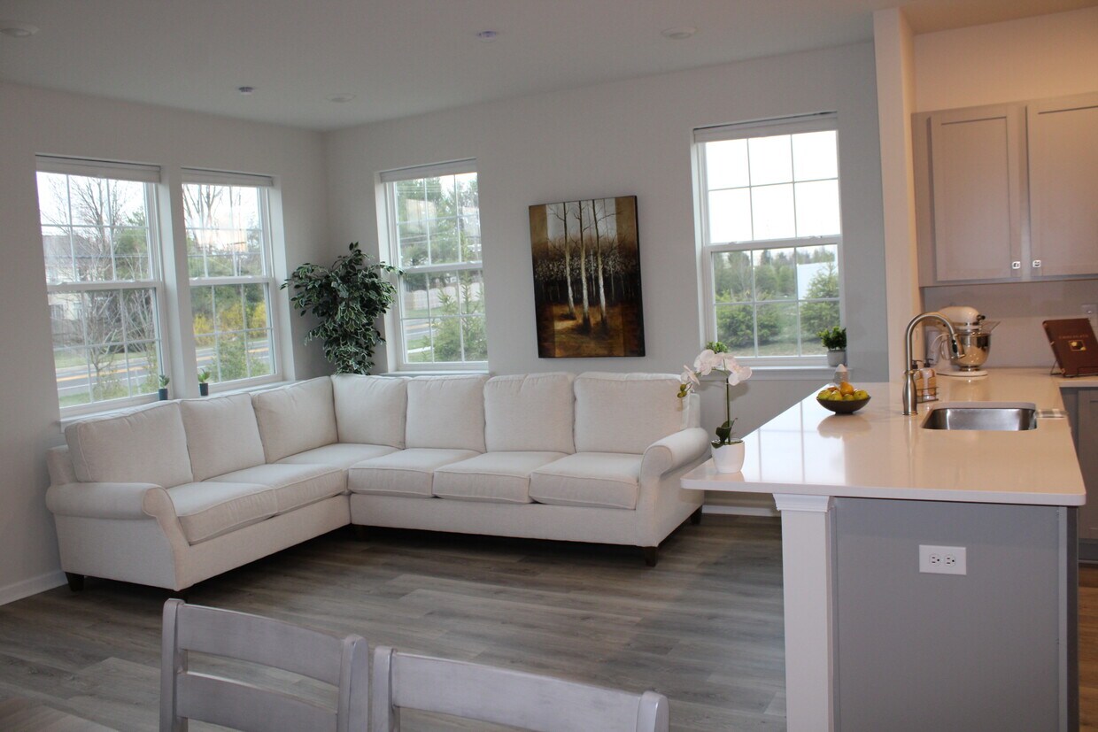
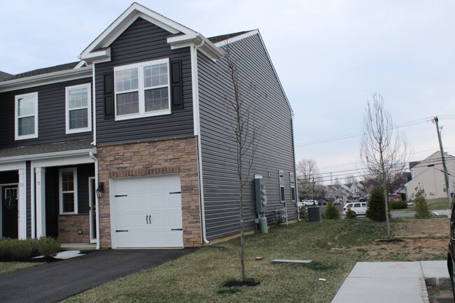
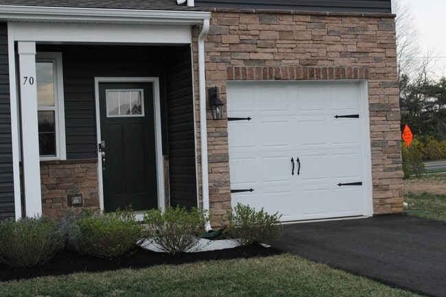
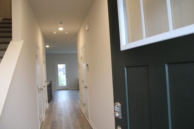
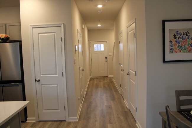
Welcome Home to 70 Nelson’s Way at Laurel Run! This beautifully crafted 2-story townhome offers 1,500 sq ft of modern living in the heart of Burlington County. Featuring 3 bedrooms, 2.5 baths, and a 1-car garage, this home blends style and convenience with an open-concept layout, perfect for everyday living and entertaining. Enjoy top-tier finishes including Quartz countertops, stainless steel appliances, recessed lighting, upgraded cabinetry, and luxury flooring throughout. The chef’s kitchen boasts an oversized peninsula and large pantry, flowing effortlessly into a bright and airy living/dining space. The primary suite offers a walk-in closet and private bath, while two additional bedrooms share a full hall bath. The upstairs laundry room and smart home features add everyday ease. Located just minutes from I-295, the NJ Turnpike, Route 130, local parks, and major shopping—including Moorestown and Cherry Hill Malls—Laurel Run is perfect for commuters and lifestyle seekers alike. Community amenities include a playground and scenic green space. Don’t miss your chance to call 70 Nelson’s Way home! Listing Presented by Corcoran Sawyer Smith
70 Nelsons Way is a townhome located in Burlington County and the 08060 ZIP Code.
* Price shown is base rent and may not include non-optional fees and utilities.
Price, availability, fees, and any applicable rent special are subject to change without notice.
* Square footage definitions vary. Displayed square footage is approximate.
Townhome Features
Washer/Dryer
High Speed Internet Access
Walk-In Closets
Tub/Shower
- High Speed Internet Access
- Washer/Dryer
- Heating
- Cable Ready
- Security System
- Storage Space
- Tub/Shower
- Stainless Steel Appliances
- Pantry
- Kitchen
- Quartz Countertops
- Walk-In Closets
- Laundry Facilities
- Playground
Fees and Policies
The fees below are based on community-supplied data and may exclude additional fees and utilities.
- Parking
-
Garage--
Details
Property Information
-
Built in 2023
Contact
- Phone Number
Location
Get Directions
Westampton is a small town in New Jersey that’s primarily made up of industrial centers, open land, and residential neighborhoods. Located about 25 miles northeast of Philadelphia, Pennsylvania, residents have quick and easy access into neighboring metropolitan communities. This short commute will take you past the Adventure Aquarium, across the Delaware River, and through Franklin Square.
This sparse suburb sits near the Columbus Farmers Market where local vendors sell their fresh goods, and the Moorestown Mall is just a few miles down Interstate 295. Rancocas State Park sits below Westampton, offering scenic hiking, jogging, and biking trails through densely forested lands. Though Westampton is mainly residential and industrial, there are a few local businesses around town and chain conveniences, along with high-ranking public schools like Rancocas Valley Regional High School.
Learn more about living in Westampton
Education
| Colleges & Universities | Distance | ||
|---|---|---|---|
| Colleges & Universities | Distance | ||
| Drive: | 11 min | 5.4 mi | |
| Drive: | 25 min | 13.3 mi | |
| Drive: | 23 min | 14.5 mi | |
| Drive: | 28 min | 15.0 mi |
70 Nelsons Way is within 11 minutes or 5.4 miles from Burlington Co., Mount Laurel. It is also near Holy Family University and Burlington Co. Coll Pemberton.
Transportation options available in Westampton include Burlington Towne Center, located 4.3 miles from 70 Nelsons Way. 70 Nelsons Way is near Trenton Mercer, located 22.3 miles or 37 minutes away, and Philadelphia International, located 28.0 miles or 42 minutes away.
| Transit / Subway | Distance | ||
|---|---|---|---|
| Transit / Subway | Distance | ||
|
|
Drive: | 7 min | 4.3 mi |
|
|
Drive: | 10 min | 5.0 mi |
|
|
Drive: | 9 min | 5.0 mi |
|
|
Drive: | 11 min | 7.0 mi |
|
|
Drive: | 12 min | 7.5 mi |
| Commuter Rail | Distance | ||
|---|---|---|---|
| Commuter Rail | Distance | ||
|
|
Drive: | 15 min | 7.6 mi |
|
|
Drive: | 15 min | 8.1 mi |
|
|
Drive: | 18 min | 9.9 mi |
|
|
Drive: | 21 min | 11.0 mi |
|
|
Drive: | 24 min | 12.9 mi |
| Airports | Distance | ||
|---|---|---|---|
| Airports | Distance | ||
|
Trenton Mercer
|
Drive: | 37 min | 22.3 mi |
|
Philadelphia International
|
Drive: | 42 min | 28.0 mi |
Time and distance from 70 Nelsons Way.
| Shopping Centers | Distance | ||
|---|---|---|---|
| Shopping Centers | Distance | ||
| Drive: | 3 min | 1.7 mi | |
| Drive: | 4 min | 2.5 mi | |
| Drive: | 5 min | 2.6 mi |
70 Nelsons Way has 3 shopping centers within 2.6 miles, which is about a 5-minute drive. The miles and minutes will be for the farthest away property.
| Parks and Recreation | Distance | ||
|---|---|---|---|
| Parks and Recreation | Distance | ||
|
Rancocas Nature Center
|
Drive: | 4 min | 3.0 mi |
|
Paws Farm Nature Center
|
Drive: | 11 min | 6.2 mi |
|
Rancocas State Park
|
Drive: | 13 min | 6.8 mi |
|
Historic Smithville Park
|
Drive: | 13 min | 7.0 mi |
|
Neshaminy State Park
|
Drive: | 18 min | 8.9 mi |
70 Nelsons Way has 5 parks within 8.9 miles, including Rancocas Nature Center, Paws Farm Nature Center, and Historic Smithville Park.
| Hospitals | Distance | ||
|---|---|---|---|
| Hospitals | Distance | ||
| Drive: | 2 min | 1.5 mi | |
| Drive: | 8 min | 3.1 mi | |
| Drive: | 9 min | 6.0 mi |
70 Nelsons Way has 3 hospitals within 6.0 miles, the nearest is Hampton Behavioral Health System which is 1.5 miles away and a 2 minute drive.
| Military Bases | Distance | ||
|---|---|---|---|
| Military Bases | Distance | ||
| Drive: | 30 min | 16.5 mi | |
| Drive: | 39 min | 21.4 mi |
70 Nelsons Way is 16.5 miles from McGuire Air Force Base, and is convenient to other military bases, including Fort Dix Military Reservation New Hanover.
Amenities
- High Speed Internet Access
- Washer/Dryer
- Heating
- Cable Ready
- Security System
- Storage Space
- Tub/Shower
- Stainless Steel Appliances
- Pantry
- Kitchen
- Quartz Countertops
- Walk-In Closets
- Laundry Facilities
- Playground
70 Nelsons Way Photos
What Are Walk Score®, Transit Score®, and Bike Score® Ratings?
Walk Score® measures the walkability of any address. Transit Score® measures access to public transit. Bike Score® measures the bikeability of any address.
What is a Sound Score Rating?
A Sound Score Rating aggregates noise caused by vehicle traffic, airplane traffic and local sources

70 Nelsons Way
Westampton, NJ 08060