

$3,400 / Month
7 High St Pl
Brookline, MA 02445
Today
Favorites
-
Bedrooms
2
-
Bathrooms
1
-
Square Feet
--
7 High St Pl

Favorites
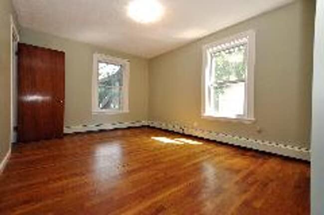
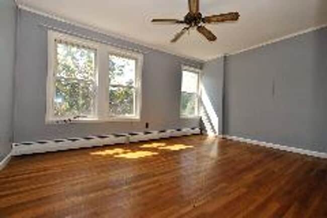
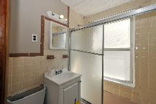
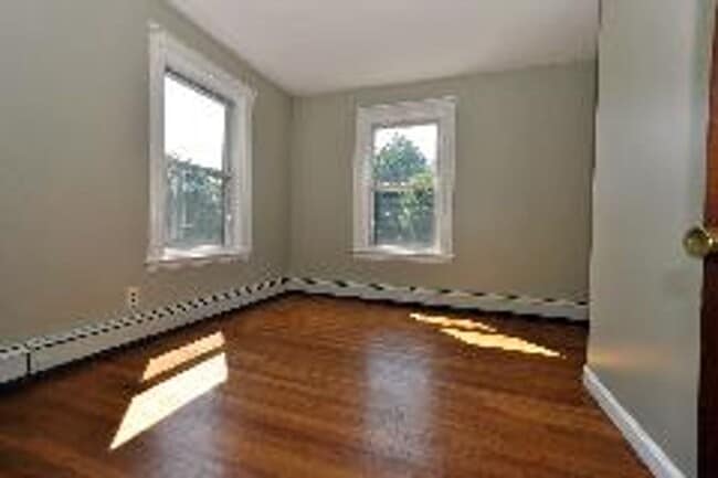
About This Home
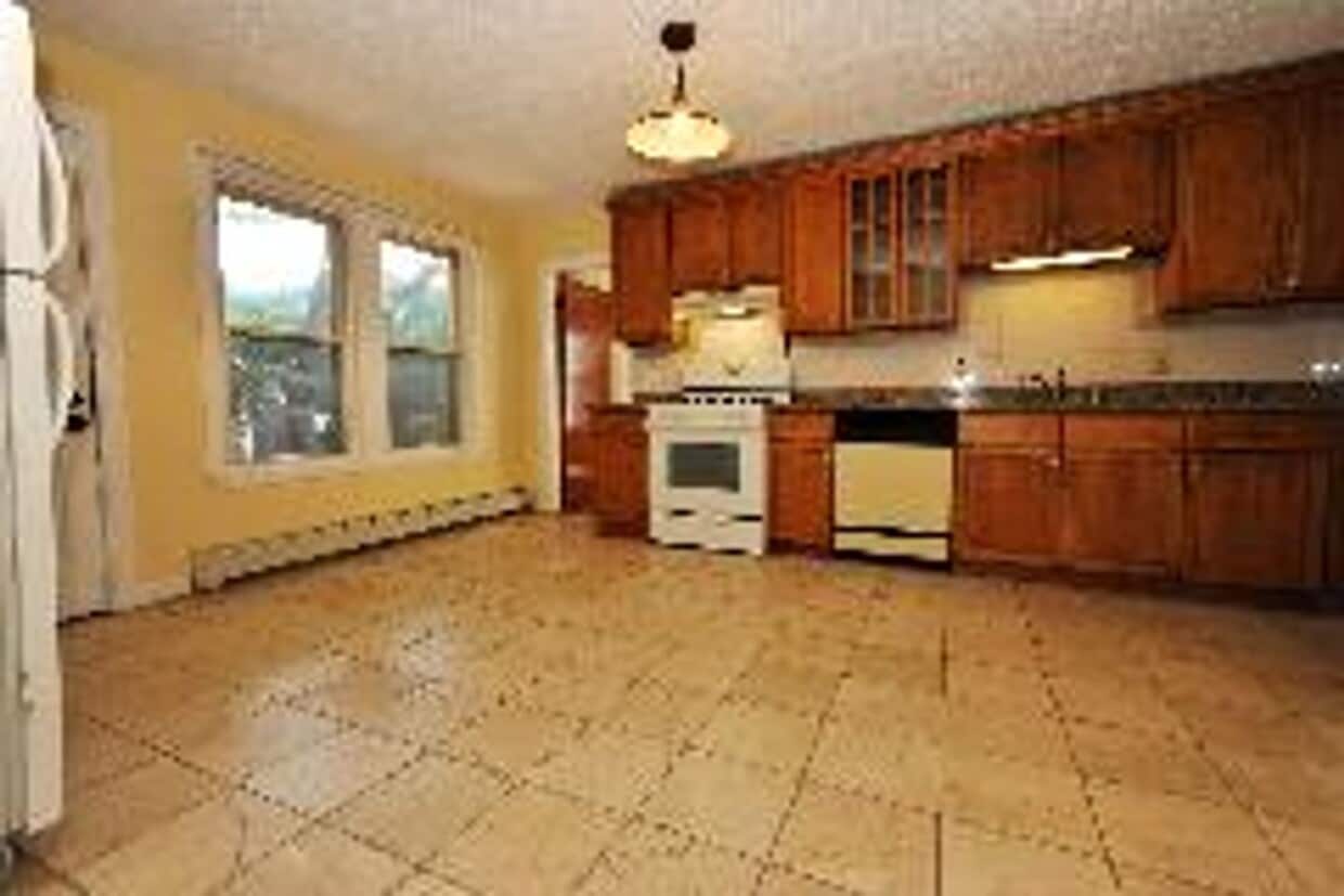
Available 9/1 or Earlier Beautiful 2 bedroom apartment in the Brookline Hills area, roughly a half mile to either the D or E Green Line Trains. One off street parking spot included! Coin-op laundry in basement. Transportation: Bus: 39 S Huntington Ave @ Bynner St (0.47 mi) Bus: 60 High St @ Highland Rd (0.04 mi) Tram: D Brookline Hills (0.45 mi) Tram: E Riverway (0.59 mi) Bus: 66 Washington St @ Walnut St (0.45 mi) Bus: 65 Washington St @ Harvard St (0.49 mi)
7 High St Pl is a house located in Norfolk County and the 02445 ZIP Code. This area is served by the Brookline attendance zone.
* Price shown is base rent and may not include non-optional fees and utilities.
Price, availability, fees, and any applicable rent special are subject to change without notice.
* Square footage definitions vary. Displayed square footage is approximate.
Contact
- Listed by Modern Real Estate (AD) | Modern Real Estate (AD)
Location
Get Directions
Brookline Village is an opulent neighborhood about five miles outside of Boston by car or train. This historic district is known for its beautiful homes and eclectic shopping destinations along Harvard Street and Washington Street. The other parts of Brookline Village feature lush community parks and residential homes. Renters have an abundance of moderately priced to luxury apartments and condos as well as spacious single-family homes for rent. Just outside of the neighborhood, residents enjoy parks like Olmsted Park, resort-like golf courses, and all the attractions offered by the big city.
Learn more about living in Brookline Village
Education
| Colleges & Universities | Distance | ||
|---|---|---|---|
| Colleges & Universities | Distance | ||
| Drive: | 2 min | 1.5 mi | |
| Drive: | 3 min | 1.9 mi | |
| Drive: | 4 min | 1.9 mi | |
| Drive: | 4 min | 1.9 mi |
7 High St Pl is within 2 minutes or 1.5 miles from MCPHS University, Boston. It is also near Simmons College and Emmanuel College.
Schools


Public Elementary & Middle School
Grades PK-8
931 Students
Nearby
Public Elementary & Middle School
Grades K-8
485 Students
Attendance Zone
Public High School
Grades 9-12
2,087 Students
Attendance Zone
Private Elementary & Middle School
Grades PK-8
235 Students
Nearby
Private Elementary School
Grades K-5
450 Students
Nearby
Private Elementary & Middle School
Grades 2 & 4-9
21 Students
Nearby
School data provided by
 The GreatSchools Rating helps parents compare schools within a state based on a variety of school quality indicators and provides a helpful picture of how effectively each school serves all of its students. Ratings are on a scale of 1 (below average) to 10 (above average) and can include test scores, college readiness, academic progress, advanced courses, equity, discipline and attendance data. We also advise parents to visit schools, consider other information on school performance and programs, and consider family needs as part of the school selection process.
View GreatSchools Rating Methodology
Data provided by GreatSchools.org © 2025. All rights reserved.
View GreatSchools Rating Methodology
Data provided by GreatSchools.org © 2025. All rights reserved.
Transportation options available in Brookline include Brookline Village Station, located 0.5 mile from 7 High St Pl. 7 High St Pl is near General Edward Lawrence Logan International, located 8.1 miles or 16 minutes away.
| Transit / Subway | Distance | ||
|---|---|---|---|
| Transit / Subway | Distance | ||
|
|
Walk: | 10 min | 0.5 mi |
|
|
Walk: | 14 min | 0.7 mi |
|
|
Walk: | 14 min | 0.7 mi |
|
|
Walk: | 15 min | 0.8 mi |
|
|
Walk: | 16 min | 0.9 mi |
| Commuter Rail | Distance | ||
|---|---|---|---|
| Commuter Rail | Distance | ||
|
|
Drive: | 4 min | 2.2 mi |
|
|
Drive: | 5 min | 2.3 mi |
| Drive: | 9 min | 3.6 mi | |
|
|
Drive: | 10 min | 4.4 mi |
| Drive: | 15 min | 6.5 mi |
| Airports | Distance | ||
|---|---|---|---|
| Airports | Distance | ||
|
General Edward Lawrence Logan International
|
Drive: | 16 min | 8.1 mi |
Time and distance from 7 High St Pl.
| Shopping Centers | Distance | ||
|---|---|---|---|
| Shopping Centers | Distance | ||
| Drive: | 3 min | 1.2 mi | |
| Drive: | 4 min | 1.5 mi | |
| Drive: | 5 min | 1.9 mi |
7 High St Pl has 3 shopping centers within 1.9 miles, which is about a 5-minute drive. The miles and minutes will be for the farthest away property.
| Parks and Recreation | Distance | ||
|---|---|---|---|
| Parks and Recreation | Distance | ||
|
Frederick Law Olmsted National Historic Site
|
Walk: | 18 min | 0.9 mi |
|
John Fitzgerald Kennedy National Historic Site
|
Drive: | 4 min | 1.6 mi |
|
Roxbury Heritage State Park
|
Drive: | 4 min | 2.1 mi |
|
Chestnut Hill Reservation
|
Drive: | 5 min | 2.3 mi |
|
Coit Observatory
|
Drive: | 6 min | 2.7 mi |
7 High St Pl has 5 parks within 2.7 miles, including Frederick Law Olmsted National Historic Site, John Fitzgerald Kennedy National Historic Site, and Coit Observatory.
| Hospitals | Distance | ||
|---|---|---|---|
| Hospitals | Distance | ||
| Drive: | 3 min | 1.1 mi | |
| Drive: | 2 min | 1.2 mi | |
| Drive: | 2 min | 1.3 mi |
7 High St Pl has 3 hospitals within 1.3 miles, the nearest is Arbour Hospital which is 1.1 miles away and a 3 minute drive.
| Military Bases | Distance | ||
|---|---|---|---|
| Military Bases | Distance | ||
| Drive: | 25 min | 14.0 mi | |
| Drive: | 31 min | 16.0 mi |
7 High St Pl is 14.0 miles from US Military Reservation, and is convenient to other military bases, including Hanscom Air Force Base.
You May Also Like
Similar Rentals Nearby


What Are Walk Score®, Transit Score®, and Bike Score® Ratings?
Walk Score® measures the walkability of any address. Transit Score® measures access to public transit. Bike Score® measures the bikeability of any address.
What is a Sound Score Rating?
A Sound Score Rating aggregates noise caused by vehicle traffic, airplane traffic and local sources
7 High St Pl
Brookline, MA 02445