
$3,100
/ Month
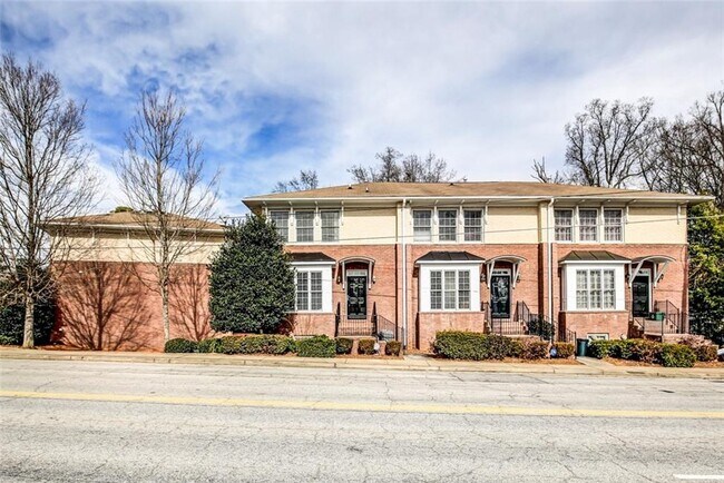
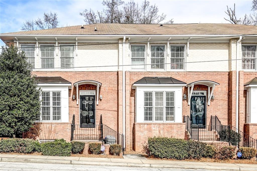
7 Chief Matthews Rd
Decatur, GA 30030
2 Weeks Ago
|
Edit
Favorites
7 Chief Matthews Rd

Favorites
Check Back Soon for Upcoming Availability
| Beds | Baths | Average SF |
|---|---|---|
| 3 Bedrooms 3 Bedrooms 3 Br | 3.5 Baths 3.5 Baths 3.5 Ba | — |
Fees and Policies
The fees listed below are community-provided and may exclude utilities or add-ons. All payments are made directly to the property and are non-refundable unless otherwise specified.
- Dogs Allowed
-
Fees not specified
- Cats Allowed
-
Fees not specified
About This Property
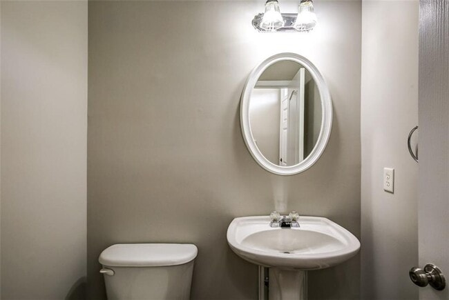
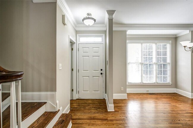
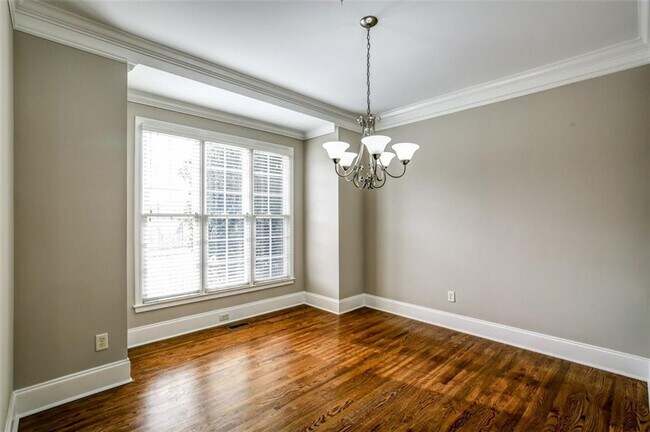
Great opportunity to lease a townhome in Decatur School System. Hardwood floors on the main level. Separate Dining Room.Open kitchen with breakfast bar.Large living room with gas fireplace.French doors open to expansive deck overlooking wooded area. Each bedroom features private bath. Master bath has tub/shower combo and walk in closet.Guest bedroom on 2nd level has walk in closet and shower.Private lower level bathroom. Large 2 car garage.Gated parking.Established Community
7 Chief Matthews Rd is a townhome located in DeKalb County and the 30030 ZIP Code. This area is served by the Decatur City attendance zone.
Townhome Features
Dishwasher
Microwave
Refrigerator
Disposal
- Dishwasher
- Disposal
- Microwave
- Range
- Refrigerator
Location
Get Directions
Lenox Place is a part of Adair Park, a popular family neighborhood in the ever-growing city of Decatur. Lenox Place is one of the older neighborhoods in the park, characterized by a lot of single-family homes and quaint apartment complexes.
Three parks — Adair Park, Corley Commons, and Parkwood Park — call the neighborhood home. Lenox Place and the surrounding area is full of historic, characterful homes and vibrant tree coverage befitting a locale in the “city in a forest,” as Atlanta has become known. This family-friendly area is also close to the popular bars and restaurants at the center of Decatur.
Dekalb Ave. and Ponce De Leon Ave. NE are two of the most popular ways to and from Lenox Place, the former of which is seeing a lot of development, making this popular neighborhood even more appealing.
Learn more about living in Lenox PlaceBelow are rent ranges for similar nearby apartments
Amenities
- Dishwasher
- Disposal
- Microwave
- Range
- Refrigerator
Education
| Colleges & Universities | Distance | ||
|---|---|---|---|
| Colleges & Universities | Distance | ||
| Drive: | 3 min | 1.6 mi | |
| Drive: | 7 min | 3.3 mi | |
| Drive: | 9 min | 3.9 mi | |
| Drive: | 9 min | 3.9 mi |
7 Chief Matthews Rd is within 3 minutes or 1.6 miles from Agnes Scott College. It is also near Emory University, Clairmont and Emory University.
Schools


Public Elementary School
Grades PK-2
183 Students
Attendance Zone
Public Elementary School
Grades 3-5
596 Students
Attendance Zone
Public Middle School
Grades 6-8
1,323 Students
Attendance Zone
Public High School
Grades 9-12
1,853 Students
Attendance Zone
Private Elementary, Middle & High School
Grades PK-12
993 Students
Nearby
Private Elementary, Middle & High School
Grades K-12
33 Students
Nearby
Private Elementary & Middle School
Grades PK-8
489 Students
Nearby
School data provided by
 The GreatSchools Rating helps parents compare schools within a state based on a variety of school quality indicators and provides a helpful picture of how effectively each school serves all of its students. Ratings are on a scale of 1 (below average) to 10 (above average) and can include test scores, college readiness, academic progress, advanced courses, equity, discipline and attendance data. We also advise parents to visit schools, consider other information on school performance and programs, and consider family needs as part of the school selection process.
View GreatSchools Rating Methodology
Data provided by GreatSchools.org © 2026. All rights reserved.
View GreatSchools Rating Methodology
Data provided by GreatSchools.org © 2026. All rights reserved.
Transportation options available in Decatur include East Lake, located 0.2 mile from 7 Chief Matthews Rd. 7 Chief Matthews Rd is near Hartsfield - Jackson Atlanta International, located 13.8 miles or 24 minutes away.
| Transit / Subway | Distance | ||
|---|---|---|---|
| Transit / Subway | Distance | ||
|
|
Walk: | 3 min | 0.2 mi |
|
|
Drive: | 3 min | 1.4 mi |
|
|
Drive: | 3 min | 1.8 mi |
|
|
Drive: | 4 min | 2.2 mi |
|
|
Drive: | 5 min | 2.6 mi |
| Commuter Rail | Distance | ||
|---|---|---|---|
| Commuter Rail | Distance | ||
|
|
Drive: | 15 min | 7.6 mi |
| Airports | Distance | ||
|---|---|---|---|
| Airports | Distance | ||
|
Hartsfield - Jackson Atlanta International
|
Drive: | 24 min | 13.8 mi |
Time and distance from 7 Chief Matthews Rd.
| Shopping Centers | Distance | ||
|---|---|---|---|
| Shopping Centers | Distance | ||
| Walk: | 18 min | 0.9 mi | |
| Drive: | 2 min | 1.1 mi | |
| Drive: | 2 min | 1.2 mi |
7 Chief Matthews Rd has 3 shopping centers within 1.2 miles, which is about a 2-minute drive. The miles and minutes will be for the farthest away property.
| Parks and Recreation | Distance | ||
|---|---|---|---|
| Parks and Recreation | Distance | ||
|
South River Watershed Alliance
|
Walk: | 17 min | 0.9 mi |
|
Bradley Observatory
|
Walk: | 18 min | 1.0 mi |
|
Fernbank Museum of Natural History
|
Drive: | 3 min | 1.4 mi |
|
Wylde Center and Oakhurst Community Garden
|
Drive: | 3 min | 1.4 mi |
|
Fernbank Forest & Science Center
|
Drive: | 4 min | 1.6 mi |
7 Chief Matthews Rd has 5 parks within 1.6 miles, including South River Watershed Alliance, Bradley Observatory, and Wylde Center and Oakhurst Community Garden.
| Hospitals | Distance | ||
|---|---|---|---|
| Hospitals | Distance | ||
| Drive: | 5 min | 2.9 mi | |
| Drive: | 7 min | 3.2 mi | |
| Drive: | 7 min | 3.3 mi |
7 Chief Matthews Rd has 3 hospitals within 3.3 miles, the nearest is Emory Decatur Hospital which is 2.9 miles away and a 5 minute drive.
| Military Bases | Distance | ||
|---|---|---|---|
| Military Bases | Distance | ||
| Drive: | 19 min | 9.5 mi | |
| Drive: | 27 min | 15.7 mi |
7 Chief Matthews Rd is 9.5 miles from Fort McPherson, and is convenient to other military bases, including Fort Gillem.
You May Also Like
Similar Rentals Nearby
-
-
3 Beds$2,842+Total Monthly PriceTotal Monthly Price NewPrices include base rent and required monthly fees of $174. Variable costs based on usage may apply.Base Rent:3 Beds$2,668+Specials
Pets Allowed Fitness Center Pool Dishwasher In Unit Washer & Dryer Walk-In Closets Stainless Steel Appliances
-
-
-
-
-
-
-
-


What Are Walk Score®, Transit Score®, and Bike Score® Ratings?
Walk Score® measures the walkability of any address. Transit Score® measures access to public transit. Bike Score® measures the bikeability of any address.
What is a Sound Score Rating?
A Sound Score Rating aggregates noise caused by vehicle traffic, airplane traffic and local sources
7 Chief Matthews Rd
Decatur, GA 30030