

$1,500 / Month
699 Los Altos Ave
Los Altos, CA 94022
2 Weeks Ago
Favorites
699 Los Altos Ave

Favorites
Check Back Soon for Upcoming Availability
| Beds | Baths | Average SF |
|---|---|---|
| 1 Bedroom 1 Bedroom 1 Br | 1 Bath 1 Bath 1 Ba | — |
Fees and Policies
The fees below are based on community-supplied data and may exclude additional fees and utilities.
Details
Utilities Included
-
Trash Removal
-
Sewer
Property Information
-
Furnished Units Available
About This Property
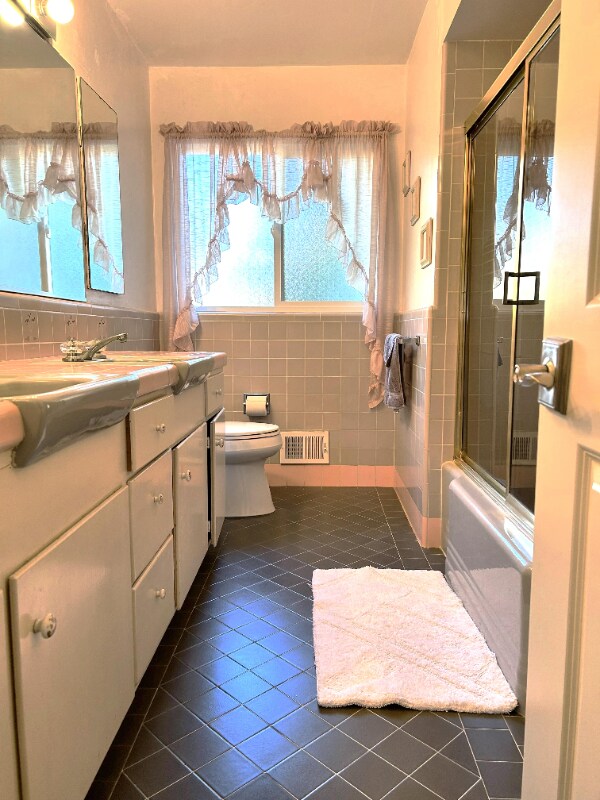
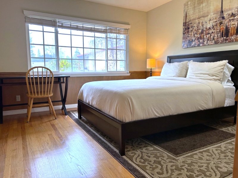
Property Id: 1333165 Large furnished room in a four bedroom, 2.5 bathroom home. Hardwood floors, large window looking to lawn. Located in Los Altos near Palo Alto and Mountain View. Walking distance to the Village shopping center, banks, restaurants, library, freeways, Cal train station, bus, etc. Furnished: queen size bed w/ new mattress, computer desk, chair, two bookshelves, large closet. Bathroom: share with one other professional female Kitchen: light use only Laundry room: washer & dryer Off-street parking available. Extra storage and refrigerator. The monthly rent is $1,500; 1/3 water water bill. Wi-Fi internet included. Security deposit ($1,500). Month to month. Looking for a quiet, clean, high quality, happy single professional or scholar female; no smoking, no guests, no alcohol, no drugs, no pets. If interested, please reply and briefly introduce yourself, please include where you work or study, when you want to move in, and how long you plan to rent.
699 Los Altos Ave is a house located in Santa Clara County and the 94022 ZIP Code. This area is served by the Los Altos Elementary attendance zone.
House Features
Washer/Dryer
Dishwasher
Hardwood Floors
Microwave
- Washer/Dryer
- Security System
- Dishwasher
- Disposal
- Microwave
- Refrigerator
- Freezer
- Hardwood Floors
- Furnished
- Bicycle Storage
- Fenced Lot
Location
Get Directions
North Los Altos contains the city’s vibrant commercial centers. The many shops and eateries of Main Street are in the southern portion of North Los Altos, while the diverse restaurants and cafes of San Antonio Road are in the northern stretches near San Antonio Center.
Outside of these commercial areas, North Los Altos is predominantly residential, offering an array of apartments available for rent along tree-lined avenues. Many of the rentals in North Los Altos feature stunning mountain views, as well as close proximity to Mountain View, Foothill College, Stanford University, and Palo Alto. Getting around from North Los Altos is simple with access to El Camino Real, Interstate 280, and San Antonio Station.
Learn more about living in North Los AltosBelow are rent ranges for similar nearby apartments
| Beds | Average Size | Lowest | Typical | Premium |
|---|---|---|---|---|
| Studio Studio Studio | 465 Sq Ft | $2,095 | $2,866 | $5,278 |
| 1 Bed 1 Bed 1 Bed | 763-768 Sq Ft | $2,038 | $3,704 | $5,961 |
| 2 Beds 2 Beds 2 Beds | 1147-1154 Sq Ft | $2,550 | $4,873 | $7,282 |
| 3 Beds 3 Beds 3 Beds | 1437 Sq Ft | $4,441 | $4,568 | $4,695 |
| 4 Beds 4 Beds 4 Beds | 2418 Sq Ft | $6,550 | $9,869 | $15,000 |
Amenities
- Washer/Dryer
- Security System
- Dishwasher
- Disposal
- Microwave
- Refrigerator
- Freezer
- Hardwood Floors
- Furnished
- Fenced Lot
- Bicycle Storage
Expenses
Utilities Included
Trash Removal, Sewer
Included
Education
| Colleges & Universities | Distance | ||
|---|---|---|---|
| Colleges & Universities | Distance | ||
| Drive: | 7 min | 2.5 mi | |
| Drive: | 8 min | 3.2 mi | |
| Drive: | 12 min | 4.5 mi | |
| Drive: | 16 min | 6.7 mi |
699 Los Altos Ave is within 7 minutes or 2.5 miles from Foothill College, Middlefield. It is also near Foothill Coll., Los Altos and Stanford University.
Schools

Public Elementary School
Grades K-5
367 Students
Nearby
Public Elementary School
Grades K-6
385 Students
Attendance Zone
Public Middle School
Grades 7-8
497 Students
Attendance Zone
Public High School
Grades 9-12
2,141 Students
Attendance Zone
Private Elementary School
Grades PK-5
Nearby
Private Elementary, Middle & High School
Grades K-12
612 Students
Nearby
Private Elementary & Middle School
Grades K-8
268 Students
Nearby
Private Elementary School
Grades K-1
Nearby
School data provided by
 The GreatSchools Rating helps parents compare schools within a state based on a variety of school quality indicators and provides a helpful picture of how effectively each school serves all of its students. Ratings are on a scale of 1 (below average) to 10 (above average) and can include test scores, college readiness, academic progress, advanced courses, equity, discipline and attendance data. We also advise parents to visit schools, consider other information on school performance and programs, and consider family needs as part of the school selection process.
View GreatSchools Rating Methodology
Data provided by GreatSchools.org © 2025. All rights reserved.
View GreatSchools Rating Methodology
Data provided by GreatSchools.org © 2025. All rights reserved.
Transportation options available in Los Altos include Mountain View Station, located 3.4 miles from 699 Los Altos Ave. 699 Los Altos Ave is near Norman Y Mineta San Jose International, located 12.9 miles or 21 minutes away, and San Francisco International, located 25.2 miles or 35 minutes away.
| Transit / Subway | Distance | ||
|---|---|---|---|
| Transit / Subway | Distance | ||
| Drive: | 7 min | 3.4 mi | |
|
|
Drive: | 7 min | 3.4 mi |
|
|
Drive: | 10 min | 4.7 mi |
| Drive: | 11 min | 5.3 mi | |
|
|
Drive: | 12 min | 5.4 mi |
| Commuter Rail | Distance | ||
|---|---|---|---|
| Commuter Rail | Distance | ||
| Drive: | 4 min | 1.5 mi | |
| Drive: | 8 min | 3.3 mi | |
| Drive: | 9 min | 3.4 mi | |
| Drive: | 9 min | 3.5 mi | |
| Drive: | 10 min | 3.6 mi |
| Airports | Distance | ||
|---|---|---|---|
| Airports | Distance | ||
|
Norman Y Mineta San Jose International
|
Drive: | 21 min | 12.9 mi |
|
San Francisco International
|
Drive: | 35 min | 25.2 mi |
Time and distance from 699 Los Altos Ave.
| Shopping Centers | Distance | ||
|---|---|---|---|
| Shopping Centers | Distance | ||
| Walk: | 17 min | 0.9 mi | |
| Drive: | 3 min | 1.2 mi | |
| Drive: | 3 min | 1.2 mi |
699 Los Altos Ave has 3 shopping centers within 1.2 miles, which is about a 3-minute walk. The miles and minutes will be for the farthest away property.
| Parks and Recreation | Distance | ||
|---|---|---|---|
| Parks and Recreation | Distance | ||
|
Redwood Grove
|
Drive: | 4 min | 1.5 mi |
|
Terman Park
|
Drive: | 6 min | 2.1 mi |
|
J. Pearce Mitchell Park
|
Drive: | 8 min | 2.7 mi |
|
Bol Park
|
Drive: | 8 min | 2.9 mi |
|
Esther Clark Nature Preserve
|
Drive: | 6 min | 3.0 mi |
699 Los Altos Ave has 5 parks within 3.0 miles, including Terman Park, Redwood Grove, and Esther Clark Nature Preserve.
| Hospitals | Distance | ||
|---|---|---|---|
| Hospitals | Distance | ||
| Drive: | 10 min | 3.8 mi | |
| Drive: | 13 min | 5.2 mi | |
| Drive: | 14 min | 6.5 mi |
699 Los Altos Ave has 3 hospitals within 6.5 miles, the nearest is El Camino Hospital which is 3.8 miles away and a 10 minute drive.
| Military Bases | Distance | ||
|---|---|---|---|
| Military Bases | Distance | ||
| Drive: | 14 min | 5.7 mi |
699 Los Altos Ave is 5.7 miles and a 14 minute drive from Ames Research Center.
You May Also Like
Similar Rentals Nearby


What Are Walk Score®, Transit Score®, and Bike Score® Ratings?
Walk Score® measures the walkability of any address. Transit Score® measures access to public transit. Bike Score® measures the bikeability of any address.
What is a Sound Score Rating?
A Sound Score Rating aggregates noise caused by vehicle traffic, airplane traffic and local sources
699 Los Altos Ave
Los Altos, CA 94022