

$2,200
Total Monthly Price
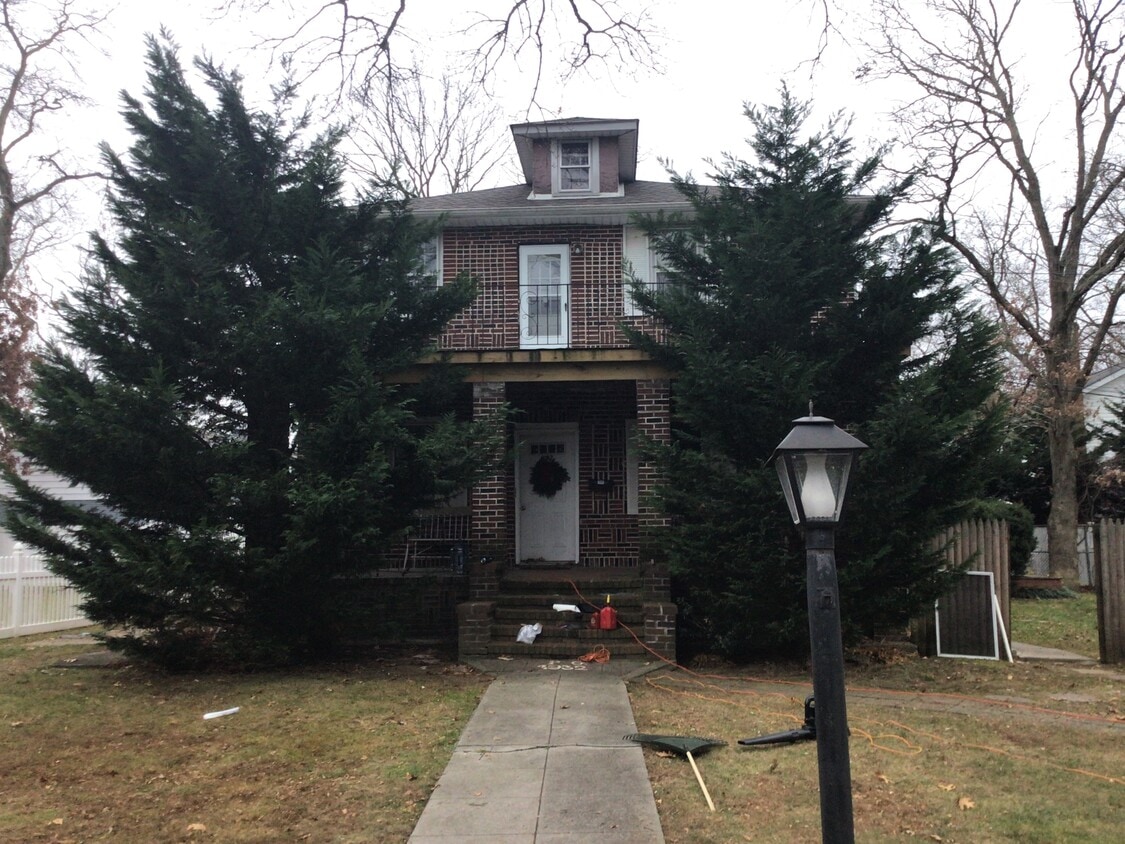
692 Muncey Rd Unit 2nd floor
West Islip, NY 11795
2 Weeks Ago
|
Edit
Favorites
692 Muncey Rd Unit 2nd floor

Favorites
Check Back Soon for Upcoming Availability
| Beds | Baths | Average SF |
|---|---|---|
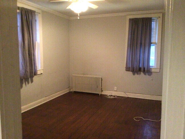
| 2 Bedrooms 2 Bedrooms 2 Br | 1 Bath 1 Bath 1 Ba | 1,000 SF |
Fees and Policies
The fees listed below are community-provided and may exclude utilities or add-ons. All payments are made directly to the property and are non-refundable unless otherwise specified.
- Parking
-
Surface Lot--
Details
Utilities Included
-
Gas
-
Water
-
Heat
-
Trash Removal
-
Sewer
Property Information
-
2 units
About This Property
Requirements: 700 credit score. NO PETS!!!! 2 months pay stubs. Call after 2pm.
692 Muncey Rd is an apartment community located in Suffolk County and the 11795 ZIP Code.
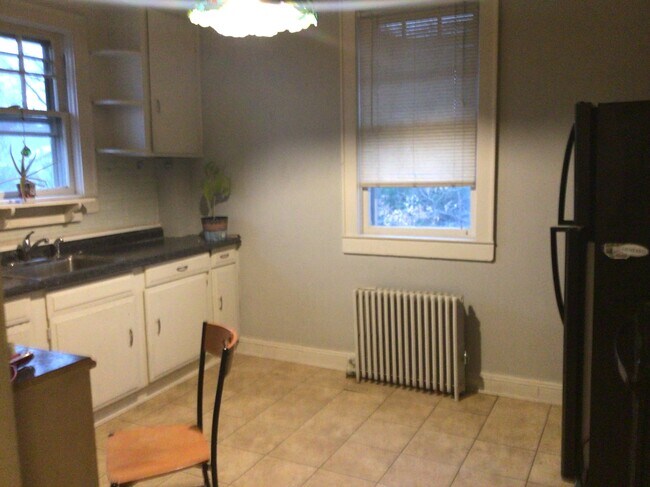
Apartment Features
- Dishwasher
692 Muncey Rd,
West Islip,
NY
11795
Amenities
- Dishwasher
Expenses
Utilities Included
Gas, Water, Heat, Trash Removal, Sewer
Included
Education
| Colleges & Universities | Distance | ||
|---|---|---|---|
| Colleges & Universities | Distance | ||
| Drive: | 12 min | 6.4 mi | |
| Drive: | 12 min | 7.7 mi | |
| Drive: | 19 min | 10.3 mi | |
| Drive: | 22 min | 15.0 mi |
692 Muncey Rd Unit 2nd floor is within 12 minutes or 6.4 miles from SUNY Suffolk Co., Grant Campus. It is also near Touro University and Farmingdale State College.
Walkability Near 692 Muncey Rd West Islip, NY 11795
Getting Around
 What do Walkability, Transit, Drivability, and Bikeability mean?
Walkability measures the walking distance to day-to-day needs.
Transit measures access to public transportation.
Drivability measures congestion, parking availability, and access to major roads.
Bikeability measures the suitability for cycling.
How It Works
What do Walkability, Transit, Drivability, and Bikeability mean?
Walkability measures the walking distance to day-to-day needs.
Transit measures access to public transportation.
Drivability measures congestion, parking availability, and access to major roads.
Bikeability measures the suitability for cycling.
How It Works
Moderately Walkable
Walkability
60
/ 100
Limited Public Transit
Transit
20
/ 100
Moderately Drivable
Drivability
70
/ 100
Fairly Bikeable
Bikeability
40
/ 100
Scores provided by
-
Soundscore™
-
/ 100
Traffic
-Airport
-Businesses
-Scores provided by
HowLoud What is a Sound Score Rating? A Sound Score Rating aggregates noise caused by vehicle traffic, airplane traffic and local sources. How It WorksYou May Also Like
Similar Rentals Nearby
-
-
-
-
-
-
-
-
2 Beds$3,213+3 Beds$5,009+Total Monthly PriceTotal Monthly Price NewPrices include base rent and required monthly fees of $83. Variable costs based on usage may apply.Base Rent:2 Beds$3,130+3 Beds$4,926+
Pets Allowed Fitness Center Clubhouse
-
-


What Are Walk Score®, Transit Score®, and Bike Score® Ratings?
Walk Score® measures the walkability of any address. Transit Score® measures access to public transit. Bike Score® measures the bikeability of any address.
What is a Sound Score Rating?
A Sound Score Rating aggregates noise caused by vehicle traffic, airplane traffic and local sources.

692 Muncey Rd
West Islip, NY 11795