

$1,500
/ Month
6919 Bugledrum Way
Columbia, MD 21045
Today
|
Edit
Favorites
667-419-0010
-
Bedrooms
2
-
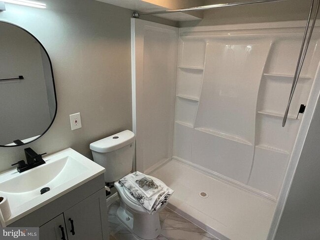
Bathrooms
2
-
Square Feet
700 sq ft
-
Available
Available Now
Highlights
- Community Pool
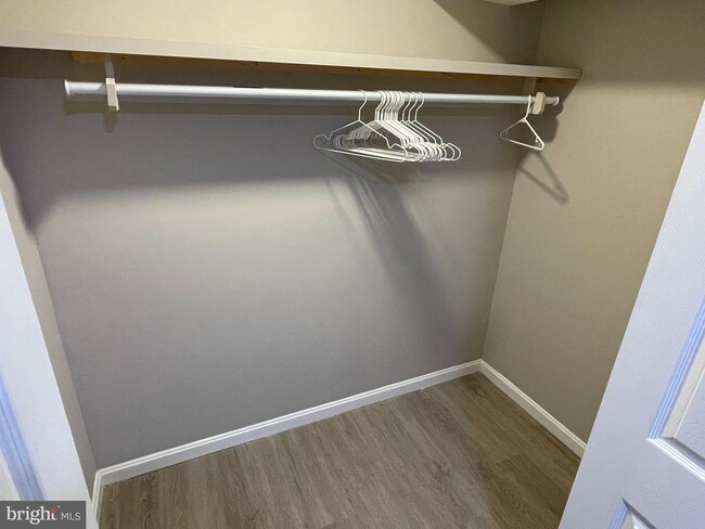
- Walk-In Closet
- Recessed Lighting
- Luxury Vinyl Plank Tile Flooring
- Forced Air Heating System
- Property is in very good condition
6919 Bugledrum Way

Favorites
About This Home
Available Now
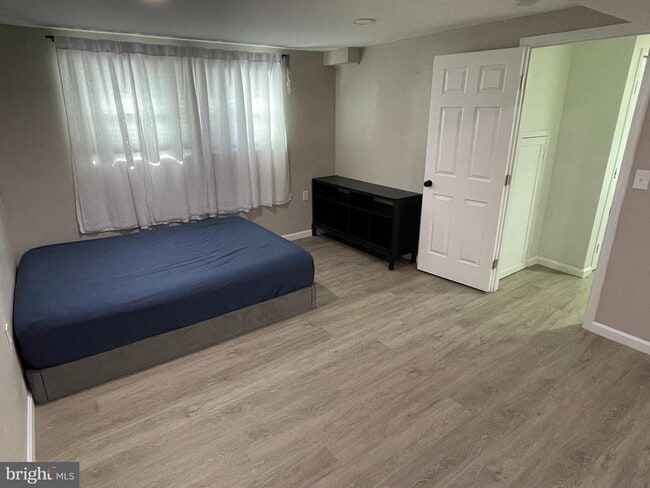
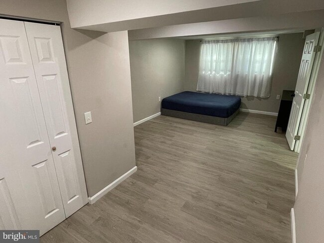
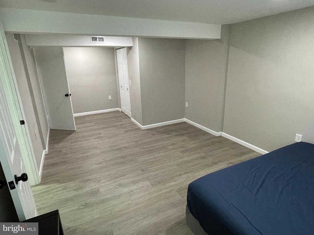
Whole Basement/Lower Level ONLY, 2 Bedrooms, 2 Full bathrooms with in-unit private Washer/Dryer. Front door entryway is the only common space. Utilities are split 50/50. - Requirements: 650+ Credit Score, Household Income 2.75x Rent, No pets, Strict No Smoking.
6919 Bugledrum Way is a house located in Howard County and the 21045 ZIP Code. This area is served by the Howard County Public Schools attendance zone.
* Price shown is base rent. Excludes user-selected optional fees and variable or usage-based fees and required charges due at or prior to move-in or at move-out. Price, availability, fees, and any applicable rent special are subject to change without notice.
* Square footage definitions vary. Displayed square footage is approximate.
Home Details
Home Type
Single Family Detached Home
Year Built
Built in 1976
Bedrooms and Bathrooms
Walk-In Closet
2 Main Level Bedrooms
2 Full Bathrooms
Finished Basement
Laundry in Basement
Home Design
Split Foyer
Slab Foundation
Frame Construction
Home Security
Carbon Monoxide Detectors
Fire and Smoke Detector
Interior Spaces
Recessed Lighting
Luxury Vinyl Plank Tile Flooring
Window Screens
Partially Furnished
700 Sq Ft Home
Property has 1 Level
Kitchen
Cooktop
Microwave
Disposal
Kitchenette
Laundry
Dryer
Washer
Listing and Financial Details
Security Deposit $1,650
Requires 1 Month of Rent Paid Up Front
12-Month Min and 36-Month Max Lease Term
Available 11/6/25
$45 Application Fee
Assessor Parcel Number 1416093521
Tenant pays for utilities - some
The owner pays for common area maintenance, internet, lawn/shrub care, snow removal, association fees
$50 Repair Deductible
No Smoking Allowed
Residential Lease
Lot Details
7,841 Sq Ft Lot
Property is in very good condition
Property is zoned NT
Parking
On-Street Parking
Utilities
Forced Air Heating System
Electric Water Heater
Vented Exhaust Fan
Community Details
Overview
Property has a Home Owners Association
Owen Brown Estates Subdivision
Pet Policy
No Pets Allowed
Recreation
Community Pool
Contact
- Listed by June Yang | Realty 1 Maryland, LLC
- Phone Number
- Contact
-
Source
 Bright MLS, Inc.
Copyright © 2025 Bright MLS, Inc.
Location
Get Directions
Amenities
- Basement
Owen Brown is one of Columbia’s largest neighborhoods and has a variety of affordable houses and apartments available for rent. The neighborhood is located just three miles south of Downtown Columbia. Residents appreciate proximity to downtown’s most popular amenities including Lake Kittamaqundi, the Mall in Columbia, and Symphony Woods Park, a large green space with several amphitheaters. Owen Brown has multiple trails, greenways, playgrounds, and a few casual restaurants, but several shopping plazas surround the neighborhood like Dobbin Center. Although Owen Brown is a large neighborhood, the community is close knit and has an active neighborhood association that hosts special events throughout the year, including flower giveaways, an annual pool party, and Food Truck Fridays.
Learn more about living in Owen Brown
Education
| Colleges & Universities | Distance | ||
|---|---|---|---|
| Colleges & Universities | Distance | ||
| Drive: | 8 min | 3.4 mi | |
| Drive: | 22 min | 12.3 mi | |
| Drive: | 22 min | 12.8 mi | |
| Drive: | 33 min | 18.1 mi |
6919 Bugledrum Way is within 8 minutes or 3.4 miles from Howard Community College. It is also near CCBC Cantonsville and UMBC.
Schools


Public Elementary School
Grades PK-5
459 Students
Attendance Zone
Public Middle School
Grades 6-8
598 Students
Attendance Zone
Public High School
Grades 9-12
1,401 Students
Attendance Zone
Private Elementary School
Grades PK-3
60 Students
Nearby
Private Elementary School
Grades PK-4
44 Students
Nearby
Private Elementary, Middle & High School
Grades PK-10
181 Students
Nearby
Private Middle & High School
Grades 7-12
Nearby
School data provided by
 The GreatSchools Rating helps parents compare schools within a state based on a variety of school quality indicators and provides a helpful picture of how effectively each school serves all of its students. Ratings are on a scale of 1 (below average) to 10 (above average) and can include test scores, college readiness, academic progress, advanced courses, equity, discipline and attendance data. We also advise parents to visit schools, consider other information on school performance and programs, and consider family needs as part of the school selection process.
View GreatSchools Rating Methodology
Data provided by GreatSchools.org © 2025. All rights reserved.
View GreatSchools Rating Methodology
Data provided by GreatSchools.org © 2025. All rights reserved.
Transportation options available in Columbia include Dorsey, located 7.5 miles from 6919 Bugledrum Way. 6919 Bugledrum Way is near Baltimore/Washington International Thurgood Marshall, located 15.0 miles or 24 minutes away, and Ronald Reagan Washington Ntl, located 31.3 miles or 52 minutes away.
| Transit / Subway | Distance | ||
|---|---|---|---|
| Transit / Subway | Distance | ||
|
|
Drive: | 16 min | 7.5 mi |
|
|
Drive: | 24 min | 15.1 mi |
|
|
Drive: | 25 min | 15.2 mi |
|
|
Drive: | 26 min | 16.0 mi |
| Commuter Rail | Distance | ||
|---|---|---|---|
| Commuter Rail | Distance | ||
|
|
Drive: | 14 min | 6.4 mi |
| Drive: | 16 min | 7.5 mi | |
| Drive: | 16 min | 7.5 mi | |
|
|
Drive: | 14 min | 7.9 mi |
|
|
Drive: | 17 min | 8.8 mi |
| Airports | Distance | ||
|---|---|---|---|
| Airports | Distance | ||
|
Baltimore/Washington International Thurgood Marshall
|
Drive: | 24 min | 15.0 mi |
|
Ronald Reagan Washington Ntl
|
Drive: | 52 min | 31.3 mi |
Time and distance from 6919 Bugledrum Way.
| Shopping Centers | Distance | ||
|---|---|---|---|
| Shopping Centers | Distance | ||
| Walk: | 17 min | 0.9 mi | |
| Drive: | 5 min | 1.7 mi | |
| Drive: | 6 min | 2.3 mi |
6919 Bugledrum Way has 3 shopping centers within 2.3 miles, which is about a 6-minute drive. The miles and minutes will be for the farthest away property.
| Parks and Recreation | Distance | ||
|---|---|---|---|
| Parks and Recreation | Distance | ||
|
Clark's Elioak Farm
|
Drive: | 13 min | 7.4 mi |
|
Benjamin Banneker Historical Park and Museum
|
Drive: | 22 min | 10.7 mi |
|
Browns Bridge Recreation Area
|
Drive: | 20 min | 10.9 mi |
|
Banneker Planetarium
|
Drive: | 22 min | 12.8 mi |
|
Mt Pleasant - Howard County Conservancy
|
Drive: | 21 min | 13.0 mi |
6919 Bugledrum Way has 5 parks within 13.0 miles, including Clark's Elioak Farm, Benjamin Banneker Historical Park and Museum, and Banneker Planetarium.
| Hospitals | Distance | ||
|---|---|---|---|
| Hospitals | Distance | ||
| Drive: | 9 min | 3.9 mi | |
| Drive: | 20 min | 12.0 mi | |
| Drive: | 25 min | 14.2 mi |
6919 Bugledrum Way has 3 hospitals within 14.2 miles, the nearest is Howard County General Hospital which is 3.9 miles away and a 9 minute drive.
| Military Bases | Distance | ||
|---|---|---|---|
| Military Bases | Distance | ||
| Drive: | 21 min | 12.2 mi |
6919 Bugledrum Way is 12.2 miles and a 21 minute drive from Fort George Meade.
You May Also Like
Similar Rentals Nearby


What Are Walk Score®, Transit Score®, and Bike Score® Ratings?
Walk Score® measures the walkability of any address. Transit Score® measures access to public transit. Bike Score® measures the bikeability of any address.
What is a Sound Score Rating?
A Sound Score Rating aggregates noise caused by vehicle traffic, airplane traffic and local sources
6919 Bugledrum Way
Columbia, MD 21045