
$3,750
/ Month
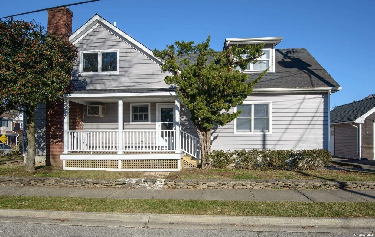
69 S 6th St
Locust Valley, NY 11560
Favorites
69 S 6th St

Favorites
Check Back Soon for Upcoming Availability
| Beds | Baths | Average SF |
|---|---|---|
| 3 Bedrooms 3 Bedrooms 3 Br | 2 Baths 2 Baths 2 Ba | 1,100 SF |
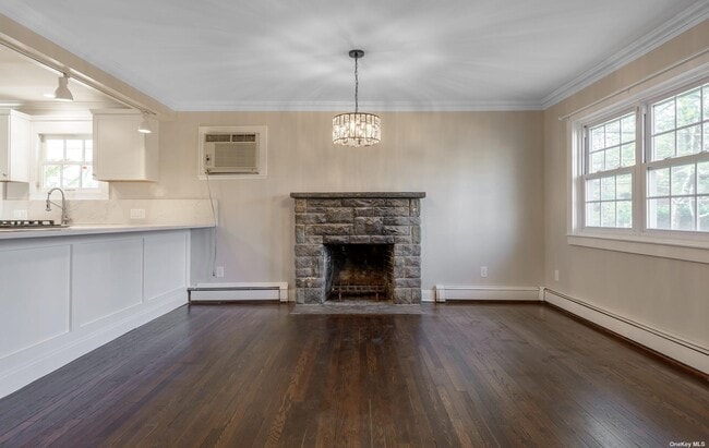
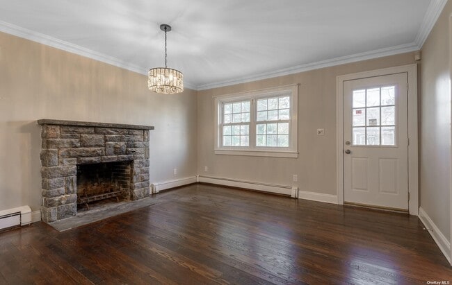
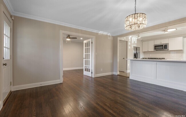
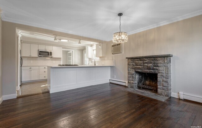
About This Property
Lovely redone first floor apartment bright and spacious. Living room,Dining room,Eat-in-Kitchen,Master Bedroom,Master Bath,2 Bed,1 Bath,Lots of Closets. Based on information submitted to the MLS GRID as of [see last changed date above]. All data is obtained from various sources and may not have been verified by broker or MLS GRID. Supplied Open House Information is subject to change without notice. All information should be independently reviewed and verified for accuracy. Properties may or may not be listed by the office/agent presenting the information. Some IDX listings have been excluded from this website. Prices displayed on all Sold listings are the Last Known Listing Price and may not be the actual selling price.
69 S 6th St is an apartment community located in Nassau County and the 11560 ZIP Code.
69 S 6th St,
Locust Valley,
NY
11560
Education
| Colleges & Universities | Distance | ||
|---|---|---|---|
| Colleges & Universities | Distance | ||
| Drive: | 13 min | 6.9 mi | |
| Drive: | 13 min | 7.6 mi | |
| Drive: | 21 min | 9.8 mi | |
| Drive: | 46 min | 27.8 mi |
69 S 6th St is within 13 minutes or 6.9 miles from Long Island Univ., CW Post. It is also near N.Y. Inst. of Technology and SUNY Westbury.
Walkability Near 69 S 6th St Locust Valley, NY 11560
Getting Around
 What do Walkability, Transit, Drivability, and Bikeability mean?
Walkability measures the walking distance to day-to-day needs.
Transit measures access to public transportation.
Drivability measures congestion, parking availability, and access to major roads.
Bikeability measures the suitability for cycling.
How It Works
What do Walkability, Transit, Drivability, and Bikeability mean?
Walkability measures the walking distance to day-to-day needs.
Transit measures access to public transportation.
Drivability measures congestion, parking availability, and access to major roads.
Bikeability measures the suitability for cycling.
How It Works
Fairly Walkable
Walkability
50
/ 100
Good Public Transit
Transit
60
/ 100
Moderately Drivable
Drivability
70
/ 100
Fairly Bikeable
Bikeability
50
/ 100
Scores provided by
-
Soundscore™
-
/ 100
Traffic
-Airport
-Businesses
-Scores provided by
HowLoud What is a Sound Score Rating? A Sound Score Rating aggregates noise caused by vehicle traffic, airplane traffic and local sources. How It WorksYou May Also Like
Similar Rentals Nearby
-
-
-
3 Beds$4,668+Total Monthly Price12 Month LeaseTotal Monthly Price NewPrices include base rent and required monthly fees of $103. Variable costs based on usage may apply.Base Rent:3 Beds$4,565+Specials
Pets Allowed Fitness Center Pool Dishwasher Refrigerator In Unit Washer & Dryer Walk-In Closets
-
-
3 Beds$4,200+Total Monthly PriceTotal Monthly Price NewPrices include base rent and required monthly fees. Variable costs based on usage may apply.1 Month Free
Pets Allowed Fitness Center Pool Dishwasher In Unit Washer & Dryer Walk-In Closets
-
3 Beds$5,672+Total Monthly Price12 Month LeaseTotal Monthly Price NewPrices include required monthly fees of $100.Base Rent:3 Beds$5,572+
Pets Allowed Fitness Center Pool In Unit Washer & Dryer Walk-In Closets Package Service EV Charging
-
-
3 Beds$4,275+Total Monthly PriceTotal Monthly Price NewPrices include required monthly fees of $75.Base Rent:3 Beds$4,200+
Pets Allowed Fitness Center Pool Dishwasher Refrigerator Kitchen
-
-


What Are Walk Score®, Transit Score®, and Bike Score® Ratings?
Walk Score® measures the walkability of any address. Transit Score® measures access to public transit. Bike Score® measures the bikeability of any address.
What is a Sound Score Rating?
A Sound Score Rating aggregates noise caused by vehicle traffic, airplane traffic and local sources.
69 S 6th St
Locust Valley, NY 11560