
$1,250
/ Month
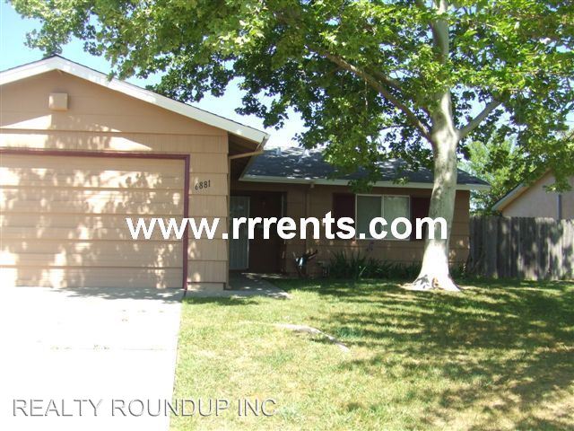
6881 Cherrywood Cir
Sacramento, CA 95823
Favorites
6881 Cherrywood Cir

Favorites
Check Back Soon for Upcoming Availability
| Beds | Baths | Average SF |
|---|---|---|
| 3 Bedrooms 3 Bedrooms 3 Br | 1 Bath 1 Bath 1 Ba | 1,010 SF |
About This Property
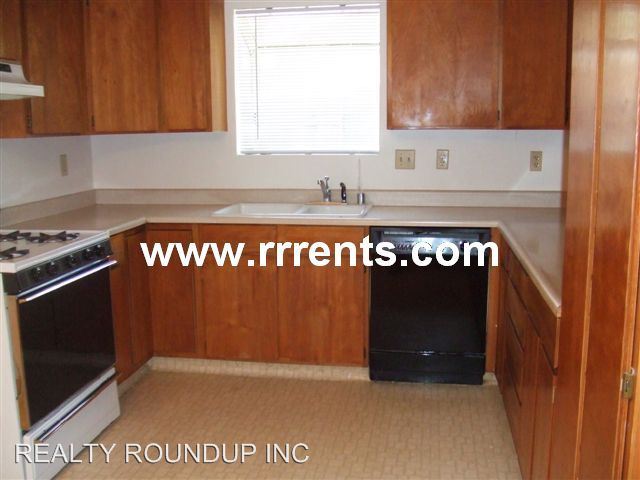
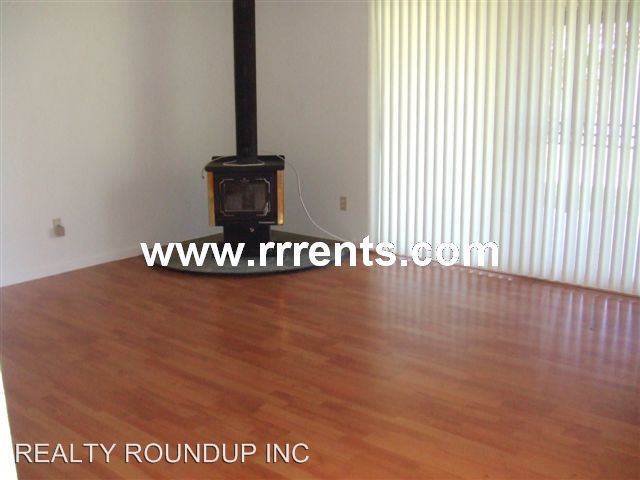
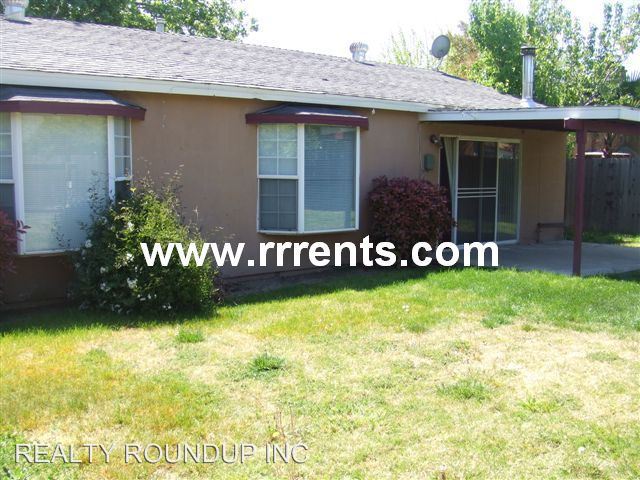
(916) 685-6601 - Lots of New! - Nice home with newer paint, newer hardwood flooring, and newer carpeting. Garage has work bench and storage. Large backyard. Easy to shopping. Hwy 99 to Cosumnes River west, right Bruceville, left Alpine Frost, Right Arroyo Vista,Left on grandstaff , Right Cherrywood (RLNE2662268) Other Amenities - Other- living room, breakfast nook, fireplace, mgr: rae hall ext 207, bre#00656926, Smoke Free, Garage. Lease lengths - 12 Months. Details regarding this property's Utilities - Resident Pays Water. Pet policies - Small Dogs Allowed, Cats Allowed.
6881 Cherrywood Cir is a house located in Sacramento County and the 95823 ZIP Code.
6881 Cherrywood Cir,
Sacramento,
CA
95823
Parkway is a suburban neighborhood about ten miles south of Downtown Sacramento. With access to several good schools, parks, shopping plazas, and restaurants, Parkway provides residents with plenty of amenities. Similar to many California neighborhoods, Parkway has mid-range to upscale rental options but there are some more affordable apartments and houses available for rent. Residents also enjoy access to Interstate 5 and Highway 99, allowing for easier trips to some of the city’s most popular destinations. Sacramento City College, California State University, and William Land Regional Park (a sprawling park with lakes, a zoo, and two amusement parks) are all convenient to Parkway.
Learn more about living in ParkwayBelow are rent ranges for similar nearby apartments
Education
| Colleges & Universities | Distance | ||
|---|---|---|---|
| Colleges & Universities | Distance | ||
| Drive: | 6 min | 1.4 mi | |
| Drive: | 12 min | 7.8 mi | |
| Drive: | 17 min | 8.4 mi | |
| Drive: | 27 min | 18.7 mi |
6881 Cherrywood Cir is within 6 minutes or 1.4 miles from Cosumnes River College. It is also near Sacramento City College and Sacramento State.
Transportation options available in Sacramento include Crc Station (Sb), located 1.2 miles from 6881 Cherrywood Cir. 6881 Cherrywood Cir is near Sacramento International, located 22.0 miles or 32 minutes away.
| Transit / Subway | Distance | ||
|---|---|---|---|
| Transit / Subway | Distance | ||
| Drive: | 3 min | 1.2 mi | |
| Walk: | 26 min | 1.4 mi | |
| Drive: | 6 min | 2.1 mi | |
| Drive: | 6 min | 2.1 mi | |
| Drive: | 13 min | 2.7 mi |
| Commuter Rail | Distance | ||
|---|---|---|---|
| Commuter Rail | Distance | ||
| Drive: | 17 min | 11.2 mi | |
| Drive: | 31 min | 23.6 mi | |
|
|
Drive: | 34 min | 26.0 mi |
|
|
Drive: | 36 min | 27.3 mi |
|
|
Drive: | 37 min | 29.5 mi |
| Airports | Distance | ||
|---|---|---|---|
| Airports | Distance | ||
|
Sacramento International
|
Drive: | 32 min | 22.0 mi |
Walkability Near 6881 Cherrywood Cir Sacramento, CA 95823
Getting Around
 What do Walkability, Transit, Drivability, and Bikeability mean?
Walkability measures the walking distance to day-to-day needs.
Transit measures access to public transportation.
Drivability measures congestion, parking availability, and access to major roads.
Bikeability measures the suitability for cycling.
How It Works
What do Walkability, Transit, Drivability, and Bikeability mean?
Walkability measures the walking distance to day-to-day needs.
Transit measures access to public transportation.
Drivability measures congestion, parking availability, and access to major roads.
Bikeability measures the suitability for cycling.
How It Works
Fairly Walkable
Walkability
50
/ 100
Limited Public Transit
Transit
20
/ 100
Exceptionally Drivable
Drivability
90
/ 100
Fairly Bikeable
Bikeability
50
/ 100
Scores provided by
-
Soundscore™
-
/ 100
Traffic
-Airport
-Businesses
-Scores provided by
HowLoud What is a Sound Score Rating? A Sound Score Rating aggregates noise caused by vehicle traffic, airplane traffic and local sources. How It WorksTime and distance from 6881 Cherrywood Cir.
| Shopping Centers | Distance | ||
|---|---|---|---|
| Shopping Centers | Distance | ||
| Walk: | 15 min | 0.8 mi | |
| Walk: | 15 min | 0.8 mi | |
| Walk: | 19 min | 1.0 mi |
6881 Cherrywood Cir has 3 shopping centers within 1.0 mile, which is about a 19-minute walk. The miles and minutes will be for the farthest away property.
| Parks and Recreation | Distance | ||
|---|---|---|---|
| Parks and Recreation | Distance | ||
|
Paradise Beach County Recreation Area
|
Drive: | 16 min | 8.2 mi |
|
Sacramento Zoo
|
Drive: | 14 min | 8.9 mi |
|
Sutter's Fort State Historical Monument
|
Drive: | 13 min | 9.2 mi |
|
California Native Plant Demonstration Garden
|
Drive: | 15 min | 9.6 mi |
|
Stone Lakes National Wildlife Refuge
|
Drive: | 20 min | 10.2 mi |
6881 Cherrywood Cir has 5 parks within 10.2 miles, including Sacramento Zoo, Paradise Beach County Recreation Area, and Sutter's Fort State Historical Monument.
| Hospitals | Distance | ||
|---|---|---|---|
| Hospitals | Distance | ||
| Walk: | 15 min | 0.8 mi | |
| Walk: | 19 min | 1.0 mi | |
| Walk: | 20 min | 1.0 mi |
6881 Cherrywood Cir has 3 hospitals within 1.0 miles, the nearest is Kaiser Foundation Hospital South Sacramento which is 0.8 mile away and a 15 minute walk.
| Military Bases | Distance | ||
|---|---|---|---|
| Military Bases | Distance | ||
| Drive: | 34 min | 19.7 mi | |
| Drive: | 64 min | 47.0 mi | |
| Drive: | 65 min | 49.5 mi |
6881 Cherrywood Cir has 3 military bases within 49.5 miles, the nearest is McClellan Air Force Base which is 19.7 miles away and a 34 minute drive.
You May Also Like
Similar Rentals Nearby


What Are Walk Score®, Transit Score®, and Bike Score® Ratings?
Walk Score® measures the walkability of any address. Transit Score® measures access to public transit. Bike Score® measures the bikeability of any address.
What is a Sound Score Rating?
A Sound Score Rating aggregates noise caused by vehicle traffic, airplane traffic and local sources.

6881 Cherrywood Cir
Sacramento, CA 95823