
4064 E 60th St
4064 E 60th St,
Huntington Park, CA 90255
$3,895 Total Monthly Price
3 Beds 12 Month Lease

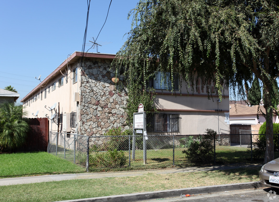

Find your new home at 6829 California Ave in Bell, CA. The location of this community is on California Ave in Bell. Here at this community, the professional leasing team is ready to help match you with your perfect apartment. Be sure to come for a visit to see the current floorplan options. Stop by 6829 California Ave today.
6829 California Ave is an apartment community located in Los Angeles County and the 90201 ZIP Code. This area is served by the Los Angeles Unified Rocp School District attendance zone.
Southeast Los Angeles is directly south of the Fashion District and east of the University of Southern California (USC). This large neighborhood is minutes from downtown Los Angeles, Hollywood, and Beverly Hills, with easy access to the 110 Freeway. This great location places you near sunny beaches, nature trails, and a bevy of leading employers. Students can access both USC and California State University Long Beach from their Southeast LA apartment.
This densely populated, diverse neighborhood features everything from food trucks and corner markets to wide sidewalks and residential areas filled with bungalows, ranch, and Spanish Colonial architecture. Southeast LA features palm trees and mountain views, tampered with gritty undertones to give it a cool, funky vibe.
As for outdoor fun, take your pick between Catalina Island, Venus Beach, or the Santa Monica Pier. Nearby, you’ll find more sunny beaches like White Point, Cabrillo, and Long Beach.
Learn more about living in Southeast Los AngelesCompare neighborhood and city base rent averages by bedroom.
| Southeast Los Angeles | Bell, CA | |
|---|---|---|
| Studio | - | $1,271 |
| 1 Bedroom | $1,133 | $1,280 |
| 2 Bedrooms | $1,222 | $1,773 |
| 3 Bedrooms | $1,289 | $1,931 |
| Colleges & Universities | Distance | ||
|---|---|---|---|
| Colleges & Universities | Distance | ||
| Drive: | 4 min | 2.0 mi | |
| Drive: | 14 min | 8.9 mi | |
| Drive: | 15 min | 9.0 mi | |
| Drive: | 16 min | 9.5 mi |


Transportation options available in Bell include Florence Station, located 2.7 miles from 6829 California Ave. 6829 California Ave is near Los Angeles International, located 13.4 miles or 24 minutes away, and Long Beach (Daugherty Field), located 14.8 miles or 23 minutes away.
| Transit / Subway | Distance | ||
|---|---|---|---|
| Transit / Subway | Distance | ||
|
|
Drive: | 5 min | 2.7 mi |
|
|
Drive: | 6 min | 3.0 mi |
|
|
Drive: | 7 min | 3.9 mi |
|
|
Drive: | 8 min | 4.1 mi |
|
|
Drive: | 10 min | 5.2 mi |
| Commuter Rail | Distance | ||
|---|---|---|---|
| Commuter Rail | Distance | ||
|
|
Drive: | 11 min | 5.3 mi |
|
|
Drive: | 13 min | 6.8 mi |
|
|
Drive: | 16 min | 7.4 mi |
|
|
Drive: | 14 min | 7.5 mi |
| Drive: | 17 min | 11.5 mi |
| Airports | Distance | ||
|---|---|---|---|
| Airports | Distance | ||
|
Los Angeles International
|
Drive: | 24 min | 13.4 mi |
|
Long Beach (Daugherty Field)
|
Drive: | 23 min | 14.8 mi |
Time and distance from 6829 California Ave.
| Shopping Centers | Distance | ||
|---|---|---|---|
| Shopping Centers | Distance | ||
| Walk: | 11 min | 0.6 mi | |
| Walk: | 11 min | 0.6 mi | |
| Walk: | 12 min | 0.6 mi |
| Parks and Recreation | Distance | ||
|---|---|---|---|
| Parks and Recreation | Distance | ||
|
Augustus Hawkins Natural Park
|
Drive: | 6 min | 3.6 mi |
|
Watts Senior Center & Rose Garden
|
Drive: | 9 min | 5.0 mi |
|
Hollenbeck Lake
|
Drive: | 11 min | 5.5 mi |
|
Watts Towers-Rodia State Park
|
Drive: | 11 min | 5.6 mi |
|
Compton Creek Natural Park at George Washington Elementary
|
Drive: | 14 min | 8.0 mi |
| Hospitals | Distance | ||
|---|---|---|---|
| Hospitals | Distance | ||
| Drive: | 4 min | 2.1 mi | |
| Drive: | 8 min | 3.5 mi | |
| Drive: | 9 min | 4.4 mi |
| Military Bases | Distance | ||
|---|---|---|---|
| Military Bases | Distance | ||
| Drive: | 22 min | 15.0 mi |
What Are Walk Score®, Transit Score®, and Bike Score® Ratings?
Walk Score® measures the walkability of any address. Transit Score® measures access to public transit. Bike Score® measures the bikeability of any address.
What is a Sound Score Rating?
A Sound Score Rating aggregates noise caused by vehicle traffic, airplane traffic and local sources.
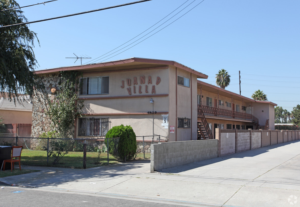
6829 California Ave
Bell, CA 90201


