
$1,350
/ Month
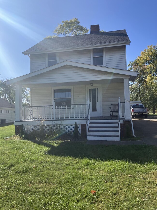
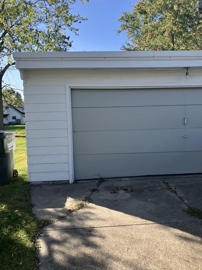
682 High St
Bedford, OH 44146
Favorites
682 High St

Favorites
Check Back Soon for Upcoming Availability
| Beds | Baths | Average SF |
|---|---|---|
| 3 Bedrooms 3 Bedrooms 3 Br | 1 Bath 1 Bath 1 Ba | 1,210 SF |
About This Property
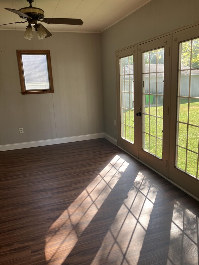
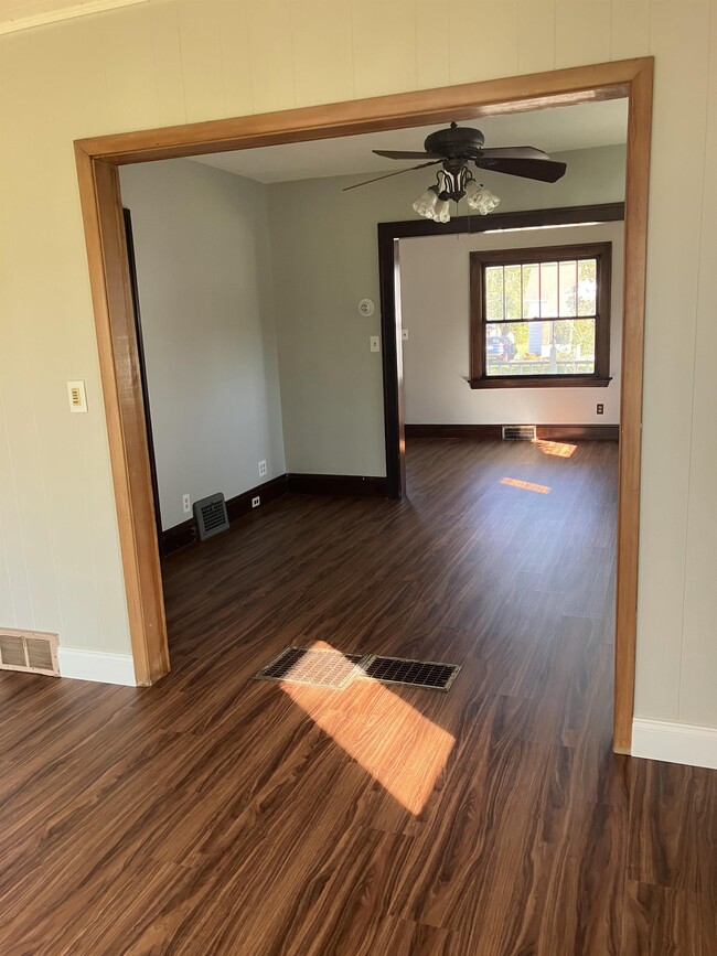
This is a newly renovated 3 bed 1 bath single family home. Tenants responsible for all utilities. Tenant must pass background check. $40 non refundable application fee which includes cost of background check.
682 High St is a house located in Cuyahoga County and the 44146 ZIP Code. This area is served by the Bedford City School District attendance zone.
682 High St,
Bedford,
OH
44146
Sitting 12 miles southeast of Cleveland, Bedford carries the kind of history that most Ohio suburbs can only gesture toward. Founded in 1797 as part of the Connecticut Western Reserve, this compact six-square-mile city built its early identity around mills and trading posts along the route between Cleveland and Pittsburgh. That layered past still shows up in the Bedford Historic District, where Public Square anchors a downtown stretching along Broadway Avenue with locally owned shops and neighborhood staples.
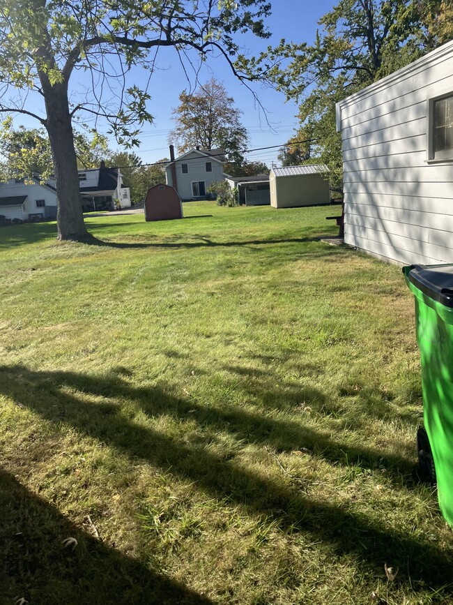
About one-fifth of Bedford's land belongs to the Cleveland Metroparks system, giving residents genuine access to natural terrain, including the striking Great Falls of Tinker's Creek. The city's compact size keeps most daily needs close at hand, and Interstate 271 and I-480 make the broader metro easy to reach. Each June, Bedford hosts its long-running Strawberry Festival, a community tradition that reflects the city's close-knit character.
Learn more about living in Bedford
Education
| Colleges & Universities | Distance | ||
|---|---|---|---|
| Colleges & Universities | Distance | ||
| Drive: | 11 min | 5.5 mi | |
| Drive: | 11 min | 6.0 mi | |
| Drive: | 16 min | 7.9 mi | |
| Drive: | 16 min | 10.2 mi |
682 High St is within 11 minutes or 5.5 miles from Cuyahoga C.C., East. It is also near Cuyahoga C.C., Eastern Campus and John Carroll University.
Schools


Public Elementary School
Grades PK-5
319 Students
Nearby
Public Elementary School
Grades PK-5
404 Students
Attendance Zone
Public Elementary School
Grades K-5
367 Students
Attendance Zone
Public Middle School
Grades 6-8
589 Students
Attendance Zone
Public High School
Grades 9-12
811 Students
Attendance Zone
Private Elementary School
Grades K-5
45 Students
Nearby
Private Elementary & Middle School
Grades K-8
138 Students
Nearby
Private Elementary, Middle & High School
Grades K-12
18 Students
Nearby
Private High School
Grades 9-12
306 Students
Nearby
School data provided by
 The GreatSchools Rating helps parents compare schools within a state based on a variety of school quality indicators and provides a helpful picture of how effectively each school serves all of its students. Ratings are on a scale of 1 (below average) to 10 (above average) and can include test scores, college readiness, academic progress, advanced courses, equity, discipline and attendance data. We also advise parents to visit schools, consider other information on school performance and programs, and consider family needs as part of the school selection process.
View GreatSchools Rating Methodology
Data provided by GreatSchools.org © 2026. All rights reserved.
View GreatSchools Rating Methodology
Data provided by GreatSchools.org © 2026. All rights reserved.
Transportation options available in Bedford include Warrensville (Blue Line), located 5.6 miles from 682 High St. 682 High St is near Cleveland-Hopkins International, located 20.6 miles or 32 minutes away, and Akron-Canton Regional, located 37.1 miles or 50 minutes away.
| Transit / Subway | Distance | ||
|---|---|---|---|
| Transit / Subway | Distance | ||
|
|
Drive: | 10 min | 5.6 mi |
|
|
Drive: | 11 min | 6.1 mi |
|
|
Drive: | 11 min | 6.4 mi |
|
|
Drive: | 12 min | 6.5 mi |
|
|
Drive: | 12 min | 6.7 mi |
| Commuter Rail | Distance | ||
|---|---|---|---|
| Commuter Rail | Distance | ||
| Drive: | 14 min | 6.1 mi | |
| Drive: | 15 min | 6.5 mi | |
| Drive: | 22 min | 9.5 mi | |
|
Boston Mill
|
Drive: | 24 min | 14.0 mi |
| Drive: | 24 min | 15.8 mi |
| Airports | Distance | ||
|---|---|---|---|
| Airports | Distance | ||
|
Cleveland-Hopkins International
|
Drive: | 32 min | 20.6 mi |
|
Akron-Canton Regional
|
Drive: | 50 min | 37.1 mi |
Walkability Near 682 High St Bedford, OH 44146
Getting Around
 What do Walkability, Transit, Drivability, and Bikeability mean?
Walkability measures the walking distance to day-to-day needs.
Transit measures access to public transportation.
Drivability measures congestion, parking availability, and access to major roads.
Bikeability measures the suitability for cycling.
How It Works
What do Walkability, Transit, Drivability, and Bikeability mean?
Walkability measures the walking distance to day-to-day needs.
Transit measures access to public transportation.
Drivability measures congestion, parking availability, and access to major roads.
Bikeability measures the suitability for cycling.
How It Works
Fairly Walkable
Walkability
50
/ 100
Limited Public Transit
Transit
30
/ 100
Exceptionally Drivable
Drivability
100
/ 100
Fairly Bikeable
Bikeability
50
/ 100
Scores provided by
-
Soundscore™
-
/ 100
Traffic
-Airport
-Businesses
-Scores provided by
HowLoud What is a Sound Score Rating? A Sound Score Rating aggregates noise caused by vehicle traffic, airplane traffic and local sources. How It WorksTime and distance from 682 High St.
| Shopping Centers | Distance | ||
|---|---|---|---|
| Shopping Centers | Distance | ||
| Walk: | 6 min | 0.3 mi | |
| Walk: | 7 min | 0.4 mi | |
| Walk: | 13 min | 0.7 mi |
682 High St has 3 shopping centers within 0.7 mile, which is about a 13-minute walk. The miles and minutes will be for the farthest away property.
| Parks and Recreation | Distance | ||
|---|---|---|---|
| Parks and Recreation | Distance | ||
|
Bedford Reservation
|
Drive: | 12 min | 4.8 mi |
|
South Chagrin Reservation
|
Drive: | 13 min | 6.5 mi |
|
Garfield Park Nature Center
|
Drive: | 12 min | 6.7 mi |
|
Nature Center at Shaker Lakes
|
Drive: | 15 min | 8.5 mi |
|
Acacia Reservation
|
Drive: | 15 min | 9.6 mi |
682 High St has 5 parks within 9.6 miles, including Bedford Reservation, Garfield Park Nature Center, and South Chagrin Reservation.
| Hospitals | Distance | ||
|---|---|---|---|
| Hospitals | Distance | ||
| Drive: | 9 min | 4.5 mi | |
| Drive: | 10 min | 4.9 mi | |
| Drive: | 11 min | 5.1 mi |
682 High St has 3 hospitals within 5.1 miles, the nearest is South Pointe Hospital which is 4.5 miles away and a 9 minute drive.
| Military Bases | Distance | ||
|---|---|---|---|
| Military Bases | Distance | ||
| Drive: | 95 min | 78.8 mi |
682 High St is 78.8 miles and a 95 minute drive from Mansfield Lahm Airport Air Guard Station.
You May Also Like
Similar Rentals Nearby


682 High St
Bedford, OH 44146