

$5,000 / Month
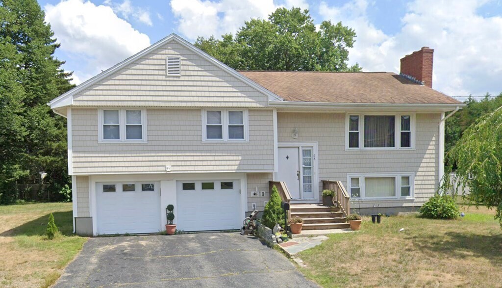
68 Whiting Way
Needham, MA 02492
2 Weeks Ago
Favorites
68 Whiting Way

Favorites
Check Back Soon for Upcoming Availability
| Beds | Baths | Average SF |
|---|---|---|
| 3 Bedrooms 3 Bedrooms 3 Br | 2 Baths 2 Baths 2 Ba | 2,026 SF |
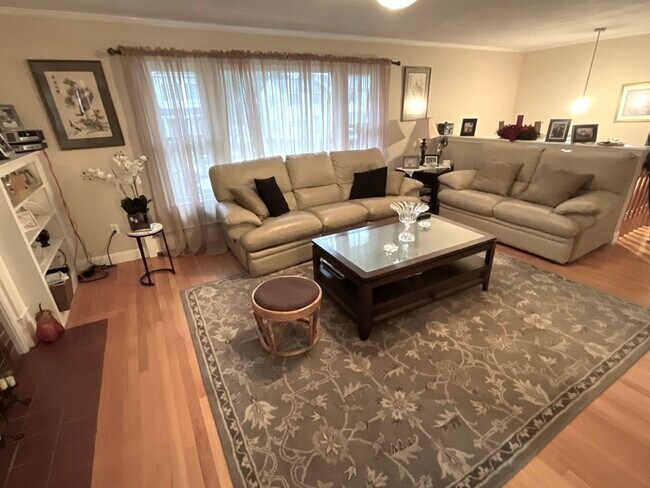
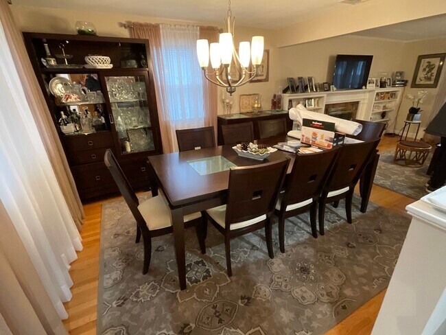
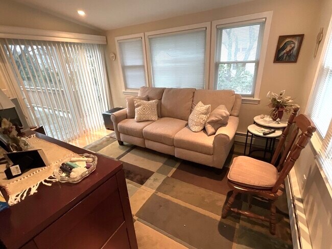
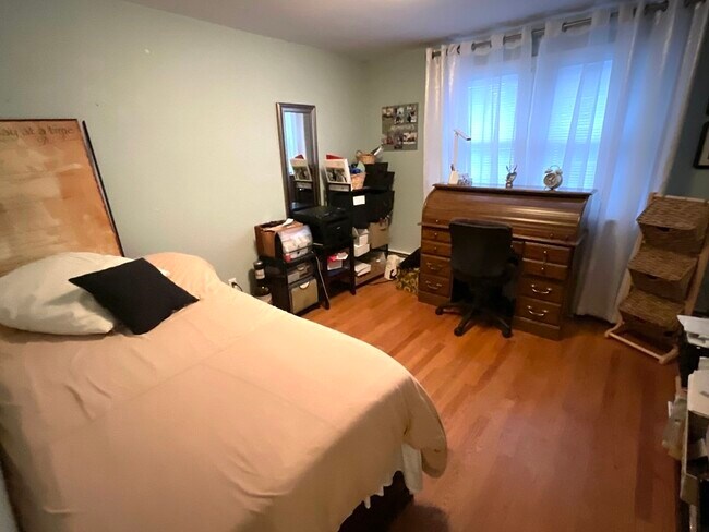
About This Property
Furnished single family rental located within the Olin Woods neighborhood,this 3 br / 2 bath single family has many wonderful features. Flat yard,3 generous bedrooms,spacious living room with high ceilings. The 2 car garage with direct entry is a real bonus this time of year. Enjoy a sunny cup of coffee in the morning on the deck in back. Tenant to pay for utilities including landscaping and snow removal. Willing to consider a short term rental.
68 Whiting Way is a house located in Norfolk County and the 02492 ZIP Code. This area is served by the Needham attendance zone.
Location
Get Directions
Just west of Boston and East of Worcester sits Metro West, a region that houses a group of towns and cities with significant historical backgrounds. A total of 19 municipalities make up the core of this community, but other municipalities are considered to be a part of the Interstate 495/Metro West Corridor.
Learn more about living in Metro WestBelow are rent ranges for similar nearby apartments
| Beds | Average Size | Lowest | Typical | Premium |
|---|---|---|---|---|
| Studio Studio Studio | 515-518 Sq Ft | $1,400 | $2,534 | $8,898 |
| 1 Bed 1 Bed 1 Bed | 876-878 Sq Ft | $1,495 | $3,007 | $9,579 |
| 2 Beds 2 Beds 2 Beds | 1271-1273 Sq Ft | $1,900 | $3,689 | $15,631 |
| 3 Beds 3 Beds 3 Beds | 1569-1573 Sq Ft | $2,500 | $4,878 | $18,973 |
| 4 Beds 4 Beds 4 Beds | 3556 Sq Ft | $1,125 | $6,655 | $17,000 |
Education
| Colleges & Universities | Distance | ||
|---|---|---|---|
| Colleges & Universities | Distance | ||
| Walk: | 17 min | 0.9 mi | |
| Drive: | 8 min | 3.1 mi | |
| Drive: | 16 min | 7.2 mi | |
| Drive: | 16 min | 8.3 mi |
68 Whiting Way is within 17 minutes or 0.9 mile from Babson College. It is also near Wellesley College and Brandeis University.
Schools


Public Elementary & Middle School
Grades 6
446 Students
Attendance Zone
Public Elementary School
Grades PK-5
699 Students
Attendance Zone
Public Middle School
Grades 6-8
922 Students
Nearby
Public Middle School
Grades 7-8
818 Students
Attendance Zone
Public High School
Grades 9-12
1,645 Students
Attendance Zone
Private Elementary School
Grades PK-6
191 Students
Nearby
Private Middle & High School
Grades 6-12
475 Students
Nearby
School data provided by
 The GreatSchools Rating helps parents compare schools within a state based on a variety of school quality indicators and provides a helpful picture of how effectively each school serves all of its students. Ratings are on a scale of 1 (below average) to 10 (above average) and can include test scores, college readiness, academic progress, advanced courses, equity, discipline and attendance data. We also advise parents to visit schools, consider other information on school performance and programs, and consider family needs as part of the school selection process.
View GreatSchools Rating Methodology
Data provided by GreatSchools.org © 2025. All rights reserved.
View GreatSchools Rating Methodology
Data provided by GreatSchools.org © 2025. All rights reserved.
Transportation options available in Needham include Waban Station, located 4.6 miles from 68 Whiting Way. 68 Whiting Way is near General Edward Lawrence Logan International, located 18.7 miles or 31 minutes away, and Worcester Regional, located 34.1 miles or 58 minutes away.
| Transit / Subway | Distance | ||
|---|---|---|---|
| Transit / Subway | Distance | ||
|
|
Drive: | 10 min | 4.6 mi |
|
|
Drive: | 9 min | 4.7 mi |
|
|
Drive: | 11 min | 4.8 mi |
|
|
Drive: | 11 min | 4.9 mi |
|
|
Drive: | 10 min | 5.3 mi |
| Commuter Rail | Distance | ||
|---|---|---|---|
| Commuter Rail | Distance | ||
|
|
Drive: | 3 min | 1.7 mi |
|
|
Drive: | 4 min | 2.1 mi |
|
|
Drive: | 5 min | 2.2 mi |
|
|
Drive: | 5 min | 2.3 mi |
|
|
Drive: | 5 min | 2.3 mi |
| Airports | Distance | ||
|---|---|---|---|
| Airports | Distance | ||
|
General Edward Lawrence Logan International
|
Drive: | 31 min | 18.7 mi |
|
Worcester Regional
|
Drive: | 58 min | 34.1 mi |
Time and distance from 68 Whiting Way.
| Shopping Centers | Distance | ||
|---|---|---|---|
| Shopping Centers | Distance | ||
| Drive: | 3 min | 1.7 mi | |
| Drive: | 4 min | 1.9 mi | |
| Drive: | 4 min | 2.2 mi |
68 Whiting Way has 3 shopping centers within 2.2 miles, which is about a 4-minute drive. The miles and minutes will be for the farthest away property.
| Parks and Recreation | Distance | ||
|---|---|---|---|
| Parks and Recreation | Distance | ||
|
Whitin Observatory
|
Drive: | 6 min | 2.6 mi |
|
Wellesley College Botanic Gardens
|
Drive: | 5 min | 2.9 mi |
|
Weezie's Garden for Children
|
Drive: | 11 min | 4.4 mi |
|
Elm Bank Reservation
|
Drive: | 11 min | 4.4 mi |
|
Horticultural Society at Elm Bank
|
Drive: | 11 min | 4.7 mi |
68 Whiting Way has 5 parks within 4.7 miles, including Whitin Observatory, Wellesley College Botanic Gardens, and Horticultural Society at Elm Bank.
| Hospitals | Distance | ||
|---|---|---|---|
| Hospitals | Distance | ||
| Drive: | 4 min | 1.9 mi | |
| Drive: | 9 min | 4.5 mi | |
| Drive: | 14 min | 7.2 mi |
68 Whiting Way has 3 hospitals within 7.2 miles, the nearest is Beth Israel Deaconess Hospital - Needham which is 1.9 miles away and a 4 minute drive.
| Military Bases | Distance | ||
|---|---|---|---|
| Military Bases | Distance | ||
| Drive: | 11 min | 5.7 mi | |
| Drive: | 27 min | 14.6 mi |
68 Whiting Way is 5.7 miles from US Military Reservation, and is convenient to other military bases, including Hanscom Air Force Base.
You May Also Like
Similar Rentals Nearby


What Are Walk Score®, Transit Score®, and Bike Score® Ratings?
Walk Score® measures the walkability of any address. Transit Score® measures access to public transit. Bike Score® measures the bikeability of any address.
What is a Sound Score Rating?
A Sound Score Rating aggregates noise caused by vehicle traffic, airplane traffic and local sources
68 Whiting Way
Needham, MA 02492