
$5,600 / Month
68 Harvest St
Boston, MA 02125
1 Day Ago
Favorites
-
Bedrooms
5
-
Bathrooms
2
-
Square Feet
--
68 Harvest St

Favorites
About This Home
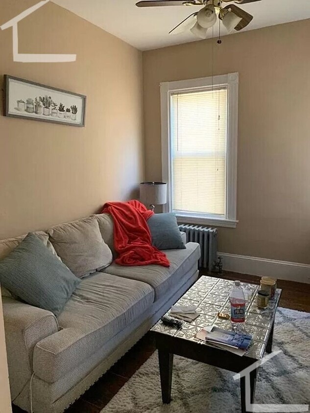
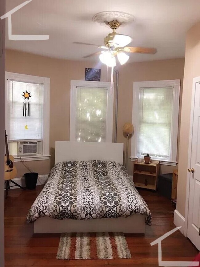
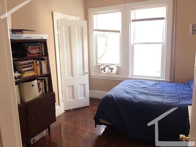
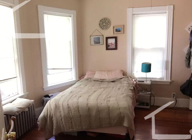
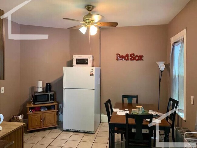
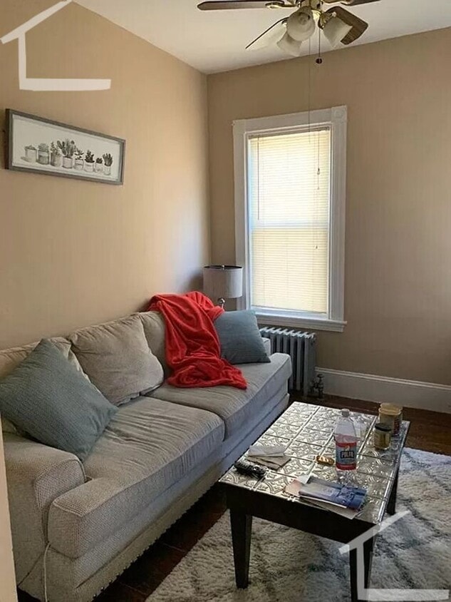
This large 5 bed 2 bath unit is located just a short walk from the Winthrop street community garden and features -Hardwood floors -Laundry in Building -A private back patio Available 9/1
68 Harvest St is a house located in Suffolk County and the 02125 ZIP Code. This area is served by the Boston Public Schools attendance zone.
* Price shown is base rent and may not include non-optional fees and utilities.
Price, availability, fees, and any applicable rent special are subject to change without notice.
* Square footage definitions vary. Displayed square footage is approximate.
Contact
- Listed by Modern Real Estate (AD) | Modern Real Estate (AD)
Location
Get Directions
Situated between the South End and Dudley Square, Lower Roxbury is a predominantly residential neighborhood brimming with apartments and town houses available for rent. Residents enjoy a walkable urban environment filled with diverse historical architecture.
Warren Street and Washington Street are the neighborhood’s main commercial thoroughfares, touting rows of specialty shops, markets, and eateries in historic buildings. Northeastern University, Wentworth Institute of Technology, and Massachusetts College of Art and Design are all just northwest of Lower Roxbury, offering the community a bevy of cultural and educational amenities. Getting around from Lower Roxbury is easy with access to multiple T stops on the Orange Line.
Learn more about living in Lower Roxbury
Education
| Colleges & Universities | Distance | ||
|---|---|---|---|
| Colleges & Universities | Distance | ||
| Drive: | 5 min | 1.6 mi | |
| Drive: | 6 min | 2.5 mi | |
| Drive: | 5 min | 2.5 mi | |
| Drive: | 7 min | 3.0 mi |
68 Harvest St is within 5 minutes or 1.6 miles from UMass Boston. It is also near Tufts University, Boston and Northeastern University.
Schools


Public Elementary & Middle School
Grades PK-8
724 Students
Attendance Zone
Public Elementary & Middle School
Grades 3-8
177 Students
Attendance Zone
Public Middle School
Grades 6-8
205 Students
Attendance Zone
Public Middle & High School
Grades 7-12
1,567 Students
Attendance Zone
Public High School
Grades 9-12
1,087 Students
Attendance Zone
Charter High School
Grades 9-10 & 12
321 Students
Attendance Zone
Private Elementary School
Grades PK-6
128 Students
Nearby
Private Elementary School
Grades PK-6
Nearby
Private Middle & High School
Grades 7-12
292 Students
Nearby
School data provided by
 The GreatSchools Rating helps parents compare schools within a state based on a variety of school quality indicators and provides a helpful picture of how effectively each school serves all of its students. Ratings are on a scale of 1 (below average) to 10 (above average) and can include test scores, college readiness, academic progress, advanced courses, equity, discipline and attendance data. We also advise parents to visit schools, consider other information on school performance and programs, and consider family needs as part of the school selection process.
View GreatSchools Rating Methodology
Data provided by GreatSchools.org © 2025. All rights reserved.
View GreatSchools Rating Methodology
Data provided by GreatSchools.org © 2025. All rights reserved.
Transportation options available in Boston include Andrew Station, located 0.5 mile from 68 Harvest St. 68 Harvest St is near General Edward Lawrence Logan International, located 5.4 miles or 10 minutes away.
| Transit / Subway | Distance | ||
|---|---|---|---|
| Transit / Subway | Distance | ||
|
|
Walk: | 10 min | 0.5 mi |
|
|
Drive: | 3 min | 1.3 mi |
|
|
Drive: | 2 min | 1.6 mi |
|
|
Drive: | 5 min | 1.9 mi |
|
|
Drive: | 6 min | 2.4 mi |
| Commuter Rail | Distance | ||
|---|---|---|---|
| Commuter Rail | Distance | ||
| Walk: | 12 min | 0.6 mi | |
|
|
Walk: | 16 min | 0.9 mi |
|
|
Drive: | 3 min | 1.5 mi |
| Drive: | 3 min | 1.8 mi | |
|
|
Drive: | 7 min | 3.1 mi |
| Airports | Distance | ||
|---|---|---|---|
| Airports | Distance | ||
|
General Edward Lawrence Logan International
|
Drive: | 10 min | 5.4 mi |
Time and distance from 68 Harvest St.
| Shopping Centers | Distance | ||
|---|---|---|---|
| Shopping Centers | Distance | ||
| Walk: | 10 min | 0.5 mi | |
| Drive: | 3 min | 1.5 mi | |
| Drive: | 4 min | 1.6 mi |
68 Harvest St has 3 shopping centers within 1.6 miles, which is about a 4-minute walk. The miles and minutes will be for the farthest away property.
| Parks and Recreation | Distance | ||
|---|---|---|---|
| Parks and Recreation | Distance | ||
|
Dorchester Shores Reservation
|
Drive: | 4 min | 1.6 mi |
|
Lower Neponset River Trail
|
Drive: | 4 min | 2.0 mi |
|
Franklin Park Zoo
|
Drive: | 3 min | 2.1 mi |
|
Roxbury Heritage State Park
|
Drive: | 4 min | 2.3 mi |
|
Squantum Point Park
|
Drive: | 12 min | 5.7 mi |
68 Harvest St has 5 parks within 5.7 miles, including Dorchester Shores Reservation, Roxbury Heritage State Park, and Lower Neponset River Trail.
| Hospitals | Distance | ||
|---|---|---|---|
| Hospitals | Distance | ||
| Drive: | 3 min | 1.5 mi | |
| Drive: | 3 min | 1.6 mi | |
| Drive: | 5 min | 2.3 mi |
68 Harvest St has 3 hospitals within 2.3 miles, the nearest is Boston Medical Center which is 1.5 miles away and a 3 minute drive.
You May Also Like
Similar Rentals Nearby


What Are Walk Score®, Transit Score®, and Bike Score® Ratings?
Walk Score® measures the walkability of any address. Transit Score® measures access to public transit. Bike Score® measures the bikeability of any address.
What is a Sound Score Rating?
A Sound Score Rating aggregates noise caused by vehicle traffic, airplane traffic and local sources
68 Harvest St
Boston, MA 02125