
$1,895
/ Month
679 Sparrow Ln
Langhorne, PA 19047
2 Weeks Ago
|
Edit
Favorites
679 Sparrow Ln

Favorites
Check Back Soon for Upcoming Availability
| Beds | Baths | Average SF |
|---|---|---|
| 2 Bedrooms 2 Bedrooms 2 Br | 2 Baths 2 Baths 2 Ba | — |
About This Property
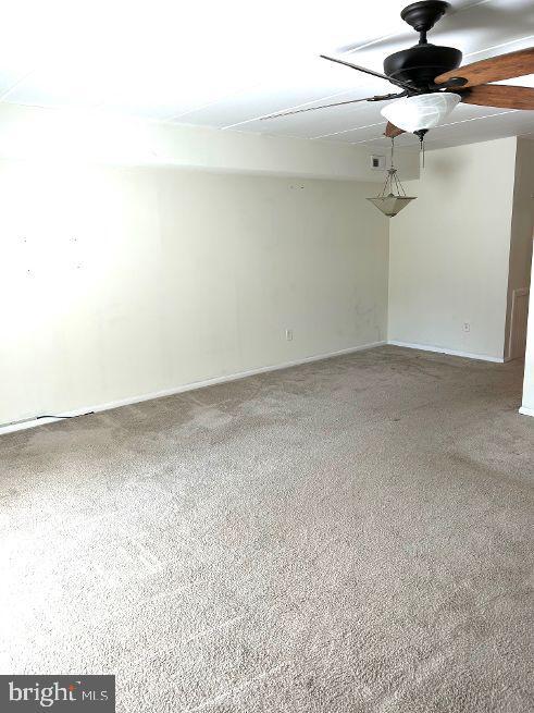
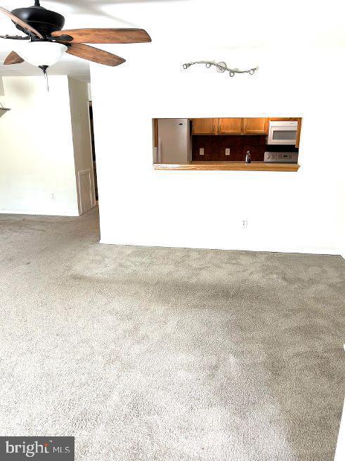
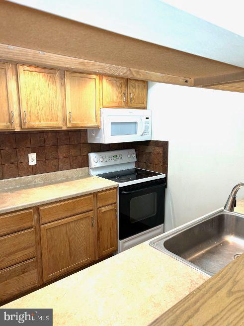
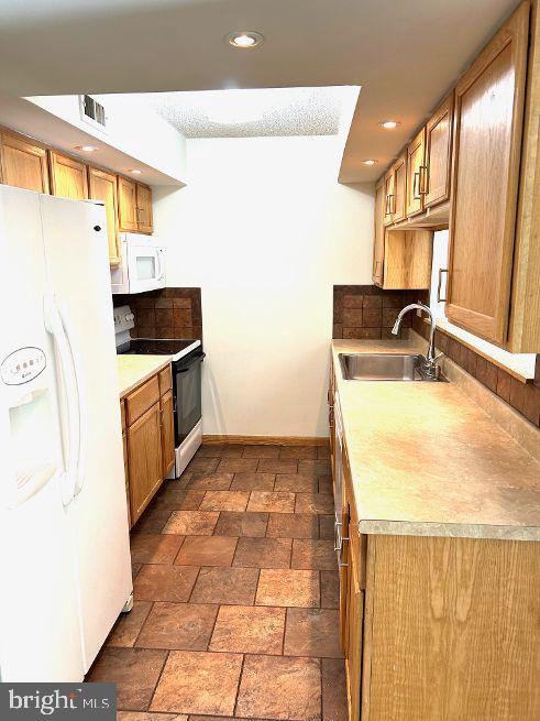
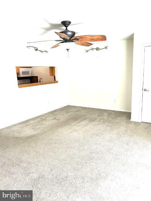
2 Bedroom 2 Bath first floor condo in Neshaminy Schools. Large Living room and dining room. Galley style kitchen. Master bedroom with walk-in closet and master bath. Laundry in unit. Driveway parking. Very large storage unit in basement.
679 Sparrow Ln is an apartment community located in Bucks County and the 19047 ZIP Code.
Features
- Basement
679 Sparrow Ln,
Langhorne,
PA
19047
Amenities
- Basement
Education
| Colleges & Universities | Distance | ||
|---|---|---|---|
| Colleges & Universities | Distance | ||
| Drive: | 11 min | 5.8 mi | |
| Drive: | 15 min | 7.8 mi | |
| Drive: | 18 min | 8.7 mi | |
| Drive: | 18 min | 11.3 mi |
679 Sparrow Ln is within 11 minutes or 5.8 miles from C.C. of Philadelphia, NE Ctr. It is also near Bucks County Community College and Holy Family University.
Transportation options available in Langhorne include Burlington South, located 7.9 miles from 679 Sparrow Ln. 679 Sparrow Ln is near Trenton Mercer, located 12.7 miles or 20 minutes away, and Philadelphia International, located 32.0 miles or 49 minutes away.
| Transit / Subway | Distance | ||
|---|---|---|---|
| Transit / Subway | Distance | ||
|
|
Drive: | 17 min | 7.9 mi |
|
|
Drive: | 19 min | 8.6 mi |
|
|
Drive: | 22 min | 11.1 mi |
|
|
Drive: | 25 min | 13.5 mi |
|
|
Drive: | 24 min | 14.0 mi |
| Commuter Rail | Distance | ||
|---|---|---|---|
| Commuter Rail | Distance | ||
|
|
Walk: | 15 min | 0.8 mi |
|
|
Drive: | 5 min | 2.5 mi |
|
|
Drive: | 8 min | 4.3 mi |
|
|
Drive: | 11 min | 5.2 mi |
|
|
Drive: | 8 min | 5.3 mi |
| Airports | Distance | ||
|---|---|---|---|
| Airports | Distance | ||
|
Trenton Mercer
|
Drive: | 20 min | 12.7 mi |
|
Philadelphia International
|
Drive: | 49 min | 32.0 mi |
Walkability Near 679 Sparrow Ln Langhorne, PA 19047
Getting Around
 What do Walkability, Transit, Drivability, and Bikeability mean?
Walkability measures the walking distance to day-to-day needs.
Transit measures access to public transportation.
Drivability measures congestion, parking availability, and access to major roads.
Bikeability measures the suitability for cycling.
How It Works
What do Walkability, Transit, Drivability, and Bikeability mean?
Walkability measures the walking distance to day-to-day needs.
Transit measures access to public transportation.
Drivability measures congestion, parking availability, and access to major roads.
Bikeability measures the suitability for cycling.
How It Works
Fairly Walkable
Walkability
40
/ 100
Limited Public Transit
Transit
30
/ 100
Very Drivable
Drivability
80
/ 100
Somewhat Bikeable
Bikeability
30
/ 100
Scores provided by
Active
Soundscore™
77
/ 100
Traffic
ActiveAirport
CalmBusinesses
CalmScores provided by
HowLoud What is a Sound Score Rating? A Sound Score Rating aggregates noise caused by vehicle traffic, airplane traffic and local sources. How It WorksTime and distance from 679 Sparrow Ln.
| Shopping Centers | Distance | ||
|---|---|---|---|
| Shopping Centers | Distance | ||
| Walk: | 7 min | 0.4 mi | |
| Drive: | 3 min | 1.2 mi | |
| Drive: | 5 min | 2.0 mi |
679 Sparrow Ln has 3 shopping centers within 2.0 miles, which is about a 5-minute drive. The miles and minutes will be for the farthest away property.
| Parks and Recreation | Distance | ||
|---|---|---|---|
| Parks and Recreation | Distance | ||
|
Core Creek Park
|
Drive: | 8 min | 4.0 mi |
|
Silver Lake Nature Center
|
Drive: | 11 min | 5.7 mi |
|
Churchville Nature Center
|
Drive: | 12 min | 6.1 mi |
|
Benjamin Rush State Park
|
Drive: | 15 min | 6.3 mi |
|
Neshaminy State Park
|
Drive: | 14 min | 7.4 mi |
679 Sparrow Ln has 5 parks within 7.4 miles, including Core Creek Park, Silver Lake Nature Center, and Churchville Nature Center.
| Hospitals | Distance | ||
|---|---|---|---|
| Hospitals | Distance | ||
| Drive: | 9 min | 4.8 mi | |
| Drive: | 12 min | 6.3 mi | |
| Drive: | 15 min | 7.7 mi |
679 Sparrow Ln has 3 hospitals within 7.7 miles, the nearest is Rothman Orthopaedic Specialty Hospital which is 4.8 miles away and a 9 minute drive.
| Military Bases | Distance | ||
|---|---|---|---|
| Military Bases | Distance | ||
| Drive: | 22 min | 11.0 mi | |
| Drive: | 25 min | 15.5 mi |
679 Sparrow Ln is 11.0 miles from Naval Air Development Center, and is convenient to other military bases, including Willow Grove Naval Air Station.
You May Also Like
Similar Rentals Nearby


What Are Walk Score®, Transit Score®, and Bike Score® Ratings?
Walk Score® measures the walkability of any address. Transit Score® measures access to public transit. Bike Score® measures the bikeability of any address.
What is a Sound Score Rating?
A Sound Score Rating aggregates noise caused by vehicle traffic, airplane traffic and local sources.
679 Sparrow Ln
Langhorne, PA 19047