6776 Yount St

6776 Yount St, Yountville, CA 94599

Share Listing
Favorites
6776 Yount St
Share Listing
Favorites

About 6776 Yount St Yountville, CA 94599

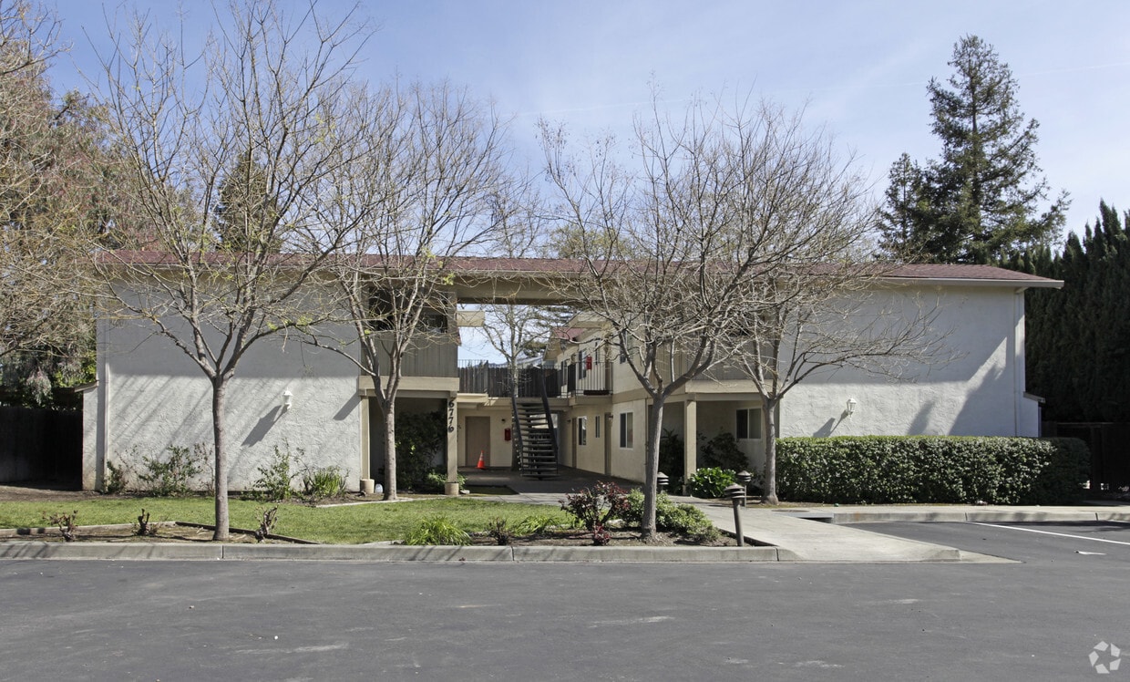
6776 Yount St offers a combination of comfort, design and quality. This apartment community is located on Yount St. in the 94599 area of Yountville. Come for a visit to check out the apartment floorplan options. From pricing to features, the team of leasing professionals is available to assist you in finding your new apartment. Come see 6776 Yount St today.

6776 Yount St is an apartment community located in Napa County and the 94599 ZIP Code. This area is served by the Napa Valley Unified School District attendance zone.

Location
6776 Yount St, Yountville,
CA 94599
Get Directions
Education
Colleges & Universities Distance
Drive: 19 min 12.0 mi
Drive: 28 min 16.9 mi
Drive: 50 min 33.3 mi
Drive: 58 min 38.0 mi
6776 Yount St is within 19 minutes or 12.0 miles from Napa Valley College. It is also near Pacific Union College and Sonoma State University.
Schools
Public Elementary & Middle School
Grades K-8
Nearby
Public Elementary School
Grades K-5
Nearby
Public Middle School
Grades 6-8
Attendance Zone
Public High School
Grades 9-12
Attendance Zone
Private Elementary School
Grades PK-5
Nearby
Private Elementary School
Grades PK-5
Nearby
Private Middle & High School
Grades 6-12
Nearby
Transportation

6776 Yount St is near Charles M Schulz - Sonoma County, located 36.1 miles or 60 minutes away.

Commuter Rail Distance
Drive: 48 min 32.7 mi
Drive: 52 min 34.4 mi
Drive: 56 min 34.5 mi
Drive: 58 min 38.8 mi
Drive: 60 min 42.5 mi
Airports Distance
Airports Distance
Charles M Schulz - Sonoma County
Drive: 60 min 36.1 mi

Walkability Near 6776 Yount St Yountville, CA 94599

Getting Around
Fairly Walkable
Walkability
40 / 100
Limited Public Transit
Transit
30 / 100
Exceptionally Drivable
Drivability
100 / 100
Somewhat Bikeable
Bikeability
30 / 100

Scores provided by

What do Walkability, Transit, Drivability, and Bikeability mean? Walkability measures the walking distance to day-to-day needs. Transit measures access to public transportation. Drivability measures congestion, parking availability, and access to major roads. Bikeability measures the suitability for cycling. How It Works
-
Soundscore
- / 100

Traffic

-

Airport

-

Businesses

-

Scores provided by

HowLoud What is a Sound Score Rating? A Sound Score Rating aggregates noise caused by vehicle traffic, airplane traffic and local sources. How It Works
Points of Interest

Time and distance from 6776 Yount St.

Shopping Centers Distance
Walk: 4 min 0.3 mi
Walk: 10 min 0.5 mi
Drive: 9 min 5.9 mi
6776 Yount St has 3 shopping centers within 5.9 miles, which is about a 9-minute drive. The miles and minutes will be for the farthest away property.
Parks and Recreation Distance
Quarryhill Botanical Garden
Drive: 35 min 13.8 mi
Bouverie Preserve
Drive: 37 min 14.7 mi
Sonoma Valley Regional Park
Drive: 39 min 15.4 mi
Sugarloaf Ridge State Park
Drive: 50 min 20.0 mi
Robert Ferguson Observatory
Drive: 56 min 21.5 mi
6776 Yount St has 5 parks within 21.5 miles, including Quarryhill Botanical Garden, Robert Ferguson Observatory, and Bouverie Preserve.
Hospitals Distance
Hospitals Distance
Drive: 13 min 7.8 mi
Drive: 41 min 16.4 mi
Drive: 32 min 22.3 mi
6776 Yount St has 3 hospitals within 22.3 miles, the nearest is Queen of the Valley Medical Center which is 7.8 miles away and a 13 minute drive.
Military Bases Distance
Drive: 35 min 25.8 mi
Drive: 45 min 34.8 mi
6776 Yount St is 25.8 miles from Mare Island Naval Reserve, and is convenient to other military bases, including Travis Air Force Base.

Explore Similar Rentals Nearby