

$3,600
/ Month
677 Fremont St Unit B
Menlo Park, CA 94025
2 Weeks Ago
|
Edit
Favorites
677 Fremont St Unit B

Favorites
Check Back Soon for Upcoming Availability
| Beds | Baths | Average SF |
|---|---|---|
| 2 Bedrooms 2 Bedrooms 2 Br | 1.5 Baths 1.5 Baths 1.5 Ba | 1,190 SF |
About This Property
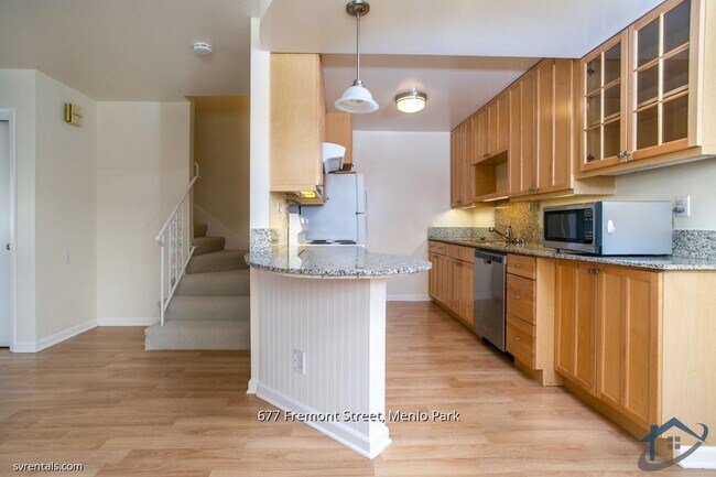
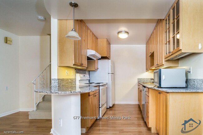
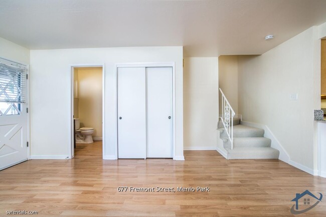
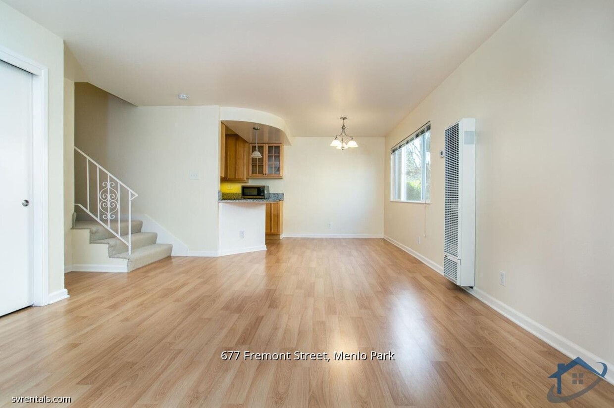
Beautiful, open-plan home on prestigious Fremont Street, close to Stanford, CalTrain, Sunday Farmer's Market, Stanford Bike Bridge, and the shops and eateries of downtown Menlo Park. Convenient to Jack Lyle Park, commute routes. The main level features a large living area, remodeled kitchen, and dining area. Upstairs are two bright bedrooms with plenty of closet space and updated, full bathroom, plus a private balcony. Dual-pane windows throughout for comfort, quiet, and energy-efficiency. Free carport parking for two cars is included. Convenient free, on-site laundry. Water, trash removal, and gardening are included; tenant pays electricity. Sorry, no animals. No smoking.
677 Fremont St is a condo located in San Mateo County and the 94025 ZIP Code. This area is served by the Menlo Park City Elementary attendance zone.
Location
Get Directions
Located in Silicon Valley, Menlo Park combines residential comfort with technological innovation. As home to Meta's headquarters and numerous venture capital firms along Sand Hill Road, the city maintains its community atmosphere with established neighborhoods and a downtown district along Santa Cruz Avenue. Housing includes both traditional homes and apartment communities, with current rental data showing one-bedroom apartments averaging $3,411 monthly and two-bedroom units at $4,626.
Menlo Park offers abundant outdoor spaces, including the 160-acre Bedwell Bayfront Park with bay views and walking trails. Downtown features independent shops and eateries, while the farmers' market operates at the historic Menlo Park train station, which holds the distinction of being California's oldest operating rail station. The proximity to Stanford University enhances educational opportunities, and commuters benefit from Caltrain service and highway access to both San Francisco and San Jose.
Learn more about living in Menlo ParkBelow are rent ranges for similar nearby apartments
Education
| Colleges & Universities | Distance | ||
|---|---|---|---|
| Colleges & Universities | Distance | ||
| Drive: | 5 min | 1.3 mi | |
| Drive: | 9 min | 3.4 mi | |
| Drive: | 16 min | 5.9 mi | |
| Drive: | 14 min | 6.9 mi |
677 Fremont St Unit B is within 5 minutes or 1.3 miles from Menlo College. It is also near Stanford University and Foothill College, Middlefield.
Schools


Public Elementary School
Grades K-5
367 Students
Nearby
Public Elementary School
Grades K-5
562 Students
Attendance Zone
Public Middle School
Grades 6-8
867 Students
Attendance Zone
Public High School
Grades 9-12
2,125 Students
Attendance Zone
Private Elementary, Middle & High School
Grades 2-10
82 Students
Nearby
Private Elementary & Middle School
Grades PK-8
270 Students
Nearby
Private Middle & High School
Grades 7-12
Nearby
School data provided by
 The GreatSchools Rating helps parents compare schools within a state based on a variety of school quality indicators and provides a helpful picture of how effectively each school serves all of its students. Ratings are on a scale of 1 (below average) to 10 (above average) and can include test scores, college readiness, academic progress, advanced courses, equity, discipline and attendance data. We also advise parents to visit schools, consider other information on school performance and programs, and consider family needs as part of the school selection process.
View GreatSchools Rating Methodology
Data provided by GreatSchools.org © 2026. All rights reserved.
View GreatSchools Rating Methodology
Data provided by GreatSchools.org © 2026. All rights reserved.
Transportation options available in Menlo Park include Mountain View Station, located 7.5 miles from 677 Fremont St Unit B. 677 Fremont St Unit B is near Norman Y Mineta San Jose International, located 17.4 miles or 28 minutes away, and San Francisco International, located 20.2 miles or 30 minutes away.
| Transit / Subway | Distance | ||
|---|---|---|---|
| Transit / Subway | Distance | ||
| Drive: | 16 min | 7.5 mi | |
|
|
Drive: | 16 min | 7.5 mi |
|
|
Drive: | 19 min | 8.8 mi |
| Drive: | 18 min | 9.8 mi | |
|
|
Drive: | 18 min | 10.0 mi |
| Commuter Rail | Distance | ||
|---|---|---|---|
| Commuter Rail | Distance | ||
| Drive: | 3 min | 1.3 mi | |
| Drive: | 4 min | 1.5 mi | |
| Drive: | 8 min | 3.3 mi | |
| Drive: | 8 min | 3.3 mi | |
| Drive: | 11 min | 4.6 mi |
| Airports | Distance | ||
|---|---|---|---|
| Airports | Distance | ||
|
Norman Y Mineta San Jose International
|
Drive: | 28 min | 17.4 mi |
|
San Francisco International
|
Drive: | 30 min | 20.2 mi |
Time and distance from 677 Fremont St Unit B.
| Shopping Centers | Distance | ||
|---|---|---|---|
| Shopping Centers | Distance | ||
| Walk: | 10 min | 0.6 mi | |
| Walk: | 12 min | 0.6 mi | |
| Walk: | 12 min | 0.7 mi |
677 Fremont St Unit B has 3 shopping centers within 0.7 mile, which is about a 12-minute walk. The miles and minutes will be for the farthest away property.
| Parks and Recreation | Distance | ||
|---|---|---|---|
| Parks and Recreation | Distance | ||
|
Jack W. Lyle Park
|
Walk: | 2 min | 0.1 mi |
|
Fremont Park
|
Walk: | 7 min | 0.4 mi |
|
Burgess Park
|
Drive: | 5 min | 1.5 mi |
|
El Palo Alto Park
|
Drive: | 6 min | 1.8 mi |
|
Hopkins Creekside Park
|
Drive: | 6 min | 1.9 mi |
677 Fremont St Unit B has 5 parks within 1.9 miles, including Jack W. Lyle Park, Fremont Park, and Burgess Park.
| Hospitals | Distance | ||
|---|---|---|---|
| Hospitals | Distance | ||
| Drive: | 6 min | 2.0 mi | |
| Drive: | 6 min | 2.4 mi | |
| Drive: | 11 min | 4.8 mi |
677 Fremont St Unit B has 3 hospitals within 4.8 miles, the nearest is Lucile Salter Packard Children's Hospital at Stanford which is 2.0 miles away and a 6 minute drive.
| Military Bases | Distance | ||
|---|---|---|---|
| Military Bases | Distance | ||
| Drive: | 21 min | 10.3 mi |
677 Fremont St Unit B is 10.3 miles and a 21 minute drive from Ames Research Center.
You May Also Like
Similar Rentals Nearby


What Are Walk Score®, Transit Score®, and Bike Score® Ratings?
Walk Score® measures the walkability of any address. Transit Score® measures access to public transit. Bike Score® measures the bikeability of any address.
What is a Sound Score Rating?
A Sound Score Rating aggregates noise caused by vehicle traffic, airplane traffic and local sources
677 Fremont St
Menlo Park, CA 94025