
The Riverdale Tower
3745 Riverdale Ave,
The Bronx, NY 10463
$2,200 - $4,500
Studio - 2 Beds
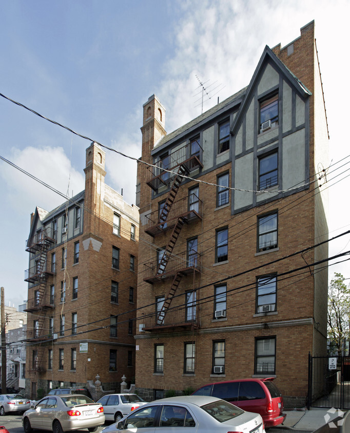

At 675 E 234th St, you've discovered your new home. These apartments are located at 675 E. 234th St. in Bronx. The leasing staff is waiting to show you all that this community has in store. Come by to see the available floorplan options. Contact us or drop by to schedule a tour and find your new place at 675 E 234th St.
675 E 234th St is an apartment community located in Bronx County and the 10466 ZIP Code. This area is served by the New York City Geographic District #11 attendance zone.
Air Conditioning
Refrigerator
Tub/Shower
Window Coverings
Wakefield is an urban neighborhood in the eastern section of the Bronx accessible to Manhattan through Interstate 87 or by hopping on one of the many public transit stations in the neighborhood. Wakefield is bounded by the Bronx River to the west, so many parks and trails that lead into the New York Botanical Garden are available to residents. The neighborhood itself consists of residential areas with apartments and condos in long-standing brick buildings as well as quaint rowhomes that make up the rental scene. Along with residences, this compact area is filled with a variety of restaurants serving everything from international cuisine to New York classics, and a range of shops and businesses provide Wakefield residents with the essentials. Other great features in the neighborhood include a community garden, green spaces, and a few schools.
Learn more about living in WakefieldCompare neighborhood and city base rent averages by bedroom.
| Wakefield | Bronx, NY | |
|---|---|---|
| Studio | $5,176 | $1,612 |
| 1 Bedroom | $1,521 | $1,633 |
| 2 Bedrooms | $1,759 | $2,094 |
| 3 Bedrooms | $1,991 | $2,352 |
| Colleges & Universities | Distance | ||
|---|---|---|---|
| Colleges & Universities | Distance | ||
| Drive: | 6 min | 3.4 mi | |
| Drive: | 7 min | 3.4 mi | |
| Drive: | 9 min | 3.5 mi | |
| Drive: | 8 min | 3.6 mi |


Transportation options available in Bronx include 233 Street, located 0.1 mile from 675 E 234th St. 675 E 234th St is near LaGuardia, located 13.5 miles or 24 minutes away, and Westchester County, located 19.1 miles or 30 minutes away.
| Transit / Subway | Distance | ||
|---|---|---|---|
| Transit / Subway | Distance | ||
|
|
Walk: | 2 min | 0.1 mi |
|
|
Walk: | 7 min | 0.4 mi |
|
|
Walk: | 10 min | 0.5 mi |
|
|
Walk: | 16 min | 0.9 mi |
|
|
Drive: | 2 min | 1.1 mi |
| Commuter Rail | Distance | ||
|---|---|---|---|
| Commuter Rail | Distance | ||
|
|
Walk: | 8 min | 0.5 mi |
|
|
Drive: | 3 min | 1.4 mi |
|
|
Drive: | 3 min | 1.6 mi |
|
|
Drive: | 4 min | 1.9 mi |
|
|
Drive: | 5 min | 2.5 mi |
| Airports | Distance | ||
|---|---|---|---|
| Airports | Distance | ||
|
LaGuardia
|
Drive: | 24 min | 13.5 mi |
|
Westchester County
|
Drive: | 30 min | 19.1 mi |
Scores provided by
Traffic
-Airport
-Businesses
-Scores provided by
HowLoud What is a Sound Score Rating? A Sound Score Rating aggregates noise caused by vehicle traffic, airplane traffic and local sources. How It WorksTime and distance from 675 E 234th St.
| Shopping Centers | Distance | ||
|---|---|---|---|
| Shopping Centers | Distance | ||
| Drive: | 4 min | 2.2 mi | |
| Drive: | 4 min | 2.2 mi | |
| Drive: | 5 min | 2.4 mi |
| Parks and Recreation | Distance | ||
|---|---|---|---|
| Parks and Recreation | Distance | ||
|
Seton Falls Park
|
Drive: | 3 min | 1.4 mi |
|
Williamsbridge Oval
|
Drive: | 5 min | 2.1 mi |
|
Van Cortlandt Park
|
Drive: | 6 min | 3.5 mi |
|
New York Botanical Garden
|
Drive: | 11 min | 3.7 mi |
|
Bronx Park
|
Drive: | 9 min | 3.8 mi |
| Hospitals | Distance | ||
|---|---|---|---|
| Hospitals | Distance | ||
| Drive: | 4 min | 2.1 mi | |
| Drive: | 4 min | 2.2 mi | |
| Drive: | 9 min | 4.3 mi |
| Military Bases | Distance | ||
|---|---|---|---|
| Military Bases | Distance | ||
| Drive: | 21 min | 11.5 mi | |
| Drive: | 37 min | 20.3 mi | |
| Drive: | 42 min | 27.6 mi |
What Are Walk Score®, Transit Score®, and Bike Score® Ratings?
Walk Score® measures the walkability of any address. Transit Score® measures access to public transit. Bike Score® measures the bikeability of any address.
What is a Sound Score Rating?
A Sound Score Rating aggregates noise caused by vehicle traffic, airplane traffic and local sources.


