
$5,200
/ Month
670 San Antonio Rd Unit 12
Palo Alto, CA 94306
2 Weeks Ago
Favorites
670 San Antonio Rd

Favorites
Check Back Soon for Upcoming Availability
| Beds | Baths | Average SF |
|---|---|---|
| 3 Bedrooms 3 Bedrooms 3 Br | 2.5 Baths 2.5 Baths 2.5 Ba | 1,382 SF |
Fees and Policies
The fees below are based on community-supplied data and may exclude additional fees and utilities.
- Parking
-
Garage--
About This Property
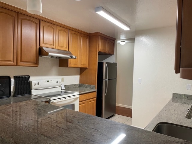
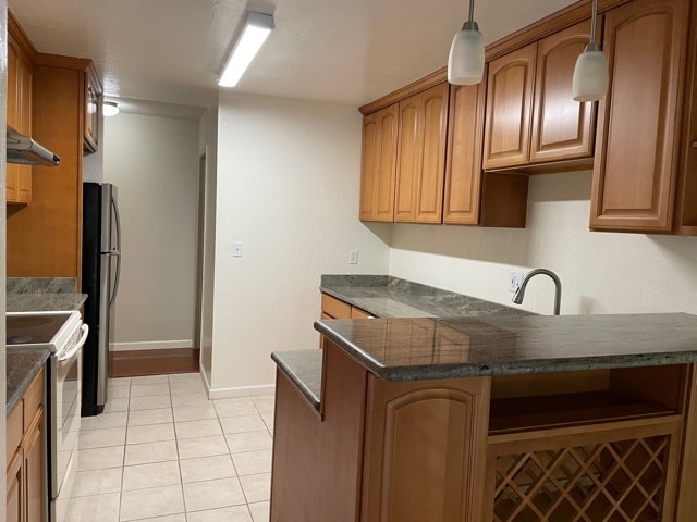
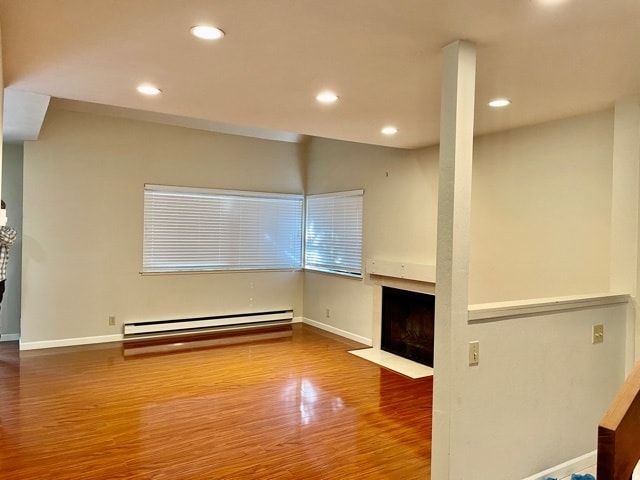
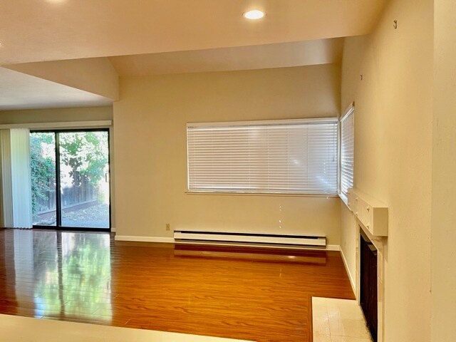
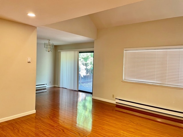
3 beds 2.5 baths Town House 4 miles to Stanford University In excellent Palo Alto school district. Engineering Hardwood floor through the house, Refrigerator, Washer and Dryer provided inside the house and with 2 car garage. Private back yard with many fruit trees. Easy access to HWY 101, 85, 280 and 237. Just minutes to CalTrain and Gooogle plex. Our convenient location close to Stanford University, Gooogle, Face book, etc. Excellent Palo Alto Schools No Smoking, No Pets Please contact Property Manager at for more information. Thank you for looking, have a wonderful day!
670 San Antonio Rd is a townhome located in Santa Clara County and the 94306 ZIP Code.
Townhome Features
Washer/Dryer
Dishwasher
Hardwood Floors
Refrigerator
- Washer/Dryer
- Smoke Free
- Fireplace
- Dishwasher
- Refrigerator
- Hardwood Floors
- Yard
Location
Get Directions
Palo Alto is known as the birthplace of Silicon Valley and that unique heritage is proudly on display, with the Computer History Museum just down the street from Google’s world headquarters and countless other tech companies all over town. The restaurant scene rivals that of nearby San Francisco, with many small, independent eateries serving up some of the best food in the Bay Area.
With close proximity to the country’s tech center, it’s no surprise that Palo Alto apartments come with some of the most incredible amenities around. Residents also have access to dozens of options for outdoor recreation, including the gorgeous hiking and biking trails through the surrounding nature preserves, several golf courses, and easy access to San Francisco Bay. Bicycling is a popular mode of transportation around Palo Alto, with many bike-friendly routes around the city.
Palo Alto is famous as the home of Stanford University, and the campus is one of the most dominant landmarks in the area.
Learn more about living in Palo Alto
Amenities
- Washer/Dryer
- Smoke Free
- Fireplace
- Dishwasher
- Refrigerator
- Hardwood Floors
- Yard
Education
| Colleges & Universities | Distance | ||
|---|---|---|---|
| Colleges & Universities | Distance | ||
| Walk: | 7 min | 0.4 mi | |
| Drive: | 11 min | 4.7 mi | |
| Drive: | 12 min | 4.7 mi | |
| Drive: | 16 min | 6.9 mi |
670 San Antonio Rd is within 7 minutes or 0.4 mile from Foothill College, Middlefield. It is also near Stanford University and Foothill Coll., Los Altos.
Transportation options available in Palo Alto include Mountain View Station, located 2.6 miles from 670 San Antonio Rd. 670 San Antonio Rd is near Norman Y Mineta San Jose International, located 10.9 miles or 16 minutes away, and San Francisco International, located 23.2 miles or 30 minutes away.
| Transit / Subway | Distance | ||
|---|---|---|---|
| Transit / Subway | Distance | ||
| Drive: | 5 min | 2.6 mi | |
|
|
Drive: | 5 min | 2.6 mi |
| Drive: | 6 min | 3.3 mi | |
|
|
Drive: | 6 min | 3.4 mi |
|
|
Drive: | 7 min | 3.9 mi |
| Commuter Rail | Distance | ||
|---|---|---|---|
| Commuter Rail | Distance | ||
| Drive: | 2 min | 1.1 mi | |
| Drive: | 7 min | 3.0 mi | |
| Drive: | 8 min | 3.2 mi | |
| Drive: | 7 min | 3.2 mi | |
| Drive: | 8 min | 3.5 mi |
| Airports | Distance | ||
|---|---|---|---|
| Airports | Distance | ||
|
Norman Y Mineta San Jose International
|
Drive: | 16 min | 10.9 mi |
|
San Francisco International
|
Drive: | 30 min | 23.2 mi |
Time and distance from 670 San Antonio Rd.
| Shopping Centers | Distance | ||
|---|---|---|---|
| Shopping Centers | Distance | ||
| Walk: | 8 min | 0.4 mi | |
| Walk: | 9 min | 0.5 mi | |
| Walk: | 11 min | 0.6 mi |
670 San Antonio Rd has 3 shopping centers within 0.6 mile, which is about a 11-minute walk. The miles and minutes will be for the farthest away property.
| Parks and Recreation | Distance | ||
|---|---|---|---|
| Parks and Recreation | Distance | ||
|
J. Pearce Mitchell Park
|
Drive: | 4 min | 1.1 mi |
|
Terman Park
|
Drive: | 6 min | 2.4 mi |
|
Stevens Creek Shoreline Nature Study Area
|
Drive: | 8 min | 2.8 mi |
|
Bol Park
|
Drive: | 8 min | 3.1 mi |
|
Esther Clark Nature Preserve
|
Drive: | 9 min | 3.4 mi |
670 San Antonio Rd has 5 parks within 3.4 miles, including J. Pearce Mitchell Park, Terman Park, and Stevens Creek Shoreline Nature Study Area.
| Hospitals | Distance | ||
|---|---|---|---|
| Hospitals | Distance | ||
| Drive: | 8 min | 4.8 mi | |
| Drive: | 13 min | 5.3 mi | |
| Drive: | 14 min | 5.9 mi |
670 San Antonio Rd has 3 hospitals within 5.9 miles, the nearest is El Camino Hospital which is 4.8 miles away and a 8 minute drive.
| Military Bases | Distance | ||
|---|---|---|---|
| Military Bases | Distance | ||
| Drive: | 9 min | 3.7 mi |
670 San Antonio Rd is 3.7 miles and a 9 minute drive from Ames Research Center.
You May Also Like
Similar Rentals Nearby


What Are Walk Score®, Transit Score®, and Bike Score® Ratings?
Walk Score® measures the walkability of any address. Transit Score® measures access to public transit. Bike Score® measures the bikeability of any address.
What is a Sound Score Rating?
A Sound Score Rating aggregates noise caused by vehicle traffic, airplane traffic and local sources
670 San Antonio Rd
Palo Alto, CA 94306