
$1,500
/ Month
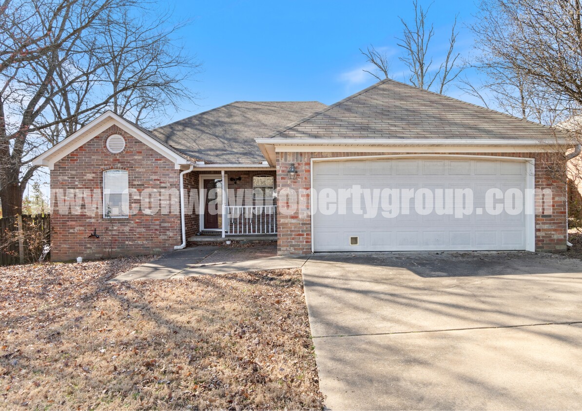
67 Weston Cir
Greenbrier, AR 72058
Favorites
67 Weston Cir

Favorites
Check Back Soon for Upcoming Availability
| Beds | Baths | Average SF |
|---|---|---|
| 3 Bedrooms 3 Bedrooms 3 Br | 2 Baths 2 Baths 2 Ba | 1,292 SF |
About This Property
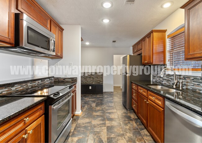
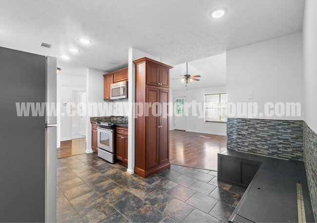
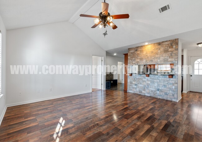
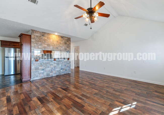
Check out this 3 bedroom and 2 bathroom home located in Greenbrier, AR! These pictures are not up to date - property has been painted since these pictures were taken. Bring your furry friends because we have no breed or weight restrictions. Our application requirements include: -Tenant/combined tenants income must be 3 times the monthly rent -No criminal background -No debt owed to previous landlords or utility companies Give us a call to schedule a showing!
67 Weston Cir is a house located in Faulkner County and the 72058 ZIP Code. This area is served by the Greenbrier School District attendance zone.
67 Weston Cir,
Greenbrier,
AR
72058
Education
| Colleges & Universities | Distance | ||
|---|---|---|---|
| Colleges & Universities | Distance | ||
| Drive: | 18 min | 11.9 mi | |
| Drive: | 25 min | 14.6 mi | |
| Drive: | 50 min | 39.8 mi | |
| Drive: | 55 min | 42.9 mi |
67 Weston Cir is within 18 minutes or 11.9 miles from Hendrix College. It is also near University of Central Arkansas and Pulaski Technical College.
Schools


Public Elementary School
Grades PK-5
422 Students
Attendance Zone
Public Middle School
Grades 6-8
590 Students
Attendance Zone
Public Middle School
Grades 6-8
586 Students
Attendance Zone
Public High School
Grades 9-12
767 Students
Attendance Zone
Private Elementary, Middle & High School
Grades PK-12
545 Students
Nearby
Private Elementary School
Grades PK-5
Nearby
School data provided by
 The GreatSchools Rating helps parents compare schools within a state based on a variety of school quality indicators and provides a helpful picture of how effectively each school serves all of its students. Ratings are on a scale of 1 (below average) to 10 (above average) and can include test scores, college readiness, academic progress, advanced courses, equity, discipline and attendance data. We also advise parents to visit schools, consider other information on school performance and programs, and consider family needs as part of the school selection process.
View GreatSchools Rating Methodology
Data provided by GreatSchools.org © 2026. All rights reserved.
View GreatSchools Rating Methodology
Data provided by GreatSchools.org © 2026. All rights reserved.
Walkability Near 67 Weston Cir Greenbrier, AR 72058
Getting Around
 What do Walkability, Transit, Drivability, and Bikeability mean?
Walkability measures the walking distance to day-to-day needs.
Transit measures access to public transportation.
Drivability measures congestion, parking availability, and access to major roads.
Bikeability measures the suitability for cycling.
How It Works
What do Walkability, Transit, Drivability, and Bikeability mean?
Walkability measures the walking distance to day-to-day needs.
Transit measures access to public transportation.
Drivability measures congestion, parking availability, and access to major roads.
Bikeability measures the suitability for cycling.
How It Works
Somewhat Walkable
Walkability
20
/ 100
Exceptionally Drivable
Drivability
100
/ 100
Somewhat Bikeable
Bikeability
20
/ 100
Scores provided by
-
Soundscore™
-
/ 100
Traffic
-Airport
-Businesses
-Scores provided by
HowLoud What is a Sound Score Rating? A Sound Score Rating aggregates noise caused by vehicle traffic, airplane traffic and local sources. How It WorksYou May Also Like
Similar Rentals Nearby


What Are Walk Score®, Transit Score®, and Bike Score® Ratings?
Walk Score® measures the walkability of any address. Transit Score® measures access to public transit. Bike Score® measures the bikeability of any address.
What is a Sound Score Rating?
A Sound Score Rating aggregates noise caused by vehicle traffic, airplane traffic and local sources.

67 Weston Cir
Greenbrier, AR 72058