
$2,000
/ Month
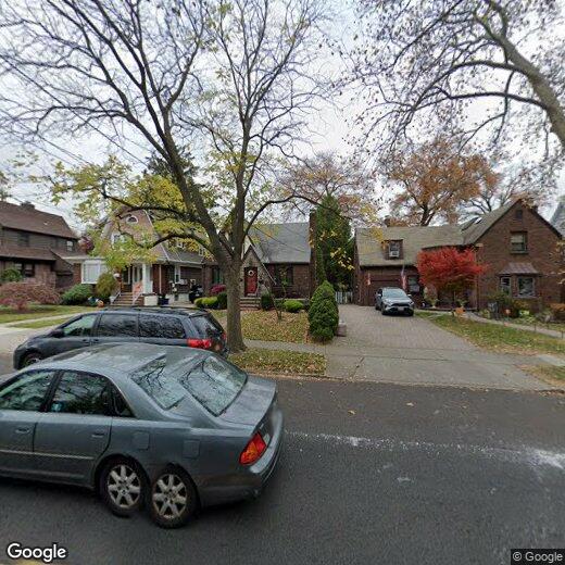
669 College Ave
Staten Island, NY 10302
Favorites
669 College Ave

Favorites
Check Back Soon for Upcoming Availability
| Beds | Baths | Average SF |
|---|---|---|
| 1 Bedroom 1 Bedroom 1 Br | 1 Bath 1 Bath 1 Ba | 2,148 SF |
Fees and Policies
Details
Lease Options
-
12 Months
About This Property
Located on the 2nd floor of a private home, this large one bedroom plus home office is charming and cozy! The apartment features a renovated kitchen with stainless steal appliances and dishwasher, private entrance, and tons of natural sunlight from the many windows throughout the apartment. Sorry no pets allowed. No smoking allowed.
669 College Ave is an apartment community located in Richmond County and the 10302 ZIP Code.
Features
- Carpet
669 College Ave,
Staten Island,
NY
10302
Staten Island occupies a singular position as New York City's southernmost borough, physically separate from the rest of the city yet firmly connected to it through the iconic, round-the-clock Staten Island Ferry. As the least densely populated of the five boroughs, it carries a noticeably quieter, more residential character than Manhattan or Brooklyn, covering roughly 59 square miles with a population near 490,000. The College of Staten Island anchors the borough's educational presence, while Snug Harbor Cultural Center and Botanical Garden reflects a deep commitment to the arts and green space. During the American Revolution, Staten Island served as a primary staging ground for British forces and remained under British control longer than any other part of what would become the United States.
Neighborhoods vary considerably across the island. St. George on the North Shore functions as the civic and cultural hub, while Tottenville anchors the quieter South Shore.
Learn more about living in Staten IslandBelow are rent ranges for similar nearby apartments
Amenities
- Carpet
Education
| Colleges & Universities | Distance | ||
|---|---|---|---|
| Colleges & Universities | Distance | ||
| Drive: | 8 min | 2.6 mi | |
| Drive: | 10 min | 3.6 mi | |
| Drive: | 13 min | 6.0 mi | |
| Drive: | 16 min | 7.7 mi |
669 College Ave is within 8 minutes or 2.6 miles from Coll. of Staten Island, CUNY. It is also near Wagner College and Union County Coll., Elizabeth.
Transportation options available in Staten Island include 8Th Street Light Rail Station, located 2.9 miles from 669 College Ave. 669 College Ave is near Newark Liberty International, located 11.2 miles or 18 minutes away, and LaGuardia, located 24.4 miles or 42 minutes away.
| Transit / Subway | Distance | ||
|---|---|---|---|
| Transit / Subway | Distance | ||
| Drive: | 6 min | 2.9 mi | |
|
|
Drive: | 8 min | 4.1 mi |
|
|
Drive: | 9 min | 5.0 mi |
|
|
Drive: | 11 min | 6.4 mi |
|
|
Drive: | 13 min | 7.1 mi |
| Commuter Rail | Distance | ||
|---|---|---|---|
| Commuter Rail | Distance | ||
|
|
Drive: | 10 min | 4.5 mi |
|
|
Drive: | 13 min | 4.5 mi |
|
|
Drive: | 14 min | 4.7 mi |
|
|
Drive: | 14 min | 4.9 mi |
|
|
Drive: | 12 min | 5.6 mi |
| Airports | Distance | ||
|---|---|---|---|
| Airports | Distance | ||
|
Newark Liberty International
|
Drive: | 18 min | 11.2 mi |
|
LaGuardia
|
Drive: | 42 min | 24.4 mi |
Walkability Near 669 College Ave Staten Island, NY 10302
Getting Around
 What do Walkability, Transit, Drivability, and Bikeability mean?
Walkability measures the walking distance to day-to-day needs.
Transit measures access to public transportation.
Drivability measures congestion, parking availability, and access to major roads.
Bikeability measures the suitability for cycling.
How It Works
What do Walkability, Transit, Drivability, and Bikeability mean?
Walkability measures the walking distance to day-to-day needs.
Transit measures access to public transportation.
Drivability measures congestion, parking availability, and access to major roads.
Bikeability measures the suitability for cycling.
How It Works
Moderately Walkable
Walkability
70
/ 100
Good Public Transit
Transit
60
/ 100
Moderately Drivable
Drivability
60
/ 100
Moderately Bikeable
Bikeability
60
/ 100
Scores provided by
-
Soundscore™
-
/ 100
Traffic
-Airport
-Businesses
-Scores provided by
HowLoud What is a Sound Score Rating? A Sound Score Rating aggregates noise caused by vehicle traffic, airplane traffic and local sources. How It WorksTime and distance from 669 College Ave.
| Shopping Centers | Distance | ||
|---|---|---|---|
| Shopping Centers | Distance | ||
| Walk: | 6 min | 0.4 mi | |
| Walk: | 8 min | 0.5 mi | |
| Walk: | 9 min | 0.5 mi |
669 College Ave has 3 shopping centers within 0.5 mile, which is about a 9-minute walk. The miles and minutes will be for the farthest away property.
| Parks and Recreation | Distance | ||
|---|---|---|---|
| Parks and Recreation | Distance | ||
|
Westerleigh Park
|
Walk: | 10 min | 0.5 mi |
|
Staten Island Zoo
|
Drive: | 4 min | 1.8 mi |
|
Faber Park
|
Drive: | 4 min | 2.0 mi |
|
Astrophysical Observatory at College of Staten Island
|
Drive: | 7 min | 2.6 mi |
|
Willowbrook Park
|
Drive: | 7 min | 2.6 mi |
669 College Ave has 5 parks within 2.6 miles, including Westerleigh Park, Faber Park, and Staten Island Zoo.
| Hospitals | Distance | ||
|---|---|---|---|
| Hospitals | Distance | ||
| Drive: | 6 min | 2.5 mi | |
| Drive: | 8 min | 4.7 mi | |
| Drive: | 14 min | 6.6 mi |
669 College Ave has 3 hospitals within 6.6 miles, the nearest is Richmond University Medical Center which is 2.5 miles away and a 6 minute drive.
| Military Bases | Distance | ||
|---|---|---|---|
| Military Bases | Distance | ||
| Drive: | 14 min | 4.4 mi | |
| Drive: | 12 min | 6.1 mi | |
| Drive: | 17 min | 8.4 mi |
669 College Ave has 3 military bases within 8.4 miles, the nearest is Naval Station NY Stapleton Site which is 4.4 miles away and a 14 minute drive.
You May Also Like
Similar Rentals Nearby


What Are Walk Score®, Transit Score®, and Bike Score® Ratings?
Walk Score® measures the walkability of any address. Transit Score® measures access to public transit. Bike Score® measures the bikeability of any address.
What is a Sound Score Rating?
A Sound Score Rating aggregates noise caused by vehicle traffic, airplane traffic and local sources.
669 College Ave
Staten Island, NY 10302