
$4,995
/ Month
663 Glenbrook Dr
Palo Alto, CA 94306
2 Weeks Ago
|
Edit
Favorites
663 Glenbrook Dr

Favorites
Check Back Soon for Upcoming Availability
| Beds | Baths | Average SF |
|---|---|---|
| 3 Bedrooms 3 Bedrooms 3 Br | 2 Baths 2 Baths 2 Ba | 1,200 SF |
About This Property
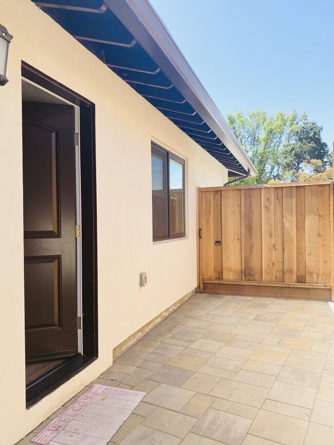
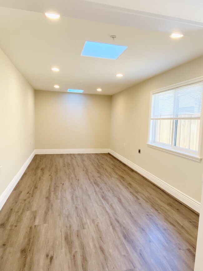
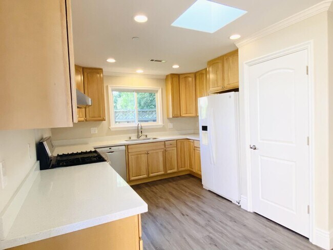
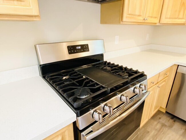
- A very nice ADU built in 2019 with hardwood cabinet and LED recess lights. High efficient HVAC system AC/Heat. Sky lights. Low energy windows. Great insulations that saves you huge on utility bills! - Washer/Dryer in unit. - Tankless water heater. - Two over-sized outdoor shed/storage. - Plenty of street parking. - Top-rated Palo Alto schools. Super quiet and safe neighborhood. - Large park next door. - Sip your morning coffee while enjoy the beauty of nature in your private backyard - Easy access to101, 280, El Camino Real, Central Express Way, and Foothill Expressway. - Bike to Stanford University. - Close to Safeway, Whole Food, Trader Joes, Ranch 99, Costco, pharmacies, ICON Movie Theatre, restaurants, and San Antonio Shopping Center. Owner occupies the front house. You will have your own private entrance and yard. Yard is small (but nice and peaceful). No garage. Plenty of street parking.
663 Glenbrook Dr is a house located in Santa Clara County and the 94306 ZIP Code. This area is served by the Palo Alto Unified School District attendance zone.
663 Glenbrook Dr,
Palo Alto,
CA
94306
North Los Altos contains the city’s vibrant commercial centers. The many shops and eateries of Main Street are in the southern portion of North Los Altos, while the diverse restaurants and cafes of San Antonio Road are in the northern stretches near San Antonio Center.
Outside of these commercial areas, North Los Altos is predominantly residential, offering an array of apartments available for rent along tree-lined avenues. Many of the rentals in North Los Altos feature stunning mountain views, as well as close proximity to Mountain View, Foothill College, Stanford University, and Palo Alto. Getting around from North Los Altos is simple with access to El Camino Real, Interstate 280, and San Antonio Station.
Learn more about living in North Los AltosBelow are rent ranges for similar nearby apartments
| Beds | Average Size | Lowest | Typical | Premium |
|---|---|---|---|---|
| Studio Studio Studio | 488 Sq Ft | $2,250 | $2,598 | $3,095 |
| 1 Bed 1 Bed 1 Bed | 760-764 Sq Ft | $2,295 | $4,166 | $9,084 |
| 2 Beds 2 Beds 2 Beds | 1129-1137 Sq Ft | $2,695 | $5,067 | $9,939 |
| 3 Beds 3 Beds 3 Beds | 1546 Sq Ft | $4,441 | $6,733 | $11,000 |
| 4 Beds 4 Beds 4 Beds | 1450 Sq Ft | $5,970 | — | — |
Education
| Colleges & Universities | Distance | ||
|---|---|---|---|
| Colleges & Universities | Distance | ||
| Drive: | 7 min | 2.1 mi | |
| Drive: | 10 min | 3.8 mi | |
| Drive: | 10 min | 4.5 mi | |
| Drive: | 15 min | 6.0 mi |
663 Glenbrook Dr is within 7 minutes or 2.1 miles from Foothill College, Middlefield. It is also near Stanford University and Foothill Coll., Los Altos.
Schools


Public Elementary School
Grades K-5
407 Students
Nearby
Public Elementary School
Grades K-5
260 Students
Attendance Zone
Public Middle School
Grades 6-8
572 Students
Attendance Zone
Public High School
Grades 9-12
1,643 Students
Attendance Zone
Private Elementary School
Grades PK-5
12 Students
Nearby
Private Elementary, Middle & High School
Grades K-12
Nearby
Private Elementary & Middle School
Grades K-8
296 Students
Nearby
School data provided by
 The GreatSchools Rating helps parents compare schools within a state based on a variety of school quality indicators and provides a helpful picture of how effectively each school serves all of its students. Ratings are on a scale of 1 (below average) to 10 (above average) and can include test scores, college readiness, academic progress, advanced courses, equity, discipline and attendance data. We also advise parents to visit schools, consider other information on school performance and programs, and consider family needs as part of the school selection process.
View GreatSchools Rating Methodology
Data provided by GreatSchools.org © 2026. All rights reserved.
View GreatSchools Rating Methodology
Data provided by GreatSchools.org © 2026. All rights reserved.
Transportation options available in Palo Alto include Mountain View Station, located 3.7 miles from 663 Glenbrook Dr. 663 Glenbrook Dr is near Norman Y Mineta San Jose International, located 13.0 miles or 21 minutes away, and San Francisco International, located 24.8 miles or 36 minutes away.
| Transit / Subway | Distance | ||
|---|---|---|---|
| Transit / Subway | Distance | ||
| Drive: | 8 min | 3.7 mi | |
|
|
Drive: | 11 min | 4.9 mi |
| Drive: | 11 min | 5.4 mi | |
|
|
Drive: | 12 min | 5.6 mi |
| Drive: | 13 min | 6.4 mi |
| Commuter Rail | Distance | ||
|---|---|---|---|
| Commuter Rail | Distance | ||
| Drive: | 6 min | 2.4 mi | |
| Drive: | 7 min | 2.6 mi | |
| Drive: | 10 min | 4.1 mi | |
| Drive: | 11 min | 4.2 mi | |
| Drive: | 12 min | 5.2 mi |
| Airports | Distance | ||
|---|---|---|---|
| Airports | Distance | ||
|
Norman Y Mineta San Jose International
|
Drive: | 21 min | 13.0 mi |
|
San Francisco International
|
Drive: | 36 min | 24.8 mi |
Walkability Near 663 Glenbrook Dr Palo Alto, CA 94306
Getting Around
 What do Walkability, Transit, Drivability, and Bikeability mean?
Walkability measures the walking distance to day-to-day needs.
Transit measures access to public transportation.
Drivability measures congestion, parking availability, and access to major roads.
Bikeability measures the suitability for cycling.
How It Works
What do Walkability, Transit, Drivability, and Bikeability mean?
Walkability measures the walking distance to day-to-day needs.
Transit measures access to public transportation.
Drivability measures congestion, parking availability, and access to major roads.
Bikeability measures the suitability for cycling.
How It Works
Fairly Walkable
Walkability
50
/ 100
Limited Public Transit
Transit
30
/ 100
Very Drivable
Drivability
80
/ 100
Fairly Bikeable
Bikeability
50
/ 100
Scores provided by
-
Soundscore™
-
/ 100
Traffic
-Airport
-Businesses
-Scores provided by
HowLoud What is a Sound Score Rating? A Sound Score Rating aggregates noise caused by vehicle traffic, airplane traffic and local sources. How It WorksTime and distance from 663 Glenbrook Dr.
| Shopping Centers | Distance | ||
|---|---|---|---|
| Shopping Centers | Distance | ||
| Drive: | 4 min | 1.7 mi | |
| Drive: | 5 min | 1.8 mi | |
| Drive: | 5 min | 1.8 mi |
663 Glenbrook Dr has 3 shopping centers within 1.8 miles, which is about a 5-minute drive. The miles and minutes will be for the farthest away property.
| Parks and Recreation | Distance | ||
|---|---|---|---|
| Parks and Recreation | Distance | ||
|
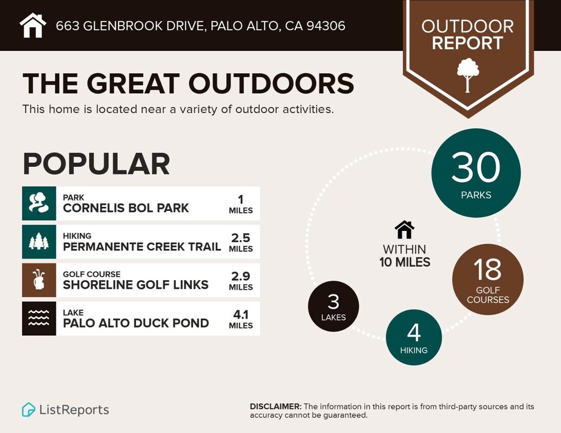
Terman Park
|
Walk: | 5 min | 0.3 mi |
|
Esther Clark Nature Preserve
|
Drive: | 4 min | 1.5 mi |
|
Bol Park
|
Drive: | 5 min | 1.6 mi |
|
J. Pearce Mitchell Park
|
Drive: | 6 min | 2.0 mi |
|
Redwood Grove
|
Drive: | 7 min | 2.9 mi |
663 Glenbrook Dr has 5 parks within 2.9 miles, including Terman Park, Bol Park, and Esther Clark Nature Preserve.
| Hospitals | Distance | ||
|---|---|---|---|
| Hospitals | Distance | ||
| Drive: | 11 min | 4.5 mi | |
| Drive: | 11 min | 4.8 mi | |
| Drive: | 12 min | 5.0 mi |
663 Glenbrook Dr has 3 hospitals within 5.0 miles, the nearest is Lucile Salter Packard Children's Hospital at Stanford which is 4.5 miles away and a 11 minute drive.
| Military Bases | Distance | ||
|---|---|---|---|
| Military Bases | Distance | ||
| Drive: | 14 min | 5.9 mi |
663 Glenbrook Dr is 5.9 miles and a 14 minute drive from Ames Research Center.
You May Also Like
Similar Rentals Nearby


What Are Walk Score®, Transit Score®, and Bike Score® Ratings?
Walk Score® measures the walkability of any address. Transit Score® measures access to public transit. Bike Score® measures the bikeability of any address.
What is a Sound Score Rating?
A Sound Score Rating aggregates noise caused by vehicle traffic, airplane traffic and local sources.

663 Glenbrook Dr
Palo Alto, CA 94306