
-
1 br, 1 bath House - 6626 Chanslor Ave
-
-
$1,900
/ Month
6626 Chanslor Ave
Bell Gardens, CA 90201
2 Weeks Ago
|
Edit
Favorites
6626 Chanslor Ave

Favorites
Check Back Soon for Upcoming Availability
| Beds | Baths | Average SF |
|---|---|---|
| 1 Bedroom 1 Bedroom 1 Br | 1 Bath 1 Bath 1 Ba | 550 SF |
Fees and Policies
The fees below are based on community-supplied data and may exclude additional fees and utilities.
- Dogs Allowed
-
Fees not specified
- Cats Allowed
-
Fees not specified
Details
Utilities Included
-
Water
About This Property
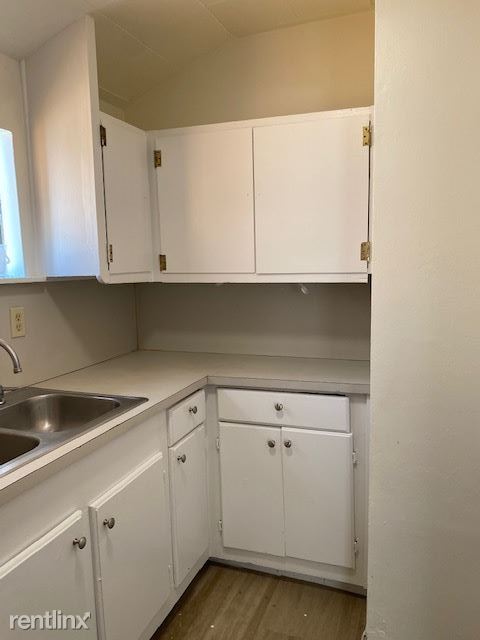
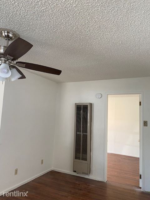
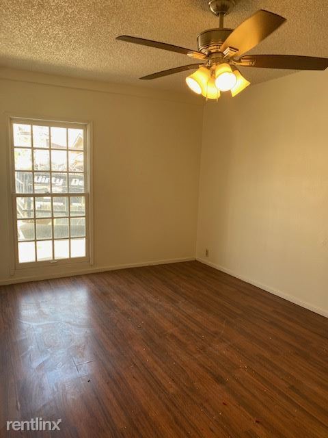
- House with large covered patio. Includes finished one car garage as recreation room, large storage shed, and 2 parking spaces. (RLNE8019566) Other Amenities: Parking, Patio. Lease lengths: 12 Months. Utilities: Water Included. Pet policies: Small Dogs Allowed, Cats Allowed.
6626 Chanslor Ave is a house located in Los Angeles County and the 90201 ZIP Code. This area is served by the Los Angeles Unified attendance zone.
Location
Get Directions
The city of Bell Gardens is a large, mostly residential urban community just minutes outside of Los Angeles proper. Ten miles southeast of Downtown Los Angeles with easy access to the 5 and the 710, Bell Gardens puts you well within reach of the entire LA area.
The area is packed with attractions that bring in folks from all around the region, including the Bicycle Hotel and Casino and multiple golf courses in town and close by. Several shopping centers are close at hand, with the Edwards South Gate multiplex movie theater on the south side of town as well. Bell Gardens is also home to the 18th century Gage Mansion, commonly recognized as the oldest house in Los Angeles County.
Learn more about living in Bell GardensBelow are rent ranges for similar nearby apartments
Expenses
Utilities Included
Water
Included
Education
| Colleges & Universities | Distance | ||
|---|---|---|---|
| Colleges & Universities | Distance | ||
| Drive: | 8 min | 4.3 mi | |
| Drive: | 12 min | 7.5 mi | |
| Drive: | 14 min | 8.8 mi | |
| Drive: | 16 min | 10.5 mi |
6626 Chanslor Ave is within 8 minutes or 4.3 miles from UEI, Huntington Park. It is also near East Los Angeles College and Cal State Los Angeles.
Schools


Public Elementary School
Grades K-5
585 Students
Attendance Zone
Public Elementary School
Grades K-5
416 Students
Nearby
Public Middle School
Grades 6-8
353 Students
Attendance Zone
Public High School
Grades 9-12
2,351 Students
Attendance Zone
Private Elementary & Middle School
Grades PK-8
133 Students
Nearby
Private Elementary School
Grades PK-4
Nearby
Private Elementary, Middle & High School
Grades 1-12
Nearby
School data provided by
 The GreatSchools Rating helps parents compare schools within a state based on a variety of school quality indicators and provides a helpful picture of how effectively each school serves all of its students. Ratings are on a scale of 1 (below average) to 10 (above average) and can include test scores, college readiness, academic progress, advanced courses, equity, discipline and attendance data. We also advise parents to visit schools, consider other information on school performance and programs, and consider family needs as part of the school selection process.
View GreatSchools Rating Methodology
Data provided by GreatSchools.org © 2025. All rights reserved.
View GreatSchools Rating Methodology
Data provided by GreatSchools.org © 2025. All rights reserved.
Transportation options available in Bell Gardens include Florence Station, located 4.6 miles from 6626 Chanslor Ave. 6626 Chanslor Ave is near Long Beach (Daugherty Field), located 13.4 miles or 22 minutes away, and Los Angeles International, located 19.4 miles or 27 minutes away.
| Transit / Subway | Distance | ||
|---|---|---|---|
| Transit / Subway | Distance | ||
|
|
Drive: | 9 min | 4.6 mi |
| Drive: | 8 min | 6.0 mi | |
|
|
Drive: | 10 min | 6.1 mi |
|
|
Drive: | 10 min | 6.5 mi |
|
|
Drive: | 11 min | 7.0 mi |
| Commuter Rail | Distance | ||
|---|---|---|---|
| Commuter Rail | Distance | ||
|
|
Drive: | 9 min | 3.2 mi |
|
|
Drive: | 11 min | 4.7 mi |
|
|
Drive: | 15 min | 10.0 mi |
|
|
Drive: | 17 min | 10.2 mi |
| Drive: | 18 min | 14.0 mi |
| Airports | Distance | ||
|---|---|---|---|
| Airports | Distance | ||
|
Long Beach (Daugherty Field)
|
Drive: | 22 min | 13.4 mi |
|
Los Angeles International
|
Drive: | 27 min | 19.4 mi |
Time and distance from 6626 Chanslor Ave.
| Shopping Centers | Distance | ||
|---|---|---|---|
| Shopping Centers | Distance | ||
| Walk: | 9 min | 0.5 mi | |
| Walk: | 11 min | 0.6 mi | |
| Walk: | 18 min | 1.0 mi |
6626 Chanslor Ave has 3 shopping centers within 1.0 mile, which is about a 18-minute walk. The miles and minutes will be for the farthest away property.
| Parks and Recreation | Distance | ||
|---|---|---|---|
| Parks and Recreation | Distance | ||
|
Augustus Hawkins Natural Park
|
Drive: | 10 min | 5.7 mi |
|
Watts Senior Center & Rose Garden
|
Drive: | 13 min | 6.8 mi |
|
Watts Towers-Rodia State Park
|
Drive: | 14 min | 8.1 mi |
|
Pio Pico State Historic Park
|
Drive: | 16 min | 8.6 mi |
|
Hollenbeck Lake
|
Drive: | 12 min | 8.6 mi |
6626 Chanslor Ave has 5 parks within 8.6 miles, including Augustus Hawkins Natural Park, Watts Senior Center & Rose Garden, and Hollenbeck Lake.
| Hospitals | Distance | ||
|---|---|---|---|
| Hospitals | Distance | ||
| Drive: | 8 min | 4.0 mi | |
| Drive: | 9 min | 4.9 mi | |
| Drive: | 8 min | 5.0 mi |
6626 Chanslor Ave has 3 hospitals within 5.0 miles, the nearest is Community Hospital of Huntington Park which is 4.0 miles away and a 8 minute drive.
| Military Bases | Distance | ||
|---|---|---|---|
| Military Bases | Distance | ||
| Drive: | 24 min | 17.8 mi | |
| Drive: | 31 min | 20.0 mi |
6626 Chanslor Ave is 17.8 miles from Los Angeles Air Force Base, and is convenient to other military bases, including Los Alamitos Army Airfield.
You May Also Like
Similar Rentals Nearby


What Are Walk Score®, Transit Score®, and Bike Score® Ratings?
Walk Score® measures the walkability of any address. Transit Score® measures access to public transit. Bike Score® measures the bikeability of any address.
What is a Sound Score Rating?
A Sound Score Rating aggregates noise caused by vehicle traffic, airplane traffic and local sources

6626 Chanslor Ave
Bell Gardens, CA 90201