
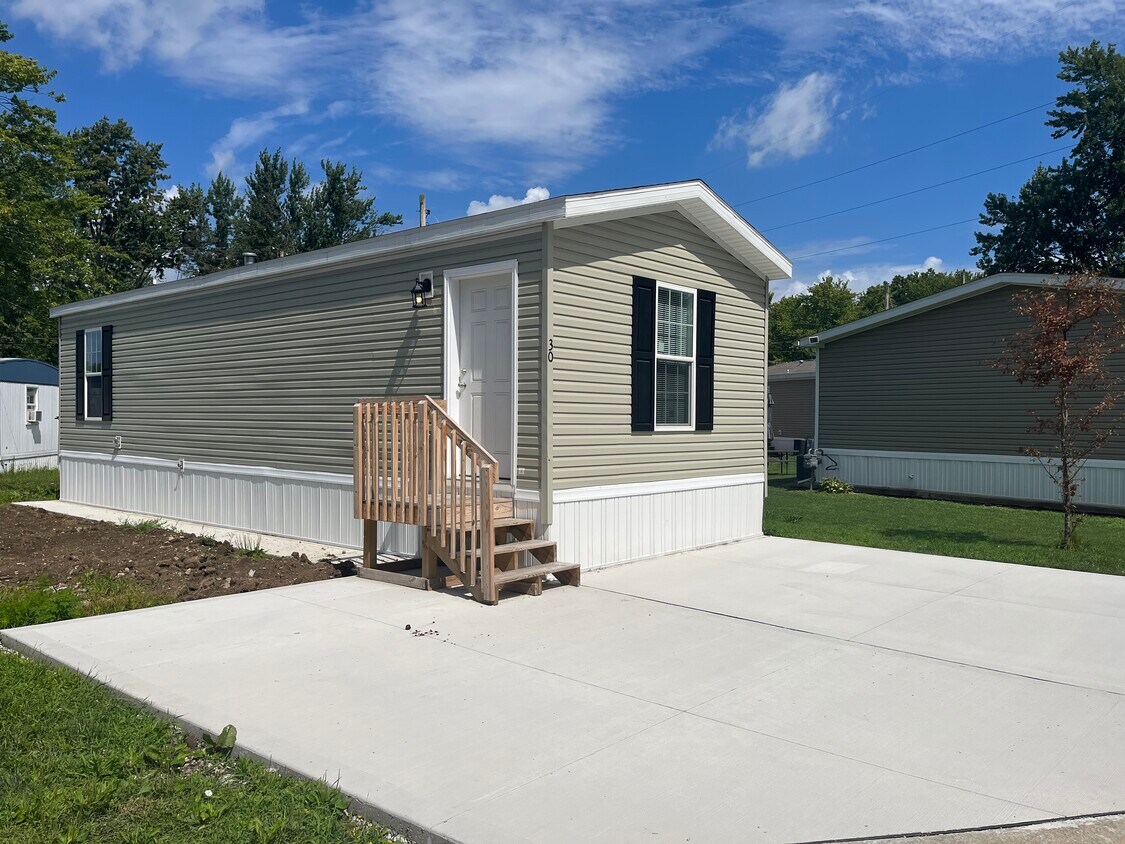
6610 Lear Nagle Rd
North Ridgeville, OH 44039
-
Bedrooms
1
-
Bathrooms
1
-
Square Feet
560 sq ft
-
Available
Available Now

About This Home
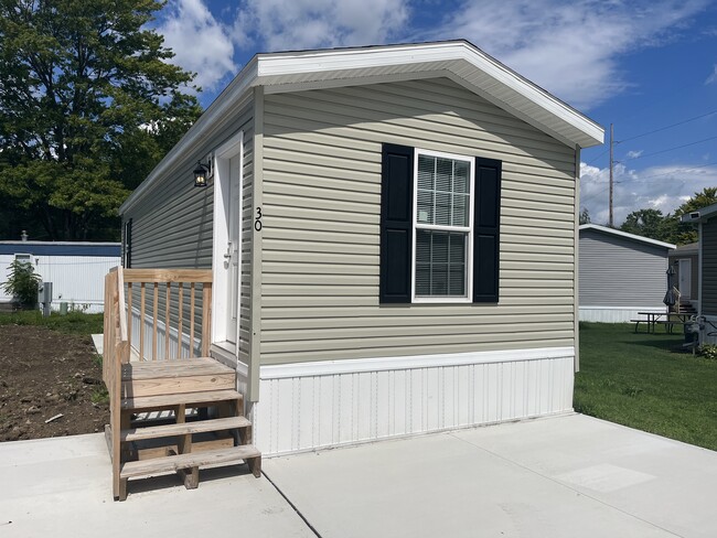
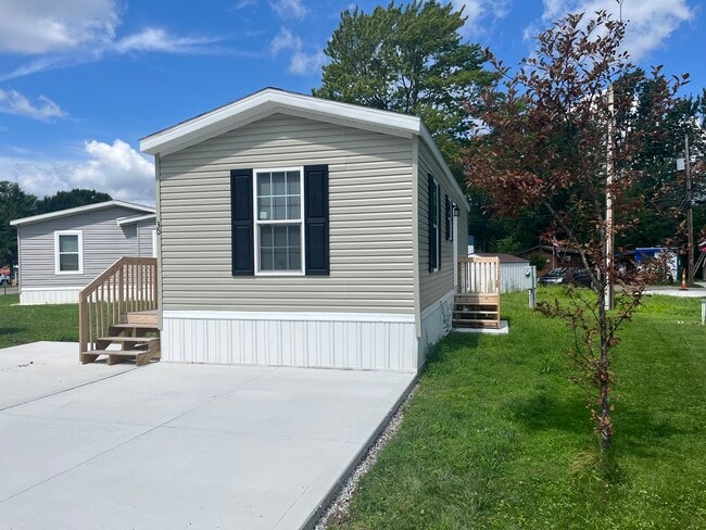
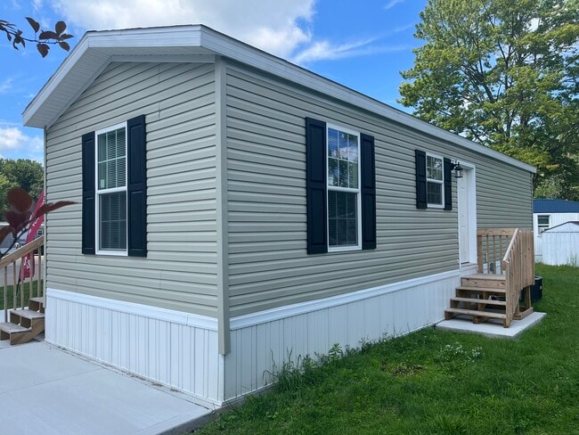
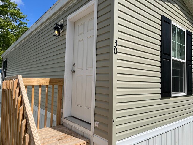
This well kept manufactured home is turnkey ready. Cozy and comfortable 1 bedroom 1 bathroom home with all appliances included, a washer and dryer hook up inside the home. Great storage space and ready for you. Call our office today to schedule a private tour of this home.
6610 Lear Nagle Rd is a house located in Lorain County and the 44039 ZIP Code. This area is served by the North Ridgeville City School District attendance zone.
Fees and Policies
The fees listed below are community-provided and may exclude utilities or add-ons. All payments are made directly to the property and are non-refundable unless otherwise specified.
-
Other
Property Fee Disclaimer: Based on community-supplied data and independent market research. Subject to change without notice. May exclude fees for mandatory or optional services and usage-based utilities.
House Features
Dishwasher
Refrigerator
Disposal
Freezer
- Dishwasher
- Disposal
- Oven
- Refrigerator
- Freezer
Contact
- Phone Number
- Website View Property Website
- Contact
North Ridgeville sits on the eastern edge of Lorain County, close enough to Cleveland to take advantage of a major metro without being absorbed by it. Ranked the safest city in Ohio, it has grown steadily into one of the most sought-after addresses in northern Ohio, drawing renters who want breathing room alongside genuine accessibility. The city sits about 20 miles west of downtown Cleveland, with Interstate 80 and 480 providing straightforward connections to the broader region, including Cleveland Hopkins International Airport. Lorain County Community College and a branch of the University of Findlay both operate campuses here, giving the city an educational anchor that supports a range of career paths. The housing mix leans toward garden-style apartment communities and townhome rentals, with options spread across mostly residential corridors.
Learn more about living in North Ridgeville- Dishwasher
- Disposal
- Oven
- Refrigerator
- Freezer
| Colleges & Universities | Distance | ||
|---|---|---|---|
| Colleges & Universities | Distance | ||
| Drive: | 14 min | 6.5 mi | |
| Drive: | 15 min | 7.1 mi | |
| Drive: | 18 min | 8.1 mi | |
| Drive: | 20 min | 8.6 mi |


View GreatSchools Rating Methodology
Data provided by GreatSchools.org © 2026. All rights reserved.
Transportation options available in North Ridgeville include Brookpark Station, located 9.9 miles from 6610 Lear Nagle Rd. 6610 Lear Nagle Rd is near Cleveland-Hopkins International, located 9.5 miles or 17 minutes away.
| Transit / Subway | Distance | ||
|---|---|---|---|
| Transit / Subway | Distance | ||
| Drive: | 15 min | 9.9 mi | |
| Drive: | 16 min | 10.0 mi | |
| Drive: | 18 min | 11.7 mi |
| Commuter Rail | Distance | ||
|---|---|---|---|
| Commuter Rail | Distance | ||
|
|
Drive: | 14 min | 6.8 mi |
| Drive: | 32 min | 21.5 mi | |
|
|
Drive: | 36 min | 22.5 mi |
| Drive: | 34 min | 23.1 mi | |
| Drive: | 38 min | 28.9 mi |
| Airports | Distance | ||
|---|---|---|---|
| Airports | Distance | ||
|
Cleveland-Hopkins International
|
Drive: | 17 min | 9.5 mi |
Scores provided by
Traffic
ActiveAirport
CalmBusinesses
CalmScores provided by
HowLoud What is a Sound Score Rating? A Sound Score Rating aggregates noise caused by vehicle traffic, airplane traffic and local sources. How It WorksTime and distance from 6610 Lear Nagle Rd.
| Shopping Centers | Distance | ||
|---|---|---|---|
| Shopping Centers | Distance | ||
| Walk: | 15 min | 0.8 mi | |
| Drive: | 3 min | 1.2 mi | |
| Drive: | 3 min | 1.2 mi |
| Parks and Recreation | Distance | ||
|---|---|---|---|
| Parks and Recreation | Distance | ||
|
Bradley Woods Reservation
|
Drive: | 6 min | 2.5 mi |
|
Sandy Ridge Reservation
|
Drive: | 11 min | 4.4 mi |
|
Miller Nature Preserve
|
Drive: | 11 min | 5.4 mi |
|
Rocky River Nature Center
|
Drive: | 14 min | 7.5 mi |
|
Black River Reservation
|
Drive: | 16 min | 10.1 mi |
| Hospitals | Distance | ||
|---|---|---|---|
| Hospitals | Distance | ||
| Drive: | 9 min | 4.4 mi | |
| Drive: | 15 min | 7.1 mi | |
| Drive: | 20 min | 8.9 mi |
| Military Bases | Distance | ||
|---|---|---|---|
| Military Bases | Distance | ||
| Drive: | 91 min | 65.4 mi | |
| Drive: | 81 min | 66.3 mi |
You May Also Like
What Are Walk Score®, Transit Score®, and Bike Score® Ratings?
Walk Score® measures the walkability of any address. Transit Score® measures access to public transit. Bike Score® measures the bikeability of any address.
What is a Sound Score Rating?
A Sound Score Rating aggregates noise caused by vehicle traffic, airplane traffic and local sources.
6610 Lear Nagle Rd
North Ridgeville, OH 44039