
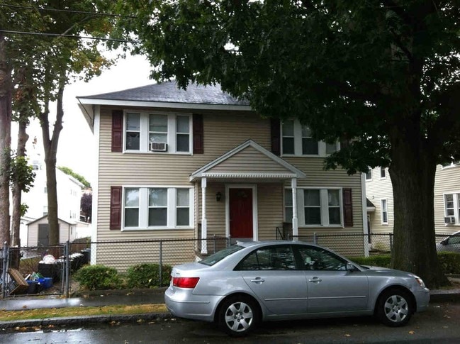
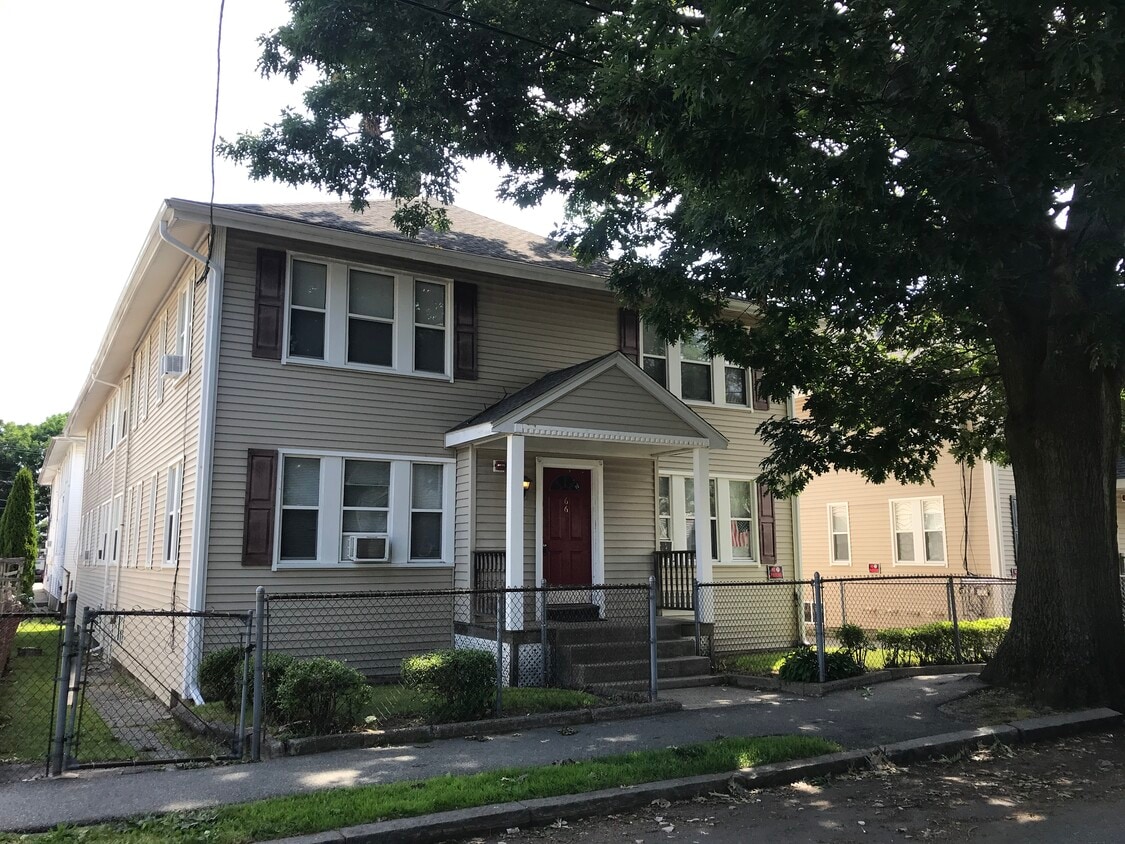
66 Safford St
66 Safford St,
Quincy,
MA
02170
-
Monthly Rent
$2,100 - $2,375
Plus Fees12 Month Lease
-
Bedrooms
1 - 2 bd
-
Bathrooms
1 ba
-
Square Feet
--
Pricing & Floor Plans
Check Back Soon for Upcoming Availability
| Beds | Baths | Average SF | Availability |
|---|---|---|---|
| 1 Bedroom 1 Bedroom 1 Br | 1 Bath 1 Bath 1 Ba | — | Call for Availability |
| 2 Bedrooms 2 Bedrooms 2 Br | 1 Bath 1 Bath 1 Ba | — | Call for Availability |
Fees and Policies
The fees listed below are community-provided and may exclude utilities or add-ons. All payments are made directly to the property and are non-refundable unless otherwise specified.
-
Dogs
-
One-Time Pet FeeCharged per pet.$0
-
Pet DepositCharged per pet.$0
-
Monthly Pet FeeCharged per pet.$0 / mo
Restrictions:1 and last month rentRead More Read Less -
-
Surface Lot
-
Parking FeeCharged per vehicle.$75 / mo
-
Property Fee Disclaimer: Based on community-supplied data and independent market research. Subject to change without notice. May exclude fees for mandatory or optional services and usage-based utilities.
Details
Property Information
-
Built in 1930
-
8 units/2 stories
About 66 Safford St Quincy, MA 02170
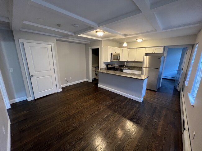
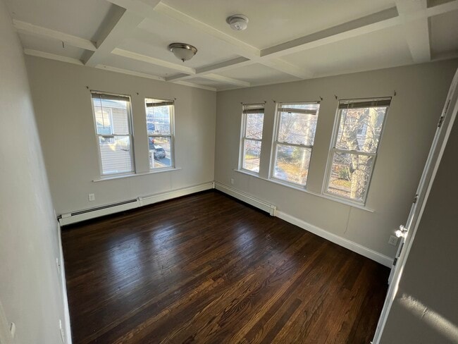
Espacioso apartamento de 1,5 habitaciones y 1 baño, renovado con buen gusto. ¡Excelente ubicación! Ubicado en North Quincy/Wollaston, a 8 minutos a pie de la línea roja del metro; a 10 minutos de UMass Boston; a 15 minutos de la estación South/centro. Cerca de supermercados, restaurantes, escuelas, parques, etc. Los apartamentos cuentan con pisos de madera recién terminados y paredes y techos recién pintados. Se admiten mascotas (se aplican restricciones). Se requiere un buen historial crediticio y buenas referencias. La habitación adicional puede usarse como una pequeña habitación de invitados o una oficina en casa. ¡Esta habitación también es ideal para un vestidor grande!
66 Safford St is an apartment community located in Norfolk County and the 02170 ZIP Code. This area is served by the Quincy attendance zone.
Contact
Across the Neponset River from Downtown Boston lies the Quincy neighborhood of Montclair. Commuters drive eight miles north on Interstate 93 to reach downtown, while residents without a car enjoy easy access using several bus lines or the Red Line's North Quincy subway station. This quiet residential community of apartments and bungalow-style houses provides a small-town atmosphere within a larger urban environment.
There’s a diverse mix of cuisine that belies Montclair’s relatively small size. Most of Montclair's businesses are found along Hancock Street near North Quincy station. Residents gather at Assembly Bar on Sundays for comfort food while watching the New England Patriots.
Learn more about living in MontclairCompare neighborhood and city base rent averages by bedroom.
| Montclair | Quincy, MA | |
|---|---|---|
| Studio | $2,345 | $2,169 |
| 1 Bedroom | $2,667 | $2,475 |
| 2 Bedrooms | $3,395 | $2,970 |
| 3 Bedrooms | - | $4,157 |
| Monday | 12am - 12am |
|---|---|
| Tuesday | 12am - 12am |
| Wednesday | 12am - 12am |
| Thursday | 12am - 12am |
| Friday | 12am - 12am |
| Saturday | 12am - 12am |
| Sunday | 12am - 12am |
| Colleges & Universities | Distance | ||
|---|---|---|---|
| Colleges & Universities | Distance | ||
| Drive: | 10 min | 4.4 mi | |
| Drive: | 15 min | 6.0 mi | |
| Drive: | 13 min | 6.9 mi | |
| Drive: | 13 min | 7.1 mi |


View GreatSchools Rating Methodology
Data provided by GreatSchools.org © 2026. All rights reserved.
Transportation options available in Quincy include North Quincy Station, located 0.4 mile from 66 Safford St. 66 Safford St is near General Edward Lawrence Logan International, located 9.8 miles or 18 minutes away.
| Transit / Subway | Distance | ||
|---|---|---|---|
| Transit / Subway | Distance | ||
|
|
Walk: | 8 min | 0.4 mi |
|
|
Walk: | 16 min | 0.8 mi |
|
|
Drive: | 6 min | 3.0 mi |
|
|
Drive: | 6 min | 3.0 mi |
|
|
Drive: | 7 min | 3.4 mi |
| Commuter Rail | Distance | ||
|---|---|---|---|
| Commuter Rail | Distance | ||
|
|
Drive: | 5 min | 2.0 mi |
|
|
Drive: | 8 min | 4.2 mi |
| Drive: | 11 min | 4.3 mi | |
| Drive: | 9 min | 4.5 mi | |
| Drive: | 10 min | 4.8 mi |
| Airports | Distance | ||
|---|---|---|---|
| Airports | Distance | ||
|
General Edward Lawrence Logan International
|
Drive: | 18 min | 9.8 mi |
Time and distance from 66 Safford St.
| Shopping Centers | Distance | ||
|---|---|---|---|
| Shopping Centers | Distance | ||
| Walk: | 5 min | 0.3 mi | |
| Drive: | 4 min | 1.2 mi | |
| Drive: | 5 min | 2.3 mi |
| Parks and Recreation | Distance | ||
|---|---|---|---|
| Parks and Recreation | Distance | ||
|
Adams National Historical Park
|
Drive: | 4 min | 1.8 mi |
|
Squantum Point Park
|
Drive: | 8 min | 2.7 mi |
|
Dorchester Shores Reservation
|
Drive: | 9 min | 4.3 mi |
|
Franklin Park Zoo
|
Drive: | 11 min | 6.1 mi |
|
Lower Neponset River Trail
|
Drive: | 11 min | 6.2 mi |
| Hospitals | Distance | ||
|---|---|---|---|
| Hospitals | Distance | ||
| Drive: | 6 min | 3.3 mi | |
| Drive: | 8 min | 3.4 mi | |
| Drive: | 10 min | 5.9 mi |
66 Safford St Photos
-
-
Foto principal
-
-
Models
-
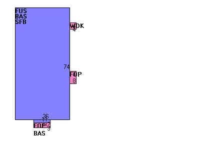
Plano de planta
66 Safford St does not offer in-unit laundry or shared facilities. Please contact the property to learn about nearby laundry options.
Utilities are not included in rent. Residents should plan to set up and pay for all services separately.
Parking is available at 66 Safford St for $75 / mo. Contact this property for details.
Yes, 66 Safford St welcomes pets. Breed restrictions, weight limits, and additional fees may apply. View this property's pet policy.
A good rule of thumb is to spend no more than 30% of your gross income on rent. Based on the lowest available rent of $2,100 for a one-bedroom, you would need to earn about $84,000 per year to qualify. Want to double-check your budget? Calculate how much rent you can afford with our Rent Affordability Calculator.
66 Safford St is offering Especiales for eligible applicants, with rental rates starting at $2,100.
While 66 Safford St does not offer Matterport 3D tours, renters can request a tour directly through our online platform.
What Are Walk Score®, Transit Score®, and Bike Score® Ratings?
Walk Score® measures the walkability of any address. Transit Score® measures access to public transit. Bike Score® measures the bikeability of any address.
What is a Sound Score Rating?
A Sound Score Rating aggregates noise caused by vehicle traffic, airplane traffic and local sources
66 Safford St
Quincy, MA 02170