

$4,500
/ Month
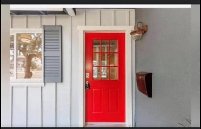
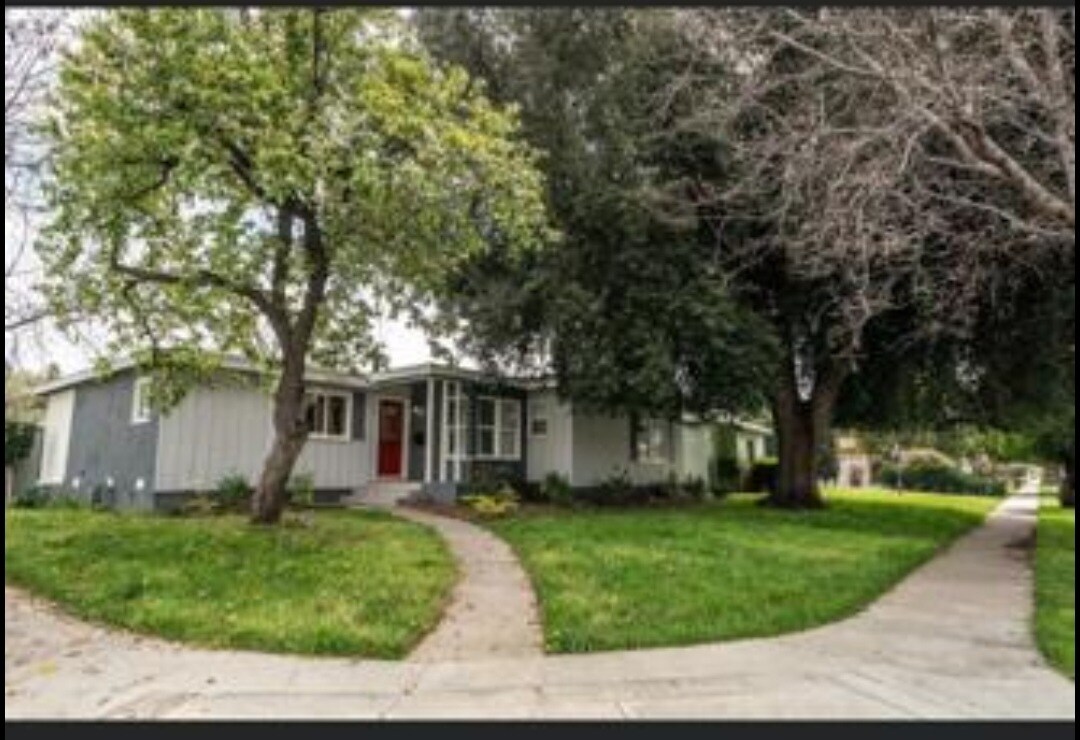
6528 Amigo Ave
Reseda, CA 91335
2 Weeks Ago
Favorites
6528 Amigo Ave

Favorites
Check Back Soon for Upcoming Availability
| Beds | Baths | Average SF |
|---|---|---|
| 4 Bedrooms 4 Bedrooms 4 Br | 2 Baths 2 Baths 2 Ba | — |
About This Property
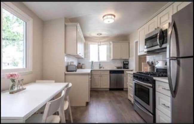
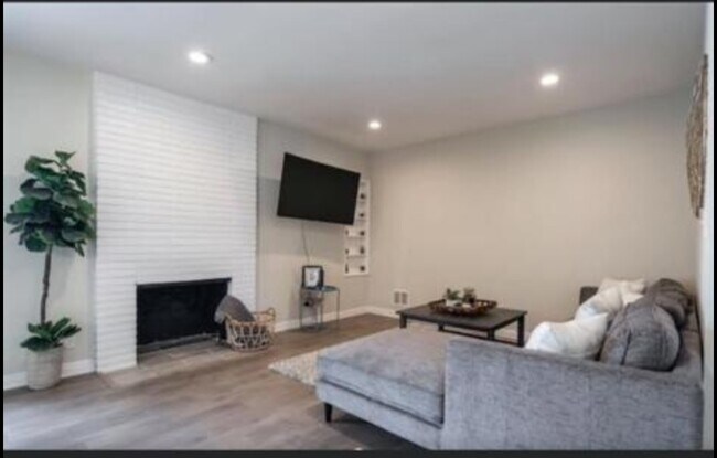
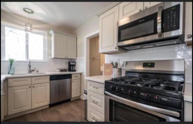
4 Beds 2 Baths - House Los Angeles, CA 91343 House for rent Remodeled house 4 bedroom 2 bathroom house, coldasac, private street in Reseda, walking distance from markets and synagogue, big back yard. Artificial Turf for low water bills and solar system for low electric bills. $4,500 for a year without furniture OR $5,500 for a short term with furniture
6528 Amigo Ave is a house located in Los Angeles County and the 91335 ZIP Code.
House Features
- Yard
Location
Get Directions
Occupying the heart of the West San Fernando Valley, Reseda has sat modestly as a pro-typical suburb of Los Angeles for over 100 years. Like most valley neighborhoods, its growth stemmed from the post-World War II boom and the proliferation of the car, bringing a culture of shopping malls and wide boulevards.
Reseda Boulevard acts as the neighborhood’s thoroughfare, running north to south. This urban community is brimming with local restaurants, close to Interstate 405. Locals enjoy the relaxing atmosphere at the Anthony C. Beilenson Park and its recreational facilities. In addition to access to the interstate, residents are in close proximity to the Northridge Metro Station.
Learn more about living in Reseda
Amenities
- Yard
Education
| Colleges & Universities | Distance | ||
|---|---|---|---|
| Colleges & Universities | Distance | ||
| Drive: | 7 min | 2.8 mi | |
| Drive: | 11 min | 5.1 mi | |
| Drive: | 15 min | 7.9 mi | |
| Drive: | 27 min | 14.7 mi |
6528 Amigo Ave is within 7 minutes or 2.8 miles from Pierce College. It is also near Cal State Northridge and Valley College.
Transportation options available in Reseda include North Hollywood Station, located 10.2 miles from 6528 Amigo Ave. 6528 Amigo Ave is near Bob Hope, located 11.5 miles or 20 minutes away, and Los Angeles International, located 23.0 miles or 33 minutes away.
| Transit / Subway | Distance | ||
|---|---|---|---|
| Transit / Subway | Distance | ||
|
|
Drive: | 17 min | 10.2 mi |
| Commuter Rail | Distance | ||
|---|---|---|---|
| Commuter Rail | Distance | ||
|
|
Drive: | 8 min | 3.6 mi |
|
|
Drive: | 9 min | 3.6 mi |
|
|
Drive: | 13 min | 7.4 mi |
|
|
Drive: | 16 min | 8.2 mi |
|
|
Drive: | 19 min | 12.6 mi |
| Airports | Distance | ||
|---|---|---|---|
| Airports | Distance | ||
|
Bob Hope
|
Drive: | 20 min | 11.5 mi |
|
Los Angeles International
|
Drive: | 33 min | 23.0 mi |
Time and distance from 6528 Amigo Ave.
| Shopping Centers | Distance | ||
|---|---|---|---|
| Shopping Centers | Distance | ||
| Walk: | 6 min | 0.3 mi | |
| Walk: | 11 min | 0.6 mi | |
| Walk: | 12 min | 0.6 mi |
6528 Amigo Ave has 3 shopping centers within 0.6 mile, which is about a 12-minute walk. The miles and minutes will be for the farthest away property.
| Parks and Recreation | Distance | ||
|---|---|---|---|
| Parks and Recreation | Distance | ||
|
Reseda Park Lake
|
Walk: | 8 min | 0.4 mi |
|
Lake Balboa
|
Drive: | 6 min | 2.9 mi |
|
NatureBridge at Santa Monica Mountains
|
Drive: | 7 min | 3.9 mi |
|
NatureBridge at Channel Islands
|
Drive: | 7 min | 3.9 mi |
|
Los Encinos State Historic Park
|
Drive: | 8 min | 4.2 mi |
6528 Amigo Ave has 5 parks within 4.2 miles, including Reseda Park Lake, Lake Balboa, and NatureBridge at Santa Monica Mountains.
| Hospitals | Distance | ||
|---|---|---|---|
| Hospitals | Distance | ||
| Walk: | 19 min | 1.0 mi | |
| Drive: | 4 min | 1.8 mi | |
| Drive: | 4 min | 2.0 mi |
6528 Amigo Ave has 3 hospitals within 2.0 miles, the nearest is Tarzana Treatment Center which is 1.0 miles away and a 19 minute walk.
| Military Bases | Distance | ||
|---|---|---|---|
| Military Bases | Distance | ||
| Drive: | 34 min | 25.6 mi |
6528 Amigo Ave is 25.6 miles and a 34 minute drive from Los Angeles Air Force Base.
You May Also Like
Similar Rentals Nearby


What Are Walk Score®, Transit Score®, and Bike Score® Ratings?
Walk Score® measures the walkability of any address. Transit Score® measures access to public transit. Bike Score® measures the bikeability of any address.
What is a Sound Score Rating?
A Sound Score Rating aggregates noise caused by vehicle traffic, airplane traffic and local sources
6528 Amigo Ave
Reseda, CA 91335