$5,000
/ Month
652 9th Ave
New York, NY 10036
2 Weeks Ago
|
Edit
Favorites
652 9th Ave

Favorites
Check Back Soon for Upcoming Availability
| Beds | Baths | Average SF |
|---|---|---|
| 4 Bedrooms 4 Bedrooms 4 Br | 2 Baths 2 Baths 2 Ba | — |
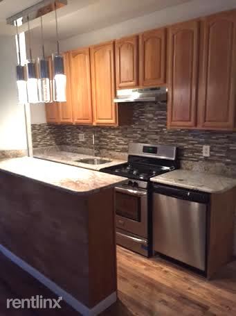
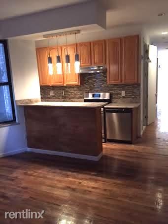
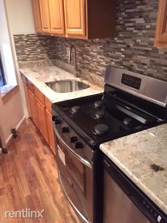
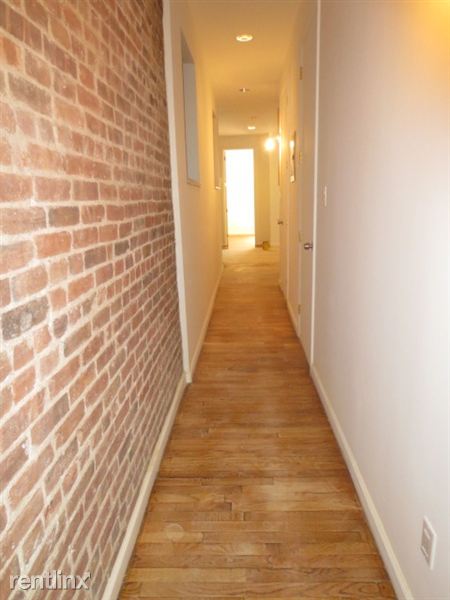
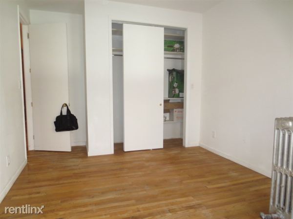
About This Property
(917) 891-1015 - Call Ian For Private Showing 917 891 1015 (RLNE1776844)
652 9th Ave is a condo located in New York County and the 10036 ZIP Code. This area is served by the New York City Geographic District # 2 attendance zone.
652 9th Ave,
New York,
NY
10036
The name “Hell’s Kitchen” make scare you away from renting here, but believe it or not, Hell’s Kitchen is one of New York’s most loved neighborhoods. Over the years, this neighborhood has undergone substantial improvements, and today it is considered one of the safest and most in-demand areas for renters in the city. But don’t worry; even though Hell’s Kitchen is popular, there are tons of available apartments for you to find your perfect home.
Hell’s Kitchen is defined by upscale new and refurbished residential buildings, though rental rates are still quite competitive for Manhattan. A vibrant collective of restaurants, bars, and art centers will leave you with plenty to do if you live here! Numerous public parks are spread throughout the community, particularly the large De Witt Clinton Park near the waterfront, and Central Park is very close as well.
Learn more about living in Hell's KitchenBelow are rent ranges for similar nearby apartments
| Beds | Average Size | Lowest | Typical | Premium |
|---|---|---|---|---|
| Studio Studio Studio | 470 Sq Ft | $2,492 | $3,849 | $6,213 |
| 1 Bed 1 Bed 1 Bed | 584-586 Sq Ft | $2,995 | $5,194 | $14,606 |
| 2 Beds 2 Beds 2 Beds | 796-802 Sq Ft | $2,030 | $6,874 | $15,060 |
| 3 Beds 3 Beds 3 Beds | 595-623 Sq Ft | $1,860 | $5,076 | $11,480 |
| 4 Beds 4 Beds 4 Beds | 231-247 Sq Ft | $1,530 | $3,220 | $13,637 |
Education
| Colleges & Universities | Distance | ||
|---|---|---|---|
| Colleges & Universities | Distance | ||
| Walk: | 16 min | 0.8 mi | |
| Walk: | 16 min | 0.8 mi | |
| Walk: | 20 min | 1.0 mi | |
| Drive: | 4 min | 1.3 mi |
652 9th Ave is within 4 minutes or 1.3 miles from Fordham Univ., Lincoln Center. It is also near John Jay College, CUNY and Technical Career Institutes.
Schools


Public Elementary, Middle & High School
Grades K-12
305 Students
Attendance Zone
Public Elementary School
Grades PK-5
453 Students
Attendance Zone
Public Middle & High School
Grades 6-12
849 Students
Attendance Zone
Public Middle & High School
Grades 6-12
523 Students
Attendance Zone
Public High School
Grades 9-12
139 Students
Attendance Zone
Public High School
Grades 9-12
407 Students
Attendance Zone
Private Elementary & Middle School
Grades PK-8
188 Students
Nearby
Private Middle & High School
Grades 6-12
196 Students
Nearby
School data provided by
 The GreatSchools Rating helps parents compare schools within a state based on a variety of school quality indicators and provides a helpful picture of how effectively each school serves all of its students. Ratings are on a scale of 1 (below average) to 10 (above average) and can include test scores, college readiness, academic progress, advanced courses, equity, discipline and attendance data. We also advise parents to visit schools, consider other information on school performance and programs, and consider family needs as part of the school selection process.
View GreatSchools Rating Methodology
Data provided by GreatSchools.org © 2026. All rights reserved.
View GreatSchools Rating Methodology
Data provided by GreatSchools.org © 2026. All rights reserved.
Transportation options available in New York include 42 Street-Port Authority Bus Terminal, located 0.4 mile from 652 9th Ave. 652 9th Ave is near LaGuardia, located 8.7 miles or 19 minutes away, and Newark Liberty International, located 13.8 miles or 19 minutes away.
| Transit / Subway | Distance | ||
|---|---|---|---|
| Transit / Subway | Distance | ||
|
|
Walk: | 6 min | 0.4 mi |
|
|
Walk: | 7 min | 0.4 mi |
| Walk: | 8 min | 0.5 mi | |
|
|
Walk: | 9 min | 0.5 mi |
| Walk: | 11 min | 0.6 mi |
| Commuter Rail | Distance | ||
|---|---|---|---|
| Commuter Rail | Distance | ||
|
|
Walk: | 19 min | 1.0 mi |
|
|
Drive: | 3 min | 1.2 mi |
|
|
Drive: | 3 min | 1.2 mi |
|
|
Drive: | 3 min | 1.4 mi |
|
|
Drive: | 3 min | 1.5 mi |
| Airports | Distance | ||
|---|---|---|---|
| Airports | Distance | ||
|
LaGuardia
|
Drive: | 19 min | 8.7 mi |
|
Newark Liberty International
|
Drive: | 19 min | 13.8 mi |
Walkability Near 652 9th Ave New York, NY 10036
Getting Around
 What do Walkability, Transit, Drivability, and Bikeability mean?
Walkability measures the walking distance to day-to-day needs.
Transit measures access to public transportation.
Drivability measures congestion, parking availability, and access to major roads.
Bikeability measures the suitability for cycling.
How It Works
What do Walkability, Transit, Drivability, and Bikeability mean?
Walkability measures the walking distance to day-to-day needs.
Transit measures access to public transportation.
Drivability measures congestion, parking availability, and access to major roads.
Bikeability measures the suitability for cycling.
How It Works
Exceptionally Walkable
Walkability
100
/ 100
Exceptional Public Transit
Transit
100
/ 100
Fairly Drivable
Drivability
40
/ 100
Very Bikeable
Bikeability
80
/ 100
Scores provided by
-
Soundscore™
-
/ 100
Traffic
-Airport
-Businesses
-Scores provided by
HowLoud What is a Sound Score Rating? A Sound Score Rating aggregates noise caused by vehicle traffic, airplane traffic and local sources. How It WorksTime and distance from 652 9th Ave.
| Shopping Centers | Distance | ||
|---|---|---|---|
| Shopping Centers | Distance | ||
| Walk: | 7 min | 0.4 mi | |
| Walk: | 7 min | 0.4 mi | |
| Drive: | 3 min | 1.5 mi |
652 9th Ave has 3 shopping centers within 1.5 miles, which is about a 3-minute drive. The miles and minutes will be for the farthest away property.
| Parks and Recreation | Distance | ||
|---|---|---|---|
| Parks and Recreation | Distance | ||
|
De Witt Clinton Park
|
Walk: | 14 min | 0.8 mi |
|
Bryant Park
|
Walk: | 16 min | 0.8 mi |
|
Damrosch Park
|
Drive: | 3 min | 1.1 mi |
|
Chelsea Park
|
Drive: | 5 min | 1.4 mi |
|
Sony Wonder Technology Lab
|
Drive: | 4 min | 1.8 mi |
652 9th Ave has 5 parks within 1.8 miles, including De Witt Clinton Park, Bryant Park, and Damrosch Park.
| Hospitals | Distance | ||
|---|---|---|---|
| Hospitals | Distance | ||
| Walk: | 15 min | 0.8 mi | |
| Drive: | 6 min | 2.2 mi | |
| Drive: | 6 min | 2.4 mi |
652 9th Ave has 3 hospitals within 2.4 miles, the nearest is Mount Sinai St. Luke's Roosevelt Hospital which is 0.8 mile away and a 15 minute walk.
| Military Bases | Distance | ||
|---|---|---|---|
| Military Bases | Distance | ||
| Drive: | 14 min | 5.3 mi | |
| Drive: | 23 min | 11.9 mi |
652 9th Ave is 5.3 miles from Governors Island Support Center, and is convenient to other military bases, including Military Ocean Terminal.
You May Also Like
Similar Rentals Nearby


What Are Walk Score®, Transit Score®, and Bike Score® Ratings?
Walk Score® measures the walkability of any address. Transit Score® measures access to public transit. Bike Score® measures the bikeability of any address.
What is a Sound Score Rating?
A Sound Score Rating aggregates noise caused by vehicle traffic, airplane traffic and local sources.

652 9th Ave
New York, NY 10036