$6,300
/ Month
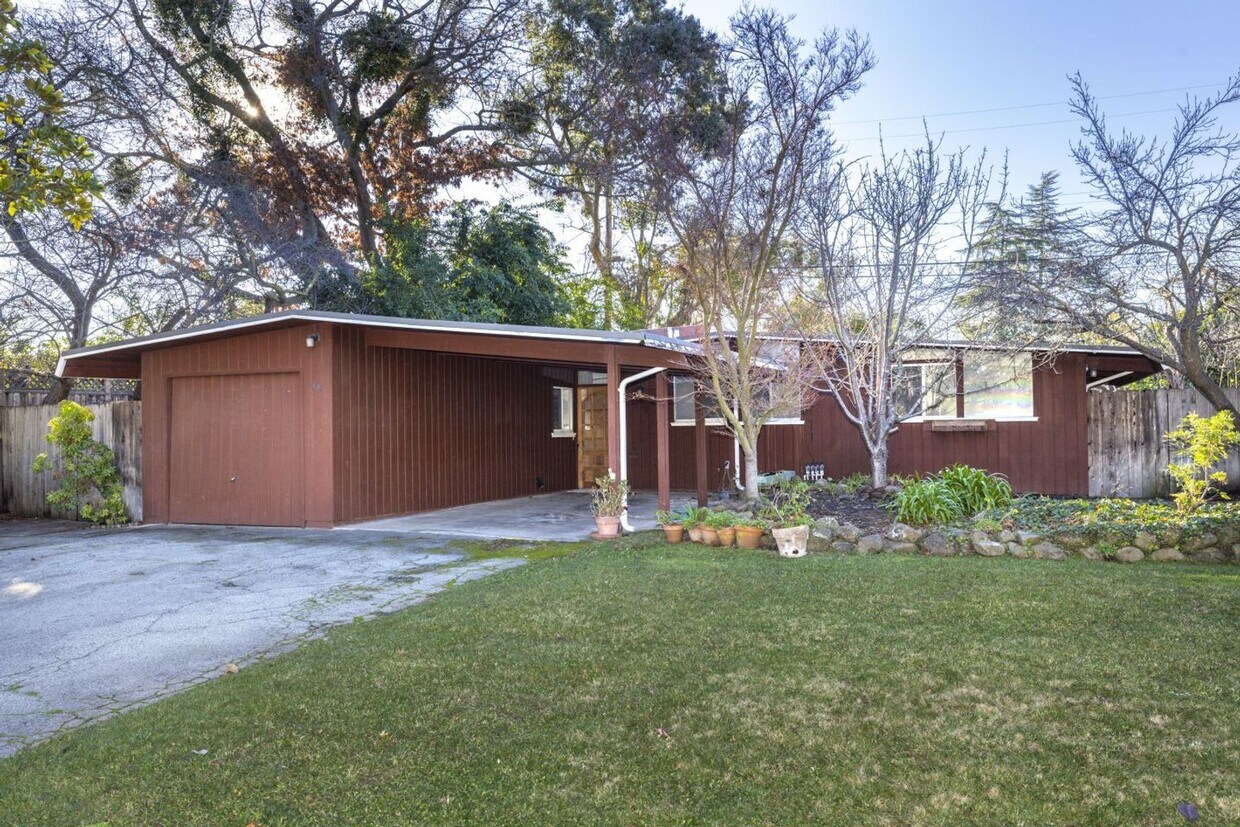
65 Roosevelt Cir
Palo Alto, CA 94306
Today
|
Edit
Favorites
650-331-1515
-
Bedrooms
3
-
Bathrooms
2
-
Square Feet
1,089 sq ft
-
Available
Available Now
65 Roosevelt Cir

Favorites
About This Home
$6,300 deposit,
Available Now
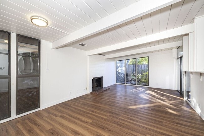
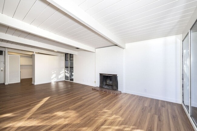
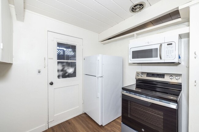
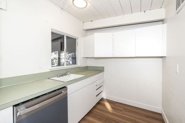
This is an updated 3 bed, 2 bath Eichler in the Circles- first time on the rental market in over 2 decades! Kitchen has new range and new dishwasher Newly installed LVT flooring Fresh paint throughout Combination living/dining room with sliding doors accessing private backyard- perfect for al fresco dining! Three similarly sized bedrooms with amazing natural light Two full bathrooms with shower over tub Central heat + AC Washer/dryer located in garage One car garage plus large storage shed in side yard Incredible location in low traffic neighborhood: a short stroll to Mitchell Park + Library, Magical Bridge Playground, Cubberley Community Center; plus Charleston Shopping Center's gourmet grocery store, restaurants, shops and more! Easy access to major thoroughfares such as Central Expy, 101 & 280 and public transit options like Caltrain Excellent Palo Alto schools: Fairmeadow, JLS, Gunn (tenant to verify availability) Contact Katie for showings Midtown Management. Inc. License #02186084
Unique Features
- hard flooring
- dual pane windows
- fresh paint
- laundry in garage
65 Roosevelt Cir is a house located in Santa Clara County and the 94306 ZIP Code.
* Price shown is base rent. Excludes user-selected optional fees and variable or usage-based fees and required charges due at or prior to move-in or at move-out. Price, availability, fees, and any applicable rent special are subject to change without notice.
* Square footage definitions vary. Displayed square footage is approximate.
Fees and Policies
The fees below are based on community-supplied data and may exclude additional fees and utilities.
-
One-Time Basics
-
Due at Move-In
-
Security Deposit - RefundableCharged per unit.$6,300
-
-
Due at Move-In
Property Fee Disclaimer: Based on community-supplied data and independent market research. Subject to change without notice. May exclude fees for mandatory or optional services and usage-based utilities.
Contact
- Listed by Midtown Management Inc. | Midtown Management Inc.
- Phone Number
- Contact
Location
Get Directions
Amenities
- hard flooring
- dual pane windows
- fresh paint
- laundry in garage
Living in Palo Alto places you in Silicon Valley, where historic neighborhoods complement the city's technological presence. Tree-lined streets wind through the community, which is anchored by Stanford University. University Avenue features local boutiques and restaurants housed in preserved historic buildings, while the Stanford Shopping Center offers high-end retail destinations. The city maintains 36 parks and preserves, including the Baylands Nature Preserve and Foothills Park, where residents enjoy hiking trails and outdoor activities. Palo Alto's infrastructure supports alternative transportation, with dedicated bike lanes throughout the city.
The rental market in Palo Alto reflects the area's popularity, with current average rents ranging from $2,634 for studios to $6,139 for four-bedroom homes. Recent trends show steady growth, with rent increases varying from 1.8% to 17% across different unit sizes over the past year.
Learn more about living in Palo Alto
Education
| Colleges & Universities | Distance | ||
|---|---|---|---|
| Colleges & Universities | Distance | ||
| Drive: | 5 min | 1.3 mi | |
| Drive: | 9 min | 3.3 mi | |
| Drive: | 13 min | 5.3 mi | |
| Drive: | 13 min | 5.5 mi |
65 Roosevelt Cir is within 5 minutes or 1.3 miles from Foothill College, Middlefield. It is also near Stanford University and Menlo College.
Transportation options available in Palo Alto include Mountain View Station, located 3.2 miles from 65 Roosevelt Cir. 65 Roosevelt Cir is near Norman Y Mineta San Jose International, located 12.2 miles or 19 minutes away, and San Francisco International, located 24.0 miles or 33 minutes away.
| Transit / Subway | Distance | ||
|---|---|---|---|
| Transit / Subway | Distance | ||
| Drive: | 6 min | 3.2 mi | |
|
|
Drive: | 6 min | 3.2 mi |
|
|
Drive: | 9 min | 4.4 mi |
| Drive: | 9 min | 4.6 mi | |
|
|
Drive: | 9 min | 4.7 mi |
| Commuter Rail | Distance | ||
|---|---|---|---|
| Commuter Rail | Distance | ||
| Drive: | 4 min | 1.8 mi | |
| Drive: | 4 min | 1.8 mi | |
| Drive: | 5 min | 2.1 mi | |
| Drive: | 8 min | 3.2 mi | |
| Drive: | 9 min | 3.7 mi |
| Airports | Distance | ||
|---|---|---|---|
| Airports | Distance | ||
|
Norman Y Mineta San Jose International
|
Drive: | 19 min | 12.2 mi |
|
San Francisco International
|
Drive: | 33 min | 24.0 mi |
Time and distance from 65 Roosevelt Cir.
| Shopping Centers | Distance | ||
|---|---|---|---|
| Shopping Centers | Distance | ||
| Walk: | 5 min | 0.3 mi | |
| Walk: | 15 min | 0.8 mi | |
| Drive: | 4 min | 1.4 mi |
65 Roosevelt Cir has 3 shopping centers within 1.4 miles, which is about a 4-minute drive. The miles and minutes will be for the farthest away property.
| Parks and Recreation | Distance | ||
|---|---|---|---|
| Parks and Recreation | Distance | ||
|
J. Pearce Mitchell Park
|
Walk: | 12 min | 0.7 mi |
|
Terman Park
|
Drive: | 4 min | 1.5 mi |
|
Bol Park
|
Drive: | 5 min | 1.8 mi |
|
Gamble Garden
|
Drive: | 6 min | 2.6 mi |
|
Rinconada Park
|
Drive: | 8 min | 3.0 mi |
65 Roosevelt Cir has 5 parks within 3.0 miles, including J. Pearce Mitchell Park, Terman Park, and Bol Park.
| Hospitals | Distance | ||
|---|---|---|---|
| Hospitals | Distance | ||
| Drive: | 10 min | 4.0 mi | |
| Drive: | 11 min | 4.5 mi | |
| Drive: | 11 min | 6.2 mi |
65 Roosevelt Cir has 3 hospitals within 6.2 miles, the nearest is Lucile Salter Packard Children's Hospital at Stanford which is 4.0 miles away and a 10 minute drive.
| Military Bases | Distance | ||
|---|---|---|---|
| Military Bases | Distance | ||
| Drive: | 12 min | 5.1 mi |
65 Roosevelt Cir is 5.1 miles and a 12 minute drive from Ames Research Center.
You May Also Like
Similar Rentals Nearby


What Are Walk Score®, Transit Score®, and Bike Score® Ratings?
Walk Score® measures the walkability of any address. Transit Score® measures access to public transit. Bike Score® measures the bikeability of any address.
What is a Sound Score Rating?
A Sound Score Rating aggregates noise caused by vehicle traffic, airplane traffic and local sources

65 Roosevelt Cir
Palo Alto, CA 94306