$1,900 / Month
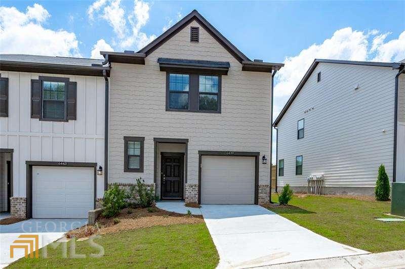
6439 Mountain Home Way
Mableton, GA 30126
2 Weeks Ago
Favorites
6439 Mountain Home Way

Favorites
Check Back Soon for Upcoming Availability
| Beds | Baths | Average SF |
|---|---|---|
| 3 Bedrooms 3 Bedrooms 3 Br | 2.5 Baths 2.5 Baths 2.5 Ba | — |
About This Property
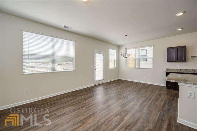
Do you have an active lifestyle? Well, then this is the townhome for you. This beautiful home is located on the corner of Smyrna, Atlanta, and Mableton. Live close to AtlantaCOs entertainment and work centers. Your townhome has easy access to everything that matters for active people, sports, fitness, entertainment, the airport, restaurants, and, of course, AtlantaCOs work Centers. The area is full of Parks and trails, like the Silver Comet Trail. Easy access to sports venues like the Atlanta BravesCO Truist Park, The Falcons, Mercedes Benz stadium, the Hawks, State Farm Arena. Casual dining is all around you. Enjoy the Chattahoochee River and the Reformation Brewery, along with Champion BBQ, or have a coffee at Chattahoochee Coffer Company. Need more? The Battery at Braves Stadium is a short drive, as well as the many restaurants in Atlanta. The community itself has a pool to refresh yourself on hot summer days. Move-in is scheduled for February 1,2022 but could be a few days earlier if you need it. In the meantime, check out the pics and contact the Listing Agent (or have your agent contact the Listing Agent) to see when the home will be available for Showings. Call now before you miss out!
6439 Mountain Home Way is a townhome located in Cobb County and the 30126 ZIP Code. This area is served by the Cobb County attendance zone.
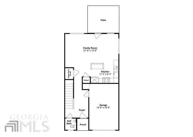
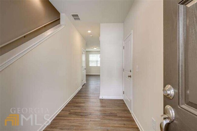
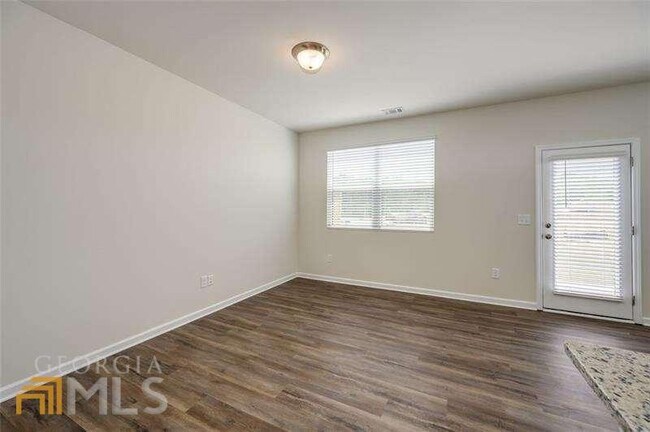
Townhome Features
Granite Countertops
Microwave
Refrigerator
Disposal
- Disposal
- Granite Countertops
- Pantry
- Microwave
- Refrigerator
Location
Get Directions
Nestled in the bustling Cobb County region, Mableton is Metro Atlanta’s largest unincorporated community. Known as one of the biggest up-and-coming areas outside of Atlanta, this city blends small-town charm with modern conveniences. Thanks to a premier location, countless amenities, and a close-knit feel, Mableton has become the ideal place to live for those seeking easy access into the city.
Situated just east of Interstate 285 and north of Interstate 20, the neighborhood features a calm suburban lifestyle minutes from Downtown Atlanta. With a diverse population, excellent schools, and great dining options, Mableton has grown to be one of the most popular locations in the metro area. In addition, locals enjoy the use of the Silver Comet Trail for running or walking.
Learn more about living in Mableton
Amenities
- Disposal
- Granite Countertops
- Pantry
- Microwave
- Refrigerator
Education
| Colleges & Universities | Distance | ||
|---|---|---|---|
| Colleges & Universities | Distance | ||
| Drive: | 10 min | 4.0 mi | |
| Drive: | 20 min | 11.0 mi | |
| Drive: | 21 min | 11.2 mi | |
| Drive: | 20 min | 11.4 mi |
6439 Mountain Home Way is within 10 minutes or 4.0 miles from Chatt. Tech, Austell. It is also near Clark Atlanta University and Morehouse College.
Schools


Public Elementary School
Grades PK-5
388 Students
Attendance Zone
Public Middle School
Grades 6-8
1,096 Students
Attendance Zone
Public High School
Grades 9-12
2,511 Students
Attendance Zone
Private Elementary, Middle & High School
Grades PK-12
852 Students
Nearby
Private Elementary & Middle School
Grades 4-7
13 Students
Nearby
Private Elementary & Middle School
Grades PK-8
Nearby
Private Elementary & Middle School
Grades K-8
Nearby
School data provided by
 The GreatSchools Rating helps parents compare schools within a state based on a variety of school quality indicators and provides a helpful picture of how effectively each school serves all of its students. Ratings are on a scale of 1 (below average) to 10 (above average) and can include test scores, college readiness, academic progress, advanced courses, equity, discipline and attendance data. We also advise parents to visit schools, consider other information on school performance and programs, and consider family needs as part of the school selection process.
View GreatSchools Rating Methodology
Data provided by GreatSchools.org © 2025. All rights reserved.
View GreatSchools Rating Methodology
Data provided by GreatSchools.org © 2025. All rights reserved.
Transportation options available in Mableton include Hamilton E Holmes, located 7.2 miles from 6439 Mountain Home Way. 6439 Mountain Home Way is near Hartsfield - Jackson Atlanta International, located 20.4 miles or 34 minutes away.
| Transit / Subway | Distance | ||
|---|---|---|---|
| Transit / Subway | Distance | ||
|
|
Drive: | 16 min | 7.2 mi |
|
|
Drive: | 15 min | 8.0 mi |
|
|
Drive: | 16 min | 8.7 mi |
|
|
Drive: | 19 min | 9.8 mi |
|
|
Drive: | 20 min | 10.5 mi |
| Commuter Rail | Distance | ||
|---|---|---|---|
| Commuter Rail | Distance | ||
|
|
Drive: | 24 min | 13.0 mi |
| Airports | Distance | ||
|---|---|---|---|
| Airports | Distance | ||
|
Hartsfield - Jackson Atlanta International
|
Drive: | 34 min | 20.4 mi |
Time and distance from 6439 Mountain Home Way.
| Shopping Centers | Distance | ||
|---|---|---|---|
| Shopping Centers | Distance | ||
| Drive: | 5 min | 1.5 mi | |
| Drive: | 6 min | 1.9 mi | |
| Drive: | 7 min | 2.0 mi |
6439 Mountain Home Way has 3 shopping centers within 2.0 miles, which is about a 7-minute drive. The miles and minutes will be for the farthest away property.
| Parks and Recreation | Distance | ||
|---|---|---|---|
| Parks and Recreation | Distance | ||
|
Silver Comet Trail
|
Drive: | 16 min | 5.8 mi |
|
Cascade Springs Nature Preserve
|
Drive: | 17 min | 9.8 mi |
|
West Atlanta Watershed Alliance (WAWA)
|
Drive: | 20 min | 10.4 mi |
|
Sweetwater Creek State Park
|
Drive: | 22 min | 11.3 mi |
|
Atlanta BeltLine Southwest Connector Spur Trail
|
Drive: | 23 min | 11.6 mi |
6439 Mountain Home Way has 5 parks within 11.6 miles, including Silver Comet Trail, Sweetwater Creek State Park, and Cascade Springs Nature Preserve.
| Hospitals | Distance | ||
|---|---|---|---|
| Hospitals | Distance | ||
| Drive: | 15 min | 6.3 mi | |
| Drive: | 15 min | 7.0 mi | |
| Drive: | 20 min | 10.7 mi |
6439 Mountain Home Way has 3 hospitals within 10.7 miles, the nearest is WellStar Cobb Hospital which is 6.3 miles away and a 15 minute drive.
| Military Bases | Distance | ||
|---|---|---|---|
| Military Bases | Distance | ||
| Drive: | 27 min | 12.5 mi | |
| Drive: | 25 min | 13.2 mi |
6439 Mountain Home Way is 12.5 miles from Dobbins Air Force Base, and is convenient to other military bases, including Fort McPherson.
You May Also Like
Similar Rentals Nearby


What Are Walk Score®, Transit Score®, and Bike Score® Ratings?
Walk Score® measures the walkability of any address. Transit Score® measures access to public transit. Bike Score® measures the bikeability of any address.
What is a Sound Score Rating?
A Sound Score Rating aggregates noise caused by vehicle traffic, airplane traffic and local sources

6439 Mountain Home Way
Mableton, GA 30126