
Altura at the Groves
11821 Skylark Cir,
Whittier, CA 90606
$2,672 - $7,803
1-3 Beds
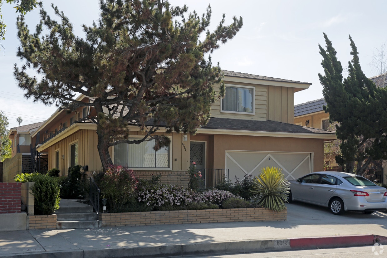

6312 Greenleaf Ave in Whittier is ready for you to visit. This community is located on Greenleaf Ave in Whittier. Be sure to check out the apartment floorplan options. The team of leasing professionals is available to assist you in finding your perfect apartment. Drop by 6312 Greenleaf Ave today.
6312 Greenleaf Ave is an apartment community located in Los Angeles County and the 90601 ZIP Code. This area is served by the Whittier City Elementary attendance zone.
Welcome to Whittier, a well-established city in Los Angeles County where historic architecture meets contemporary living. Originally founded by Quakers in the late 1800s, this community of 87,306 residents offers diverse housing options throughout its distinctive neighborhoods, from historic properties in the Uptown district to newer homes in Friendly Hills. The rental market currently shows moderate growth, with one-bedroom apartments averaging $1,631 monthly and experiencing a 1.4% increase over the past year. Two-bedroom units typically rent for $2,036, while three-bedroom homes command around $2,463 per month.
Life in Whittier centers around the historic Uptown district, where palm-lined Greenleaf Avenue features independent boutiques and eateries. The presence of Whittier College enriches the community with educational and cultural events. Outdoor enthusiasts appreciate the walking paths at Central Park and the extensive trail network throughout the Whittier Hills.
Learn more about living in WhittierCompare neighborhood and city base rent averages by bedroom.
| Uptown Whittier | Whittier, CA | |
|---|---|---|
| Studio | $1,176 | $1,438 |
| 1 Bedroom | $1,485 | $1,657 |
| 2 Bedrooms | $1,805 | $2,088 |
| 3 Bedrooms | $1,972 | $2,538 |
| Colleges & Universities | Distance | ||
|---|---|---|---|
| Colleges & Universities | Distance | ||
| Drive: | 4 min | 1.5 mi | |
| Drive: | 8 min | 4.0 mi | |
| Drive: | 14 min | 6.9 mi | |
| Drive: | 17 min | 8.5 mi |


Transportation options available in Whittier include Atlantic, located 8.3 miles from 6312 Greenleaf Ave. 6312 Greenleaf Ave is near Long Beach (Daugherty Field), located 19.2 miles or 29 minutes away, and Los Angeles International, located 27.4 miles or 37 minutes away.
| Transit / Subway | Distance | ||
|---|---|---|---|
| Transit / Subway | Distance | ||
|
|
Drive: | 16 min | 8.3 mi |
|
|
Drive: | 16 min | 8.5 mi |
| Drive: | 18 min | 9.0 mi | |
|
|
Drive: | 15 min | 10.2 mi |
|
|
Drive: | 16 min | 10.3 mi |
| Commuter Rail | Distance | ||
|---|---|---|---|
| Commuter Rail | Distance | ||
|
|
Drive: | 12 min | 5.9 mi |
|
|
Drive: | 14 min | 6.9 mi |
|
|
Drive: | 17 min | 7.7 mi |
|
|
Drive: | 17 min | 9.4 mi |
|
|
Drive: | 16 min | 10.0 mi |
| Airports | Distance | ||
|---|---|---|---|
| Airports | Distance | ||
|
Long Beach (Daugherty Field)
|
Drive: | 29 min | 19.2 mi |
|
Los Angeles International
|
Drive: | 37 min | 27.4 mi |
Time and distance from 6312 Greenleaf Ave.
| Shopping Centers | Distance | ||
|---|---|---|---|
| Shopping Centers | Distance | ||
| Walk: | 12 min | 0.6 mi | |
| Walk: | 18 min | 1.0 mi | |
| Drive: | 4 min | 1.4 mi |
| Parks and Recreation | Distance | ||
|---|---|---|---|
| Parks and Recreation | Distance | ||
|
Pio Pico State Historic Park
|
Drive: | 6 min | 2.3 mi |
|
Whittier Narrows Nature Center
|
Drive: | 11 min | 5.4 mi |
|
Whittier Narrows Recreation Area
|
Drive: | 14 min | 6.8 mi |
|
La Habra Historical Museum
|
Drive: | 16 min | 7.8 mi |
|
Schabarum Regional Park
|
Drive: | 19 min | 8.9 mi |
| Hospitals | Distance | ||
|---|---|---|---|
| Hospitals | Distance | ||
| Drive: | 5 min | 1.9 mi | |
| Drive: | 8 min | 3.7 mi | |
| Drive: | 9 min | 4.7 mi |
| Military Bases | Distance | ||
|---|---|---|---|
| Military Bases | Distance | ||
| Drive: | 28 min | 15.1 mi | |
| Drive: | 34 min | 25.8 mi |
What Are Walk Score®, Transit Score®, and Bike Score® Ratings?
Walk Score® measures the walkability of any address. Transit Score® measures access to public transit. Bike Score® measures the bikeability of any address.
What is a Sound Score Rating?
A Sound Score Rating aggregates noise caused by vehicle traffic, airplane traffic and local sources


 - Violet on Virgil")


