

$2,200
/ Month
6301 Bethel Island Rd
Bethel Island, CA 94511
Today
Favorites
925-408-2791
-
Bedrooms
3
-
Bathrooms
1
-
Square Feet
1,000 sq ft
-
Available
Available Now
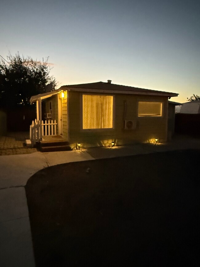
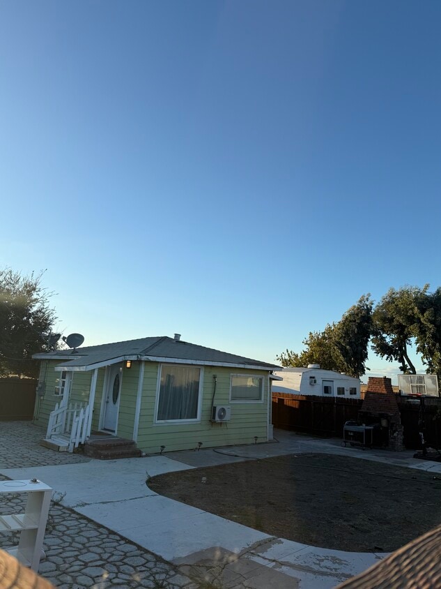
6301 Bethel Island Rd

Favorites
About This Home
$2,200 deposit,
Available Now
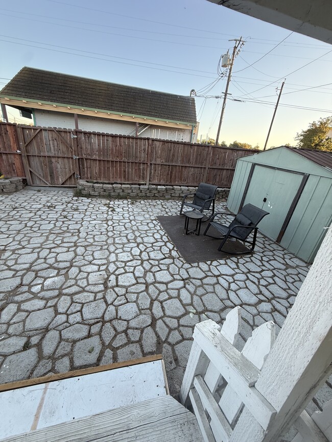
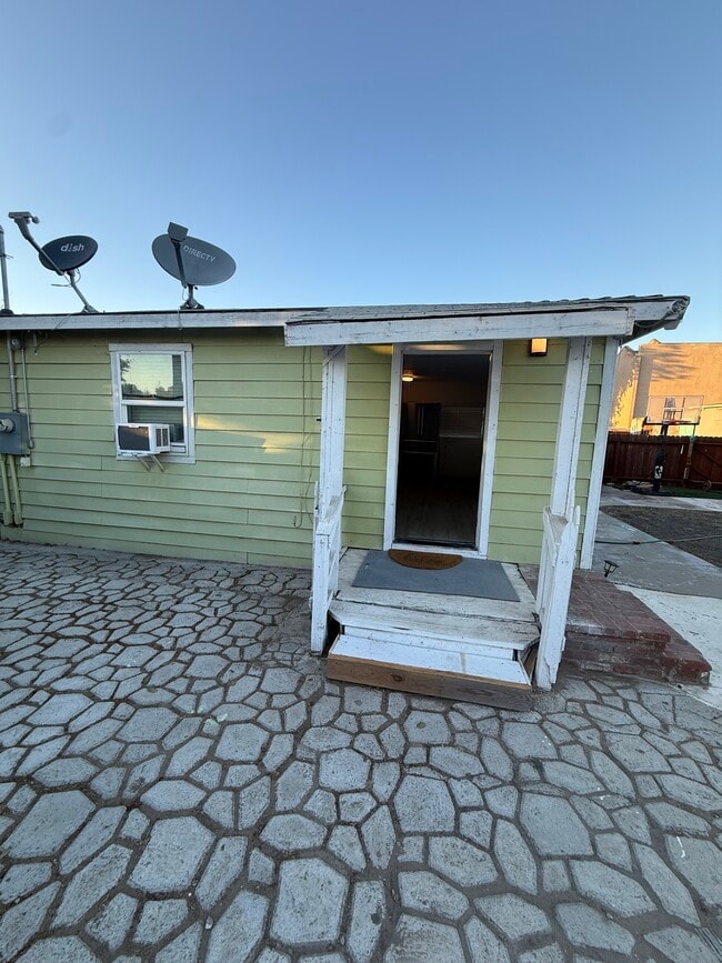
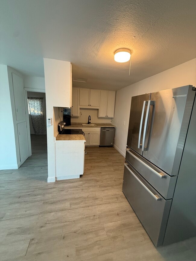
Approximately 1,000 sq. ft. of living space Private entrance Plenty of storage space Large backyard — great for family gatherings or gardening Located in a quiet, friendly neighborhood Ready for immediate move-in! Contact Arash: Call or text anytime for more information or to schedule a viewing.
6301 Bethel Island Rd is a house located in Contra Costa County and the 94511 ZIP Code. This area is served by the Oakley Union Elementary attendance zone.
* Price shown is base rent. Excludes user-selected optional fees and variable or usage-based fees and required charges due at or prior to move-in or at move-out. Price, availability, fees, and any applicable rent special are subject to change without notice.
* Square footage definitions vary. Displayed square footage is approximate.
House Features
- Dishwasher
Fees and Policies
The fees below are based on community-supplied data and may exclude additional fees and utilities.
- Dogs Allowed
-
Fees not specified
- Cats Allowed
-
Fees not specified
Contact
- Listed by Arash
- Phone Number
- Contact
Location
Get Directions
Amenities
- Dishwasher
Education
| Colleges & Universities | Distance | ||
|---|---|---|---|
| Colleges & Universities | Distance | ||
| Drive: | 17 min | 7.9 mi | |
| Drive: | 32 min | 16.2 mi | |
| Drive: | 62 min | 37.9 mi | |
| Drive: | 64 min | 39.2 mi |
6301 Bethel Island Rd is within 17 minutes or 7.9 miles from Los Medanos College, Brentwood. It is also near Los Medanos College, Pittsburg and University of the Pacific.
Schools


Public Elementary School
Grades K-5
496 Students
Attendance Zone
Public Elementary School
Grades K-6
460 Students
Nearby
Public Middle School
Grades 6-8
910 Students
Attendance Zone
Public High School
Grades 9-12
2,527 Students
Attendance Zone
Private Elementary, Middle & High School
Grades 1-11
12 Students
Nearby
Private Elementary, Middle & High School
Grades K-12
Nearby
Private Elementary, Middle & High School
Grades PK-11
Nearby
School data provided by
 The GreatSchools Rating helps parents compare schools within a state based on a variety of school quality indicators and provides a helpful picture of how effectively each school serves all of its students. Ratings are on a scale of 1 (below average) to 10 (above average) and can include test scores, college readiness, academic progress, advanced courses, equity, discipline and attendance data. We also advise parents to visit schools, consider other information on school performance and programs, and consider family needs as part of the school selection process.
View GreatSchools Rating Methodology
Data provided by GreatSchools.org © 2025. All rights reserved.
View GreatSchools Rating Methodology
Data provided by GreatSchools.org © 2025. All rights reserved.
Transportation options available in Bethel Island include Antioch, located 10.7 miles from 6301 Bethel Island Rd. 6301 Bethel Island Rd is near Stockton Metro, located 39.8 miles or 64 minutes away.
| Transit / Subway | Distance | ||
|---|---|---|---|
| Transit / Subway | Distance | ||
|
|
Drive: | 20 min | 10.7 mi |
| Commuter Rail | Distance | ||
|---|---|---|---|
| Commuter Rail | Distance | ||
|
|
Drive: | 26 min | 12.6 mi |
| Drive: | 50 min | 30.0 mi | |
|
|
Drive: | 57 min | 35.4 mi |
| Drive: | 59 min | 36.6 mi | |
|
|
Drive: | 70 min | 44.5 mi |
| Airports | Distance | ||
|---|---|---|---|
| Airports | Distance | ||
|
Stockton Metro
|
Drive: | 64 min | 39.8 mi |
Time and distance from 6301 Bethel Island Rd.
| Shopping Centers | Distance | ||
|---|---|---|---|
| Shopping Centers | Distance | ||
| Walk: | 1 min | 0.1 mi | |
| Walk: | 17 min | 0.9 mi | |
| Drive: | 11 min | 4.2 mi |
6301 Bethel Island Rd has 3 shopping centers within 4.2 miles, which is about a 11-minute walk. The miles and minutes will be for the farthest away property.
| Parks and Recreation | Distance | ||
|---|---|---|---|
| Parks and Recreation | Distance | ||
|
Franks Tract State Recreation Area
|
Drive: | 6 min | 2.3 mi |
|
Marsh Creek Regional Trail
|
Drive: | 17 min | 7.8 mi |
|
Big Break Regional Shoreline
|
Drive: | 18 min | 7.9 mi |
|
Brannan Island State Recreation Area
|
Drive: | 33 min | 17.7 mi |
|
Delta Meadows State Park
|
Drive: | 33 min | 17.8 mi |
6301 Bethel Island Rd has 5 parks within 17.8 miles, including Franks Tract State Recreation Area, Marsh Creek Regional Trail, and Big Break Regional Shoreline.
| Hospitals | Distance | ||
|---|---|---|---|
| Hospitals | Distance | ||
| Drive: | 27 min | 12.6 mi | |
| Drive: | 25 min | 13.4 mi |
6301 Bethel Island Rd is 12.6 miles from Kaiser Foundation Hospital - Antioch, and is convenient to other hospitals, including Sutter Delta Medical Center.
| Military Bases | Distance | ||
|---|---|---|---|
| Military Bases | Distance | ||
| Drive: | 56 min | 32.9 mi |
6301 Bethel Island Rd is 32.9 miles and a 56 minute drive from Stockton Naval Commun Station.
You May Also Like
Similar Rentals Nearby


What Are Walk Score®, Transit Score®, and Bike Score® Ratings?
Walk Score® measures the walkability of any address. Transit Score® measures access to public transit. Bike Score® measures the bikeability of any address.
What is a Sound Score Rating?
A Sound Score Rating aggregates noise caused by vehicle traffic, airplane traffic and local sources
6301 Bethel Island Rd
Bethel Island, CA 94511