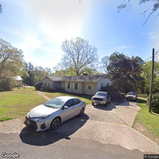
$2,000 / Month

630 W Charlton St

,

Milledgeville, GA 31061

Share Listing
Favorites
630 W Charlton St
Share Listing
Favorites

Check Back Soon for Upcoming Availability

Beds Baths Average SF
Studio Studio 0 Br 1 Bath 1 Bath 1 Ba
Location
630 W Charlton St, Milledgeville,
GA 31061
Get Directions
| Edit

Under 30 minutes

Commute Time is calculated at rush hour.
City - Milledgeville

Situated midway between Atlanta and Augusta, Milledgeville is rooted in a rich history, serving as Georgia’s Antebellum Capital from 1803 to 1868. A slew of historic mansions and museums pay homage to Milledgeville’s colorful past while rows of local restaurants, coffee shops, art galleries, boutiques, and antique stores contribute to the small-town character of Downtown Milledgeville.

Milledgeville offers a wide variety of recreational opportunities, including boating on Lake Sinclair, hiking the Bartram Trail, and kayaking and canoeing the Oconee River. Milledgeville is also home to several parks and golf courses, presenting even more options for outdoor activities. Convenient access to U.S. 441 makes getting around from Milledgeville simple.

Learn more about living in Milledgeville 
Education
Colleges & Universities Distance
Walk: 13 min 0.7 mi
Drive: 5 min 1.6 mi
Drive: 53 min 34.0 mi
Drive: 60 min 38.6 mi
630 W Charlton St is within 13 minutes or 0.7 mile from Georgia College. It is also near Georgia Military College and Mercer University.
Schools
Public Elementary School
Grades PK-5
1,021 Students
Nearby
Public Middle School
Grades 6-8
986 Students
Attendance Zone
Public High School
Grades 9-12
1,311 Students
Attendance Zone
Private Elementary, Middle & High School
Grades K-12
467 Students
Nearby
Private Middle & High School
Grades 6-12
Nearby
Transportation

Walkability Near 630 W Charlton St Milledgeville, GA 31061

Getting Around
Fairly Walkable
Walkability
40 / 100
Exceptionally Drivable
Drivability
100 / 100
Fairly Bikeable
Bikeability
40 / 100

Scores provided by

What do Walkability, Transit, Drivability, and Bikeability mean? Walkability measures the walking distance to day-to-day needs. Transit measures access to public transportation. Drivability measures congestion, parking availability, and access to major roads. Bikeability measures the suitability for cycling. How It Works
-
Soundscore
- / 100

Traffic

-

Airport

-

Businesses

-

Scores provided by

HowLoud What is a Sound Score Rating? A Sound Score Rating aggregates noise caused by vehicle traffic, airplane traffic and local sources. How It Works
Points of Interest

Time and distance from 630 W Charlton St.

Shopping Centers Distance
Drive: 4 min 1.3 mi
Drive: 6 min 2.1 mi
Drive: 5 min 2.3 mi
630 W Charlton St has 3 shopping centers within 2.3 miles, which is about a 5-minute drive. The miles and minutes will be for the farthest away property.
Parks and Recreation Distance
Lockerly Arboretum / Lockerly Hall
Drive: 7 min 2.7 mi
630 W Charlton St has a nearby park, Lockerly Arboretum / Lockerly Hall , located 2.7 miles or 7 minutes away.
Hospitals Distance
Hospitals Distance
Walk: 10 min 0.5 mi
630 W Charlton St is 0.5 mile and a 10 minute walk from Navicent Health Baldwin.
Military Bases Distance
Drive: 75 min 49.5 mi
Drive: 97 min 69.5 mi
Drive: 99 min 72.9 mi
630 W Charlton St has 3 military bases within 72.9 miles, the nearest is Robins Air Force Base which is 49.5 miles away and a 75 minute drive.

You May Also Like

Similar Rentals Nearby