
The Q Playa
5901-5921 Center Dr,
Los Angeles, CA 90045
$2,782 - $7,212
Studio - 3 Beds
Welcome to our lovely gated community! We're conveniently located near major freeways, shopping centers, and transportation, making it easy to get where you need to go. Plus, our community offers a variety of amenities including parking and onsite laundry to make your life more comfortable. We'd love to show you around, so give us a call today! Don't miss out on this amazing apartment! Please note that we don't allow pets - we apologize for any inconvenience.
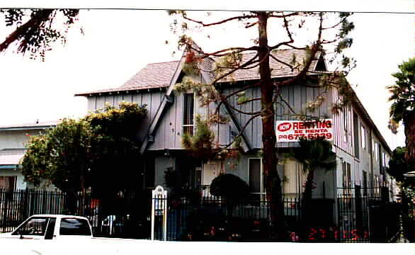
630 E. 97th St. is an apartment community located in Los Angeles County and the 90301 ZIP Code. This area is served by the Inglewood Unified attendance zone.
Less than five miles east of LAX and about 11 miles southwest of Downtown Los Angeles, Inglewood boasts a prime location near the Pacific Coast with convenience to several beaches and parks. Inglewood is surrounded by four major freeways: Interstates 405, 105, 110, and 10, which all afford residents simple travels and commutes.
Aside from its convenient location, Inglewood has plenty to offer residents and visitors alike. The Forum, designed by the same architect as Madison Square Garden in New York, hosts a variety of major concerts and events on a regular basis. The Los Angeles Stadium at Hollywood Park is under construction in Inglewood and set to house the Los Angeles Rams and the Los Angeles Chargers. Local restaurants abound in Inglewood, which tend to flourish due to strong community support of local businesses.
Inglewood also offers a wide variety of apartments available for rent, from newly constructed luxury apartments to more modest apartments in historic structures.
Learn more about living in Inglewood| Colleges & Universities | Distance | ||
|---|---|---|---|
| Colleges & Universities | Distance | ||
| Drive: | 8 min | 3.6 mi | |
| Drive: | 9 min | 5.1 mi | |
| Drive: | 10 min | 6.0 mi | |
| Drive: | 12 min | 6.1 mi |


Transportation options available in Inglewood include Downtown Inglewood Station, located 1.8 miles from 630 E. 97th St.. 630 E. 97th St. is near Los Angeles International, located 4.1 miles or 8 minutes away, and Long Beach (Daugherty Field), located 18.3 miles or 26 minutes away.
| Transit / Subway | Distance | ||
|---|---|---|---|
| Transit / Subway | Distance | ||
| Drive: | 4 min | 1.8 mi | |
| Drive: | 4 min | 2.2 mi | |
| Drive: | 5 min | 2.8 mi | |
|
|
Drive: | 5 min | 2.9 mi |
|
|
Drive: | 7 min | 4.6 mi |
| Commuter Rail | Distance | ||
|---|---|---|---|
| Commuter Rail | Distance | ||
|
|
Drive: | 20 min | 13.6 mi |
|
|
Drive: | 22 min | 13.8 mi |
|
|
Drive: | 27 min | 15.8 mi |
| Drive: | 23 min | 17.6 mi | |
|
|
Drive: | 26 min | 18.2 mi |
| Airports | Distance | ||
|---|---|---|---|
| Airports | Distance | ||
|
Los Angeles International
|
Drive: | 8 min | 4.1 mi |
|
Long Beach (Daugherty Field)
|
Drive: | 26 min | 18.3 mi |
Time and distance from 630 E. 97th St..
| Shopping Centers | Distance | ||
|---|---|---|---|
| Shopping Centers | Distance | ||
| Walk: | 4 min | 0.2 mi | |
| Walk: | 4 min | 0.2 mi |
| Parks and Recreation | Distance | ||
|---|---|---|---|
| Parks and Recreation | Distance | ||
|
Ballona Creek Trail - Ballona Wetlands Ecological Reserve Access
|
Drive: | 10 min | 6.4 mi |
|
Kenneth Hahn State Recreation Area
|
Drive: | 14 min | 6.8 mi |
|
Dockweiler State Beach
|
Drive: | 12 min | 7.3 mi |
|
Natural History Museum of LA County
|
Drive: | 14 min | 7.8 mi |
|
California Science Center
|
Drive: | 14 min | 9.1 mi |
| Hospitals | Distance | ||
|---|---|---|---|
| Hospitals | Distance | ||
| Walk: | 4 min | 0.2 mi | |
| Drive: | 12 min | 7.1 mi | |
| Drive: | 12 min | 8.5 mi |
| Military Bases | Distance | ||
|---|---|---|---|
| Military Bases | Distance | ||
| Drive: | 8 min | 4.4 mi |
What Are Walk Score®, Transit Score®, and Bike Score® Ratings?
Walk Score® measures the walkability of any address. Transit Score® measures access to public transit. Bike Score® measures the bikeability of any address.
What is a Sound Score Rating?
A Sound Score Rating aggregates noise caused by vehicle traffic, airplane traffic and local sources

630 E 97th St
Inglewood, CA 90301


")


