
$4,495
/ Month
629 Keats Ct
Palo Alto, CA 94303
2 Weeks Ago
|
Edit
Favorites
629 Keats Ct

Favorites
Check Back Soon for Upcoming Availability
| Beds | Baths | Average SF |
|---|---|---|
| 3 Bedrooms 3 Bedrooms 3 Br | 2 Baths 2 Baths 2 Ba | 1,100 SF |
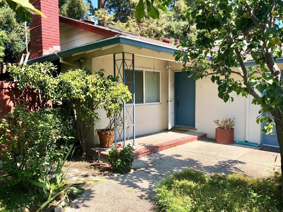
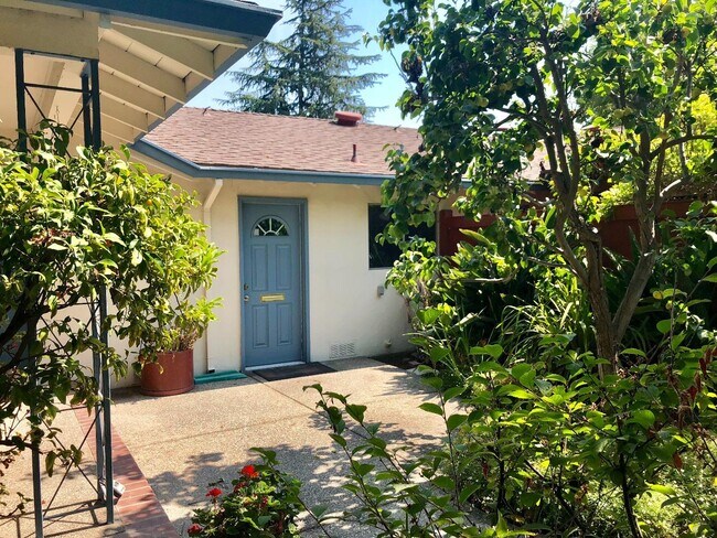
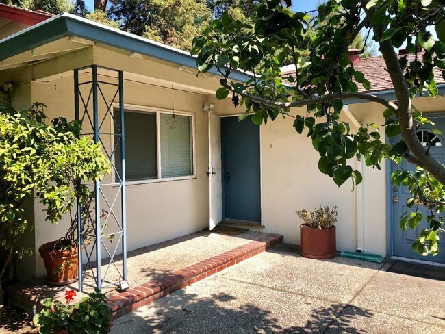
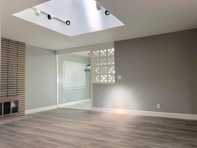
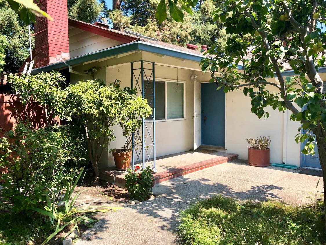
About This Property
An Oasis in heart of silicon valley. Tranquil and peaceful 1 story 3bed/2bath single family home located in convenient Palo alto for rent. Spacious front yard and nice private back yard + 2 car side by side garage. Great floor plan come with living room, dining, kitchen and 3 bedrooms with 2 bath. Great for family or friends to shared with. Short distance to highway or local attractions. Built-in BBQ and water in backyard. Great schools for people with kids: Fairmeadow Elementary /Jane Lathrop Stanford Middle & Gunn High. Near Cubberly community center and playground. Many activities for kids or family here like soccer, tennis & ballet. Near famous private schools. Very convenient to everywhere. Close to school, many shopping area and restaurants. High walk scores. Near Costco, cal-train, easy access to 101, central express, 85. Close to Google, Facebook and Stanford etc. Easy commute!
629 Keats Ct is a house located in Santa Clara County and the 94303 ZIP Code. This area is served by the Palo Alto Unified School District attendance zone.
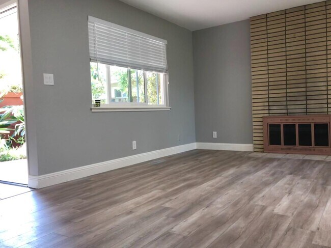
House Features
- Fireplace
629 Keats Ct,
Palo Alto,
CA
94303
Living in Palo Alto places you in Silicon Valley, where historic neighborhoods complement the city's technological presence. Tree-lined streets wind through the community, which is anchored by Stanford University. University Avenue features local boutiques and restaurants housed in preserved historic buildings, while the Stanford Shopping Center offers high-end retail destinations. The city maintains 36 parks and preserves, including the Baylands Nature Preserve and Foothills Park, where residents enjoy hiking trails and outdoor activities. Palo Alto's infrastructure supports alternative transportation, with dedicated bike lanes throughout the city.
The rental market in Palo Alto reflects the area's popularity, with current average rents ranging from $2,634 for studios to $6,139 for four-bedroom homes. Recent trends show steady growth, with rent increases varying from 1.8% to 17% across different unit sizes over the past year.
Learn more about living in Palo AltoBelow are rent ranges for similar nearby apartments
Amenities
- Fireplace
Education
| Colleges & Universities | Distance | ||
|---|---|---|---|
| Colleges & Universities | Distance | ||
| Walk: | 5 min | 0.3 mi | |
| Drive: | 13 min | 4.4 mi | |
| Drive: | 11 min | 4.9 mi | |
| Drive: | 16 min | 6.6 mi |
629 Keats Ct is within 5 minutes or 0.3 mile from Foothill College, Middlefield. It is also near Stanford University and Foothill Coll., Los Altos.
Schools


Public Elementary School
Grades K-5
407 Students
Nearby
Public Elementary School
Grades K-5
425 Students
Attendance Zone
Public Middle School
Grades 6-8
1,002 Students
Attendance Zone
Public High School
Grades 9-12
1,643 Students
Attendance Zone
Private Elementary & Middle School
Grades PK-8
Nearby
Private Elementary & Middle School
Grades K-8
Nearby
Private Middle & High School
Grades 6-12
Nearby
School data provided by
 The GreatSchools Rating helps parents compare schools within a state based on a variety of school quality indicators and provides a helpful picture of how effectively each school serves all of its students. Ratings are on a scale of 1 (below average) to 10 (above average) and can include test scores, college readiness, academic progress, advanced courses, equity, discipline and attendance data. We also advise parents to visit schools, consider other information on school performance and programs, and consider family needs as part of the school selection process.
View GreatSchools Rating Methodology
Data provided by GreatSchools.org © 2026. All rights reserved.
View GreatSchools Rating Methodology
Data provided by GreatSchools.org © 2026. All rights reserved.
Transportation options available in Palo Alto include Mountain View Station, located 2.7 miles from 629 Keats Ct. 629 Keats Ct is near Norman Y Mineta San Jose International, located 11.0 miles or 16 minutes away, and San Francisco International, located 23.2 miles or 30 minutes away.
| Transit / Subway | Distance | ||
|---|---|---|---|
| Transit / Subway | Distance | ||
| Drive: | 5 min | 2.7 mi | |
| Drive: | 6 min | 3.4 mi | |
|
|
Drive: | 7 min | 4.0 mi |
|
|
Drive: | 8 min | 4.0 mi |
| Drive: | 8 min | 4.3 mi |
| Commuter Rail | Distance | ||
|---|---|---|---|
| Commuter Rail | Distance | ||
| Drive: | 3 min | 1.3 mi | |
| Drive: | 8 min | 3.1 mi | |
| Drive: | 8 min | 3.2 mi | |
| Drive: | 11 min | 4.3 mi | |
| Drive: | 11 min | 6.2 mi |
| Airports | Distance | ||
|---|---|---|---|
| Airports | Distance | ||
|
Norman Y Mineta San Jose International
|
Drive: | 16 min | 11.0 mi |
|
San Francisco International
|
Drive: | 30 min | 23.2 mi |
Walkability Near 629 Keats Ct Palo Alto, CA 94303
Getting Around
 What do Walkability, Transit, Drivability, and Bikeability mean?
Walkability measures the walking distance to day-to-day needs.
Transit measures access to public transportation.
Drivability measures congestion, parking availability, and access to major roads.
Bikeability measures the suitability for cycling.
How It Works
What do Walkability, Transit, Drivability, and Bikeability mean?
Walkability measures the walking distance to day-to-day needs.
Transit measures access to public transportation.
Drivability measures congestion, parking availability, and access to major roads.
Bikeability measures the suitability for cycling.
How It Works
Fairly Walkable
Walkability
50
/ 100
Some Public Transit
Transit
40
/ 100
Exceptionally Drivable
Drivability
90
/ 100
Moderately Bikeable
Bikeability
70
/ 100
Scores provided by
-
Soundscore™
-
/ 100
Traffic
-Airport
-Businesses
-Scores provided by
HowLoud What is a Sound Score Rating? A Sound Score Rating aggregates noise caused by vehicle traffic, airplane traffic and local sources. How It WorksTime and distance from 629 Keats Ct.
| Shopping Centers | Distance | ||
|---|---|---|---|
| Shopping Centers | Distance | ||
| Walk: | 8 min | 0.4 mi | |
| Walk: | 11 min | 0.6 mi | |
| Walk: | 13 min | 0.7 mi |
629 Keats Ct has 3 shopping centers within 0.7 mile, which is about a 13-minute walk. The miles and minutes will be for the farthest away property.
| Parks and Recreation | Distance | ||
|---|---|---|---|
| Parks and Recreation | Distance | ||
|
J. Pearce Mitchell Park
|
Walk: | 16 min | 0.8 mi |
|
Terman Park
|
Drive: | 6 min | 2.1 mi |
|
Bol Park
|
Drive: | 8 min | 2.9 mi |
|
Stevens Creek Shoreline Nature Study Area
|
Drive: | 8 min | 3.0 mi |
|
Esther Clark Nature Preserve
|
Drive: | 9 min | 3.1 mi |
629 Keats Ct has 5 parks within 3.1 miles, including J. Pearce Mitchell Park, Terman Park, and Bol Park.
| Hospitals | Distance | ||
|---|---|---|---|
| Hospitals | Distance | ||
| Drive: | 8 min | 4.9 mi | |
| Drive: | 13 min | 5.1 mi | |
| Drive: | 14 min | 5.6 mi |
629 Keats Ct has 3 hospitals within 5.6 miles, the nearest is El Camino Hospital which is 4.9 miles away and a 8 minute drive.
| Military Bases | Distance | ||
|---|---|---|---|
| Military Bases | Distance | ||
| Drive: | 9 min | 3.8 mi |
629 Keats Ct is 3.8 miles and a 9 minute drive from Ames Research Center.
You May Also Like
Similar Rentals Nearby


What Are Walk Score®, Transit Score®, and Bike Score® Ratings?
Walk Score® measures the walkability of any address. Transit Score® measures access to public transit. Bike Score® measures the bikeability of any address.
What is a Sound Score Rating?
A Sound Score Rating aggregates noise caused by vehicle traffic, airplane traffic and local sources.
629 Keats Ct
Palo Alto, CA 94303