
$6,950 / Month
626 Grizzly Peak Blvd
Berkeley, CA 94708
Today
Favorites
412-871-6008
-
Bedrooms
4
-
Bathrooms
2.5
-
Square Feet
1,800 sq ft
-
Available
Available Aug 15
626 Grizzly Peak Blvd

Favorites
About This Home
$6,950 deposit,
Available Aug 15
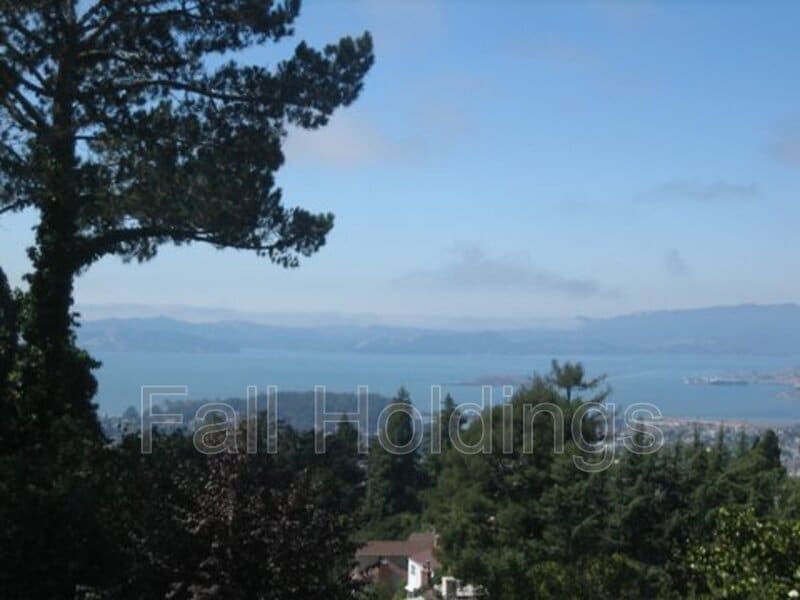
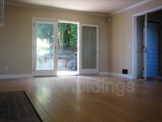
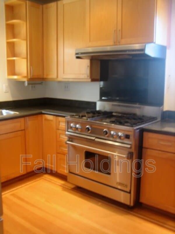
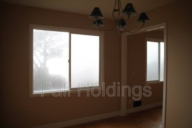
Great Berkeley Hills Home with 3 Bridge Views Large Backyard with Workshop Most Rooms Wired with Ethernet Living Room Wired for 5 Channel Sound On 65 Bus Line Close to UC Berkeley, LBNL, Tilden Park 1.5 - Car Attached Garage
626 Grizzly Peak Blvd is a house located in Alameda County and the 94708 ZIP Code. This area is served by the Berkeley Unified attendance zone.
* Price shown is base rent and may not include non-optional fees and utilities.
Price, availability, fees, and any applicable rent special are subject to change without notice.
* Square footage definitions vary. Displayed square footage is approximate.
House Features
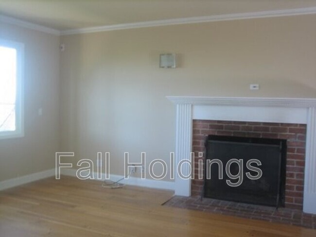
- Fireplace
- Dishwasher
- Balcony
Fees and Policies
The fees below are based on community-supplied data and may exclude additional fees and utilities.
- Dogs Allowed
-
Fees not specified
- Cats Allowed
-
Fees not specified
Contact
- Phone Number
- Contact
Location
Get Directions
Amenities
- Fireplace
- Dishwasher
- Balcony
Located about two miles east of central Berkeley, the neighborhood of Berkeley Hills offers spacious houses for rent with modern kitchens and stunning views of the hills, valleys, canyons, and San Francisco Bay.
Locals in this neighborhood love to hang out at breathtaking, 2,000-acre Tilden Regional Park with its carousel, hiking trails, scenic views, picnic areas, and swimming holes. Enjoy the much smaller Berkeley Rose Garden with its terraced plantings of roses and views of San Francisco Bay. If you like rock climbing or bouldering, visit Grotto Rock Park or Cragmont Rock Park, which also features views of the Bay.
Buy beautiful 19th- and 20th-century Japanese prints at the Scriptum art gallery, and perch atop the fiberglass whale at the Lawrence Hall of Science. Savor some American cuisine at Foothill restaurant.
Learn more about living in Berkeley Hills
Education
| Colleges & Universities | Distance | ||
|---|---|---|---|
| Colleges & Universities | Distance | ||
| Drive: | 8 min | 2.6 mi | |
| Drive: | 9 min | 2.7 mi | |
| Drive: | 18 min | 6.1 mi | |
| Drive: | 18 min | 9.1 mi |
626 Grizzly Peak Blvd is within 8 minutes or 2.6 miles from Berkeley City College. It is also near UC Berkeley and Samuel Merritt University.
Schools


Public Elementary School
Grades K-5
303 Students
Attendance Zone
Public Elementary School
Grades K-5
262 Students
Attendance Zone
Public Elementary School
Grades K-5
270 Students
Nearby
Public Middle School
Grades 6-8
871 Students
Attendance Zone
Public High School
Grades 9-12
3,204 Students
Attendance Zone
Private Elementary & Middle School
Grades K-8
296 Students
Nearby
Private Elementary & Middle School
Grades PK-8
Nearby
Private High School
Grades 9-12
627 Students
Nearby
School data provided by
 The GreatSchools Rating helps parents compare schools within a state based on a variety of school quality indicators and provides a helpful picture of how effectively each school serves all of its students. Ratings are on a scale of 1 (below average) to 10 (above average) and can include test scores, college readiness, academic progress, advanced courses, equity, discipline and attendance data. We also advise parents to visit schools, consider other information on school performance and programs, and consider family needs as part of the school selection process.
View GreatSchools Rating Methodology
Data provided by GreatSchools.org © 2025. All rights reserved.
View GreatSchools Rating Methodology
Data provided by GreatSchools.org © 2025. All rights reserved.
Transportation options available in Berkeley include Downtown Berkeley, located 2.5 miles from 626 Grizzly Peak Blvd. 626 Grizzly Peak Blvd is near Metro Oakland International, located 17.5 miles or 33 minutes away, and San Francisco International, located 27.0 miles or 46 minutes away.
| Transit / Subway | Distance | ||
|---|---|---|---|
| Transit / Subway | Distance | ||
|
|
Drive: | 8 min | 2.5 mi |
|
|
Drive: | 8 min | 2.5 mi |
|
|
Drive: | 8 min | 2.5 mi |
|
|
Drive: | 8 min | 2.5 mi |
|
|
Drive: | 10 min | 3.4 mi |
| Commuter Rail | Distance | ||
|---|---|---|---|
| Commuter Rail | Distance | ||
|
|
Drive: | 11 min | 3.6 mi |
|
|
Drive: | 16 min | 5.7 mi |
| Drive: | 16 min | 7.1 mi | |
|
|
Drive: | 22 min | 9.1 mi |
|
|
Drive: | 36 min | 23.6 mi |
| Airports | Distance | ||
|---|---|---|---|
| Airports | Distance | ||
|
Metro Oakland International
|
Drive: | 33 min | 17.5 mi |
|
San Francisco International
|
Drive: | 46 min | 27.0 mi |
Time and distance from 626 Grizzly Peak Blvd.
| Shopping Centers | Distance | ||
|---|---|---|---|
| Shopping Centers | Distance | ||
| Drive: | 7 min | 2.2 mi | |
| Drive: | 9 min | 2.7 mi | |
| Drive: | 10 min | 3.1 mi |
626 Grizzly Peak Blvd has 3 shopping centers within 3.1 miles, which is about a 10-minute drive. The miles and minutes will be for the farthest away property.
| Parks and Recreation | Distance | ||
|---|---|---|---|
| Parks and Recreation | Distance | ||
|
Cragmont Rock Park
|
Walk: | 13 min | 0.7 mi |
|
Remillard Park
|
Walk: | 13 min | 0.7 mi |
|
Tilden Nature Area
|
Walk: | 16 min | 0.9 mi |
|
Mortar Rock Park
|
Walk: | 18 min | 1.0 mi |
|
Indian Rock Park
|
Drive: | 3 min | 1.1 mi |
626 Grizzly Peak Blvd has 5 parks within 1.1 miles, including Cragmont Rock Park, Remillard Park, and Tilden Nature Area.
| Hospitals | Distance | ||
|---|---|---|---|
| Hospitals | Distance | ||
| Drive: | 12 min | 4.1 mi | |
| Drive: | 15 min | 4.9 mi | |
| Drive: | 18 min | 6.0 mi |
626 Grizzly Peak Blvd has 3 hospitals within 6.0 miles, the nearest is Alta Bates Summit Medical Center - Alta Bates Campus which is 4.1 miles away and a 12 minute drive.
| Military Bases | Distance | ||
|---|---|---|---|
| Military Bases | Distance | ||
| Drive: | 5 min | 2.0 mi | |
| Drive: | 17 min | 8.0 mi | |
| Drive: | 25 min | 10.0 mi |
626 Grizzly Peak Blvd has 3 military bases within 10.0 miles, the nearest is Military Reservation which is 2.0 miles away and a 5 minute drive.
You May Also Like
Similar Rentals Nearby


What Are Walk Score®, Transit Score®, and Bike Score® Ratings?
Walk Score® measures the walkability of any address. Transit Score® measures access to public transit. Bike Score® measures the bikeability of any address.
What is a Sound Score Rating?
A Sound Score Rating aggregates noise caused by vehicle traffic, airplane traffic and local sources

626 Grizzly Peak Blvd
Berkeley, CA 94708