
The Equestrian At Pelham Parkway
1680 Pelham Pkwy S,
Bronx, NY 10461
$1,850 - $2,900
Studio - 2 Beds
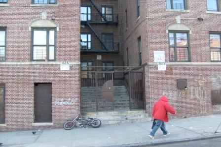
At 625-627 Manida St in Bronx, find a great place to live. In a convenient location on Manida St. in Bronx's 10474 Zip code, renters can easily connect with a number of points of interest in the surrounding area. The professional leasing team is ready for you to come by to check us out. Be sure to come for a visit to view the available floorplans. Come be a part of 625-627 Manida St. Contact or drop by the leasing office to schedule a tour today.
625-627 Manida St is an apartment community located in Bronx County and the 10474 ZIP Code. This area is served by the New York City Geographic District # 8 attendance zone.
Air Conditioning
Refrigerator
Heating
Oven
Dominated by the presence of its key industry, Hunts Point houses one of the largest food distribution facilities on the planet. A small but dense residential area comprised of apartment buildings and row houses make up the landscape of this section of the Bronx. Hunts Point has a diverse community and stands as a historic district that hosts a collection of pre-war townhouses and high stooped multi-family units. This neighborhood is steadily growing and is conveniently located only six miles northeast of Midtown Manhattan. An influx of new businesses and residents is making this neighborhood highly sought-after for its excellent location and short commute.
Learn more about living in Hunts PointCompare neighborhood and city base rent averages by bedroom.
| Hunts Point | Bronx, NY | |
|---|---|---|
| Studio | $1,754 | $1,613 |
| 1 Bedroom | $1,125 | $1,636 |
| 2 Bedrooms | $1,058 | $2,098 |
| 3 Bedrooms | $1,654 | $2,358 |
| Colleges & Universities | Distance | ||
|---|---|---|---|
| Colleges & Universities | Distance | ||
| Drive: | 6 min | 3.6 mi | |
| Drive: | 12 min | 4.2 mi | |
| Drive: | 10 min | 4.9 mi | |
| Drive: | 10 min | 5.5 mi |


Transportation options available in Bronx include Longwood Avenue, located 0.6 mile from 625-627 Manida St. 625-627 Manida St is near LaGuardia, located 7.2 miles or 14 minutes away, and John F Kennedy International, located 18.4 miles or 27 minutes away.
| Transit / Subway | Distance | ||
|---|---|---|---|
| Transit / Subway | Distance | ||
|
|
Walk: | 11 min | 0.6 mi |
|
|
Walk: | 11 min | 0.6 mi |
|
|
Walk: | 19 min | 1.0 mi |
|
|
Drive: | 3 min | 1.1 mi |
|
|
Drive: | 3 min | 1.4 mi |
| Commuter Rail | Distance | ||
|---|---|---|---|
| Commuter Rail | Distance | ||
|
|
Drive: | 7 min | 2.4 mi |
|
|
Drive: | 6 min | 3.4 mi |
|
|
Drive: | 6 min | 3.8 mi |
|
|
Drive: | 8 min | 4.0 mi |
| Drive: | 10 min | 5.4 mi |
| Airports | Distance | ||
|---|---|---|---|
| Airports | Distance | ||
|
LaGuardia
|
Drive: | 14 min | 7.2 mi |
|
John F Kennedy International
|
Drive: | 27 min | 18.4 mi |
Scores provided by
Traffic
-Airport
-Businesses
-Scores provided by
HowLoud What is a Sound Score Rating? A Sound Score Rating aggregates noise caused by vehicle traffic, airplane traffic and local sources. How It WorksTime and distance from 625-627 Manida St.
| Shopping Centers | Distance | ||
|---|---|---|---|
| Shopping Centers | Distance | ||
| Drive: | 5 min | 1.8 mi | |
| Drive: | 4 min | 2.0 mi |
| Parks and Recreation | Distance | ||
|---|---|---|---|
| Parks and Recreation | Distance | ||
|
Barretto Point Park
|
Walk: | 11 min | 0.6 mi |
|
Concrete Plant Park
|
Drive: | 3 min | 1.3 mi |
|
Captain Rivera Playground
|
Drive: | 3 min | 1.4 mi |
|
St. Mary's Park
|
Drive: | 4 min | 1.6 mi |
|
Soundview Park
|
Drive: | 6 min | 2.5 mi |
| Hospitals | Distance | ||
|---|---|---|---|
| Hospitals | Distance | ||
| Drive: | 6 min | 2.3 mi | |
| Drive: | 6 min | 2.4 mi | |
| Drive: | 11 min | 4.6 mi |
| Military Bases | Distance | ||
|---|---|---|---|
| Military Bases | Distance | ||
| Drive: | 17 min | 9.3 mi | |
| Drive: | 27 min | 13.9 mi | |
| Drive: | 40 min | 19.8 mi |
What Are Walk Score®, Transit Score®, and Bike Score® Ratings?
Walk Score® measures the walkability of any address. Transit Score® measures access to public transit. Bike Score® measures the bikeability of any address.
What is a Sound Score Rating?
A Sound Score Rating aggregates noise caused by vehicle traffic, airplane traffic and local sources.


