
$2,999 / Month
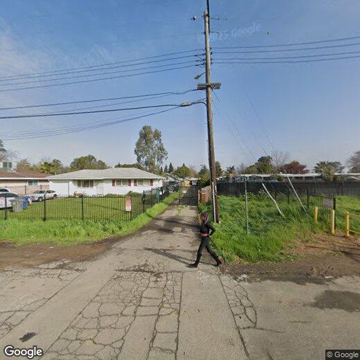
6245 Dias Ave
Sacramento, CA 95824
2 Weeks Ago
Favorites
6245 Dias Ave

Favorites
Check Back Soon for Upcoming Availability
| Beds | Baths | Average SF |
|---|---|---|
| 4 Bedrooms 4 Bedrooms 4 Br | 2 Baths 2 Baths 2 Ba | 1,950 SF |
Fees and Policies
The fees below are based on community-supplied data and may exclude additional fees and utilities.
- Dogs Allowed
-
Fees not specified
- Cats Allowed
-
Fees not specified
- Parking
-
Other--
Location
Get Directions
Parkway-South Sacramento is an area less than 10 miles south of the heart of Sacramento surrounded by great amenities like Sacramento Executive Airport, Sacramento Zoo, and top-notch medical centers. But the community itself has a lot to offer. Split by Highway 99, the town is a mix of residential, retail, and industrial. Repair shops, building suppliers, and auto shops make up the western portion of town in Southgate Industrial Park while an abundance of retailers are situated right below in the Southgate Commercial District. The rest of the area is mainly residential with peaceful neighborhoods making up the western sections of town with a variety of moderately priced apartments to choose from.
Learn more about living in Parkway-South SacramentoBelow are rent ranges for similar nearby apartments
| Beds | Average Size | Lowest | Typical | Premium |
|---|---|---|---|---|
| Studio Studio Studio | 437-439 Sq Ft | $1,100 | $1,355 | $1,400 |
| 1 Bed 1 Bed 1 Bed | 644-645 Sq Ft | $990 | $1,405 | $1,646 |
| 2 Beds 2 Beds 2 Beds | 832 Sq Ft | $1,400 | $1,708 | $2,150 |
| 3 Beds 3 Beds 3 Beds | 1180 Sq Ft | $1,750 | $2,312 | $2,650 |
| 4 Beds 4 Beds 4 Beds | 1566 Sq Ft | $2,207 | $2,404 | $2,600 |
Education
| Colleges & Universities | Distance | ||
|---|---|---|---|
| Colleges & Universities | Distance | ||
| Drive: | 10 min | 5.0 mi | |
| Drive: | 12 min | 5.2 mi | |
| Drive: | 13 min | 5.3 mi | |
| Drive: | 25 min | 15.9 mi |
6245 Dias Ave is within 10 minutes or 5.0 miles from Sacramento City College. It is also near Sacramento State and Cosumnes River College.
Transportation options available in Sacramento include 47Th Avenue Station (Eb), located 3.0 miles from 6245 Dias Ave. 6245 Dias Ave is near Sacramento International, located 19.2 miles or 30 minutes away.
| Transit / Subway | Distance | ||
|---|---|---|---|
| Transit / Subway | Distance | ||
| Drive: | 7 min | 3.0 mi | |
| Drive: | 8 min | 3.4 mi | |
| Drive: | 9 min | 3.8 mi | |
| Drive: | 9 min | 3.9 mi | |
| Drive: | 10 min | 4.5 mi |
| Commuter Rail | Distance | ||
|---|---|---|---|
| Commuter Rail | Distance | ||
| Drive: | 15 min | 8.5 mi | |
|
|
Drive: | 29 min | 20.8 mi |
|
|
Drive: | 34 min | 24.6 mi |
|
|
Drive: | 35 min | 26.7 mi |
|
|
Drive: | 40 min | 29.4 mi |
| Airports | Distance | ||
|---|---|---|---|
| Airports | Distance | ||
|
Sacramento International
|
Drive: | 30 min | 19.2 mi |
Time and distance from 6245 Dias Ave.
| Shopping Centers | Distance | ||
|---|---|---|---|
| Shopping Centers | Distance | ||
| Walk: | 8 min | 0.4 mi | |
| Walk: | 9 min | 0.5 mi | |
| Walk: | 14 min | 0.7 mi |
6245 Dias Ave has 3 shopping centers within 0.7 mile, which is about a 14-minute walk. The miles and minutes will be for the farthest away property.
| Parks and Recreation | Distance | ||
|---|---|---|---|
| Parks and Recreation | Distance | ||
|
Paradise Beach County Recreation Area
|
Drive: | 11 min | 5.1 mi |
|
Sacramento Zoo
|
Drive: | 12 min | 6.1 mi |
|
Sutter's Fort State Historical Monument
|
Drive: | 11 min | 6.4 mi |
|
California Native Plant Demonstration Garden
|
Drive: | 13 min | 6.8 mi |
|
Leland Stanford Mansion State Historic Park
|
Drive: | 13 min | 7.4 mi |
6245 Dias Ave has 5 parks within 7.4 miles, including Paradise Beach County Recreation Area, Sutter's Fort State Historical Monument, and Sacramento Zoo.
| Hospitals | Distance | ||
|---|---|---|---|
| Hospitals | Distance | ||
| Drive: | 8 min | 3.4 mi | |
| Drive: | 8 min | 3.5 mi | |
| Drive: | 8 min | 3.8 mi |
6245 Dias Ave has 3 hospitals within 3.8 miles, the nearest is Shriners Hospitals for Children GÇö Northern California which is 3.4 miles away and a 8 minute drive.
| Military Bases | Distance | ||
|---|---|---|---|
| Military Bases | Distance | ||
| Drive: | 32 min | 16.9 mi |
6245 Dias Ave is 16.9 miles and a 32 minute drive from McClellan Air Force Base.
You May Also Like
Similar Rentals Nearby


What Are Walk Score®, Transit Score®, and Bike Score® Ratings?
Walk Score® measures the walkability of any address. Transit Score® measures access to public transit. Bike Score® measures the bikeability of any address.
What is a Sound Score Rating?
A Sound Score Rating aggregates noise caused by vehicle traffic, airplane traffic and local sources
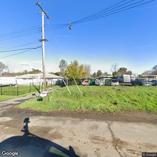
6245 Dias Ave
Sacramento, CA 95824