")
Palm View Village (Furnished Units Available)
14724 Inglewood Ave,
Lawndale, CA 90260
$2,150 - $2,550
Studio - 1 Bed
Just remodeled. All new stove, dishwasher, sink. Quartz counter tops, new plank floors and new paint. Close to Riviera Village, underground parking and extra storage. Laundry room for building. Corner building backs up to Riviera Village residential area. Small balcony. About 7-8 blocks to beach.
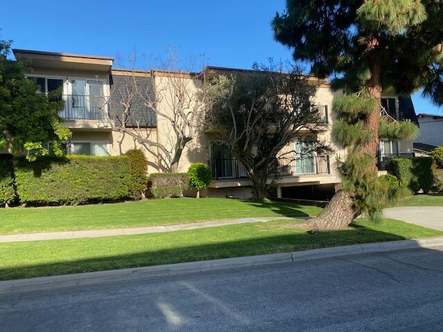
6164 S Pacific Coast Hwy is an apartment community located in Los Angeles County and the 90277 ZIP Code. This area is served by the Torrance Unified School District attendance zone.
Dishwasher
Refrigerator
Disposal
Stainless Steel Appliances
Comfortable single-family homes and low-rise apartment buildings provide the majority of living space in the quiet Riviera neighborhood, found in the very south end of Redondo Beach. Locals hang out at Avenue C Beach for a pick-up game of beach volleyball or at Burnout Beach, a peaceful stretch of sand popular with surfers and snorkelers.
Residents of the Riviera neighborhood head to nearby Riviera Village to work out or grab a bite to eat. Restaurants in the area serve two-for-one deals every "Tasty Tuesday," and patrons congregate in the Village for the annual Summer Festival and regular farmers markets.
Learn more about living in RivieraCompare neighborhood and city base rent averages by bedroom.
| Riviera | Redondo Beach, CA | |
|---|---|---|
| Studio | $1,678 | $2,275 |
| 1 Bedroom | $2,106 | $2,520 |
| 2 Bedrooms | $3,165 | $3,084 |
| 3 Bedrooms | $3,440 | $4,167 |
| Colleges & Universities | Distance | ||
|---|---|---|---|
| Colleges & Universities | Distance | ||
| Drive: | 12 min | 6.9 mi | |
| Drive: | 14 min | 7.4 mi | |
| Drive: | 20 min | 10.7 mi | |
| Drive: | 20 min | 11.2 mi |


Transportation options available in Redondo Beach include Marine/Redondo Station, located 6.4 miles from 6164 S Pacific Coast Hwy. 6164 S Pacific Coast Hwy is near Los Angeles International, located 10.0 miles or 20 minutes away, and Long Beach (Daugherty Field), located 14.6 miles or 25 minutes away.
| Transit / Subway | Distance | ||
|---|---|---|---|
| Transit / Subway | Distance | ||
|
|
Drive: | 13 min | 6.4 mi |
|
|
Drive: | 13 min | 6.8 mi |
|
|
Drive: | 14 min | 7.5 mi |
|
|
Drive: | 16 min | 8.0 mi |
| Drive: | 16 min | 8.3 mi |
| Commuter Rail | Distance | ||
|---|---|---|---|
| Commuter Rail | Distance | ||
|
|
Drive: | 33 min | 23.8 mi |
|
|
Drive: | 35 min | 24.0 mi |
|
|
Drive: | 37 min | 24.2 mi |
|
|
Drive: | 37 min | 24.7 mi |
|
|
Drive: | 40 min | 25.7 mi |
| Airports | Distance | ||
|---|---|---|---|
| Airports | Distance | ||
|
Los Angeles International
|
Drive: | 20 min | 10.0 mi |
|
Long Beach (Daugherty Field)
|
Drive: | 25 min | 14.6 mi |
Scores provided by
Traffic
BusyAirport
ActiveBusinesses
ActiveScores provided by
HowLoud What is a Sound Score Rating? A Sound Score Rating aggregates noise caused by vehicle traffic, airplane traffic and local sources. How It WorksTime and distance from 6164 S Pacific Coast Hwy.
| Shopping Centers | Distance | ||
|---|---|---|---|
| Shopping Centers | Distance | ||
| Walk: | 3 min | 0.2 mi | |
| Walk: | 5 min | 0.3 mi | |
| Walk: | 6 min | 0.3 mi |
| Parks and Recreation | Distance | ||
|---|---|---|---|
| Parks and Recreation | Distance | ||
|
Madrona Marsh Preserve & Nature Center
|
Drive: | 6 min | 3.2 mi |
|
South Coast Botanic Garden
|
Drive: | 8 min | 4.5 mi |
|
George F. Canyon Preserve & Nature Center
|
Drive: | 9 min | 5.7 mi |
|
Point Vicente Interpretive Center
|
Drive: | 11 min | 6.7 mi |
|
Abalone Cove Shoreline Park
|
Drive: | 15 min | 8.9 mi |
| Hospitals | Distance | ||
|---|---|---|---|
| Hospitals | Distance | ||
| Drive: | 5 min | 2.7 mi | |
| Drive: | 5 min | 2.9 mi | |
| Drive: | 5 min | 3.3 mi |
| Military Bases | Distance | ||
|---|---|---|---|
| Military Bases | Distance | ||
| Drive: | 14 min | 7.5 mi | |
| Drive: | 21 min | 10.9 mi | |
| Drive: | 24 min | 13.2 mi |
Pets Allowed In Unit Washer & Dryer Maintenance on site Heat Controlled Access Elevator
What Are Walk Score®, Transit Score®, and Bike Score® Ratings?
Walk Score® measures the walkability of any address. Transit Score® measures access to public transit. Bike Score® measures the bikeability of any address.
What is a Sound Score Rating?
A Sound Score Rating aggregates noise caused by vehicle traffic, airplane traffic and local sources.

6164 S Pacific Coast Hwy
Redondo Beach, CA 90277


 - Violet on Virgil")