
$2,800
/ Month
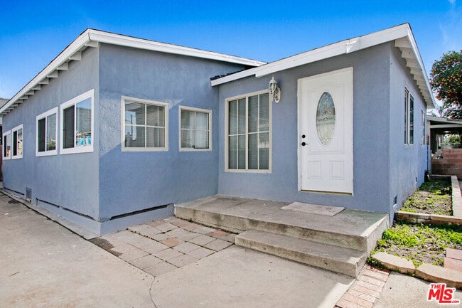
609 Pico St
San Fernando, CA 91340
2 Weeks Ago
|
Edit
Favorites
609 Pico St

Favorites
Check Back Soon for Upcoming Availability
| Beds | Baths | Average SF |
|---|---|---|
| 2 Bedrooms 2 Bedrooms 2 Br | 1 Bath 1 Bath 1 Ba | 850 SF |
Fees and Policies
The fees below are based on community-supplied data and may exclude additional fees and utilities.
Pet policies are negotiable.
About This Property
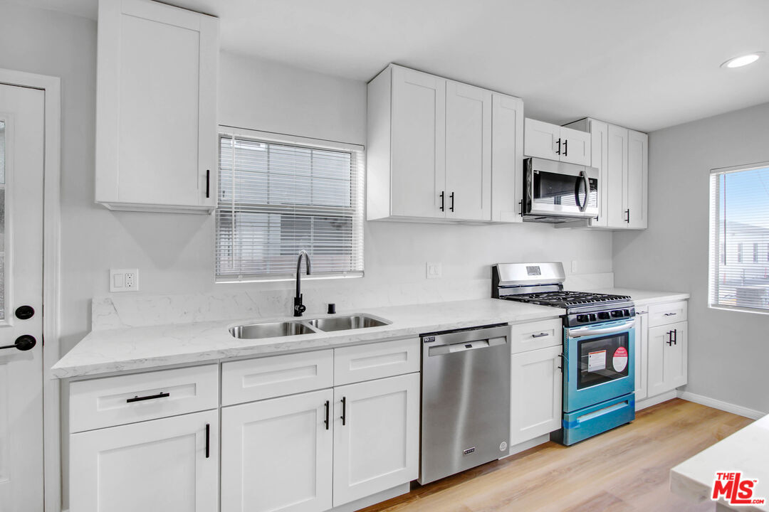
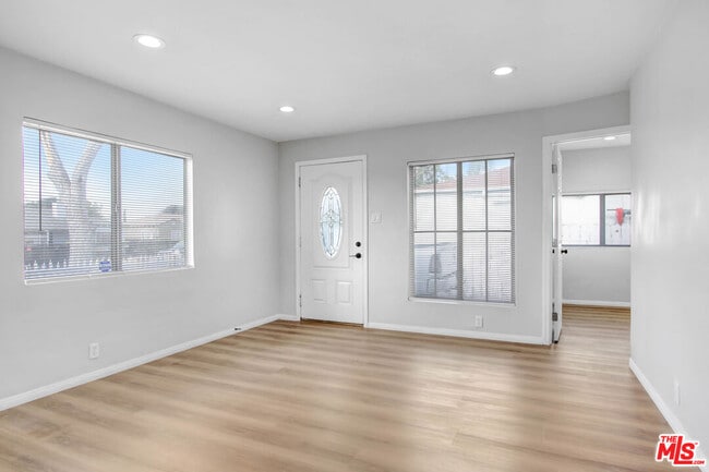
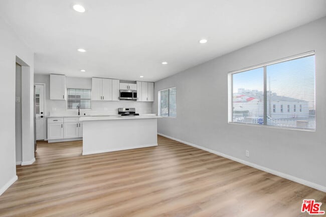
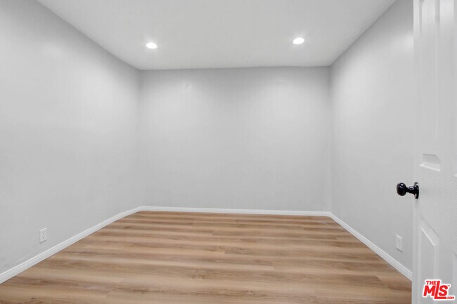
READY TO MOVE IN!!!!! Newly remodel and tastefully done, nice and bright natural lights, vinyl plank flooring, crown molding, and freshly painted throughout the home. This home features 2 bedroom with 1 full bathroom. The kitchen is fully equipped with stainless steel appliances, including double door fridge, microwave, dishwasher, stove and oven. The home also comes with its own washer and dryer - NO MORE TRIPS TO THE LAUNDROMAT!!! This home is located, close to the freeways, Provident Hospital, Bishop Alemany High School, restaurants, and groceries stores. Pets are welcome with a security deposit. Please call listing agent for a private showing.
609 Pico St is a house located in Los Angeles County and the 91340 ZIP Code. This area is served by the Los Angeles Unified attendance zone.
House Features
Dishwasher
Washer/Dryer Hookup
Microwave
Refrigerator
- Washer/Dryer Hookup
- Dishwasher
- Microwave
- Refrigerator
Location
Get Directions
Nestled at the foothills of the San Gabriel Mountains, San Fernando is a small city in the northwestern region of Los Angeles County. Situated between Interstates 5 and 210, getting around from San Fernando is a breeze.
In addition to stunning mountain views, San Fernando boasts endless opportunities for outdoor recreation with close proximity to a number of parks such as Hansen Dam Recreation Center, Veterans Memorial Community Regional Park, Wilson Canyon Park, and O’Melveny Park. San Fernando is home to a diverse range of shopping and dining options, including the San Fernando Swap Meet and authentic Latin American cuisine. Discovery Cube Los Angeles and Nethercutt Museum are also close to San Fernando.
Learn more about living in San FernandoBelow are rent ranges for similar nearby apartments
Amenities
- Washer/Dryer Hookup
- Dishwasher
- Microwave
- Refrigerator
Education
| Colleges & Universities | Distance | ||
|---|---|---|---|
| Colleges & Universities | Distance | ||
| Drive: | 7 min | 4.0 mi | |
| Drive: | 13 min | 6.8 mi | |
| Drive: | 14 min | 9.4 mi | |
| Drive: | 14 min | 9.5 mi |
609 Pico St is within 7 minutes or 4.0 miles from Mission College. It is also near Cal State Northridge and Woodbury University.
Schools


Charter Elementary, Middle & High School
Grades K-12
2,877 Students
Nearby
Public Elementary School
Grades K-5
378 Students
Attendance Zone
Public Middle School
Grades 6-8
524 Students
Attendance Zone
Public High School
Grades 9-12
1,745 Students
Attendance Zone
Private Elementary School
Grades PK-6
Nearby
Private Elementary & Middle School
Grades K-8
245 Students
Nearby
Private High School
Grades 9-12
984 Students
Nearby
School data provided by
 The GreatSchools Rating helps parents compare schools within a state based on a variety of school quality indicators and provides a helpful picture of how effectively each school serves all of its students. Ratings are on a scale of 1 (below average) to 10 (above average) and can include test scores, college readiness, academic progress, advanced courses, equity, discipline and attendance data. We also advise parents to visit schools, consider other information on school performance and programs, and consider family needs as part of the school selection process.
View GreatSchools Rating Methodology
Data provided by GreatSchools.org © 2025. All rights reserved.
View GreatSchools Rating Methodology
Data provided by GreatSchools.org © 2025. All rights reserved.
Transportation options available in San Fernando include North Hollywood Station, located 9.9 miles from 609 Pico St. 609 Pico St is near Bob Hope, located 7.4 miles or 12 minutes away, and Los Angeles International, located 27.8 miles or 37 minutes away.
| Transit / Subway | Distance | ||
|---|---|---|---|
| Transit / Subway | Distance | ||
|
|
Drive: | 13 min | 9.9 mi |
| Commuter Rail | Distance | ||
|---|---|---|---|
| Commuter Rail | Distance | ||
|
|
Drive: | 3 min | 1.6 mi |
|
|
Drive: | 9 min | 5.2 mi |
|
|
Drive: | 8 min | 5.5 mi |
|
|
Drive: | 17 min | 9.6 mi |
|
|
Drive: | 17 min | 9.6 mi |
| Airports | Distance | ||
|---|---|---|---|
| Airports | Distance | ||
|
Bob Hope
|
Drive: | 12 min | 7.4 mi |
|
Los Angeles International
|
Drive: | 37 min | 27.8 mi |
Time and distance from 609 Pico St.
| Shopping Centers | Distance | ||
|---|---|---|---|
| Shopping Centers | Distance | ||
| Walk: | 11 min | 0.6 mi | |
| Walk: | 11 min | 0.6 mi | |
| Walk: | 12 min | 0.6 mi |
609 Pico St has 3 shopping centers within 0.6 mile, which is about a 12-minute walk. The miles and minutes will be for the farthest away property.
| Parks and Recreation | Distance | ||
|---|---|---|---|
| Parks and Recreation | Distance | ||
|
El Cariso Regional Park
|
Drive: | 7 min | 4.1 mi |
|
Veterans Memorial Park
|
Drive: | 12 min | 5.2 mi |
|
Aliso Canyon Park
|
Drive: | 14 min | 7.6 mi |
|
Cal State Northridge Botanic Garden
|
Drive: | 13 min | 8.0 mi |
|
Wildlife Waystation
|
Drive: | 15 min | 9.6 mi |
609 Pico St has 5 parks within 9.6 miles, including El Cariso Regional Park, Veterans Memorial Park, and Aliso Canyon Park.
| Hospitals | Distance | ||
|---|---|---|---|
| Hospitals | Distance | ||
| Drive: | 3 min | 1.7 mi | |
| Drive: | 5 min | 3.7 mi | |
| Drive: | 9 min | 4.7 mi |
609 Pico St has 3 hospitals within 4.7 miles, the nearest is Providence Holy Cross Medical Center which is 1.7 miles away and a 3 minute drive.
| Military Bases | Distance | ||
|---|---|---|---|
| Military Bases | Distance | ||
| Drive: | 37 min | 30.4 mi |
609 Pico St is 30.4 miles and a 37 minute drive from Los Angeles Air Force Base.
You May Also Like
Similar Rentals Nearby


What Are Walk Score®, Transit Score®, and Bike Score® Ratings?
Walk Score® measures the walkability of any address. Transit Score® measures access to public transit. Bike Score® measures the bikeability of any address.
What is a Sound Score Rating?
A Sound Score Rating aggregates noise caused by vehicle traffic, airplane traffic and local sources

609 Pico St
San Fernando, CA 91340