
$4,450
/ Month
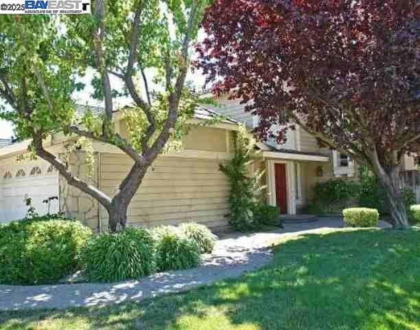
6084 Vía de los Cerros
Pleasanton, CA 94566
Today
|
Edit
Favorites
925-462-1101
-
Bedrooms
3
-
Bathrooms
2.5
-
Square Feet
1,745 sq ft
-
Available
Not Available
Highlights
- Contemporary Architecture
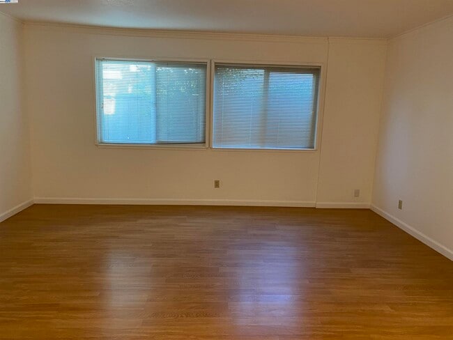
- Wood Flooring
- 2 Car Attached Garage
- Forced Air Heating and Cooling System
- Carpet
6084 Vía de los Cerros

Favorites
About This Home
Not Available
Hermosa casa de 3 dormitorios en el barrio Del Prado de Pleasanton. Esta casa de dos plantas ofrece 168 m² de espacio habitable con 3 dormitorios, 2.5 baños y garaje para dos coches. Pintura y alfombra nuevas en toda la casa. La cocina, renovada, está equipada con refrigerador, horno y lavavajillas. Los pisos son de alfombra y laminado nuevos. Los dormitorios ofrecen amplios armarios. Servicios adicionales: lavadora y secadora, iluminación nueva y aire acondicionado central. El inquilino es responsable de todos los servicios públicos. Fácil acceso a las autopistas I-580, I-680, BART y ACE. A solo minutos del centro de Pleasanton, donde podrá disfrutar de restaurantes locales, mercado de agricultores, tiendas y conciertos en el parque (solo en verano). ¡Este es el lugar perfecto para llamar hogar! LA INFORMACIÓN SE CONSIDERA CONFIABLE, PERO NO ESTÁ GARANTIZADA.
6084 Vía De Los Cerros is a house located in Alameda County and the 94566 ZIP Code. This area is served by the Pleasanton Unified attendance zone.
* Price shown is base rent. Excludes user-selected optional fees and variable or usage-based fees and required charges due at or prior to move-in or at move-out. Price, availability, fees, and any applicable rent special are subject to change without notice.
* Square footage definitions vary. Displayed square footage is approximate.
Home Details
Home Type
Single Family Detached Home
Year Built
Built in 1985
Bedrooms and Bathrooms
2.5 Bathrooms
3 Bedrooms
Flooring
Wood
Carpet
Home Design
Contemporary Architecture
Vinyl Siding
Composition Shingle Roof
Interior Spaces
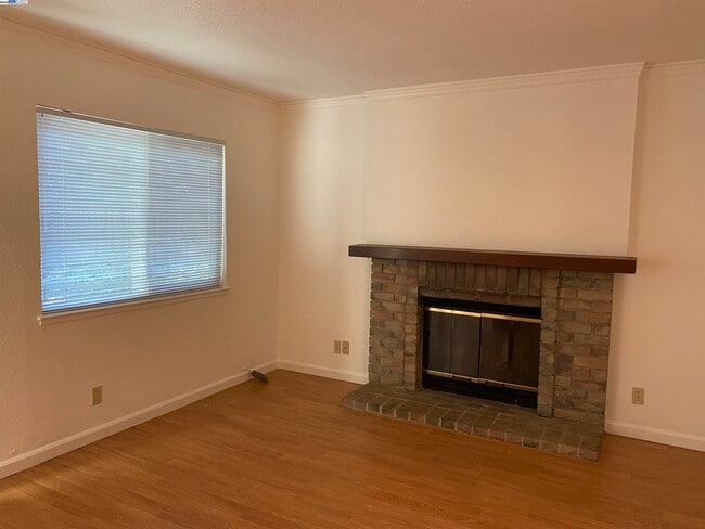
Family Room with Fireplace
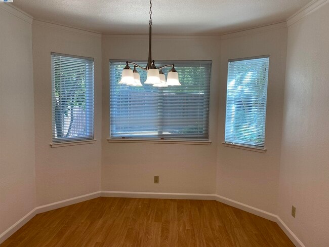
2-Story Property
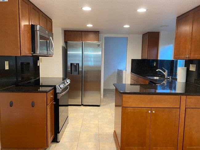
Kitchen
Electric Cooktop
Dishwasher
Laundry
Dryer
Washer
Listing and Financial Details
Assessor Parcel Number 946453987
Lot Details
4,948 Sq Ft Lot
Parking
2 Car Attached Garage
Garage Door Opener
Utilities
Forced Air Heating and Cooling System
Community Details
Overview
No Home Owners Association
Contact
- Listed by Kandy Wilson | Wilson Property Management
- Phone Number
- Contact
-
Source
 Bay East Association of REALTORS ®
Copyright© 2026 Bay East, Contra Costa, bridgeMLS. All rights reserved. All information provided by the listing agent/broker is deemed reliable but is not guaranteed and should be independently verified.
Location
Get Directions
The cities of Livermore, Dublin and Pleasanton form a loosely shaped triangle within California's Tri-Valley region, a cluster of three small valleys about 33 miles east of San Francisco and 35 miles northeast of San Jose. Known for its Mediterranean climate, rolling hills and historic vineyards, this once bucolic region now boasts three separate downtown areas, a bustling business community and some of the best wineries in the state.
At the eastern end of the region lies the city of Livermore. Once known as Livermores, Livermore Ranch and Nottingham, the city sits at the center of Livermore Valley, a historic region dotted with more than 5,000 acres of mostly family-owned vineyards. A pastoral neighborhood known for its charming yet functional hilltop windmills, Livermore hosts the internationally recognized and sometimes controversial center of scientific research, Lawrence Livermore National Laboratories.
Learn more about living in Dublin/Pleasanton/Livermore
Education
| Colleges & Universities | Distance | ||
|---|---|---|---|
| Colleges & Universities | Distance | ||
| Drive: | 13 min | 6.5 mi | |
| Drive: | 16 min | 9.5 mi | |
| Drive: | 19 min | 12.6 mi | |
| Drive: | 25 min | 15.9 mi |
6084 Vía de los Cerros is within 13 minutes or 6.5 miles from Diablo Valley Coll, San Ramon. It is also near Las Positas College and Ohlone College, Fremont Campus.
Schools


Public Elementary School
Grades K-5
497 Students
Nearby
Public Elementary School
Grades K-5
648 Students
Attendance Zone
Public Middle School
Grades 6-8
1,158 Students
Attendance Zone
Public High School
Grades 9-12
2,199 Students
Attendance Zone
Private Elementary School
Grades PK-5
Nearby
Private Elementary, Middle & High School
Grades 1-12
Nearby
School data provided by
 The GreatSchools Rating helps parents compare schools within a state based on a variety of school quality indicators and provides a helpful picture of how effectively each school serves all of its students. Ratings are on a scale of 1 (below average) to 10 (above average) and can include test scores, college readiness, academic progress, advanced courses, equity, discipline and attendance data. We also advise parents to visit schools, consider other information on school performance and programs, and consider family needs as part of the school selection process.
View GreatSchools Rating Methodology
Data provided by GreatSchools.org © 2026. All rights reserved.
View GreatSchools Rating Methodology
Data provided by GreatSchools.org © 2026. All rights reserved.
Transportation options available in Pleasanton include Dublin Pleasanton Station, located 2.8 miles from 6084 Vía de los Cerros. 6084 Vía de los Cerros is near Metro Oakland International, located 22.3 miles or 30 minutes away, and Norman Y Mineta San Jose International, located 27.6 miles or 36 minutes away.
| Transit / Subway | Distance | ||
|---|---|---|---|
| Transit / Subway | Distance | ||
|
|
Drive: | 5 min | 2.8 mi |
|
|
Drive: | 7 min | 3.8 mi |
|
|
Drive: | 23 min | 15.0 mi |
|
|
Drive: | 23 min | 15.1 mi |
|
|
Drive: | 29 min | 16.9 mi |
| Commuter Rail | Distance | ||
|---|---|---|---|
| Commuter Rail | Distance | ||
| Drive: | 4 min | 1.9 mi | |
| Drive: | 5 min | 2.0 mi | |
| Drive: | 15 min | 8.0 mi | |
| Drive: | 15 min | 8.1 mi | |
| Drive: | 26 min | 16.7 mi |
| Airports | Distance | ||
|---|---|---|---|
| Airports | Distance | ||
|
Metro Oakland International
|
Drive: | 30 min | 22.3 mi |
|
Norman Y Mineta San Jose International
|
Drive: | 36 min | 27.6 mi |
Time and distance from 6084 Vía de los Cerros.
| Shopping Centers | Distance | ||
|---|---|---|---|
| Shopping Centers | Distance | ||
| Walk: | 10 min | 0.6 mi | |
| Walk: | 10 min | 0.6 mi | |
| Drive: | 3 min | 1.2 mi |
6084 Vía de los Cerros has 3 shopping centers within 1.2 miles, which is about a 3-minute drive. The miles and minutes will be for the farthest away property.
| Parks and Recreation | Distance | ||
|---|---|---|---|
| Parks and Recreation | Distance | ||
|
Shadow Cliffs Regional Recreation Area
|
Drive: | 10 min | 3.9 mi |
|
Dublin Hills Regional Parks
|
Drive: | 17 min | 6.7 mi |
|
Bishop Ranch Regional Preserve
|
Drive: | 15 min | 9.2 mi |
|
Pleasanton Ridge Regional Park
|
Drive: | 20 min | 12.9 mi |
|
Garin/Dry Creek Pioneer Parks
|
Drive: | 29 min | 17.4 mi |
6084 Vía de los Cerros has 5 parks within 17.4 miles, including Shadow Cliffs Regional Recreation Area, Dublin Hills Regional Parks, and Pleasanton Ridge Regional Park.
| Hospitals | Distance | ||
|---|---|---|---|
| Hospitals | Distance | ||
| Drive: | 6 min | 2.7 mi | |
| Drive: | 16 min | 10.4 mi | |
| Drive: | 23 min | 15.4 mi |
6084 Vía de los Cerros has 3 hospitals within 15.4 miles, the nearest is Stanford Health Care - ValleyCare which is 2.7 miles away and a 6 minute drive.
| Military Bases | Distance | ||
|---|---|---|---|
| Military Bases | Distance | ||
| Drive: | 41 min | 30.3 mi |
6084 Vía de los Cerros is 30.3 miles and a 41 minute drive from Ames Research Center.
You May Also Like
Similar Rentals Nearby


What Are Walk Score®, Transit Score®, and Bike Score® Ratings?
Walk Score® measures the walkability of any address. Transit Score® measures access to public transit. Bike Score® measures the bikeability of any address.
What is a Sound Score Rating?
A Sound Score Rating aggregates noise caused by vehicle traffic, airplane traffic and local sources
6084 Vía de los Cerros
Pleasanton, CA 94566