
$1,500
/ Month
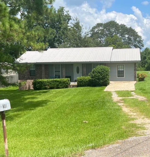
608 MS-590
Ellisville, MS 39437
2 Weeks Ago
|
Edit
Favorites
608 MS-590

Favorites
Check Back Soon for Upcoming Availability
| Beds | Baths | Average SF |
|---|---|---|
| 4 Bedrooms 4 Bedrooms 4 Br | 2 Baths 2 Baths 2 Ba | 1,500 SF |
Fees and Policies
The fees listed below are community-provided and may exclude utilities or add-ons. All payments are made directly to the property and are non-refundable unless otherwise specified.
Details
Utilities Included
-
Trash Removal
About This Property
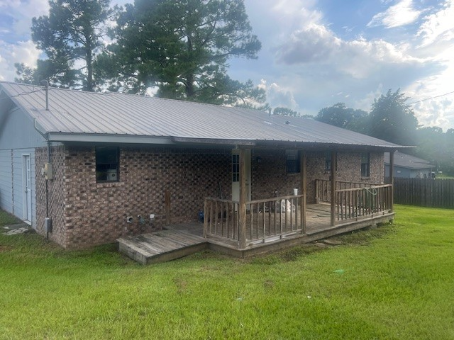
Property Id: 1544834 4 BR / 2 BA Single family home located 1/2 mile from I 59 (Exit 85) on MS HWY 590. Huge yard, covered front porch and back porch.
608 Ms-590 is a house located in Jones County and the 39437 ZIP Code. This area is served by the Jones Co School Dist attendance zone.
House Features
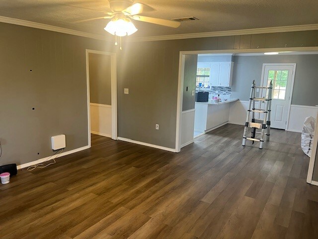
Dishwasher
Microwave
Refrigerator
Disposal
- Dishwasher
- Disposal
- Microwave
- Oven
- Refrigerator
- Freezer
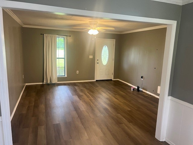
- Tile Floors
608 MS-590,
Ellisville,
MS
39437
Amenities
- Dishwasher
- Disposal
- Microwave
- Oven
- Refrigerator
- Freezer
- Tile Floors
Expenses
Utilities Included
Trash Removal
Included
Education
| Colleges & Universities | Distance | ||
|---|---|---|---|
| Colleges & Universities | Distance | ||
| Drive: | 6 min | 4.0 mi | |
| Drive: | 28 min | 22.2 mi | |
| Drive: | 34 min | 25.5 mi |
608 MS-590 is within 6 minutes or 4.0 miles from Jones College. It is also near Southern Miss and William Carey University.
Schools


Public Elementary School
Grades PK-5
480 Students
Nearby
Public Elementary School
Grades PK-5
1,070 Students
Attendance Zone
Public Middle & High School
Grades 6-12
1,306 Students
Attendance Zone
Private Elementary, Middle & High School
Grades PK-12
539 Students
Nearby
School data provided by
 The GreatSchools Rating helps parents compare schools within a state based on a variety of school quality indicators and provides a helpful picture of how effectively each school serves all of its students. Ratings are on a scale of 1 (below average) to 10 (above average) and can include test scores, college readiness, academic progress, advanced courses, equity, discipline and attendance data. We also advise parents to visit schools, consider other information on school performance and programs, and consider family needs as part of the school selection process.
View GreatSchools Rating Methodology
Data provided by GreatSchools.org © 2026. All rights reserved.
View GreatSchools Rating Methodology
Data provided by GreatSchools.org © 2026. All rights reserved.
Walkability Near 608 MS-590 Ellisville, MS 39437
Getting Around
 What do Walkability, Transit, Drivability, and Bikeability mean?
Walkability measures the walking distance to day-to-day needs.
Transit measures access to public transportation.
Drivability measures congestion, parking availability, and access to major roads.
Bikeability measures the suitability for cycling.
How It Works
What do Walkability, Transit, Drivability, and Bikeability mean?
Walkability measures the walking distance to day-to-day needs.
Transit measures access to public transportation.
Drivability measures congestion, parking availability, and access to major roads.
Bikeability measures the suitability for cycling.
How It Works
Not Walkable
Walkability
10
/ 100
Exceptionally Drivable
Drivability
100
/ 100
Not Bikeable
Bikeability
0
/ 100
Scores provided by
-
Soundscore™
-
/ 100
Traffic
-Airport
-Businesses
-Scores provided by
HowLoud What is a Sound Score Rating? A Sound Score Rating aggregates noise caused by vehicle traffic, airplane traffic and local sources. How It WorksSimilar Rentals Nearby


What Are Walk Score®, Transit Score®, and Bike Score® Ratings?
Walk Score® measures the walkability of any address. Transit Score® measures access to public transit. Bike Score® measures the bikeability of any address.
What is a Sound Score Rating?
A Sound Score Rating aggregates noise caused by vehicle traffic, airplane traffic and local sources.

608 MS-590
Ellisville, MS 39437