
$1,600
/ Month
608 Hwy 70 Sea Level Unit R1
Sealevel, NC 28577
2 Weeks Ago
|
Edit
Favorites
608 Hwy 70 Sea Level Unit R1

Favorites
Check Back Soon for Upcoming Availability
| Beds | Baths | Average SF |
|---|---|---|
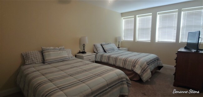
| 2 Bedrooms 2 Bedrooms 2 Br | 2 Baths 2 Baths 2 Ba | 1,500 SF |
Fees and Policies
The fees listed below are community-provided and may exclude utilities or add-ons. All payments are made directly to the property and are non-refundable unless otherwise specified.
Details
Utilities Included
-
Water
-
Electricity
-
Trash Removal
-
Sewer
Property Information
-
Furnished Units Available
About This Property
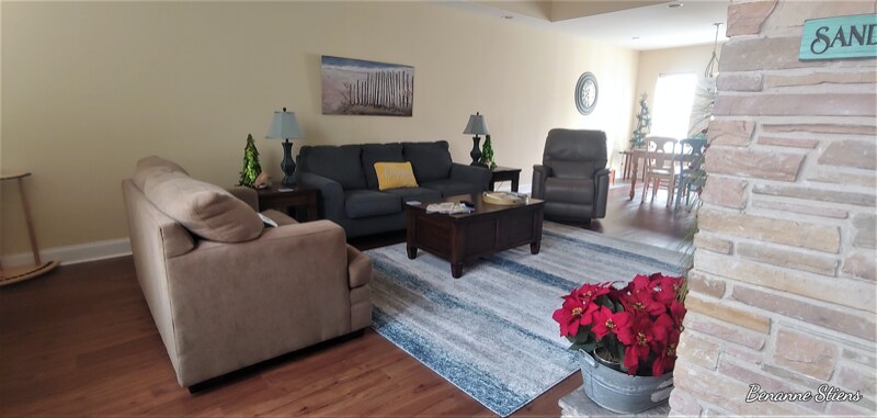
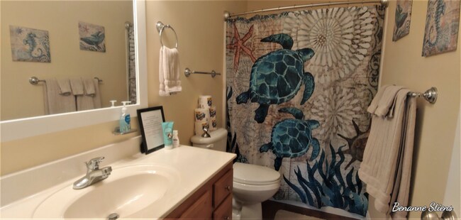
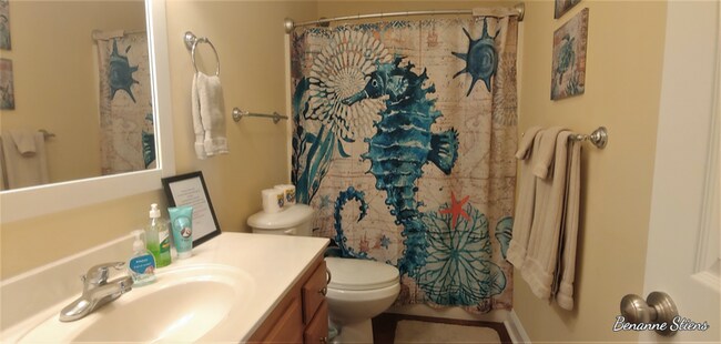
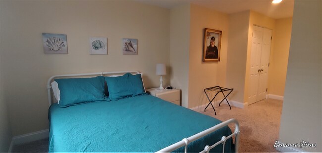
Property Id: 806559 Beautifully furnished and appointed condo on Nelson's Bay in Sea Level NC. Salty Breeze is a two bedroom, two bath unit. Could possibly be rented unfurnished also. Utilities, basic cable and WIFI included in rental amount.
608 Hwy 70 Sea Level is a condo located in Carteret County and the 28577 ZIP Code. This area is served by the Carteret County Public School District attendance zone.
Condo Features
Washer/Dryer
Dishwasher
Microwave
Refrigerator
- Washer/Dryer
- Dishwasher
- Microwave
- Oven
- Refrigerator
- Furnished
608 Hwy 70 Sea Level,
Sealevel,
NC
28577
Amenities
- Washer/Dryer
- Dishwasher
- Microwave
- Oven
- Refrigerator
- Furnished
Expenses
Utilities Included
Water, Electricity, Trash Removal, Sewer
Included
Education
Schools


Public Elementary & Middle School
Grades PK-8
249 Students
Nearby
Public Elementary School
Grades PK-5
88 Students
Attendance Zone
Public High School
Grades 9-12
530 Students
Attendance Zone
Private Elementary School
Grades PK-5
130 Students
Nearby
School data provided by
 The GreatSchools Rating helps parents compare schools within a state based on a variety of school quality indicators and provides a helpful picture of how effectively each school serves all of its students. Ratings are on a scale of 1 (below average) to 10 (above average) and can include test scores, college readiness, academic progress, advanced courses, equity, discipline and attendance data. We also advise parents to visit schools, consider other information on school performance and programs, and consider family needs as part of the school selection process.
View GreatSchools Rating Methodology
Data provided by GreatSchools.org © 2026. All rights reserved.
View GreatSchools Rating Methodology
Data provided by GreatSchools.org © 2026. All rights reserved.
Walkability Near 608 Hwy 70 Sea Level Sealevel, NC 28577
Getting Around
 What do Walkability, Transit, Drivability, and Bikeability mean?
Walkability measures the walking distance to day-to-day needs.
Transit measures access to public transportation.
Drivability measures congestion, parking availability, and access to major roads.
Bikeability measures the suitability for cycling.
How It Works
What do Walkability, Transit, Drivability, and Bikeability mean?
Walkability measures the walking distance to day-to-day needs.
Transit measures access to public transportation.
Drivability measures congestion, parking availability, and access to major roads.
Bikeability measures the suitability for cycling.
How It Works
Somewhat Walkable
Walkability
20
/ 100
Exceptionally Drivable
Drivability
90
/ 100
Somewhat Bikeable
Bikeability
20
/ 100
Scores provided by
-
Soundscore™
-
/ 100
Traffic
-Airport
-Businesses
-Scores provided by
HowLoud What is a Sound Score Rating? A Sound Score Rating aggregates noise caused by vehicle traffic, airplane traffic and local sources. How It WorksSimilar Rentals Nearby
-
-
 2 Beds, 2 Baths, 840 sq ft$1,650Total Monthly PriceTotal Monthly Price NewPrices include all required monthly fees.301 Commerce Way Unit 329
What Are Walk Score®, Transit Score®, and Bike Score® Ratings?
Walk Score® measures the walkability of any address. Transit Score® measures access to public transit. Bike Score® measures the bikeability of any address.
What is a Sound Score Rating?
A Sound Score Rating aggregates noise caused by vehicle traffic, airplane traffic and local sources.

608 Hwy 70 Sea Level
Sealevel, NC 28577